Metropolitan Store building is composed of: Dr. John McDiarmid building (closest) built 1885 and Nation & Shewan building built 1889. Combined building strengthened by E.C. Higgins 1920 - see neg. file K9.
Custodial History
For custodial history see the collection level description of the Lawrence Stuckey collection.
Scope and Content
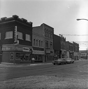
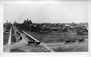
800 block of Rosser Avenue, south side, looking west from 8th Street.
For custodial history see the collection level description of the Lawrence Stuckey collection.
Scope and Content
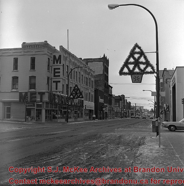
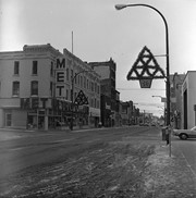
1000 block of Rosser Ave., north side. Showing (left to right): Public Library (ex. Merchants Bank of Canada) built 1906; [Smith's Tobacco Shop,]; A.C. Fraser Block built 1890; Scotia Towers built 1970's.
For custodial history see the collection level description of the Lawrence Stuckey collection.
Scope and Content
1000 block of Rosser Ave., north side. Showing (left to right): Public Library (ex. Merchants Bank of Canada) built 1906; [Smith's Tobacco Shop,]; A.C. Fraser Block built 1890; Scotia Towers built 1970's.
Photograph shows a funeral procession travelling west on Lorne Avenue and turning south onto 18th Street in Brandon. The photograph was taken from Brandon College.
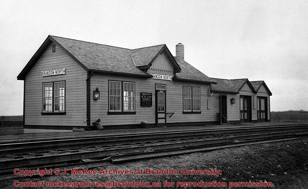
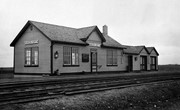
[This station, located 13 km north of Brandon on the east side of PTH 10, was] built in the early 1930s to replace Knox as the CNR’s mainline station for Brandon. All passenger trains stopped and buses operated between the CNR’s Brandon station and Brandon North to meet all trains. It was enlarged as shown here in late 1930s, and at peak operation in the 1940s & 1950s saw six daily passenger trains 1 - 2 & 3 - 4 “Continental Limited” and 11 - 12 locals. VIA trains 3 and 4 "Supercontinental" ceased operation Nov. 15, 1981 leaving no passenger service on the former Grand Trunk Pacific mainline of CNR [at that time]. This station was demolished in the fall of 1982.
Custodial History
For custodial history see the collection level description of the Lawrence Stuckey collection.
Photographs have been glued to a backing board that has warped over time
History / Biographical
Photograph of possible Dakota from Sioux Valley in Brandon for the summer fair.
Scope and Content
Photograph shows street view of north side of Rosser Avenue, primarily the 700 block. Businesses visible in the Fleming Block include: Lowes Brothers Clothing, Robert Hall [Insurance Broker], Manitoba Farmers Hedge and Wire Fence Company. Businesses visible in the Beaubier Block include the Empire Hotel. Businesses east of the Empire Hotel are grocer A.M. Percival and the Brandon Hardware Company. A number of Aboriginal peoples are driving horse and buggies west along Rosser Avenue as spectators look on.
Notes
Writing on the front of the photograph matting reads: 294 July 1906. One photograph (20-2009.10) is glued below and two others are glued on the reverse side. Page appears to be from a photo album.
Photographs have been glued to a backing board that has warped over time
History / Biographical
Photograph of possible Dakota from Sioux Valley in Brandon for the summer fair.
Scope and Content
Photograph shows street view of north side of Rosser Avenue, primarily the 700 block. Businesses visible in the Fleming Block include: Lowes Brothers Clothing, Robert Hall [Insurance Broker], Manitoba Farmers Hedge and Wire Fence Company. Businesses visible in the Beaubier Block include the Empire Hotel. Businesses east of the Empire Hotel are grocer A.M. Percival and the Brandon Hardware Company. A number of Aboriginal peoples are driving horse and carriages west along Rosser Avenue as spectators look on.
Notes
Writing on the front of the photograph matting reads: 295 July 1906. One photograph (20-2009.11) is glued above and two others are glued on the reverse side. Page appears to be from a photo album.
After demise of the streetcars, a transit system was started by MacArthur Transportation Co. with three routes, an east end loop, a south end loop, and a west end loop, with terminal at 8th St. & Rosser Ave. The E & W was operated as a continuous route with two locally built coach bodies on new Maple Leaf trucks. A secondhand, larger, Leland coach was acquired for the S. end, which was replaced by a large GMC about 1938.
Custodial History
For custodial history see the collection level description of the Lawrence Stuckey collection.
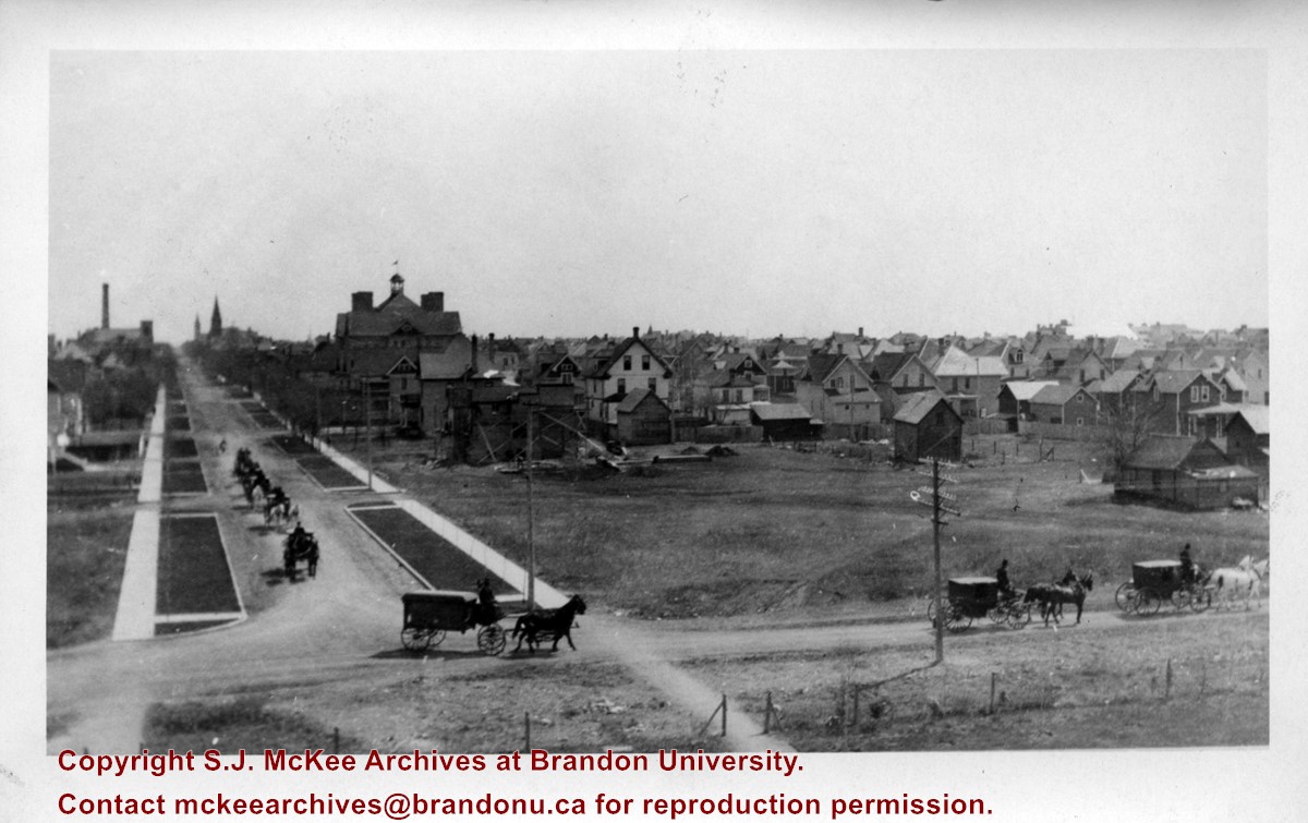
View is southwest from the north side of Princess Avenue. Photograph shows the north driveway entrance on campus. The original Music Building, the A.E. McKenzie Building, Clark Hall and part of the Brandon College Building are visible.
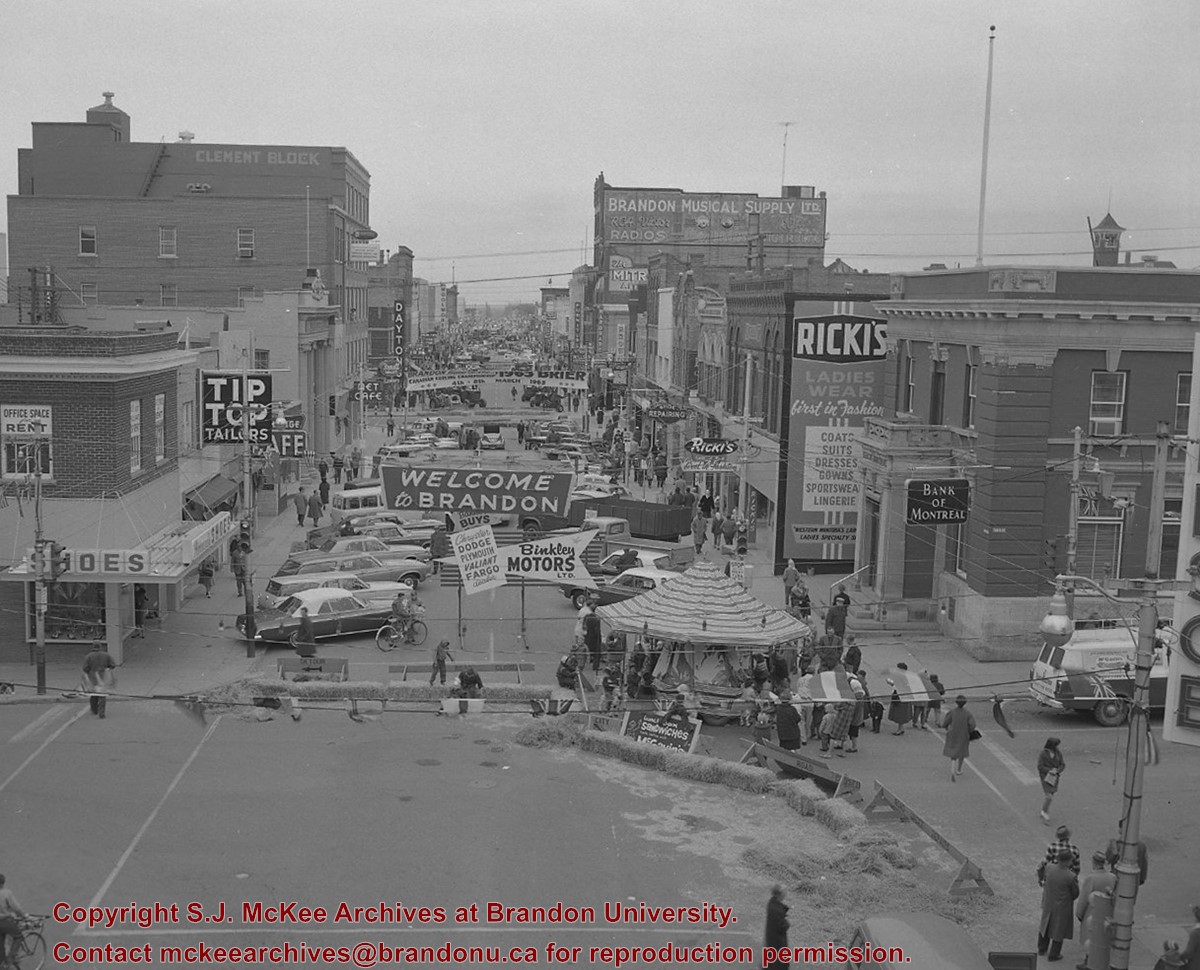
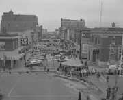
Photograph is looking south and shows the paving of 9th Street between Pacific and Rosser Avenues. Visible are: work crews, spectators and a police officer on duty, King George Cafe, McKenzie Block, and Clement Block. The Prince Edward Hotel is under construction in the background. Also visible are signs for: Cat Cafe and Roseland.
Repro Restriction
The McKee Archives is the copyright holder for the Stuckey materials.
See MG 1 Brandon College Teaching and Administration, 1.11 Martin Johns fonds for custodial history.
Scope and Content
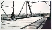
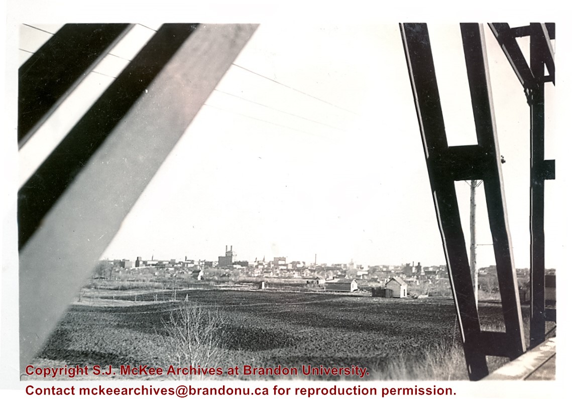
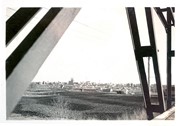
Photograph is looking south southeast from the Assiniboine bridge on 18th Street and shows the Brandon cityscape in the background.
Notes
Writing on the back of the photo reads: "Brandon from the Assiniboine bridge. The 2 girls were just local coloring. Don't ask me who they were or are? The College is just off the street on the right away in the background."
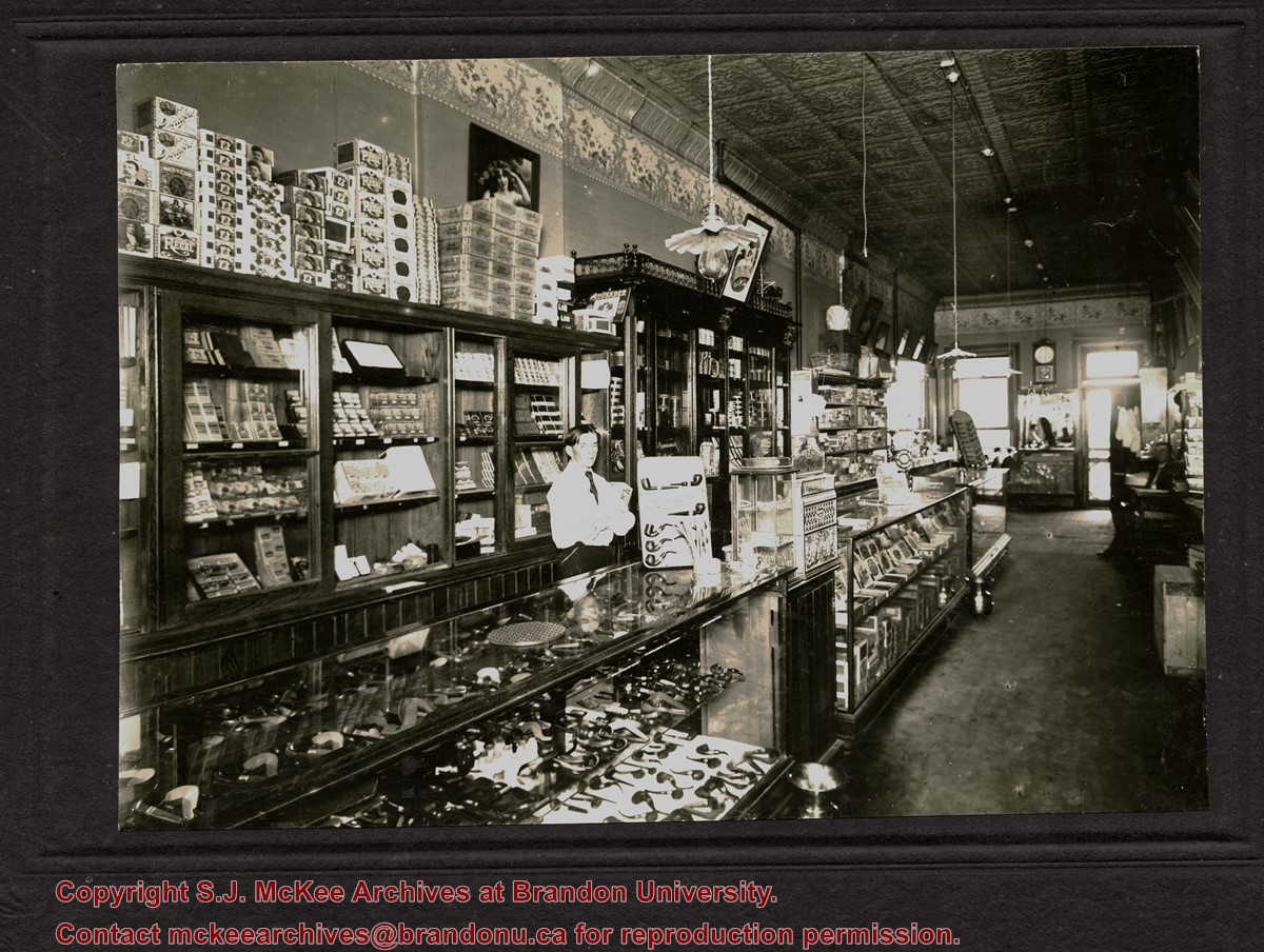
The decorative ceiling and border are consistent with another photograph in the McGuinness collection (see 20-2009.78) in which Gordon Irwin is identified. According to Henderson's 1909 Brandon City Directory, Gordon Irwin - a barber - and tobacconist J.S. Rosby shared at storefront at 919 Rosser Avenue. This address is situated on the north side of Rosser Avenue, adjacent to a laneway. It is possible that the back of the shop overlooks the Grand Union Hotel on the corner of Pacific Avenue and 10th Street.
Scope and Content
Photograph shows the interior of a store primarily selling pipes and cigars. An ornate tin ceiling and wallpaper border are evident. A barber shop area can be seen in the back of the shop near the exit.
Notes
Writing on the back reads: Harold Tackaberry says may have been Jory's or Waldron's, now part of Knowlton's. The handwriting is Fred McGuinness'.
Photographs have been glued to a backing board that has warped over time
History / Biographical
Photograph of possible Dakota from Sioux Valley in Brandon for the summer fair.
Scope and Content
Photograph shows street view of north side of Rosser Avenue, primarily the 700 block. Businesses visible in the Beaubier Block include the Empire Hotel. Businesses east of the Empire Hotel are grocer A.M. Percival, the Brandon Hardware Company, and the Arlington Hotel. A number of Aboriginal peoples are driving horse and buggies east along Rosser Avenue as large numbers of spectators look on.
Notes
Writing on the front of the photograph matting reads: 298. One photograph (20-2009.79) is glued above, another (20-2009.81) adjacent. One other is glued on the reverse side. Page appears to be from a photo album.

.jpg?width=1200&404=no-img.jpg&watermark=wmk)
.jpg?width=180&404=no-img.jpg)
.jpg?width=1200&404=no-img.jpg&watermark=wmk)
.jpg?width=180&404=no-img.jpg)


.jpg?width=1200&404=no-img.jpg&watermark=wmk)
.jpg?width=180&404=no-img.jpg)


.jpg%3fmaxheight%3d1000%26maxwidth%3d1000%26watermark%3dwmk&description=1000+block+of+Rosser+Avenue)
.jpg%3fmaxheight%3d1000%26maxwidth%3d1000%26watermark%3dwmk&description=1000+block+of+Rosser+Avenue)
)
.jpg%3fmaxheight%3d1000%26maxwidth%3d1000%26watermark%3dwmk&description=600+and+700+blocks+of+Rosser+Avenue)