Skip header and navigation

Revise Search

20 records – page 1 of 1.

Chater Protestant School District fonds

http://archives.brandonu.ca/en/permalink/descriptions4851
Part Of
RG 5 Western Manitoba Manuscript Collection
Description Level
Collection
GMD
textual records
Date Range
1892-1959
Accession Number
45-1997
Part Of
RG 5 Western Manitoba Manuscript Collection
Description Level
Collection
Accession Number
45-1997
GMD
textual records
Date Range
1892-1959
Physical Description
22 cm
History / Biographical
The Chater Protestant School District was established in 1883, with the arrival of settlers in southwestern Manitoba. In 1890, it became the Chater School District following school reform in Manitoba. The original Protestant District school was a wooden structure constructed in the village of Chater a few miles east of Brandon, Manitoba. In 1906, funds were raised for the building of a cement structure to replace the original wooden one. The Chater School District was dissolved in 1966, but the school house continued to serve as a community center until 1973, when it was demolished.
Custodial History
This fonds was accessioned by the McKee Archives in 1997. Prior custodial history is unknown.
Scope and Content
Fonds includes minutes of the School Trustees (1891-1931, 1940-1959), teaching contracts (1937-1957), financial records of the school (1939-1958), a booklet titled "The Public School Act, The Education Department Act, The School Attendance Act, The Teachers Retirement Allowances Act"(1954), and a collection of school registers (1912-13, 1915-49, 1954-55, 1957-58) from the Chater School District. Included within the minute books of the Chater School District are financial records for the "Chater Association of Patrons of Industry, charter # 3532" (1891-1895). Also included is an ink stamp reading "Chater Protestant School District, No. 181, Manitoba Canada."
Notes
CAIN No. 202640
Subject Access
Chater
Patrons of Industry
Public Schooling
Public Schools
Agrarian organizations
Storage Location
1997 accessions
Storage Range
1997 accessions
Show Less

Canadian Union of Public Employees (Brandon, Manitoba) fonds

http://archives.brandonu.ca/en/permalink/descriptions4826
Part Of
RG 5 Western Manitoba Manuscript Collection
Description Level
Collection
GMD
textual records
Date Range
1956-1890; predominant 1964-1980
Accession Number
22-2003, 30-1999
Part Of
RG 5 Western Manitoba Manuscript Collection
Description Level
Collection
Accession Number
22-2003, 30-1999
GMD
textual records
Date Range
1956-1890; predominant 1964-1980
Physical Description
5.2 m
History / Biographical
The Canadian Union of Public Employees came into existence in September 1963, during a convention in Winnipeg when The National Union of Public Employees and the National Union of Public Service Employees merged. In 1964, the Manitoba Division of CUPE (now CUPE Manitoba) held its founding convention in The Pas. At that time, there were 12 affiliated local unions and a total membership of 1,300. The Canadian Union of Public Employees is Canada's largest union. Public service employees formed CUPE to protect their rights, to negotiate wages and working conditions, and to achieve dignity in the workplace.
Custodial History
Fonds was in the possesssion of the Brandon CUPE Office until its donation to the S.J. McKee Archives in 1995.
Scope and Content
Fonds contains general administrative files of the CUPE including agreements, newspaper clippings, correspondence, and convention records. In addition, fonds includes records for many CUPE locals in southwestern and north-central Manitoba. These includes files for each local containing agreements, lists of officials, correspondence and financial records. An extensive body of records dating from 1956 exists for CUPE local #69. This local began its existence as the Brandon Civic Employees Federal Union formed in April 1919.
Notes
CAIN No. 202610
Subject Access
Canadian Union of Public Employees
Brandon Civic Employees Federal Union Local 69
collective bargaining
public sector unions
industrial relations
Storage Location
2003 accessions
Storage Range
2003 accessions
Show Less

Brandon University campus

http://archives.brandonu.ca/en/permalink/descriptions8026
Part Of
Aerial views and campus photographs
Description Level
Item
GMD
graphic
Date Range
c. 1996
Part Of
Aerial views and campus photographs
Description Level
Item
Series Number
2.1
Item Number
2.1.93
GMD
graphic
Date Range
c. 1996
Physical Description
6" x 4" (colour)
Scope and Content
View is east northeast from the sidewalk on the southeast corner of the George T. Richardson Centre (John R. Robbins Library). Photographs shows the campus during winter, including the Physical Plant and Development H-Huts, as well as the Brandon College Building and Clark Hall after the majority of the renovations were completed.
Images
Show Less

Brandon University campus

http://archives.brandonu.ca/en/permalink/descriptions8027
Part Of
Aerial views and campus photographs
Description Level
Item
GMD
graphic
Date Range
c. 1985
Part Of
Aerial views and campus photographs
Description Level
Item
Series Number
2.1
Item Number
2.1.94
GMD
graphic
Date Range
c. 1985
Physical Description
5" x 3.5" (colour)
Scope and Content
View is southwest from 18th Street, just north of the Brandon University sign. Tken during the summer, the photograph shows the front lawn, a portion of the flower bed, the Citizens' Science Building, the Knowles Douglas Students' Union Centre, the John R. Brodie Science Centre and McMaster Hall.
Images
Show Less

Brandon University campus

http://archives.brandonu.ca/en/permalink/descriptions8028
Part Of
Aerial views and campus photographs
Description Level
Item
GMD
graphic
Date Range
c. 1980s
Part Of
Aerial views and campus photographs
Description Level
Item
Series Number
2.1
Item Number
2.1.95
GMD
graphic
Date Range
c. 1980s
Physical Description
5" x 3.5" (colour)
Scope and Content
View is northeast. Photograph shows the green space before the Library extension in 1993. Brandon College Building and the Development H-Hut in the background.
Images
Show Less

Brandon University campus

http://archives.brandonu.ca/en/permalink/descriptions8029
Part Of
Aerial views and campus photographs
Description Level
Item
GMD
graphic
Date Range
c. 1988
Part Of
Aerial views and campus photographs
Description Level
Item
Series Number
2.1
Item Number
2.1.96
GMD
graphic
Date Range
c. 1988
Physical Description
5" x 3.5" (colour)
Scope and Content
View is northwest from the roof of the John R. Brodie Science Centre. Photograph shows part of McMaster Hall, the H-Huts, the Citzens' Science Building, the Brandon College Building and Clark Hall, the driveway, the J.R.C. Evans Lecture Theatre, the A.E. McKenzie Building and the Queen Elizabeth II Music Building.
Images
Show Less

Brandon University campus

http://archives.brandonu.ca/en/permalink/descriptions8030
Part Of
Aerial views and campus photographs
Description Level
Item
GMD
graphic
Date Range
c. early 1990s
Part Of
Aerial views and campus photographs
Description Level
Item
Series Number
2.1
Item Number
2.1.97
GMD
graphic
Date Range
c. early 1990s
Physical Description
4" x 6" (b/w)
Scope and Content
View is north from the Knowles Douglas Students' Union Centre looking down the driveway toward Princess Avenue.
Images
Show Less

Brandon University campus

http://archives.brandonu.ca/en/permalink/descriptions8031
Part Of
Aerial views and campus photographs
Description Level
Item
GMD
graphic
Date Range
c. 1995
Part Of
Aerial views and campus photographs
Description Level
Item
Series Number
2.1
Item Number
2.1.98
GMD
graphic
Date Range
c. 1995
Physical Description
6" x 4" (colour)
Scope and Content
View is northwest from the sidewalk on the west side of 18th Street. Photograph shows the John R. Brodie Science Centre sign, McMaster Hall and its entrance, the lawn in from of McMaster Hall, a portion of the Knowles Douglas Students' Union Centre and the Citizens' Science Building.
Images
Show Less

Brandon University campus

http://archives.brandonu.ca/en/permalink/descriptions8032
Part Of
Aerial views and campus photographs
Description Level
Item
GMD
graphic
Date Range
c. 2000
Part Of
Aerial views and campus photographs
Creator
Photographer: Sandy Black
Description Level
Item
Series Number
2.1
Item Number
2.1.99
GMD
graphic
Date Range
c. 2000
Physical Description
6" x 4" (colour)
Scope and Content
View is southwest from the corner of Clark Hall and the Clark Hall extension. Photograph shows students entering and exiting the George T. Richardson Centre and walking through the courtyard.
Images
Show Less

Brandon University campus

http://archives.brandonu.ca/en/permalink/descriptions8033
Part Of
Aerial views and campus photographs
Description Level
Item
GMD
graphic
Date Range
c. 1990s
Part Of
Aerial views and campus photographs
Description Level
Item
Series Number
2.1
Item Number
2.1.101
GMD
graphic
Date Range
c. 1990s
Physical Description
4" x 6" (colour)
Scope and Content
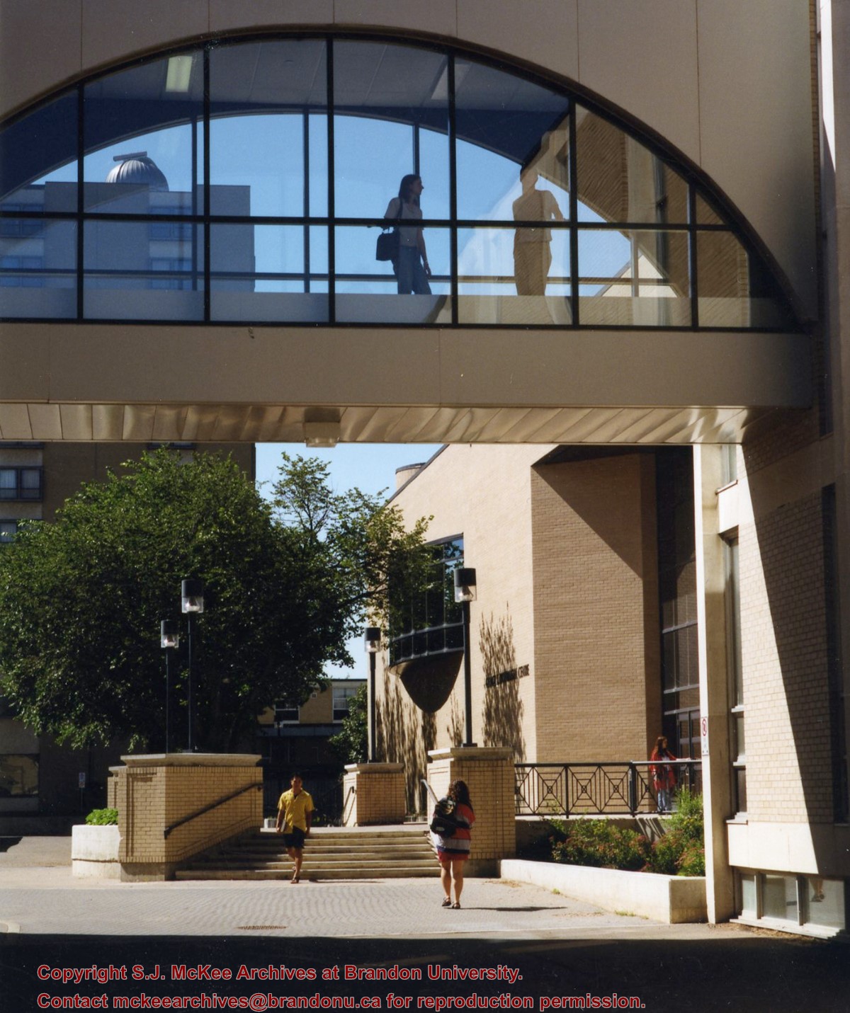
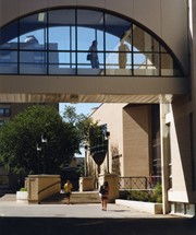
View is south from appromately the skywalk. Photograph shows the walkway that runs in front of the A.E. McKenzie Building south to the George T. Richardson Centre staircase and entrance. McMaster Hall in the background.
Images
Show Less

Brandon University campus

http://archives.brandonu.ca/en/permalink/descriptions8034
Part Of
Aerial views and campus photographs
Description Level
Item
GMD
graphic
Date Range
c. 2000
Part Of
Aerial views and campus photographs
Creator
Photograph: Sandy Black
Description Level
Item
Series Number
2.1
Item Number
2.1.102
GMD
graphic
Date Range
c. 2000
Physical Description
4" x 6" (colour)
Scope and Content
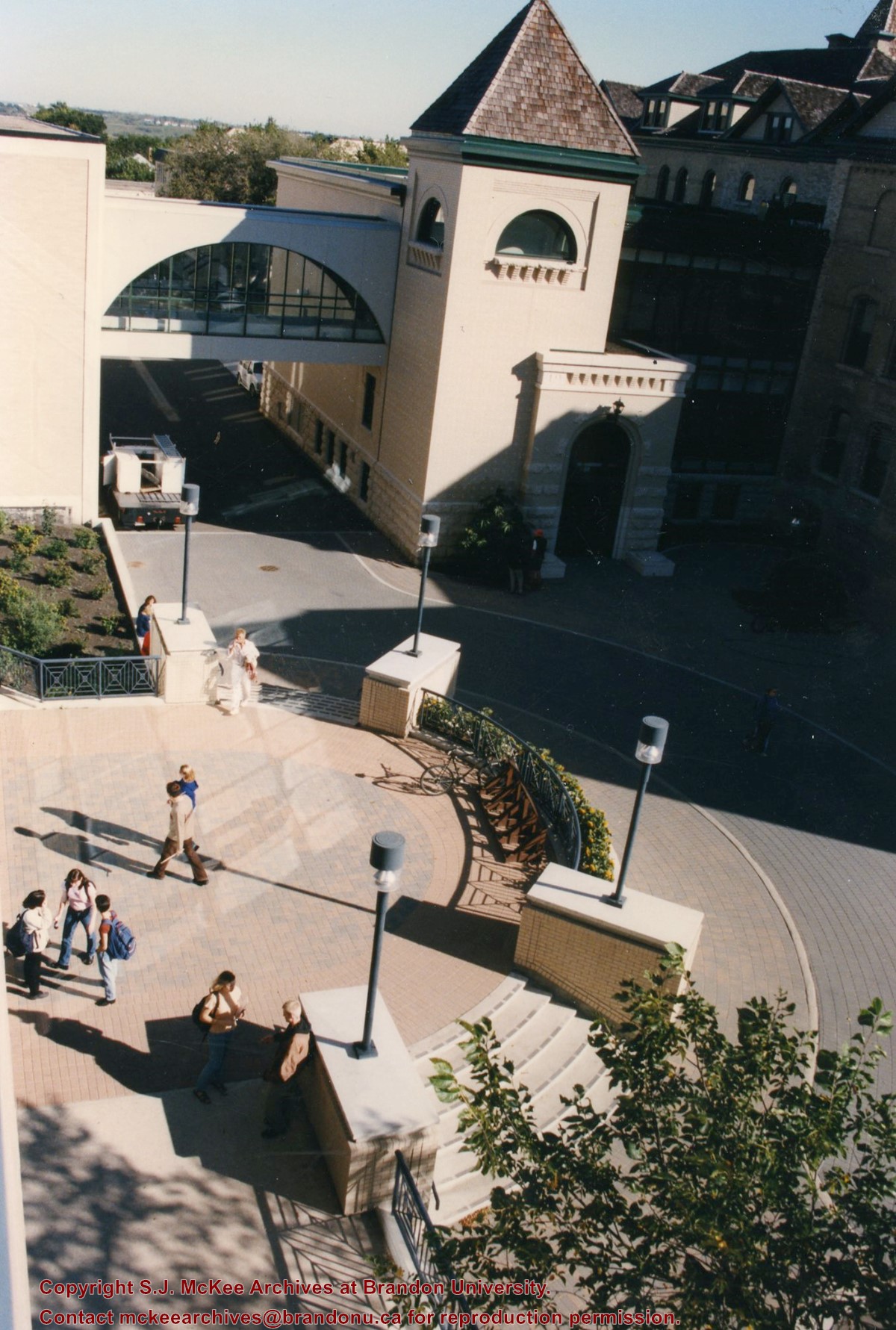
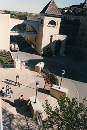
View is north northeast from the roof of the John E. Robbins Library in the George T. Richardson Centre. Photograph shows the entrance to the Richardson Building, part of the courtyard and the Clark Hall extension.
Images
Show Less

Brandon University campus

http://archives.brandonu.ca/en/permalink/descriptions8035
Part Of
Aerial views and campus photographs
Description Level
Item
GMD
graphic
Date Range
c. 2000
Part Of
Aerial views and campus photographs
Creator
Photographer: Sandy Black
Description Level
Item
Series Number
2.1
Item Number
2.1.103
GMD
graphic
Date Range
c. 2000
Physical Description
6" x 4" (colour)
Scope and Content
View is northeast from in front of the John E. Robbins Library in the George T. Richardson Centre. Photograph shows the entrance to the Richardson Building, most of the courtyard, Clark Hall and its extension.
Images
Show Less

Brandon University campus

http://archives.brandonu.ca/en/permalink/descriptions8036
Part Of
Aerial views and campus photographs
Description Level
Item
GMD
graphic
Date Range
c. 2000
Part Of
Aerial views and campus photographs
Creator
Photographer: Sandy Black
Description Level
Item
Series Number
2.1
Item Number
2.1.104
GMD
graphic
Date Range
c. 2000
Physical Description
6" x 4" (colour)
Scope and Content
View is northeast from the roof of the George T. Richardson Centre (John E. Robbins Library). Photograph shows the courtyard and the west side of the Brandon College building and Clark Hall, as well as the Clark Hall extension and part of the skywalk.
Images
Show Less

Brandon University campus

http://archives.brandonu.ca/en/permalink/descriptions8037
Part Of
Aerial views and campus photographs
Description Level
Item
GMD
graphic
Date Range
c. 2000
Part Of
Aerial views and campus photographs
Creator
Photographer: Sandy Black
Description Level
Item
Series Number
2.1
Item Number
2.1.105
GMD
graphic
Date Range
c. 2000
Physical Description
6" x 4" (colour)
Scope and Content
View is east southeast from the roof of the A.E. McKenzie Building. Photograph shows the courtyard and the west side of the Brandon College Building, as well as the Citizens' Science Building and the greenspace in between the two buildings.
Images
Show Less

Brandon University campus

http://archives.brandonu.ca/en/permalink/descriptions8038
Part Of
Aerial views and campus photographs
Description Level
Item
GMD
graphic
Date Range
c. 2000
Part Of
Aerial views and campus photographs
Creator
Photographer: Sandy Black
Description Level
Item
Series Number
2.1
Item Number
2.1.106
GMD
graphic
Date Range
c. 2000
Physical Description
4" x 6" (colour)
Scope and Content
View is from the front steps of the Education Building looking south down the east side of the Brandon College Building and Clark Hall to the Knowles Douglas Students' Union Centre and the John R. Brodie Science Centre in the background.
Images
Show Less

Brandon University campus

http://archives.brandonu.ca/en/permalink/descriptions8039
Part Of
Aerial views and campus photographs
Description Level
Item
GMD
graphic
Date Range
c. 2000
Part Of
Aerial views and campus photographs
Creator
Photographer: Sandy Black
Description Level
Item
Series Number
2.1
Item Number
2.1.107
GMD
graphic
Date Range
c. 2000
Physical Description
4" x 6" (colour)
Scope and Content
Photograph shows the Brandon College Building. It was taken from the sidewalk on 18th Street looking southwest across the front lawn.
Notes
Note on the back of the photograph reads "Please return photo to Sandy."
Images
Show Less

Brandon University campus

http://archives.brandonu.ca/en/permalink/descriptions8040
Part Of
Aerial views and campus photographs
Description Level
Item
GMD
graphic
Date Range
c. 2000
Part Of
Aerial views and campus photographs
Creator
Photographer: Sandy Black
Description Level
Item
Series Number
2.1
Item Number
2.1.108
GMD
graphic
Date Range
c. 2000
Physical Description
4" x 5" (colour)
Scope and Content
View is south. Photograph shows the skywalk and the steps leading to the entrance of the George T. Richardson Centre.
Images
Show Less

Brandon University campus

http://archives.brandonu.ca/en/permalink/descriptions8041
Part Of
Aerial views and campus photographs
Description Level
Item
GMD
graphic
Date Range
c. 1988
Part Of
Aerial views and campus photographs
Description Level
Item
Series Number
2.1
Item Number
2.1.110
GMD
graphic
Date Range
c. 1988
Physical Description
5" x 4" (colour)
Scope and Content
View is north northwest from the roof of McMaster Hall. Photograph shows part of the Citizens' Science Building, a number of H-Huts, the Brandon College Building, the greenspace, the J.R.C. Evans Lecture Theatre, the A.E. McKenzie Building, the Queen Elizabeth II Music Building and the Western Manitoba Centennial Auditorium. A number of residential blocks are also visible.
Images
Show Less

Brandon University campus

http://archives.brandonu.ca/en/permalink/descriptions8042
Part Of
Aerial views and campus photographs
Description Level
Item
GMD
graphic
Date Range
c. 1995
Part Of
Aerial views and campus photographs
Description Level
Item
Series Number
2.1
Item Number
2.1.111
GMD
graphic
Date Range
c. 1995
Physical Description
6" x 4" (b/w)
Scope and Content
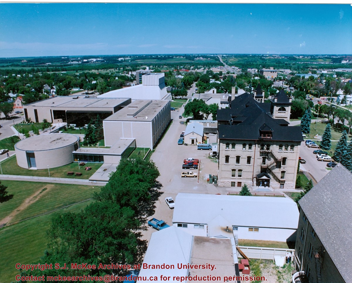
View is north northeast from the roof of McMaster Hall. Photograph shows a couple of H-Huts, the Brandon College Building, Clark Hall, the George T. Richardson Centre, the A.E. McKenzie Building, the original Music Building and the Western Manitoba Centennial Auditorium. A number of residential blocks are also visible.
Images
Show Less

Brandon University campus

http://archives.brandonu.ca/en/permalink/descriptions8043
Part Of
Aerial views and campus photographs
Description Level
Item
GMD
graphic
Date Range
c. 1995
Part Of
Aerial views and campus photographs
Description Level
Item
Series Number
2.1
Item Number
2.1.112
GMD
graphic
Date Range
c. 1995
Physical Description
4" x 6" (b/w)
Scope and Content
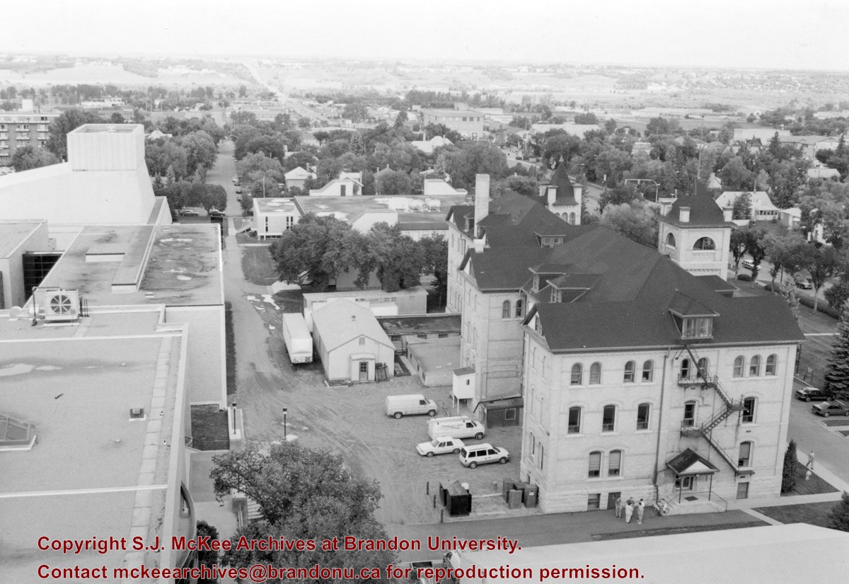
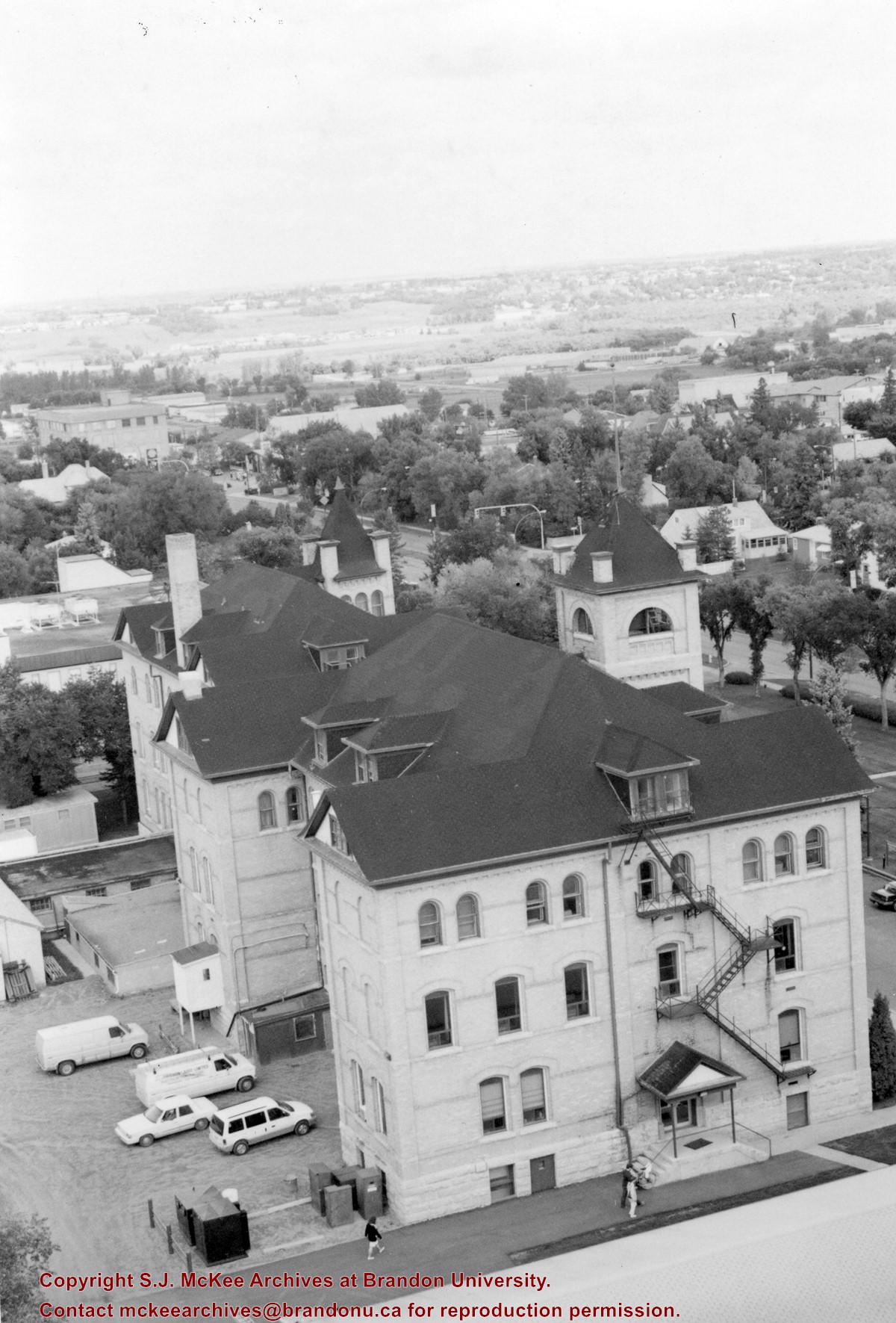
View is northeast from the roof of McMaster Hall. Photograph shows the Brandon College Building and Clark Hall, as well as the roof of the Education Building and portions of two H-Huts. A number of residential blocks are also visible.
Images
Show Less

20 records – page 1 of 1.