Aerial photographs of the campus were generally commissioned by the College/University to record important milestones, such as centennials, changes in status, and building projects. The general campus photographs were placed in this sub-series because the composition of the images made it difficult to place them with individual buildings.
Scope and Content
Sub-series consists of photographs of the Brandon College and Brandon University campus.
Red ink stain is on the front right corner of postcard
Scope and Content
Photograph shows 10th Street facing south from Princess Avenue. Visible landmarks and businesses include: Manitoba Power Commission (MPC)'s power sub-station, First Baptist Church, Wheat City Arena, and the grand stand at the Exhibition Grounds.
The partial sign visible at the bottom of the photograph on the east side of 10th Street reads Yates and Neale, which refers to a plumbing and heating company that dissolved in 1943 to be replaced by Neale, Stothard and Chapman.
Businesses on the west side of 10th Street include: Dominion Tire & Radio Co., Bolts Barber Shop, Elviss T.E. Co. Stables.
Notes
Information concerning Yates and Neale courtesy Jack Stothard. Writing on the front of the postcard reads: Brandon, Looking S.W., Jerrett Photo. This photograph shows a rare view of the 200-block of 10th Street.
For custodial history see the collection level description of the Lawrence Stuckey collection.
Scope and Content
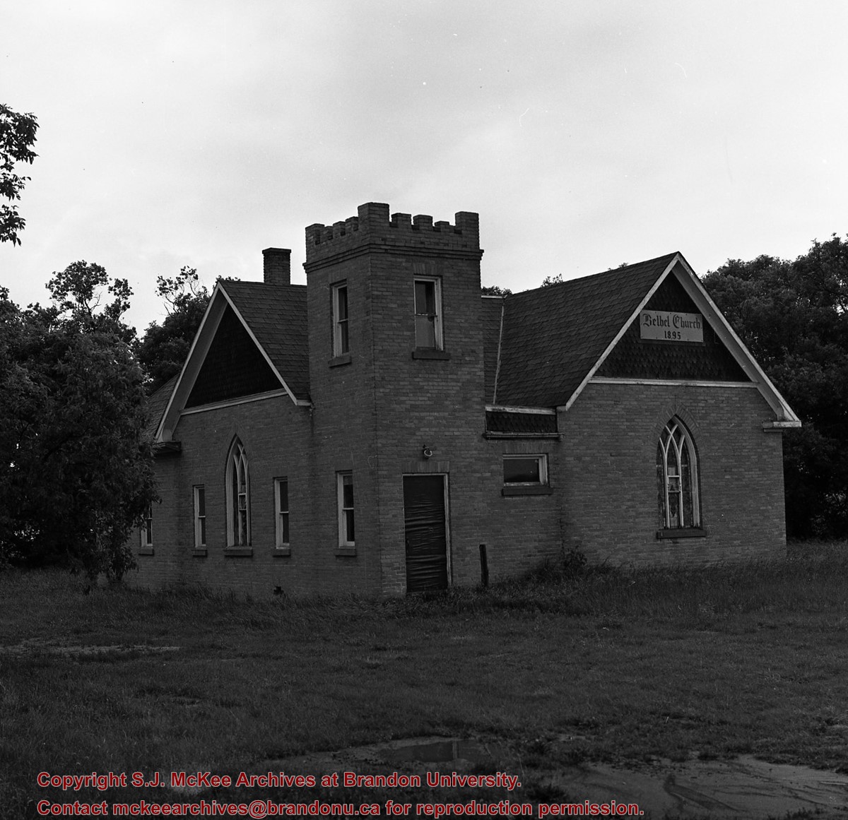
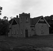
Image of Bethel Church (1895) on Highways 2 & 21 west of Deleau, Manitoba.
Notes
[Brandon SW includes communities south of Trans-Canada #1 highway and west of PTH #10.] [Images 349a and 349b are images of the exterior of the church, and images 349c-349-e are images of the stained glass windows.]
For custodial history see the collection level description of the Lawrence Stuckey collection.
Scope and Content
Image of Bethel Church (1895) on Highways 2 & 21 west of Deleau, Manitoba.
Notes
[Brandon SW includes communities south of Trans-Canada #1 highway and west of PTH #10.] [Images 349a and 349b are images of the exterior of the church, and images 349c-349-e are images of the stained glass windows.]
Photograph shows a western view of the residential area along Lorne Avenue from St. Augustine's Roman Catholic Church. Roof-tops of Central School, First Baptist, Brandon College, Manitoba Power Plant, and Old City Hall are visible.
Notes
Writing on the front of the postcard reads: Lorne Avenue, looking West from St. Augustine's R.C. Church, Brandon, Man. Writing on the back of the postcard reads: The Valentine & Sons Publishing Ltd., Montreal and London, Printed in Great Britain. A cancelled George VI purple Canada 3 cent stamp has been postmarked: Brandon SP 11 52.


+on+Highways++2+%26+21+west+of+Deleau%2c+Manitoba.)
+on+Highways++2+%26+21+west+of+Deleau%2c+Manitoba.)
+on+Highways++2+%26+21+west+of+Deleau%2c+Manitoba.)
+on+Highways++2+%26+21+west+of+Deleau%2c+Manitoba.)
+on+Highways++2+%26+21+west+of+Deleau%2c+Manitoba.)
+on+Highway+2-21+near+Hartney+Junction)