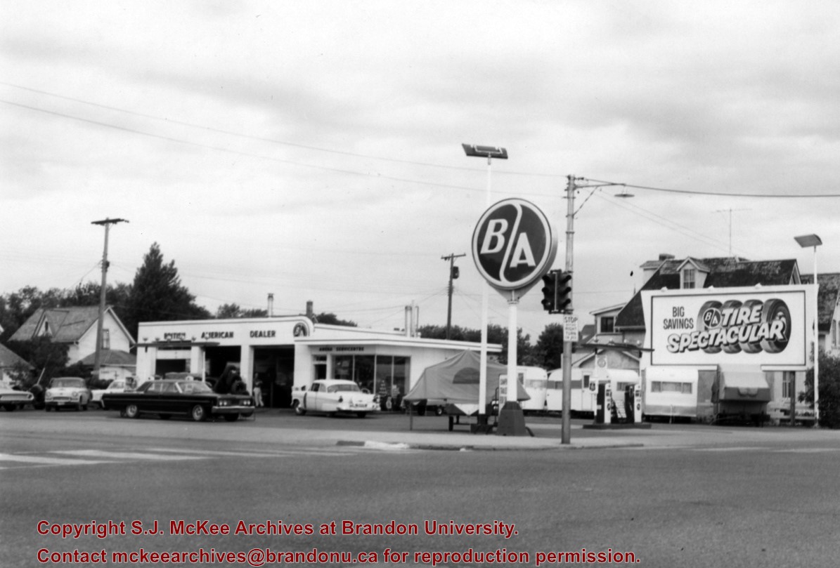
The British American gas station was located on the north side of Victoria Avenue between 10th and 11th Streets. An Esso gas station later occupied the site; at present it is the parking lot and building for the Manitoba Liquor Commission retail outlet.
Scope and Content
Photograph is looking northwest from across Victoria Avenue and shows the British American station building, signs, gas pumps and various cars in the lot.
Repro Restriction
The McKee Archives is the copyright holder for the Stuckey materials.
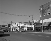
The Specialty Shop [to the right of the "OK Used Cars" sign] was opened by Ms. Helen Lamont in 1953.
Custodial History
For custodial history see the collection level description of the Lawrence Stuckey collection.
Scope and Content
This image shows commercial buildings located on the east side of the 100 block of 10th Street.
Businesses shown include Western Motors automobile dealership and a Specialty Shop
Notes
[Mr. Stuckey put three negatives and three prints in same envelope. We have separated them and numbered the negatives EA3(1), EA3(2) and EA3(3), and the prints EA3(1a), EA3(2a), EA3(3a).]
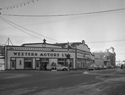
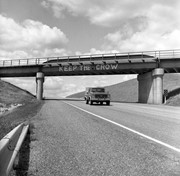
Mr. Stuckey's notes: Similar painting on other side "Refuse the Cruise." Bridge newly painted July or Aug. 83.
Custodial History
For custodial history see the collection level description of the Lawrence Stuckey collection.
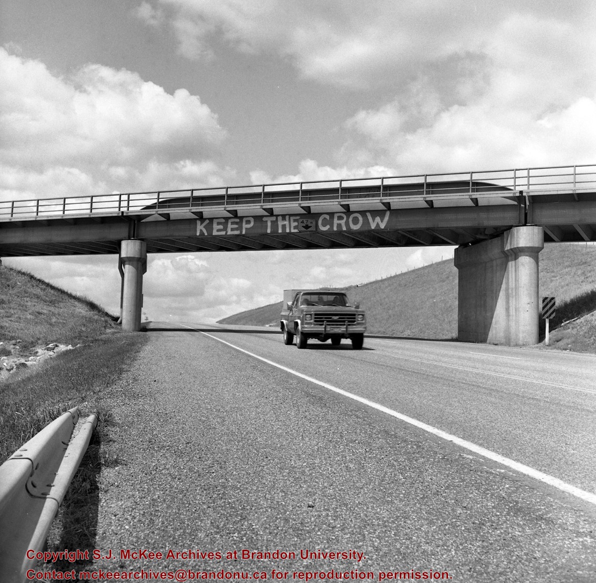
Scope and Content
Image of CP Bridge over Hwy. 10 "KEEP THE CROW", Minnedosa, Manitoba. Image was taken along the CPR Minnedosa & Bredenbury subdivision (ex. Manitoba & N.W. Railway).
Notes
["KEEP THE CROW" appears to have been spray painted on the side of the bridge].
For custodial history see the collection level description of the Lawrence Stuckey collection.
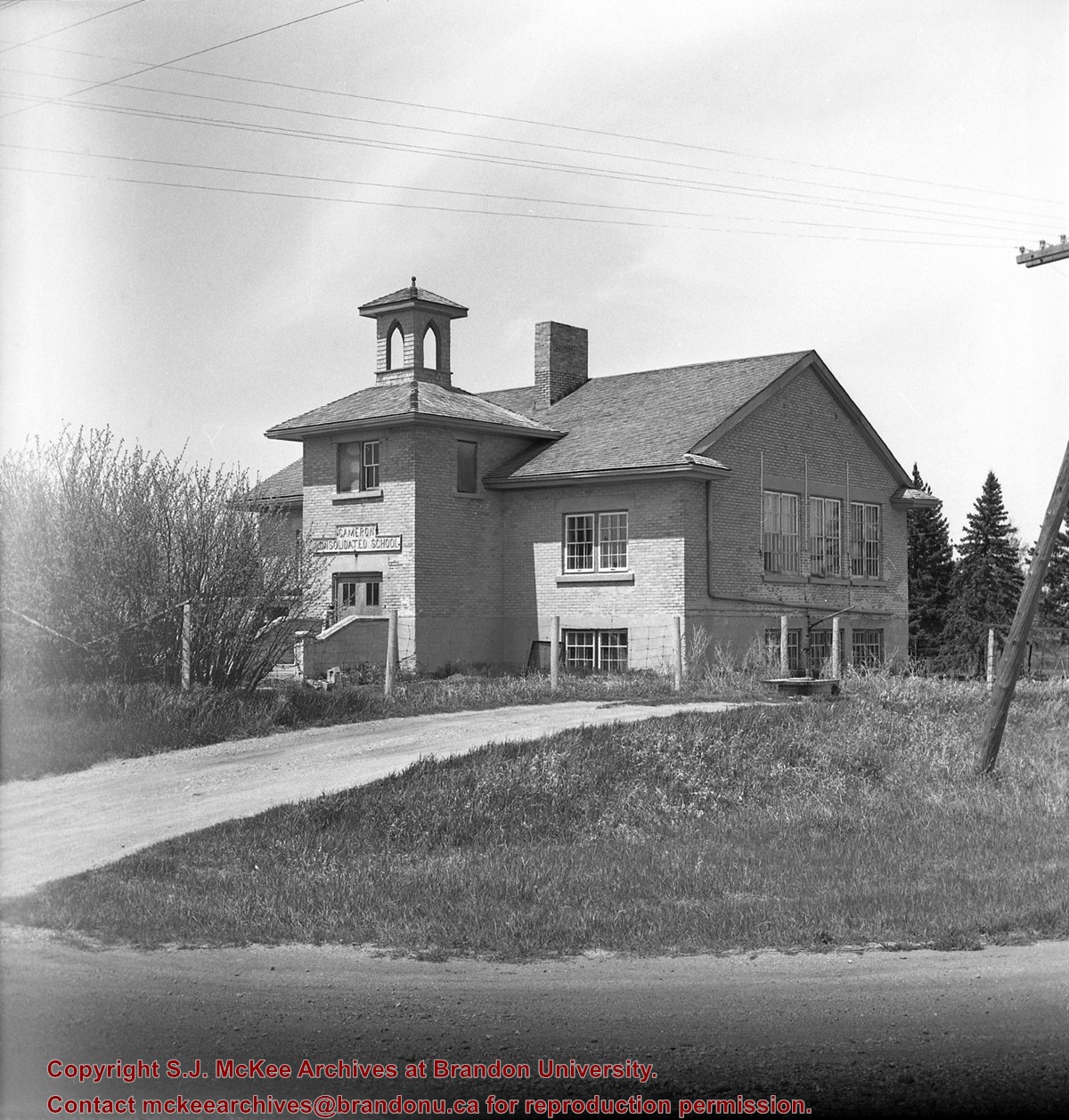
Scope and Content
Image of Bethel Church (1895) on Highways 2 & 21 west of Deleau, Manitoba.
Notes
[Brandon SW includes communities south of Trans-Canada #1 highway and west of PTH #10.] [Images 349a and 349b are images of the exterior of the church, and images 349c-349-e are images of the stained glass windows.]
For custodial history see the collection level description of the Lawrence Stuckey collection.
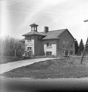
Scope and Content
Image of Bethel Church (1895) on Highways 2 & 21 west of Deleau, Manitoba.
Notes
[Brandon SW includes communities south of Trans-Canada #1 highway and west of PTH #10.] [Images 349a and 349b are images of the exterior of the church, and images 349c-349-e are images of the stained glass windows.]
For custodial history see the collection level description of the Lawrence Stuckey collection.
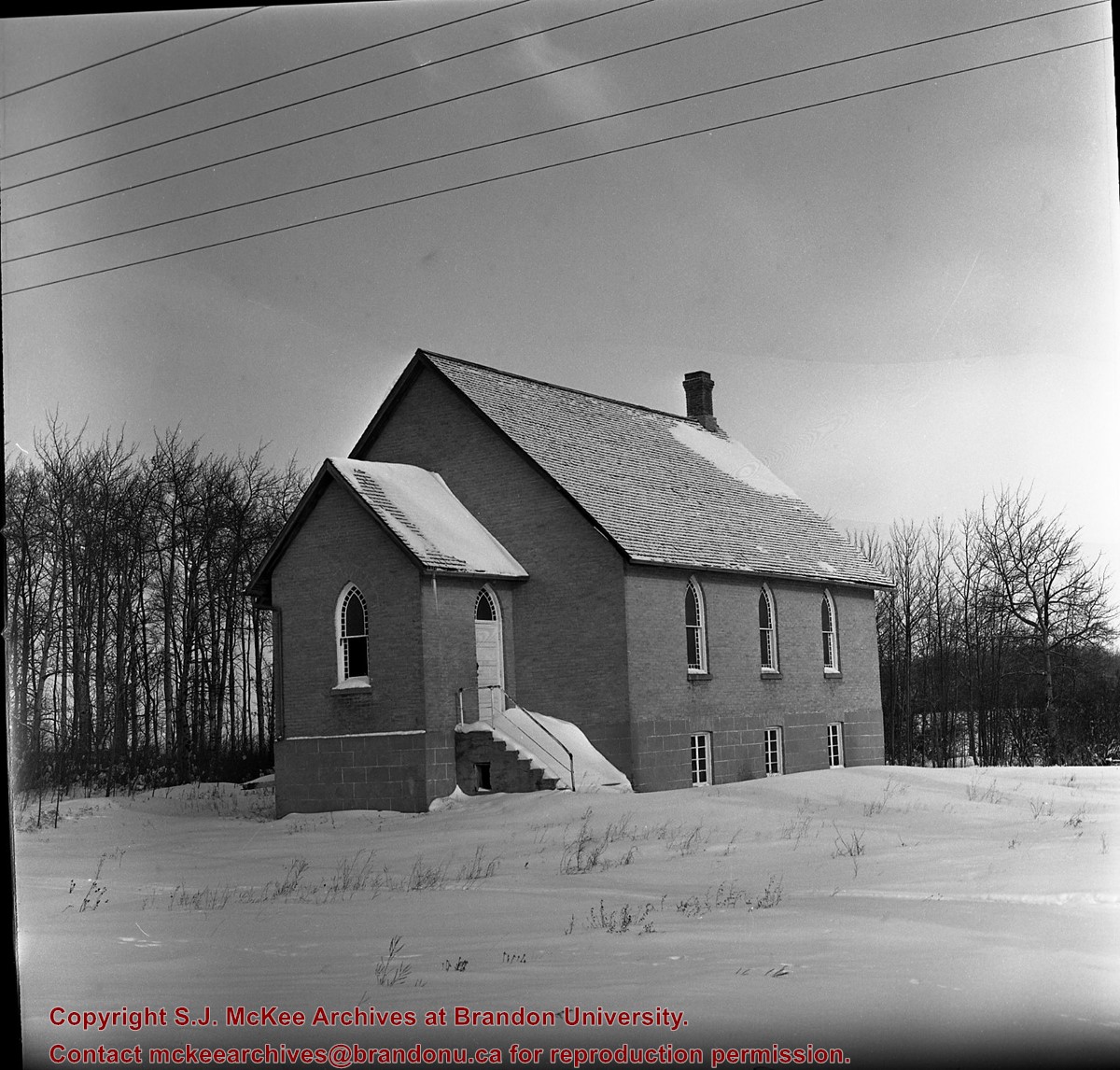
Scope and Content
Image of Bethel Church (1895) on Highways 2 & 21 west of Deleau, Manitoba.
Notes
[Brandon SW includes communities south of Trans-Canada #1 highway and west of PTH #10.] [Images 349a and 349b are images of the exterior of the church, and images 349c-349-e are images of the stained glass windows.]
For custodial history see the collection level description of the Lawrence Stuckey collection.
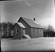
Scope and Content
Image of Bethel Church (1895) on Highways 2 & 21 west of Deleau, Manitoba.
Notes
[Brandon SW includes communities south of Trans-Canada #1 highway and west of PTH #10.] [Images 349a and 349b are images of the exterior of the church, and images 349c-349-e are images of the stained glass windows.]
For custodial history see the collection level description of the Lawrence Stuckey collection.
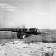
Scope and Content
Image of CPR Highway 10 bridge (town in background) and XW 5693-5703-5918-5960-5947-3036, Minnedosa, Manitoba. Image was taken along the CPR Minnedosa & Bredenbury subdivision (ex. Manitoba & N.W. Railway).
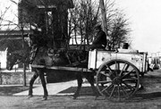
William A. Fleming, Brandon's first water dealer, is said to have begun his business in 1881. He sold drinking water for 5 cents per pail from the 1920s through the mid 1930s. The source of his water was a well located on the east side of the 100 block of 12th Street. Fleming's business was taken over by two men with a water tank on a truck, and continued till 1946 when it was closed due to contamination.
Custodial History
For custodial history see the collection level description of the Lawrence Stuckey collection.
Scope and Content
Mr. Wm. Fleming, Water Dealer, with horse and water cart
Notes
Ad on cart: W.H. Mallett Jeweller Issuer of Marriage Licenses.
Photo courtesy of the Assiniboine Historical Society.


.jpg?width=1200&404=no-img.jpg&watermark=wmk)
.jpg?width=180&404=no-img.jpg)
.jpg?width=1200&404=no-img.jpg&watermark=wmk)
.jpg?width=180&404=no-img.jpg)


.jpg?width=1200&404=no-img.jpg&watermark=wmk)
.jpg?width=180&404=no-img.jpg)
.jpg?width=1200&404=no-img.jpg&watermark=wmk)
.jpg?width=180&404=no-img.jpg)
.jpg%3fmaxheight%3d1000%26maxwidth%3d1000%26watermark%3dwmk&description=10th+Street+Businesses+-+East+Side+of+100+Block)
.jpg%3fmaxheight%3d1000%26maxwidth%3d1000%26watermark%3dwmk&description=10th+Street+Businesses+-+East+Side+of+100+Block)
+on+Highways++2+%26+21+west+of+Deleau%2c+Manitoba.)
+on+Highways++2+%26+21+west+of+Deleau%2c+Manitoba.)
+on+Highways++2+%26+21+west+of+Deleau%2c+Manitoba.)
+on+Highways++2+%26+21+west+of+Deleau%2c+Manitoba.)
+on+Highways++2+%26+21+west+of+Deleau%2c+Manitoba.)
+and+XW+5693-5703-5918-5960-5947-3036%2c+Minnedosa%2c+Manitoba.)
.jpg%3fmaxheight%3d1000%26maxwidth%3d1000%26watermark%3dwmk&description=Fire+Station+No.+1)
.jpg%3fmaxheight%3d1000%26maxwidth%3d1000%26watermark%3dwmk&description=Fire+Station+No.+1)