These blocks of ice were used to fill the ice houses of the Wheat City Ice Co. (located north of Rosser Avenue on the west side of 15th Street, and south of Princess Avenue on the east side of 17th Street), the CPR icehouses (at the station and 3rd St. & Assiniboine Ave), and the CNR icehouse (at Forth Street and McTavish Avenue). In addition, large quantities of ice were shipped to smaller towns in railcars (usually old refrigerator cars).
Custodial History
For custodial history see the collection level description of the Lawrence Stuckey collection.
Scope and Content
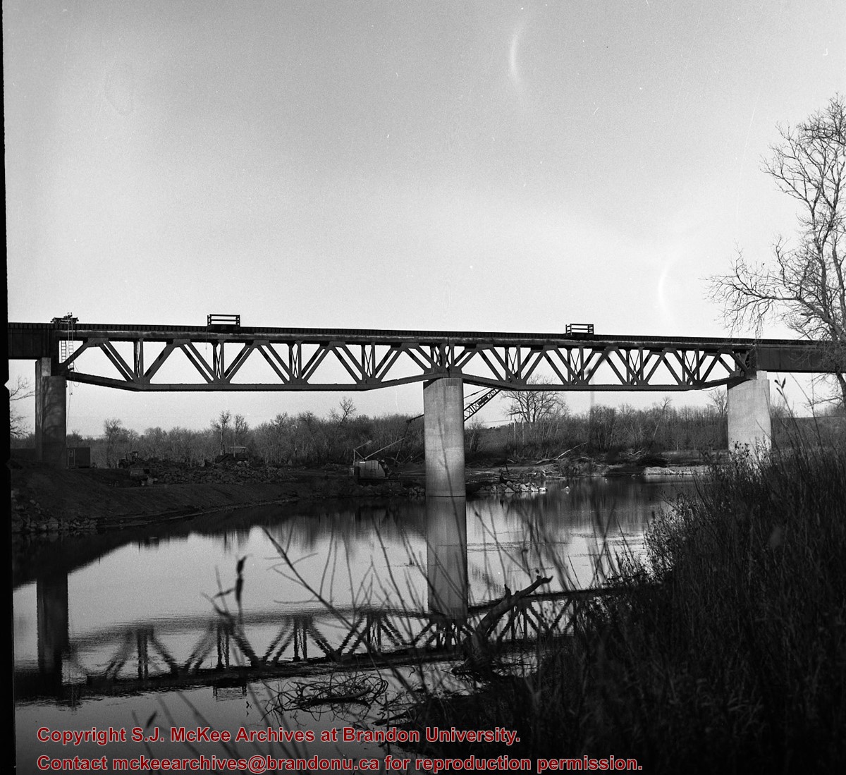
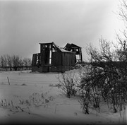
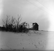
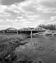
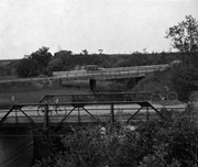
Cutting ice from the Assiniboine River
Notes
This is one of five images that show the method in which ice is cut into blocks and loaded onto sleighs or trucks. Note the large draft horses still in use at this date.
[Mr. Stuckey put five negatives into the same envelope. We have separated them and numbered them H12(1) to H12(5).]
Additional information provided by the Fred McGuinness collection (20-2009).
These blocks of ice were used to fill the ice houses of the Wheat City Ice Co. (located north of Rosser Avenue on the west side of 15th Street, and south of Princess Avenue on the east side of 17th Street), the CPR icehouses (at the station and 3rd St. & Assiniboine Ave), and the CNR icehouse (at Forth Street and McTavish Avenue). In addition, large quantities of ice were shipped to smaller towns in railcars (usually old refrigerator cars).
Custodial History
For custodial history see the collection level description of the Lawrence Stuckey collection.
Scope and Content
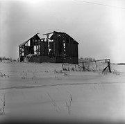
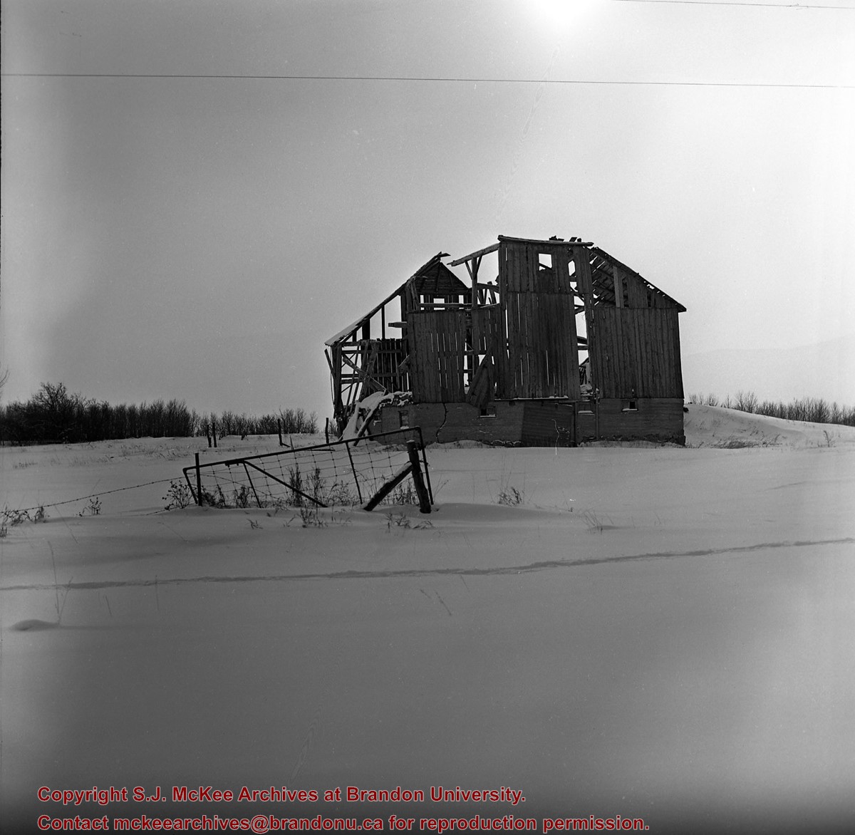
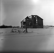
Cutting ice from the Assiniboine River
Notes
This is one of five images that show the method in which ice is cut into blocks and loaded onto sleighs or trucks. Note the large draft horses still in use at this date.
[Mr. Stuckey put five negatives into the same envelope. We have separated them and numbered them H12(1) to H12(5).]
Additional information provided by the Fred McGuinness collection (20-2009).


.jpg?width=1200&404=no-img.jpg&watermark=wmk)
.jpg?width=180&404=no-img.jpg)
.jpg?width=1200&404=no-img.jpg&watermark=wmk)
.jpg?width=180&404=no-img.jpg)
.jpg?width=1200&404=no-img.jpg&watermark=wmk)
.jpg?width=180&404=no-img.jpg)
.jpg?width=1200&404=no-img.jpg&watermark=wmk)
.jpg?width=180&404=no-img.jpg)
.jpg?width=1200&404=no-img.jpg&watermark=wmk)
.jpg?width=180&404=no-img.jpg)


)
)
)
.jpg%3fmaxheight%3d1000%26maxwidth%3d1000%26watermark%3dwmk&description=Cutting+Ice+from+the+Assiniboine+River)
.jpg%3fmaxheight%3d1000%26maxwidth%3d1000%26watermark%3dwmk&description=Cutting+Ice+from+the+Assiniboine+River)
.jpg%3fmaxheight%3d1000%26maxwidth%3d1000%26watermark%3dwmk&description=Cutting+Ice+from+the+Assiniboine+River)
.jpg%3fmaxheight%3d1000%26maxwidth%3d1000%26watermark%3dwmk&description=Cutting+Ice+from+the+Assiniboine+River)
.jpg%3fmaxheight%3d1000%26maxwidth%3d1000%26watermark%3dwmk&description=Cutting+Ice+from+the+Assiniboine+River)