View is southwest from the north side of Princess Avenue. Photograph shows the north driveway entrance on campus. The original Music Building, the A.E. McKenzie Building, Clark Hall and part of the Brandon College Building are visible.
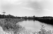
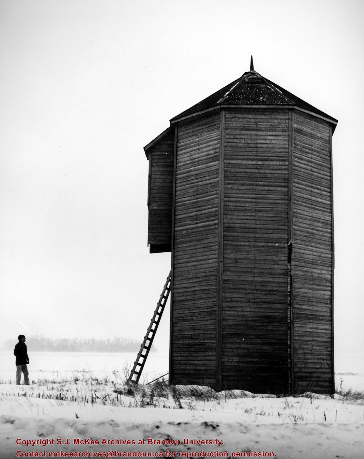
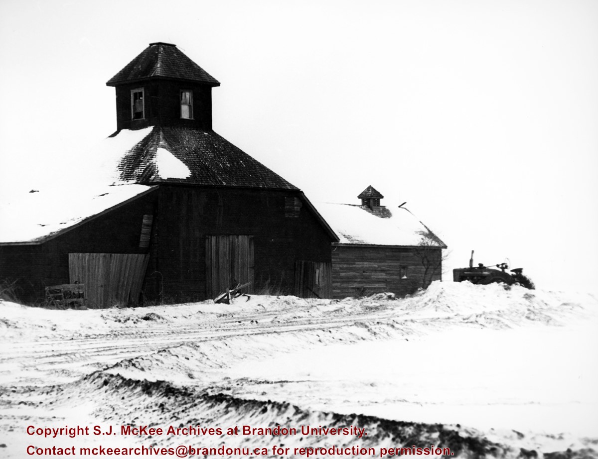
This bridge was condemned in the late 1930s but cyclists continued to use it until it was torn down (approximately 1940)
Until the early 1920s the Canadian Pacific Railway maintained a well and pumping station near the southeast corner of this bridge, which pumped water through a pipeline to a locomotive watering tank at Kemnay.
Custodial History
For custodial history see the collection level description of the Lawrence Stuckey collection.
Scope and Content
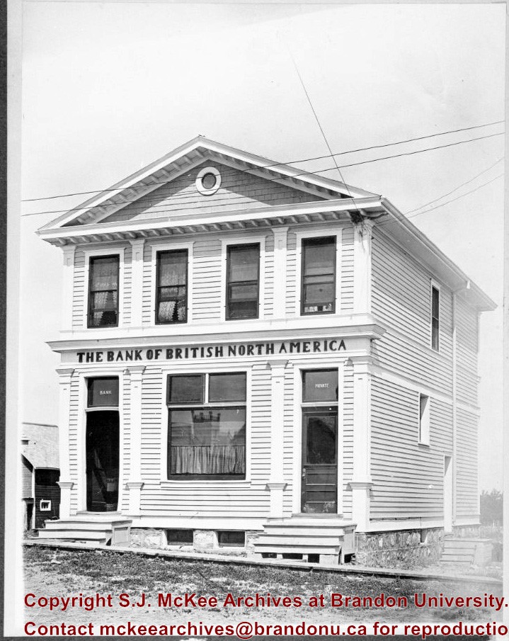
Assiniboine River Bridge North of Kemnay
Notes
[Mr. Stuckey put a negative and print in the same envelope. We have separated them, numbering the negative OB5(1) and the print OB5(1a).]
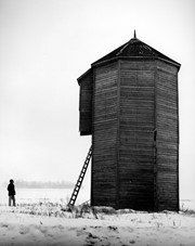
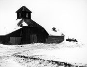
This bridge was condemned in the late 1930s but cyclists continued to use it until it was torn down (approximately 1940)
Until the early 1920s the Canadian Pacific Railway maintained a well and pumping station near the southeast corner of this bridge, which pumped water through a pipeline to a locomotive watering tank at Kemnay.
Custodial History
For custodial history see the collection level description of the Lawrence Stuckey collection.
Scope and Content
Assiniboine River Bridge North of Kemnay
Notes
[Mr. Stuckey put a negative and print in the same envelope. We have separated them, numbering the negative OB5(1) and the print OB5(1a).]
The Brandon Armoury is located at the southwest corner of Victoria Avenue and 11th Street.
Custodial History
Donated by Ron Brown.
Scope and Content
Photograph is a portrait of the Royal North-West Mounted Police C squadron returned from World War I. The photo was taken at the Brandon Armoury where the squadron was housed before being restationed.
Notes
Information on the photo was taken from G.F. Barker's Brandon: A City (p. 200).
Photograph is looking southwest from in front of the Original Music Building and shows the north side of the A.E. McKenzie Building and the west side of the Queen Elizabeth II Music Building (including the link). A number of cars in the parking lot are also visible.
Photograph has pen markings and publishing mark-up notes on front and back of matting
Scope and Content
Photograph shows the north side of the 900-block of Rosser Avenue, facing west from 9th Street. All the shops appear to be woodframed buildings; the sidewalk has yet to be installed and wooden planks have been laid down in front of the shops. Visible storefronts include: (left to right): Leask & Rose, general merchants (at the 11th Street intersect); Fortier & Bucke - Manufacturers' Agents and CPR Express Co.; The New Era - real estate office; Imperial Bank of Canada; Durand & Macdonald Law Office, T.D. McLean - jeweller; Deacon & Hooper - grocers; and J. Barker Vosburgh - Surgeon & Dentist. The building in the foreground has Rosser Avenue and 9th Street street signs affixed above the entrance to the building. A chuckwagon is parked in front of Fortier & Bucke.
Notes
Writing on the front of the photograph reads: Brandon.
See fonds level description of the Alf Fowler collection for custodial history.
Scope and Content
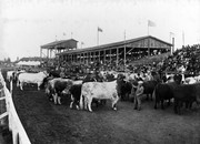
Photo shows the old Grand Stand on the Exhibition Grounds (now the Keystone Grounds) during what appears to be a cattle auction or show. Unlike the other photos of the Grand Stand in the collection, this photo was taken from the track looking into the Grand Stand rather than looking onto the track from the Grand Stand.
Storage Range
RG 5 Western Manitoba Manuscript collection - photograph storage drawer


.jpg?width=1200&404=no-img.jpg&watermark=wmk)
.jpg?width=180&404=no-img.jpg)
.jpg?width=1200&404=no-img.jpg&watermark=wmk)
.jpg?width=180&404=no-img.jpg)


.jpg%3fmaxheight%3d1000%26maxwidth%3d1000%26watermark%3dwmk&description=Assiniboine+River+Bridge+North+of+Kemnay)
.jpg%3fmaxheight%3d1000%26maxwidth%3d1000%26watermark%3dwmk&description=Assiniboine+River+Bridge+North+of+Kemnay)
)