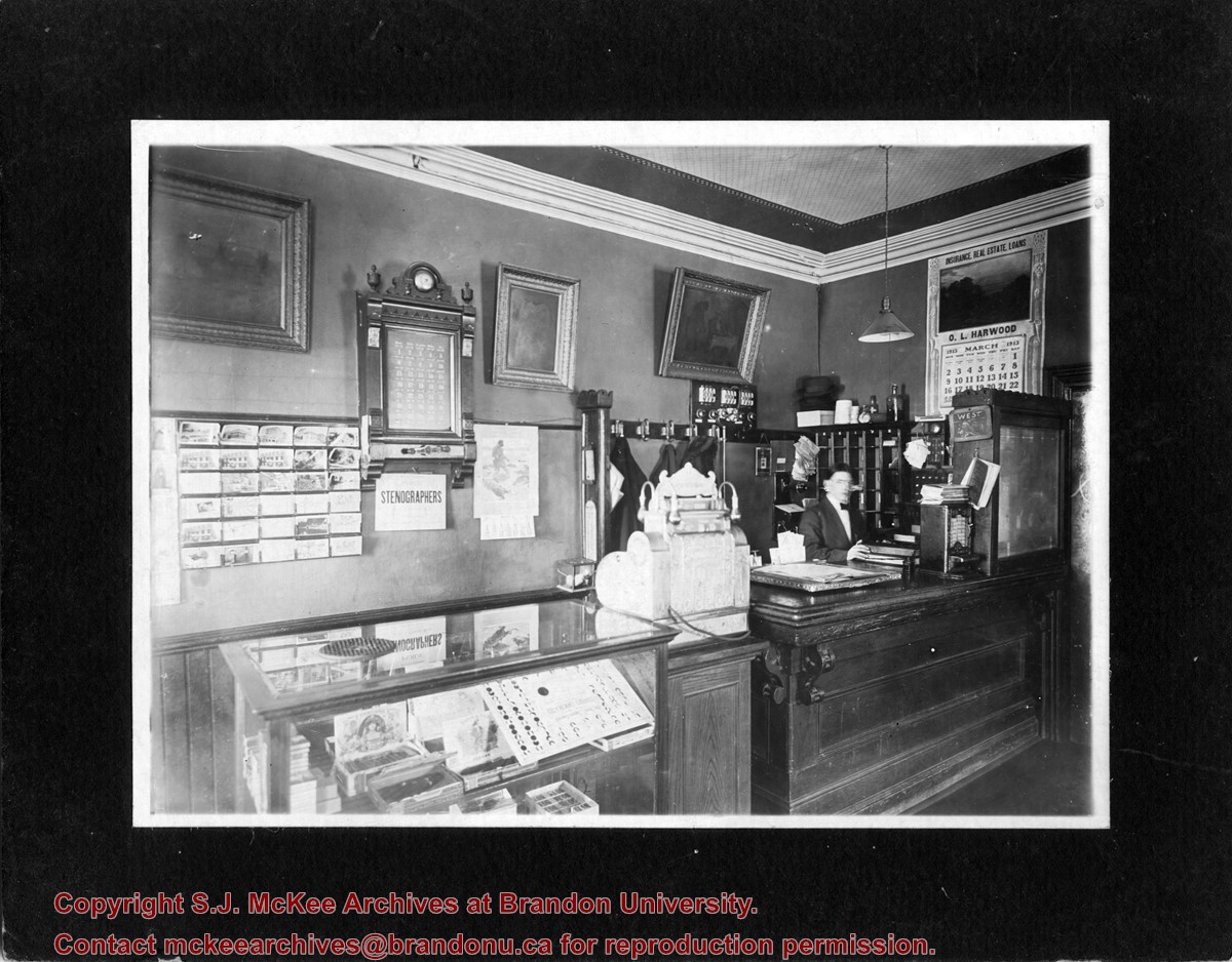
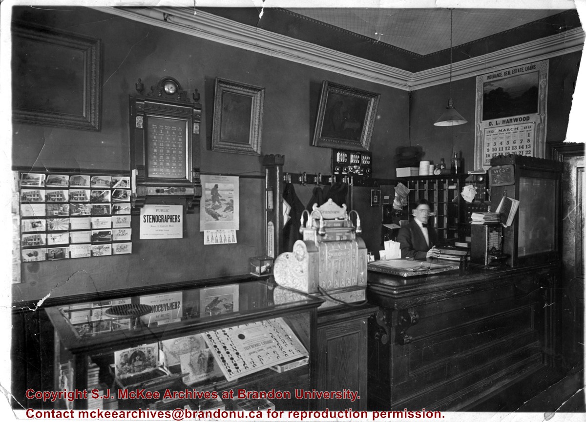
Photograph shows the possible interior of the Grandview Hotel. A young man is working behind the counter that holds a cash register and tobacco display case. A calendar for March 1913 advertises O.L. Harwood's Insurance, Real Estate, and Loans. Below the hotel's 35-room call box is an advertisement for the Public Stenographers Company. A postcard stand holds cards of Brandon's courthouse and other prominent buildings.
Photograph shows the possible interior of the Grandview Hotel. A young man is working behind the counter that holds a cash register and tobacco display case. A calendar for March 1913 advertises O.L. Harwood's Insurance, Real Estate, and Loans. Below the hotel's 35-room call box is an advertisement for the Public Stenographers Company. A postcard stand holds cards of Brandon's courthouse and other prominent buildings.
Notes
Date ascertained from calendar above counter. This photograph is a duplicate of 20-2009.23 but is in sharper focus. Grand View is written in pencil on the back of the photograph.
Postcard shows an aerial view of the city of Brandon
Notes
Writing on the back of the postcard reads: No. 10. Brandon, Manitoba, Canada / Aerial View of Brandon / Distributed by Clements Drug Store / Brandon, Manitoba, Canada / Photos by: R.J. "Bob" Snazel. / Printed by: D.W. Friesen & Sons Ltd. Altona, Manitoba, Canada. The postcard is addressed to Mr. F.A. Rosser and is postmarked Brandon 30 May 1970. A 6-cent Queen Elizabeth red postage stamp portraying various modes of the transportation. The stamp has been cancelled with a postmark that reads "Help Retarded Children."
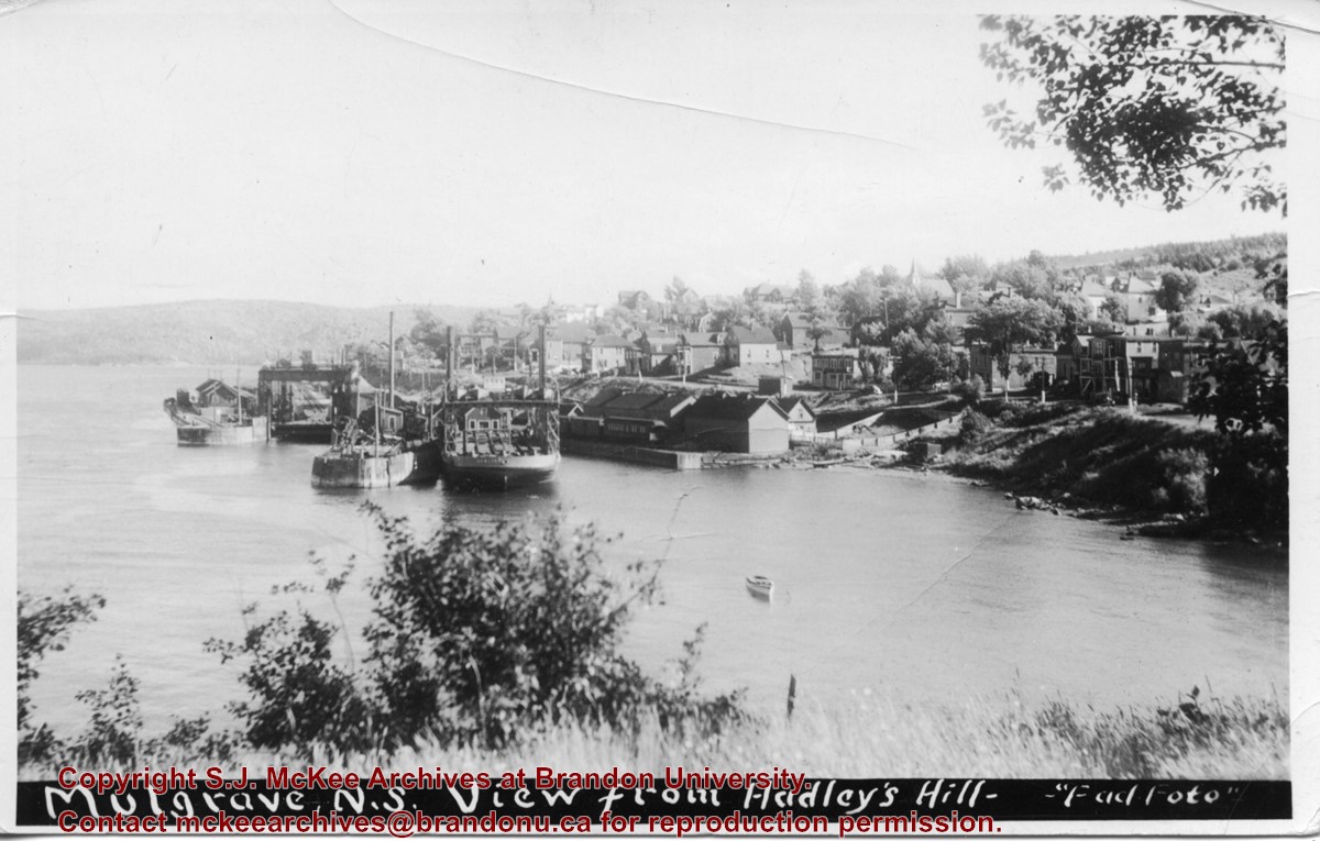
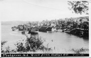
Photograph shows the train station at the port of Mulgrave, Nova Scotia. Possibly the site where the HMCS Alachasse was docked when Fred McGuinness was a telegraphers in the Canadian Navy.
Notes
Writing on the back of the postcard reads: AZO post card
Photograph has been glued to a backing board that has warped over time
History / Biographical
On 16 November 1906, Manitoba was hit by a severe winter storm that began that Thursday evening and extended through the weekend. The Brandon Daily Sun ("Storm Extends Over a Large Territory," 17 Nov. 1906, 1) reported that rail and telegraph services had been disrupted, country roads were impassable, and business in town was at a stand still. Following the weekend, the daily reported the blizzard was one of the greatest in recent memory. CPR trains had been caught in drifts by Carberry and an express car had caught fire and was destroyed ("Worst Storm in Many Years," Brandon Daily Sun, 19 Nov. 1906, 1).
Scope and Content
Photograph shows street view of intersection of the 000 block of 8th Street and Rosser Avenue in the winter. Businesses on the east side of 8th Street from Pacific to Rosser Avenues are clearly visible and include: a Lunch Room (likely Aagaard's Lunch Counter), the Hotel Imperial Annex, Liverpool House (a boarding house), R.S. Thompson and Company Real Estate Office (Land Office), a barber shop (likely J. Coulter's), Frank Gowen photography studio. Fleming's Drug Store on the corner of 8th Street and Rosser Avenue has been replaced by the Bank of Hamilton. The Imperial Hotel is visible on the west side of 8th Street. The 8th Street Bridge is visible in the background.
Notes
Writing on the front of the photograph matting reads: 338, November 1906. Page appears to be from a photo album. The photograph appears to be taken from the interior of a builing on the southwest corner of 8th Street and Rosser Avenue.
Photograph has been glued to a backing board that has warped over time
History / Biographical
On 16 November 1906, Manitoba was hit by a severe winter storm that began that Thursday evening and extended through the weekend. The Brandon Daily Sun ("Storm Extends Over a Large Territory," 17 Nov. 1906, 1) reported that rail and telegraph services had been disrupted, country roads were impassable, and business in town was at a stand still. Following the weekend, the daily reported the blizzard was one of the greatest in recent memory. CPR trains had been caught in drifts by Carberry and an express car had caught fire and was destroyed ("Worst Storm in Many Years," Brandon Daily Sun, 19 Nov. 1906, 1).
Scope and Content
Photograph shows street view of intersection of the 000 block of 8th Street and Rosser Avenue in the winter. Businesses on the east side of 8th Street from Pacific to Rosser Avenues are clearly visible and include: a Lunch Room (likely Aagaard's Lunch Counter), the Hotel Imperial Annex, Liverpool House (a boarding house), R.S. Thompson and Company Real Estate Office (Land Office), a barber shop (likely J. Coulter's), Frank Gowen photography studio. Fleming's Drug Store on the corner of 8th Street and Rosser Avenue has been replaced by the Bank of Hamilton. The Imperial Hotel is visible on the west side of 8th Street. The 8th Street Bridge is visible in the background. Men in winter coats and hats are crossing the street at the intersection. A horse-drawn sleigh is parked on 8th Street.
Notes
Writing on the front of the photograph matting reads: 340, after the storm November 1906. Page appears to be from a photo album. The photograph appears to be taken from the interior of a builing on the southwest corner of 8th Street and Rosser Avenue.
Photograph shows a view from the rooftop of the Prince Edward Hotel. The south side of the Brandon Hotel (most recently the Brandon Inn) and a service station along Prince Avenue can be seen.
Notes
Writing on the back of photograph reads: across the street from roof of P.E. Hotel 1927
Brient was a point along the Algoma Central Railway line that connected the Helen Mine to the Michipicoten Harbour. It is located southwest of Wawa, Ontario.
Scope and Content
Photograph shows ore box cars in a railway yard.
Notes
Writing beneath the photograph in the album reads: yard at Brient
Trembley was a point along the Algoma Central Railway line that connected the Helen Mine to the Michipicoten Harbour. It is located southwest of Wawa, Ontario.
Scope and Content
Photograph shows railroad tracks. A line of ore cars stretch along one track. Writing on the side of one of the cars (#3017) reads: Algoma Central Railway Co.
Notes
Writing beneath the photograph in the album reads: Trembley - Ore Cars
Photographs have been glued to a backing board that has warped over time
Scope and Content
Photograph shows street view of north side of Rosser Avenue, primarily the 700 block. The Fleming Block, Beaubier Block and its Empire Hotel, A.M. Percival (a grocer), the Brandon Hardware Company (600 block), and the Arlington Hotel (500 block) are visible along the north side of the avenue. The Bank of Hamilton Building on the southeast corner of 8th Street and Rosser appears to be under construction. A sign in the second storey window above the main entrance reads: law office. The streets are muddy and a horse and buggy is traveling west on Rosser Avenue.
Notes
Writing on the front of the photograph matting reads: mud November 12, 1906, 339. The photograph appears to be taken from the interior of a builing on the southwest corner of 8th Street and Rosser Avenue. Page appears to be from a photo album.
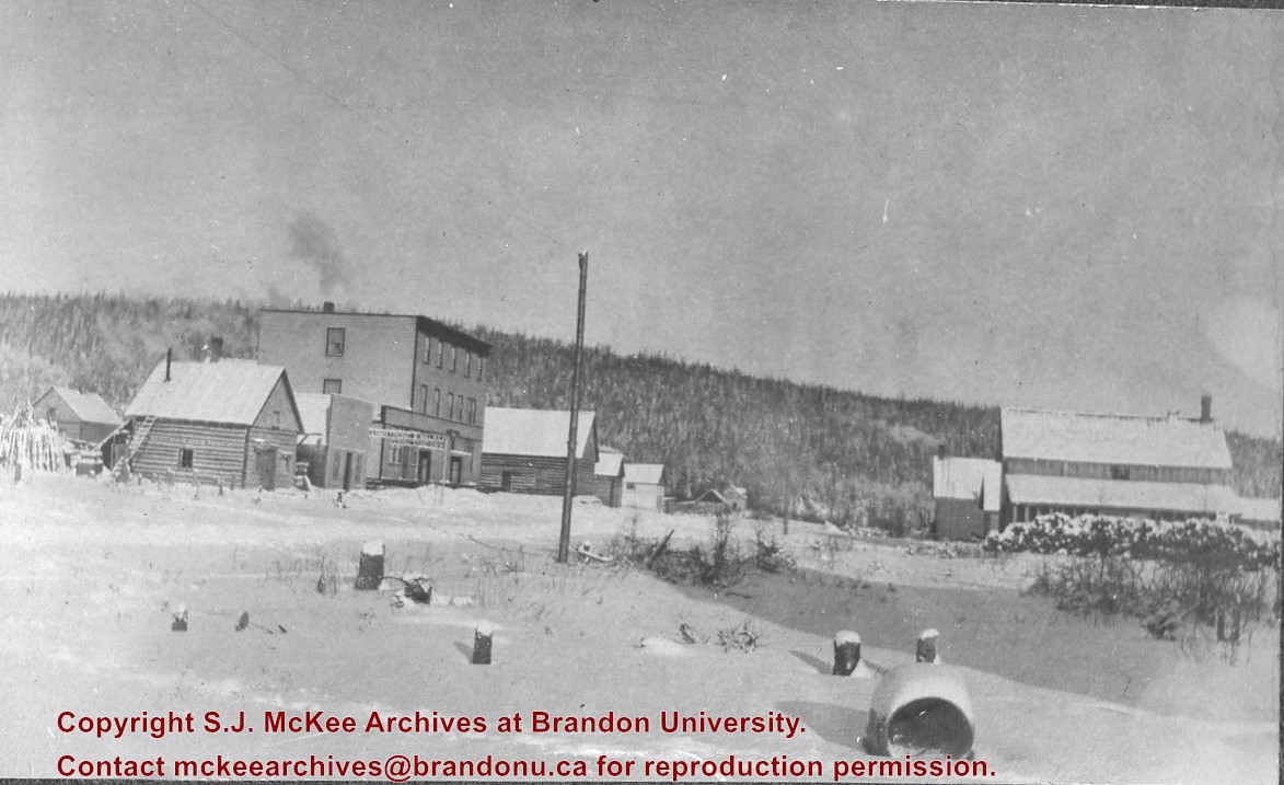
Brient was a point along the Algoma Central Railway line that connected the Helen Mine to the Michipicoten Harbour. It is located southwest of Wawa, Ontario.
Scope and Content
Photograph shows several men standing on railway tracks before a wood-framed train station in the winter. A sign attached to the station reads: British American Express Co. The man in the foreground appears to have a mailbag over on his back and several newspapers tucked beneath his arm.
Notes
Writing beneath the photograph in the album reads: station at Brient
In 1901, American entrepreneur Francis Hector Clergue (1856-1939) obtained the charter for the Ontario, Hudson Bay and Western Railway. Following his purchase, he reincoporated the Algoma Central Railway to the Algoma Central and Hudson's Bay Railway. (Source: Sault St. Mairie Public Library, "Transportation - Algoma Central Railway," Sault History Online, 2008)
Scope and Content
Photograph shows railroad tracks cutting through the Canadian Shield.
Notes
Writing beneath the photograph in the album reads: Algoma Central & Hundson Bay Ry.
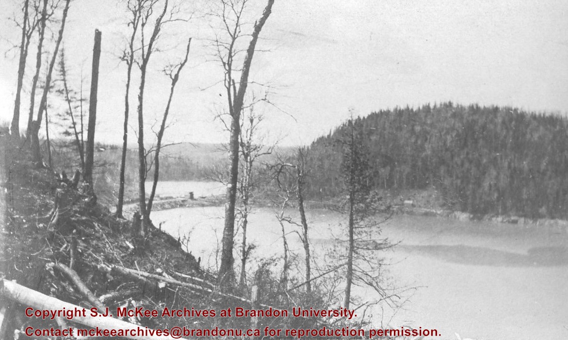
The Lake Talbot tresle was a point along the Algoma Central Railway line that connected the Helen Mine to the Michipicoten Harbour. It is located north of Wawa and southwest of the Helen Mine.
Scope and Content
Photograph shows several men walking a railway line. Before them is a tresle bridge.
Notes
Writing beneath the photograph in the album reads: Lake Talbott Tresle [sic.]
Photographs have been glued to a backing board that has warped over time
Scope and Content
Photograph shows parade floats travelling on 100 block of 8th Street (Brandon). Horse-drawn floats appear to belong to the Amalgamated Society of Carpenters and Joiners, Murdock/Murdoch Brothers (furniture dealers), and F.W. Durst (cement contractor). Businesses visible in the background include the Sylvester Brothers Manufacturing Company and McDiarmid and Clarke lumber and fuel yard. Spectators in the foreground are leaning on a wooden fence likely belonging to the Old City Hall.
Notes
Writing on the front of the photograph matting reads: 315 July 1906. Two photographs (20-2009.7, 20-2009.6) are glued on the reverse side. Page appears to be from a photo album.


