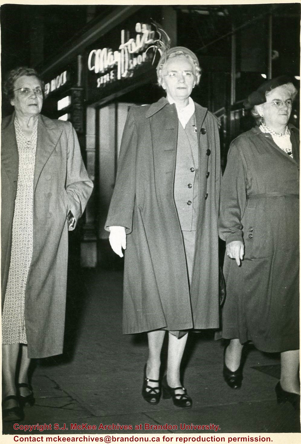
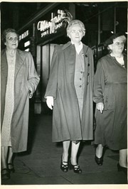
Photograph shows a group of three elderly women walking on a sidewalk in front of Mayfair Style Shop. Isabella Louisa McGuinness is the woman on the right.
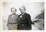
Photograph shows two elderly woman standing near a dock in a harbour. The woman on the right is Isabella Louisa McGuinness. The on the left may be her sister, "Annie"
Notes
Photograph possibly of Mary Charlotte Oldfield (nee McGuinness) with Rev. Henry John Herbert Oldfield and John William Frederick "Fred"
Joseph Donaldson's Ltd. Food Market appears in the Henderson's Brandon City Directory from 1906 to 1929. Donaldson's main meat/butcher shop was located at 813 Rosser Avenue. A second branch was opened by 1914 at 228 Rosser Avenue but relocated to 654 Tenth Street by 1917. The branch relocated by 1921 to 662 Tenth Street where it remained until ca.1929. This address was referred to as the "Busy Corner" in the Henderson's Directory. In 1931, butcher Ted Hill appears to have taken over the Donaldson's establishments.
Scope and Content
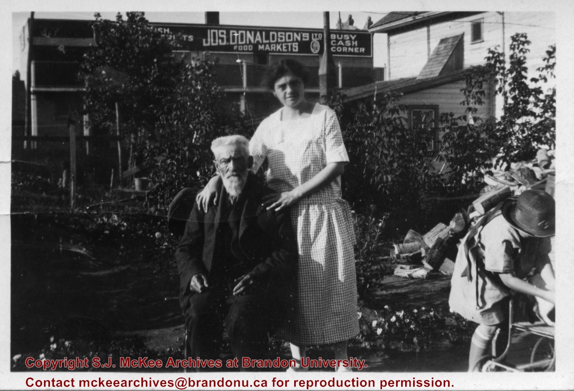
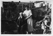
Photograph shows George Pope sitting in a backyard. Standing next to him is Isabella Louise McGuinness (Pope). A young girl, perhaps Ruth McGuinness, is standing over a stroller. A wood pile and garden plants can be seen in the backyard. An advertisement for Joseph Donaldson's Ltd Food Markets can be seen on a business beside the residence.
Notes
Writing on the back of the photograph reads: This is mum her uncle George Pope who came to Brandon in 1880 (I think) in the back yard of 708-10th Street. It looked like Ruth in the lower right corner. I was interested in the Donaldson advertising.
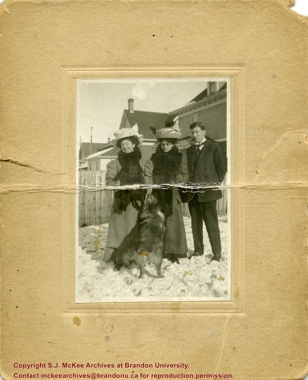
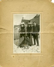
Photograph shows two women, a man, and dog, standing in a residential backyard during the winter. The women are wearing large hats and fur stoles. The woman standing in the middle is likely Isabella Louisa McGuinness (nee Pope), mother to Brandon Sun editor Fred McGuinness.
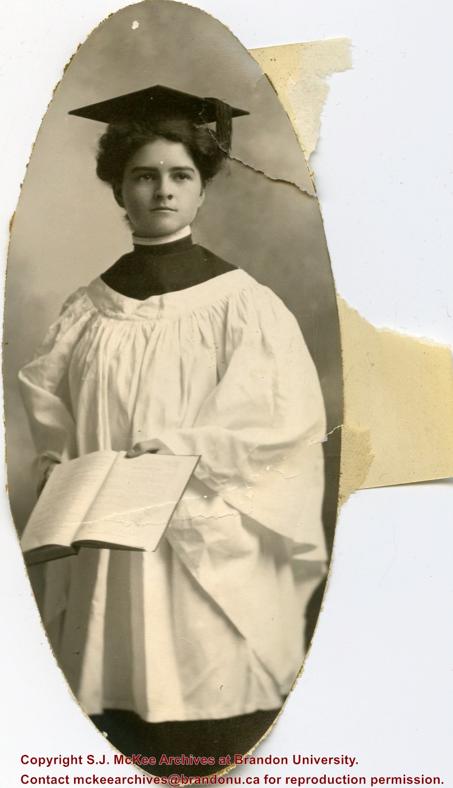
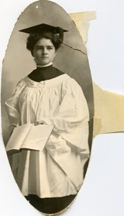
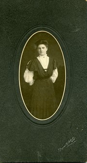
Photograph shows Isabella Louisa Pope, mother to Brandon Sun editor Fred McGuinness. Miss Pope is wearing a white lace blouse with a black pinafore-like dress.
Photograph shows the Brandon Wheat Market along Pacific Avenue on November 30, 1885. Farmers can be seen driving wagon teams loaded with bags of grain in line on Pacific Avenue from 10 Street to at least 7th Street. On the north side of Pacific Avenue the CPR Land Office and grain elevators are pictured. On the south side of Pacific Avenue, the general merchant/hardware store Bower, Blackburn, Mundell & Porter is situated on the corner of Pacific Avenue and 10th Street. A 10th Street sign is affixed to the merchants' store. On the east side of the general store, Edie House, the Grand View Hotel, and a Farmers' boarding and lodging house can be seen. Most of the buildings appear to be woodframed except for the Grand View, which is constructed of brick. Sidewalks appear to be in place on the south side of Pacific and snow dusts the streets. A baby swathed in winter clothing sits in a pram/baby carriage in front of the general store.
Notes
Writing on the front of the photograph reads: Novemeber 30th, 1885, Brandon Wheat Market
Photograph shows the train station at the port of Mulgrave, Nova Scotia. Possibly the site where the HMCS Alachasse was docked when Fred McGuinness was a telegraphers in the Canadian Navy.
Notes
Writing on the back of the postcard reads: AZO post card
Brient was a point along the Algoma Central Railway line that connected the Helen Mine to the Michipicoten Harbour. It is located southwest of Wawa, Ontario.
Scope and Content
Photograph shows ore box cars in a railway yard.
Notes
Writing beneath the photograph in the album reads: yard at Brient
Trembley was a point along the Algoma Central Railway line that connected the Helen Mine to the Michipicoten Harbour. It is located southwest of Wawa, Ontario.
Scope and Content
Photograph shows railroad tracks. A line of ore cars stretch along one track. Writing on the side of one of the cars (#3017) reads: Algoma Central Railway Co.
Notes
Writing beneath the photograph in the album reads: Trembley - Ore Cars
Brient was a point along the Algoma Central Railway line that connected the Helen Mine to the Michipicoten Harbour. It is located southwest of Wawa, Ontario.
Scope and Content
Photograph shows several men standing on railway tracks before a wood-framed train station in the winter. A sign attached to the station reads: British American Express Co. The man in the foreground appears to have a mailbag over on his back and several newspapers tucked beneath his arm.
Notes
Writing beneath the photograph in the album reads: station at Brient
In 1901, American entrepreneur Francis Hector Clergue (1856-1939) obtained the charter for the Ontario, Hudson Bay and Western Railway. Following his purchase, he reincoporated the Algoma Central Railway to the Algoma Central and Hudson's Bay Railway. (Source: Sault St. Mairie Public Library, "Transportation - Algoma Central Railway," Sault History Online, 2008)
Scope and Content
Photograph shows railroad tracks cutting through the Canadian Shield.
Notes
Writing beneath the photograph in the album reads: Algoma Central & Hundson Bay Ry.
The Lake Talbot tresle was a point along the Algoma Central Railway line that connected the Helen Mine to the Michipicoten Harbour. It is located north of Wawa and southwest of the Helen Mine.
Scope and Content
Photograph shows several men walking a railway line. Before them is a tresle bridge.
Notes
Writing beneath the photograph in the album reads: Lake Talbott Tresle [sic.]
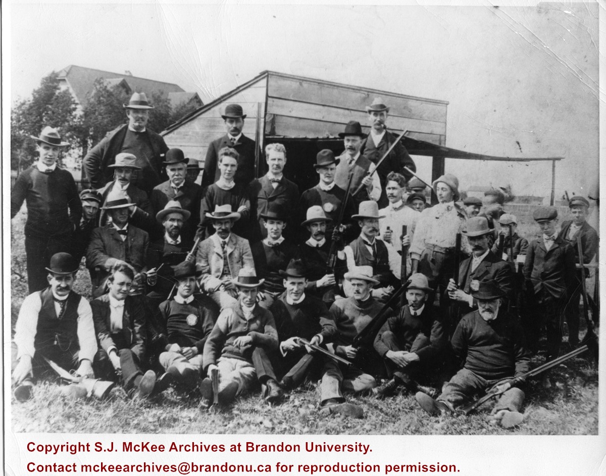
The Old Brandon Gun Club was located on 6th Street south of the Canadian National tracks. In a note to Fred McGuinness, Bill Love shares a story about how children trapped pigeons for the glun from stables and church belfries. The birds were later used for pigeon pie.
Custodial History
Photograph given to Fred McGuinness by Bill Love/Lowe?
Scope and Content
Photograph shows large group of men posing with their shotguns in front of a hunting blind or shed. The moustached man kneeling at the end of the second row, right-hand side, wearing a bowler hat has been identified as the grandfather of Bill Love (possibly William D. Love).
Photograph shows a panorama, bird's-eye-view of downtown Brandon, between Pacific and Rosser Avenues and 7th Street facing east. Photoraph likely taken from the McKenzie Seeds Building. Visible businesses include: Western Canada Flour Mills, Hanbury Hardware Co. Ltd., Cockshutt Plow Co., New Pacific Hotel, Gordon McKay Building, and Arlington Hotel.
Notes
Part of "Souvenir of Brandon, Manitoba, Canada [viewbook], Printed by Photogelatine Engraving Co. Limited, Ottawa." Dates obtained from the Burchill's Music Store Henderson's Brandon City Directory listings (1927-1929). Writing on the front of the photograph reads: Panorama of Brandon, Man.
In the spring of 1994, Fred McGuinness was contracted by Great Plains Publications to assist with the writing of the centennial publication Old Pathways, New Horizons: A History of the Wawanesa Mutual Insurance Company, 1896-1996. Published in 1996, by Great Plains Publications (Winnipeg), Old Pathways, New Horizons is a 111-page illustrated soft cover book.
Custodial History
These materials were donated to the SJ McKee Archives by the Estate of Fred McGuinness circa 2011. The Archives accessioned the records in 2015.
Scope and Content
The subseries consists of two draft manuscripts and two letters of correspondence. Records were generated during the writing of the book Old Pathways, New Horizons: A History of the Wawanesa Mutual Insurance Company, 1896-1996. The book was commissioned by the Wawanesa Mutual Insurance Company and published in 1996 by Great Plains Publishing Limited.
Notes
Information in the history/biography was taken from a letter dated April 19, 1994, to Fred McGuinness from Gregg Shilliday (see file 11) and publication information listed in the dust jacket of the book
Accruals
Closed
Finding Aid
A file level inventory is available
Storage Location
2015 accessions
Arrangement
Arrangement was artificially created by the Archives


)
)