Photograph shows the train station at the port of Mulgrave, Nova Scotia. Possibly the site where the HMCS Alachasse was docked when Fred McGuinness was a telegraphers in the Canadian Navy.
Notes
Writing on the back of the postcard reads: AZO post card
Brient was a point along the Algoma Central Railway line that connected the Helen Mine to the Michipicoten Harbour. It is located southwest of Wawa, Ontario.
Scope and Content
Photograph shows several men standing on railway tracks before a wood-framed train station in the winter. A sign attached to the station reads: British American Express Co. The man in the foreground appears to have a mailbag over on his back and several newspapers tucked beneath his arm.
Notes
Writing beneath the photograph in the album reads: station at Brient
Photograph shows the CPR Train Station on Pacific Avenue and 10th Street.
Notes
Part of "Souvenir of Brandon, Manitoba, Canada [viewbook], Printed by Photogelatine Engraving Co. Limited, Ottawa." Dates obtained from the Burchill's Music Store Henderson's Brandon City Directory listings (1927-1929). Writing on the front of the photograph reads: CPR Station, Brandon, Man.
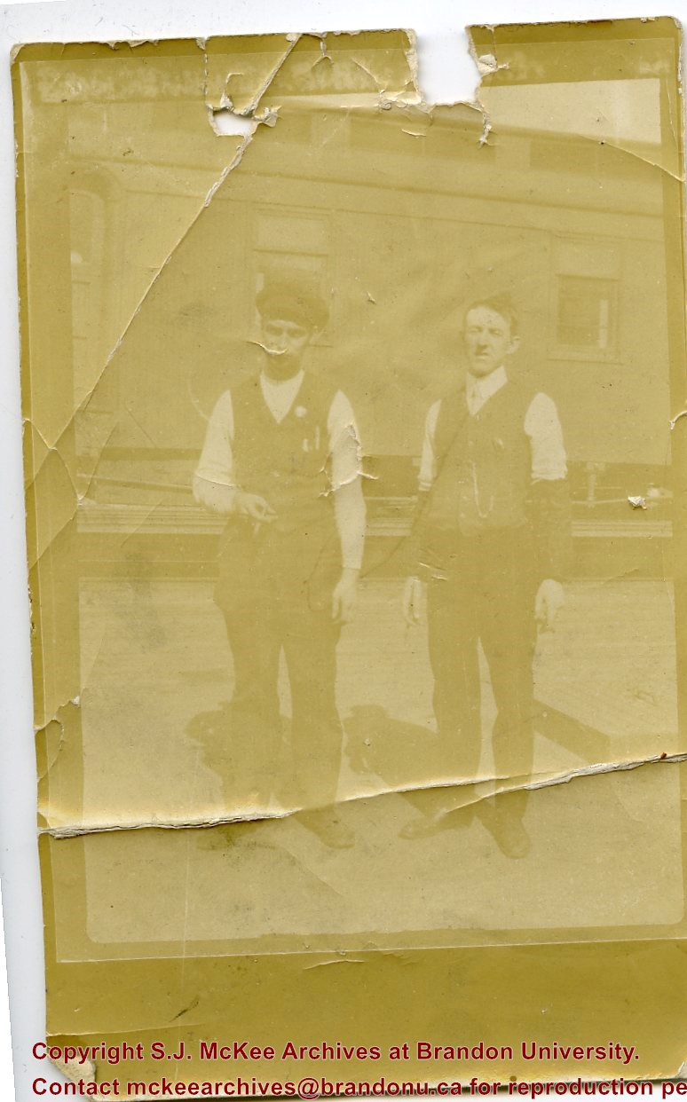
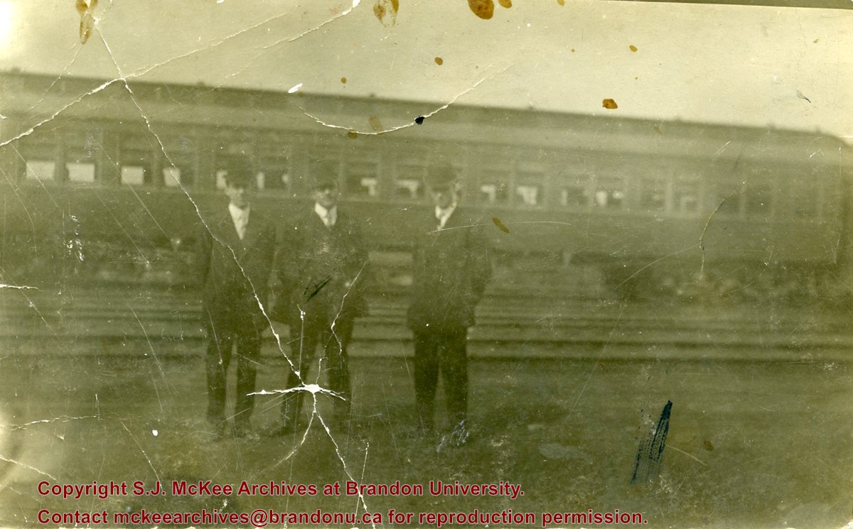
Photograph shows a group of men in suits and hats standing in a railway yard. A passenger train car is in the background. William Frederick McGuinness is standing on the left
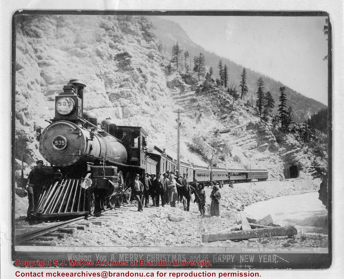
Photograph shows a possible CPR train stopped on the tracks at the base of a mountain. Train employees and passengers are posing alongside the train.
Notes
Writing on the front of the photograph reads: Train #1033 "Pacific Express" in Kicking Horse Pass near Golden / Trueman & Caple Photo, Vancouver, BC / Wishing You A Merry Christmas and a Happy New Year
Date obtained from Margery Hadley McDougall, "R.H. Trueman, Artist and Documentarian," BC Studies, No. 52, Winter 1981-82, pp.129-141.
Brient was a point along the Algoma Central Railway line that connected the Helen Mine to the Michipicoten Harbour. It is located southwest of Wawa, Ontario.
Scope and Content
Photograph shows ore box cars in a railway yard.
Notes
Writing beneath the photograph in the album reads: yard at Brient
Trembley was a point along the Algoma Central Railway line that connected the Helen Mine to the Michipicoten Harbour. It is located southwest of Wawa, Ontario.
Scope and Content
Photograph shows railroad tracks. A line of ore cars stretch along one track. Writing on the side of one of the cars (#3017) reads: Algoma Central Railway Co.
Notes
Writing beneath the photograph in the album reads: Trembley - Ore Cars
The Medicine Hat Exhibition and Stampede Parade Day was held on Thursday, July 19, 1962, at 9:30 a.m. The local newspaper reported that approximately 24,000 people were in attendance to see parade marshall Rod Ashburner leading 175 entries consisting of 90 floats, 75 horses, and 10 bands. There were 19 parade categories eligible for $12,000 in prize money and included: junior and senior cowboys and cowgirls; fancy and Shetland ponies; sulky class open; comic, commercial, industrial and organizational floats; decorated cars; special ranch class; 4-H Clubs; and a non-competitive class.
The parade route started at Second St. and Allowance Ave., from Second St. to Ash Ave., north on Ash to First St. SE., from First St. S.E. to Fourth Ave., south to Second St. to South Railway St., south on South Railway St. to Third St., with a finish at McLeod Trail. A route map was published in the Medicine Hat News the day before the parade.
Aerial photographs of the parade were taken by Medicine Hat News photographer Howard Heid (1930-2005) from the private helicopter of John Bourn. Bourn was a pilot from Woodville, Wisconsin, who chartered his four-seater helicopter for sight-seers at exhibitions and stampedes across the county.
(Sources: Pat Currie, "Let 'Er Go!," Medicine Hat News, 19 July 1962,1; Harald Gunderson, "'Eye in the Sky' Best Parade View," Medicine Hat News, 19 July 1962,1; "Parade Starts at 9:30 Sharp," 18 July 1962)
Scope and Content
Photograph shows an aerial view of the Medicine Hat Exhibition and Stampede Parade route with a focus on the First Street SE. A number of gas stations and garages are visible along this route and include Texaco, Shell, Ford, and B/A. The Fraternal Order of Eagles lodge is also visible.
Notes
This photograph appeared on the front page of The Medicine Hat News (19 July 1962).
In 1901, American entrepreneur Francis Hector Clergue (1856-1939) obtained the charter for the Ontario, Hudson Bay and Western Railway. Following his purchase, he reincoporated the Algoma Central Railway to the Algoma Central and Hudson's Bay Railway. (Source: Sault St. Mairie Public Library, "Transportation - Algoma Central Railway," Sault History Online, 2008)
Scope and Content
Photograph shows railroad tracks cutting through the Canadian Shield.
Notes
Writing beneath the photograph in the album reads: Algoma Central & Hundson Bay Ry.
The Lake Talbot tresle was a point along the Algoma Central Railway line that connected the Helen Mine to the Michipicoten Harbour. It is located north of Wawa and southwest of the Helen Mine.
Scope and Content
Photograph shows several men walking a railway line. Before them is a tresle bridge.
Notes
Writing beneath the photograph in the album reads: Lake Talbott Tresle [sic.]
According to Russ Gourluck (Silver Screens on the Prairie, Winnipeg: Great Plains Publications, 2012, 26), the Orpheum Theatre was in operation from 1917 to 1920 when it then became the Willis Theatre.
Scope and Content
Postcard shows the 100 block of 10th Street facing north. The CPR train station can be seen at the end of 10th Street. The sign for the Rex Cafe is visible on the west side of 10th Street. On the east side of 10th Street, billboards for Campbell & Campbell furniture are visible as well as signs for Pianos and the Orpheum Theatre. Motorists and cyclists share the road. Street car tracks run the length of 10th Street.
Notes
Postcard was manufactured by T.B. [Tichnor Brothers, Inc., 1908-1987] Cambridge, Massachusetts.
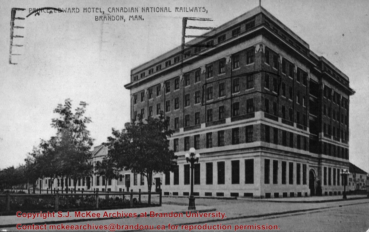
Photograph shows the Prince Edward Hotel and Canadian National Railways Station along Princess Avenue facing southwest.
Notes
Writing on the back of the postcard reads: Novelty Manufacturing & Art Co. Ltd., Montreal. A cancelled George VI brown Canada 2 cent stamp has been postmarked: Regina, Sask, Terminal A., Jul 22 12:30 PM 1940, Save Time, Use Air Mail.
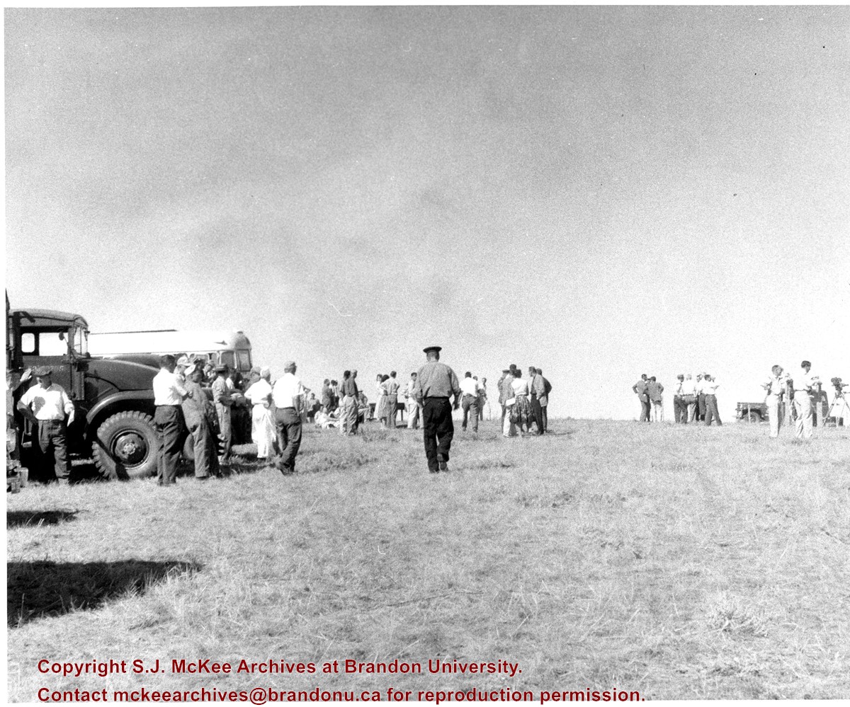
Suffield, Alberta, is situated approximately 40km northwest of Medicine Hat, Alberta. A few "large explosive events" (100 to 500 tons) were conducted at the Defence Research Board's (DRB) Suffield Experimental Station in the 1960s. On 19 January 1961, Medicine Hat citizens felt tremors in the community as a result of five tons of TNT being detonated at the station. The station director attributed this anomaly to freak atmospheric and weather conditions. At the time the DRB was testing the effects of shock waves on military equipment.
In July 1964, the Suffield Experimental Station detonated 30,600 blocks of TNT - 500 tons - to test the largest, non-nuclear, non-confined, surface blast. Placed in various sections radiating from ground zero to test the effects of the blast were targets, dummy-men, miscellaneous instruments, mines, model ships, nose cones, repirators, vehicles, subterranean chambers, shelters, tunnels, foxholes, and trenches. Several hundred people were expected to observe the blast, including 80 "official observers" and a VIP party of military and research personnel from Canada, the United States, and Britain.
(Sources: "Hellyer Heads VIP List Coming Here for SES Blast," Medicine Hat News, 09 July 1964, 7; Patrick J.Roe, "Blast Area Awaits a Cloudless Day," Medicine Hat News, 16 July 1964, 2; "Suffield Explosion Felt Here," Medicine Hat News, 19 January 1961, 7)
Scope and Content
Photograph shows observors waiting for a detonation at the Suffield Experimental Station. Camera operators can be seen on the right waiting to film the blast.
Suffield, Alberta, is situated approximately 40km northwest of Medicine Hat, Alberta. A few "large explosive events" (100 to 500 tons) were conducted at the Defence Research Board's (DRB) Suffield Experimental Station in the 1960s. On 19 January 1961, Medicine Hat citizens felt tremors in the community as a result of five tons of TNT being detonated at the station. The station director attributed this anomaly to freak atmospheric and weather conditions. At the time the DRB was testing the effects of shock waves on military equipment.
In July 1964, the Suffield Experimental Station detonated 30,600 blocks of TNT - 500 tons - to test the largest, non-nuclear, non-confined, surface blast. Placed in various sections radiating from ground zero to test the effects of the blast were targets, dummy-men, miscellaneous instruments, mines, model ships, nose cones, repirators, vehicles, subterranean chambers, shelters, tunnels, foxholes, and trenches. Several hundred people were expected to observe the blast, including 80 "official observers" and a VIP party of military and research personnel from Canada, the United States, and Britain.
(Sources: "Hellyer Heads VIP List Coming Here for SES Blast," Medicine Hat News, 09 July 1964, 7; Patrick J.Roe, "Blast Area Awaits a Cloudless Day," Medicine Hat News, 16 July 1964, 2; "Suffield Explosion Felt Here," Medicine Hat News, 19 January 1961, 7)
Scope and Content
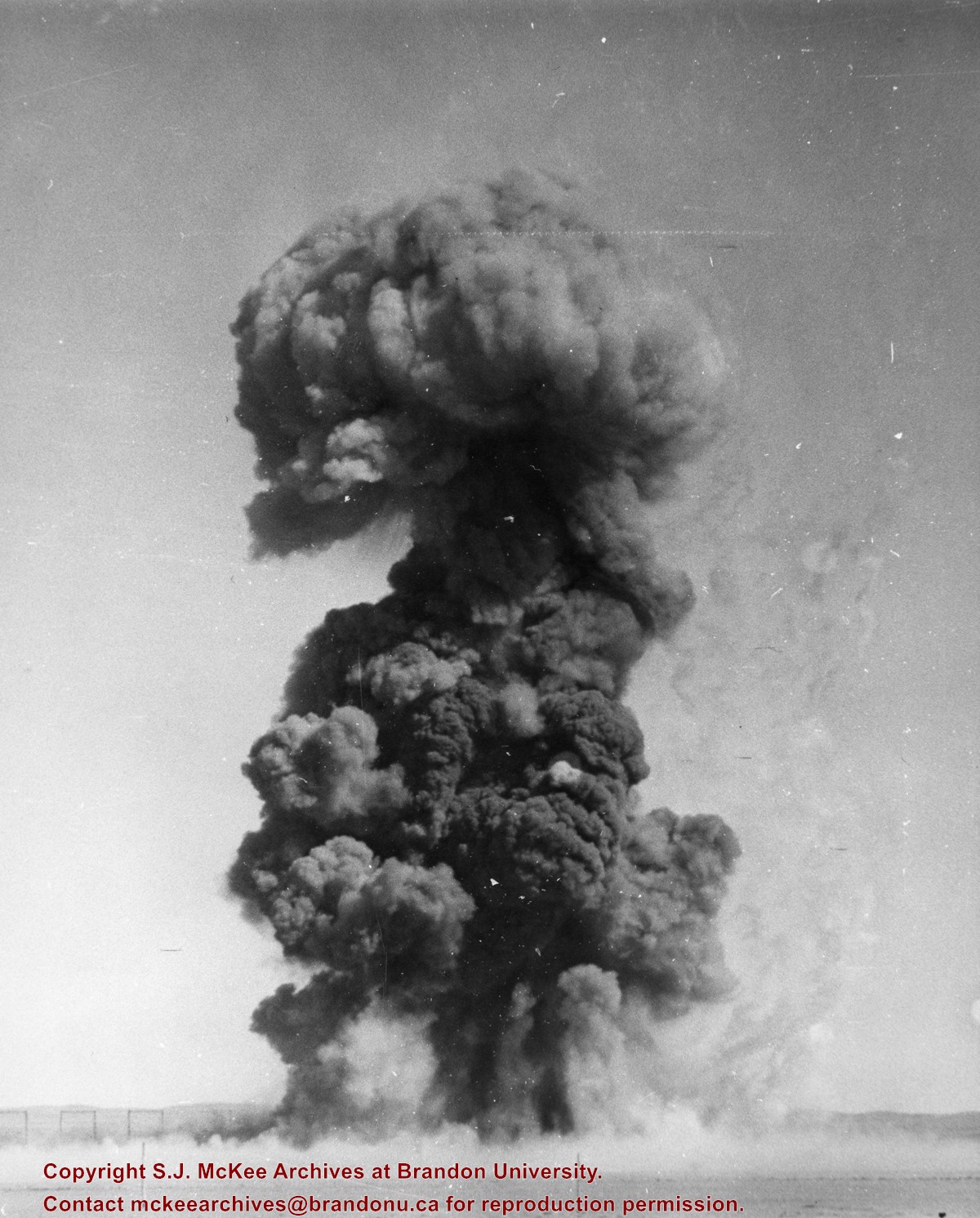
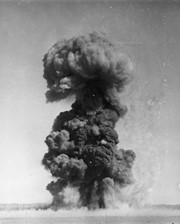
Photograph shows a detonation at the Suffield Experimental Station.
Suffield, Alberta, is situated approximately 40km northwest of Medicine Hat, Alberta. A few "large explosive events" (100 to 500 tons) were conducted at the Defence Research Board's (DRB) Suffield Experimental Station in the 1960s. On 19 January 1961, Medicine Hat citizens felt tremors in the community as a result of five tons of TNT being detonated at the station. The station director attributed this anomaly to freak atmospheric and weather conditions. At the time the DRB was testing the effects of shock waves on military equipment.
In July 1964, the Suffield Experimental Station detonated 30,600 blocks of TNT - 500 tons - to test the largest, non-nuclear, non-confined, surface blast. Placed in various sections radiating from ground zero to test the effects of the blast were targets, dummy-men, miscellaneous instruments, mines, model ships, nose cones, repirators, vehicles, subterranean chambers, shelters, tunnels, foxholes, and trenches. Several hundred people were expected to observe the blast, including 80 "official observers" and a VIP party of military and research personnel from Canada, the United States, and Britain.
(Sources: "Hellyer Heads VIP List Coming Here for SES Blast," Medicine Hat News, 09 July 1964, 7; Patrick J.Roe, "Blast Area Awaits a Cloudless Day," Medicine Hat News, 16 July 1964, 2; "Suffield Explosion Felt Here," Medicine Hat News, 19 January 1961, 7)
Scope and Content
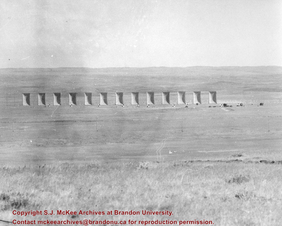
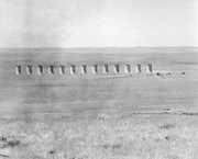
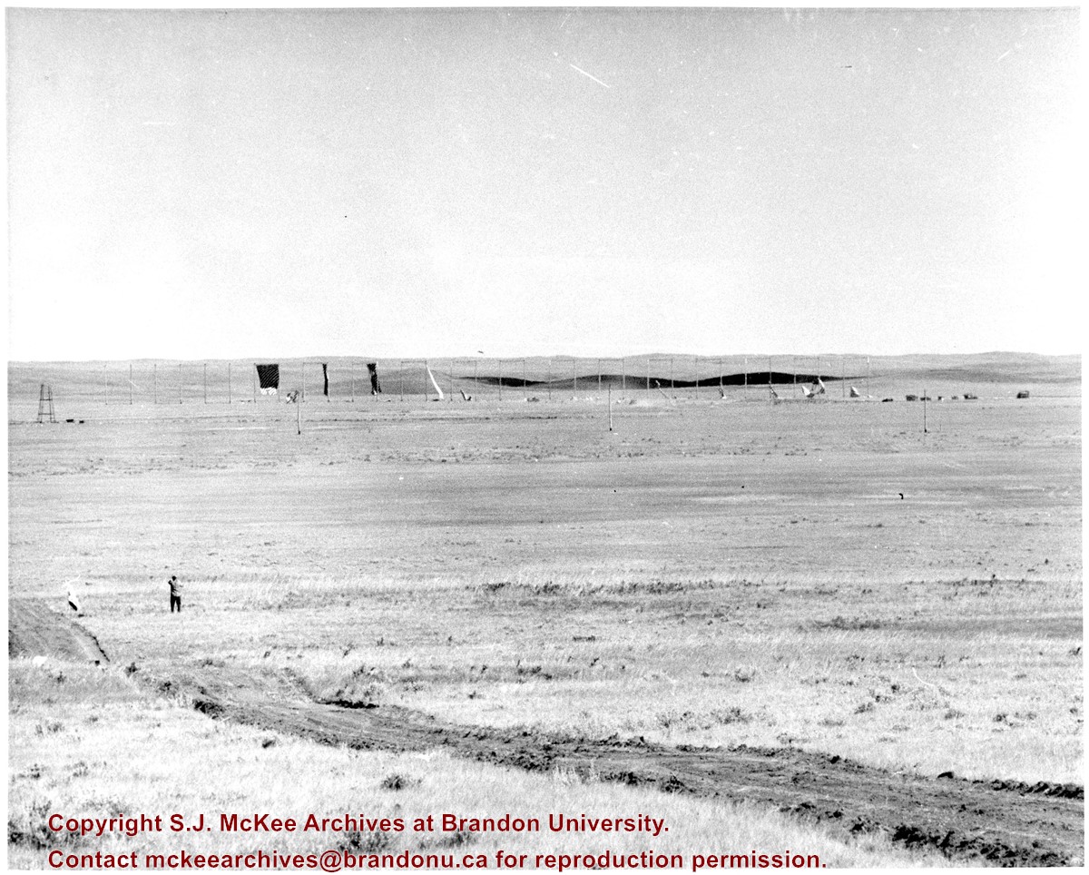
Photograph shows blast targets/dummies pre-detonation at the Suffield Experimental Station.
Suffield, Alberta, is situated approximately 40km northwest of Medicine Hat, Alberta. A few "large explosive events" (100 to 500 tons) were conducted at the Defence Research Board's (DRB) Suffield Experimental Station in the 1960s. On 19 January 1961, Medicine Hat citizens felt tremors in the community as a result of five tons of TNT being detonated at the station. The station director attributed this anomaly to freak atmospheric and weather conditions. At the time the DRB was testing the effects of shock waves on military equipment.
In July 1964, the Suffield Experimental Station detonated 30,600 blocks of TNT - 500 tons - to test the largest, non-nuclear, non-confined, surface blast. Placed in various sections radiating from ground zero to test the effects of the blast were targets, dummy-men, miscellaneous instruments, mines, model ships, nose cones, repirators, vehicles, subterranean chambers, shelters, tunnels, foxholes, and trenches. Several hundred people were expected to observe the blast, including 80 "official observers" and a VIP party of military and research personnel from Canada, the United States, and Britain.
(Sources: "Hellyer Heads VIP List Coming Here for SES Blast," Medicine Hat News, 09 July 1964, 7; Patrick J.Roe, "Blast Area Awaits a Cloudless Day," Medicine Hat News, 16 July 1964, 2; "Suffield Explosion Felt Here," Medicine Hat News, 19 January 1961, 7)
Scope and Content
Photograph shows blast targets/dummies post-detonation at the Suffield Experimental Station.


)