Skip header and navigation

Revise Search

20 records – page 13 of 1.

Former Engine House, Reston, Manitoba

http://archives.brandonu.ca/en/permalink/descriptions10351
Part Of
RG 11 Lawrence Stuckey fonds
Description Level
Item
GMD
graphic
Date Range
July 1, 1986
Accession Number
1-2002
Part Of
RG 11 Lawrence Stuckey fonds
Creator
L.A. Stuckey
Description Level
Item
Series Number
3.3
Item Number
1-2002.3.3.CPR[75.0c]
Accession Number
1-2002
GMD
graphic
Date Range
July 1, 1986
Physical Description
2.5" x 2.5" (b/w)
Material Details
Negative
History / Biographical
Mr. Stuckey's notes: Built to serve Reston-Wolseley branch. Branch opened 1904.
Custodial History
For custodial history see the collection level description of the Lawrence Stuckey collection.
Scope and Content
Image of the former engine house in Reston, Manitoba. Image was taken along the CPR lines south of the mainline.
Name Access
Reston engine house
CPR
Subject Access
Engine houses (Railroads)
Repro Restriction
The McKee Archives is the copyright holder of the Stuckey materials.
Storage Location
Lawrence Stuckey collection
Arrangement
[Mr. Stuckey put four negatives in the same envelope. We have separated them and numbered them (75.0a) to (75.0d)].
Images
Show Less

Former Engine House, Reston, Manitoba

http://archives.brandonu.ca/en/permalink/descriptions10352
Part Of
RG 11 Lawrence Stuckey fonds
Description Level
Item
GMD
graphic
Date Range
July 1, 1986
Accession Number
1-2002
Part Of
RG 11 Lawrence Stuckey fonds
Creator
L.A. Stuckey
Description Level
Item
Series Number
3.3
Item Number
1-2002.3.3.CPR[75.0d]
Accession Number
1-2002
GMD
graphic
Date Range
July 1, 1986
Physical Description
2.5" x 2.5" (b/w)
Material Details
Negative
History / Biographical
Mr. Stuckey's notes: Built to serve Reston-Wolseley branch. Branch opened 1904.
Custodial History
For custodial history see the collection level description of the Lawrence Stuckey collection.
Scope and Content
Image of the former engine house in Reston, Manitoba. Image was taken along the CPR lines south of the mainline.
Name Access
Reston engine house
CPR
Subject Access
Engine houses (Railroads)
Repro Restriction
The McKee Archives is the copyright holder of the Stuckey materials.
Storage Location
Lawrence Stuckey collection
Arrangement
[Mr. Stuckey put four negatives in the same envelope. We have separated them and numbered them (75.0a) to (75.0d)].
Images
Show Less

Two views looking east and west from Tupper St. overpass, Portage La Prairie, Manitoba

http://archives.brandonu.ca/en/permalink/descriptions10423
Part Of
RG 11 Lawrence Stuckey fonds
Description Level
Item
GMD
graphic
Date Range
April 19, 1965
Accession Number
1-2002
Part Of
RG 11 Lawrence Stuckey fonds
Creator
L.A. Stuckey
Description Level
Item
Series Number
3.3
Item Number
1-2002.3.3.CNR[136a]
Accession Number
1-2002
GMD
graphic
Date Range
April 19, 1965
Physical Description
4.25" x 2.5" (b/w)
Material Details
Negative
History / Biographical
Stuckey's notes: collection of George H. Harris, Winnipeg, Manitoba.
Custodial History
For custodial history see the collection level description of the Lawrence Stuckey collection.
Scope and Content
Image of two views looking east and west from Tupper St. overpass, Portage La Prairie, Manitoba, taken along the CNR mainline, Rivers substation.
Notes
From the collection of George H. Harris, Winnipeg, Manitoba.
Name Access
CNR
Portage La Prairie, Manitoba
Subject Access
railways
railway stations
towns
geographic features
Repro Restriction
The McKee Archives is the copyright holder of the Stuckey materials.
Storage Location
Lawrence Stuckey collection
Arrangement
[Mr. Stuckey put two negatives in same envelope. We have separated them and numbered them (136a) and (136b)].
Images
Show Less

North Lauder locale Radiocarbon Report 4

http://archives.brandonu.ca/en/permalink/descriptions12330
Part Of
RG 7 Beverley Nicholson fonds
Description Level
Sub sub series
GMD
multiple media
Date Range
1997-2000
Accession Number
1-2010
Part Of
RG 7 Beverley Nicholson fonds
Description Level
Sub sub series
Series Number
2.5.4
Accession Number
1-2010
GMD
multiple media
Date Range
1997-2000
Physical Description
pages 5-7
Material Details
Radiocarbon date reports have been scanned in multi-page PDF files.
History / Biographical
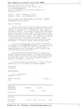
North Lauder Radiocarbon Date report by Beta Analytic Inc. for Flintstone Hill #109529 and #109530. Radiocarbon dating The technique of radiocarbon dating was developed by Willard Libby and his colleagues at the University of Chicago in 1949. Radiocarbon dating is used to estimate the age of organic remains from archaeological sites. Organic matter has a radioactive form of carbon (C14) that begins to decay upon death. C14 decays at a steady, known rate of a half life of 5,730 years. The technique is useful for material up to 50,000 years. Fluctuations of C14 in the atmosphere can affect results so dates are calibrated against dendrochronology. Radiocarbon dates are calibrated to calendar years. Dates are reported in radiocarbon years or Before Present. Before Present refers to dates before 1950. The introduction of massive amounts of C14, due to atomic bomb and surface testing of atomic weapons, has widely increased the standard deviation on all dates after A.D. 1700 causing these dates to be unreliable. Accelerated mass spectrometry can more accurately measure C14 with smaller samples and can date materials to 80,000 years.
Scope and Content
Sub sub series contains radiocarbon dates from: Atkinson site and Flintstone Hill.
Name Access
North Lauder locale Radiocarbon Report 4
Subject Access
Archaeology North Lauder locale North Lauder locale Radiocarbon Report 4
Documents

2.5.4_FSH_RC14_Beta-109529_109530.pdf

Read PDF Download PDF
Show Less

ARCH 4: Makotchi-Ded Dontipi locale

http://archives.brandonu.ca/en/permalink/descriptions10215
Part Of
RG 7 Beverley Nicholson fonds
Description Level
Series
GMD
multiple media
Date Range
1992 to 2002
Accession Number
1-2010
Part Of
RG 7 Beverley Nicholson fonds
Description Level
Series
Series Number
4
Accession Number
1-2010
GMD
multiple media
Date Range
1992 to 2002
History / Biographical
Introduction Information on archaeological materials in this locale first came to the attention of Dr. Nicholson through Doug Jackson, a local artifact collector from Souris. Doug had observed archaeological materials that included bone, ceramics and lithic material that had been exposed by municipal road building activity, northwest of Lauder Manitoba Environment 
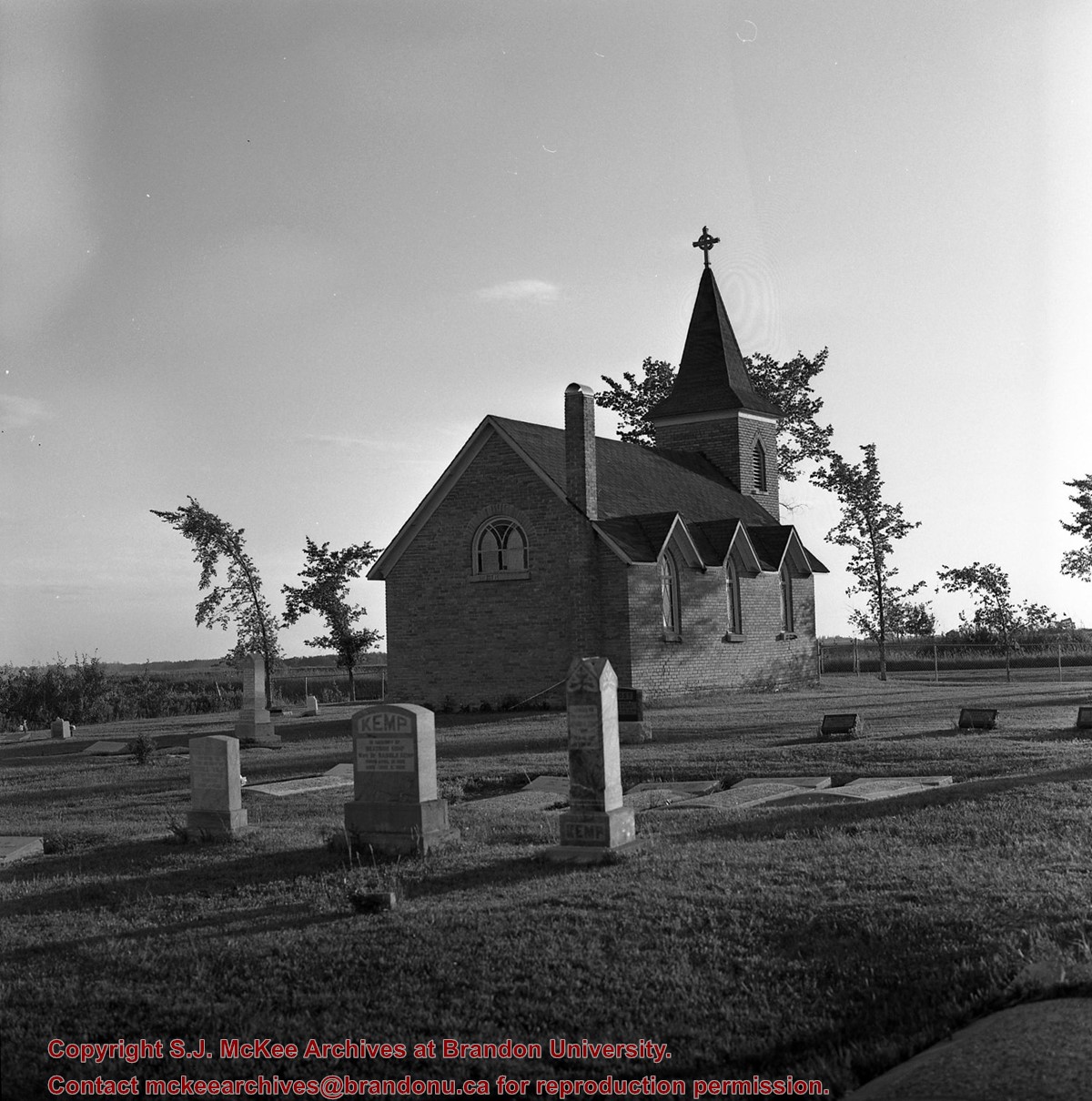
The Makotchi-Ded Dontipi locale is located among stabilized sand dunes in the Lauder Sandhills in Southwestern Manitoba, northwest of the village of Lauder. The area is a mosaic of medium grass prairie and copses of aspen poplar and aspen-oak, together with intermittent sedge grass marshes and small ponds. These wetlands are bordered with balsam poplar, water birch, willows and red osier dogwood. The well-drained upland forest also contains saskatoon, chokecherry, wild current, hazelnut bushes and occasional wild plums. Lowland areas have nannyberries and high-bush cranberry. Wild strawberries grow in lightly shaded areas along trail margins and in open patches in aspen forest. History of Excavations The Makotchi-Ded Dontipi locale is a virtual "island" of forest and marshlands in a vast expanse of mixed grass prairie. This archaeologically and environmentally rich area was given the Dakota name Makotchi-Ded Dontipi, meaning "the place where we live". Summation Prior to European settlement, the area was a rich environment for hunter-gatherer people. Archaeological investigations from 1992 to 2002 have revealed numerous sites within the locale. Some of these sites have been extensively excavated while others have been identified or tested. Seven sites that have been identified in this locale range in age from the historic through protohistoric periods and extend into the middle precontact period. The major sites are the initial Middle Missouri Duthie site, the late precontact Jackson, Bradshaw sites and the protohistoric Twin Fawns, Schuddemat and Hollow B sites. The multi-component Vera site includes historic Métis, late precontact Vickers Focus, and middle precontact Besant, Pelican Lake, McKean Complex and Oxbow occupations. Over 230 units were excavated as well as numerous test pits and several extensive surveys.
Scope and Content
Scope and Content The Series has been divided into seven sub-series, including (1) Duthie site (2) Jackson site (3) Twin Fawns site (4) Vera site (5) Schuddemat site (6) Bradshaw site (7) Hollow B site.
Name Access
Makotchi-Ded Dontipi locale
Subject Access
Archaeology
Arrangement
Series is arranged by site and by year of field work.
Show Less

CPR 18th Street crossing & signal tower

http://archives.brandonu.ca/en/permalink/descriptions9943
Part Of
RG 11 Lawrence Stuckey fonds
Description Level
Item
GMD
graphic
Date Range
1962
Accession Number
1-2002
Part Of
RG 11 Lawrence Stuckey fonds
Creator
L.A. Stuckey
Description Level
Item
Series Number
3.1
Item Number
1-2002.3.1P20(1)
Accession Number
1-2002
GMD
graphic
Date Range
1962
Physical Description
2 1/2" x 2 1/2"
Material Details
Negative
History / Biographical
The Towerman controlled the crossing gates, [as well as] switches and signals for all routes into and out of the station and freight yards. [Mr. Stuckey's] grandfather, Samuel Gilmour, operated the previous tower for many years (which only operated the crossing gates), and continued to operate the new tower for several years after it was built (ca. 1929). This tower was made obsolete with the installation of Centralized Traffic Control in 1965.
Custodial History
For custodial history see the collection level description of the Lawrence Stuckey collection.
Scope and Content
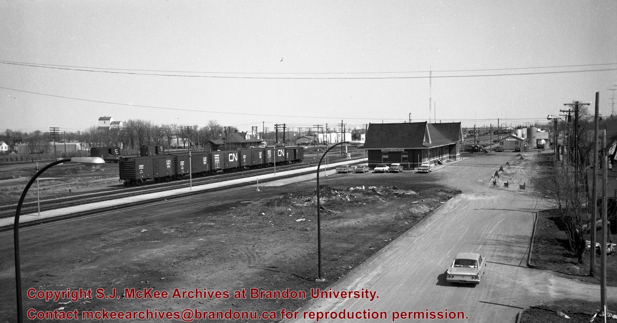
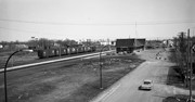
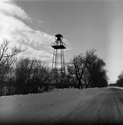
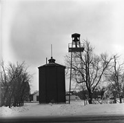
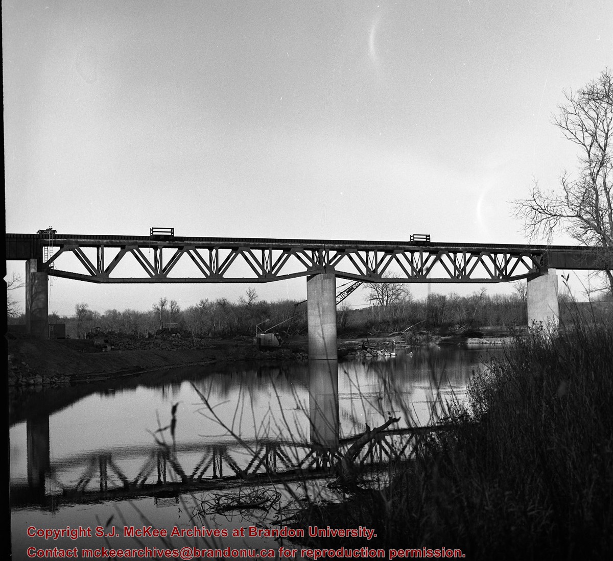
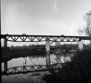
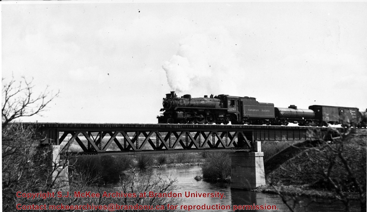
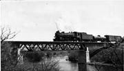
Canadian Pacific Railway's18th Street crossing & signal tower.
Notes
Photo taken just before construction started on overpass
For a better picture of this tower see photo No. 53 (engine 2911) in CPR steam trains file
Name Access
CPR crossing & signal towers
Subject Access
crossing towers
signal towers
railroads
railways
Canadian Pacific Railway in Brandon
Repro Restriction
The McKee Archives is the copyright holder for the Stuckey materials.
Location Copy
1-2002.3.9.163
Storage Location
Lawrence Stuckey collection
Arrangement
[Mr. Stuckey numbered two envelopes P20. We have kept the same number but designated the first envelope P20(1) and the contents of the second envelope P20(2) and P20(3).]
Images
Show Less

St. Mary's Roman Catholic church from CPR station

http://archives.brandonu.ca/en/permalink/descriptions8711
Part Of
RG 11 Lawrence Stuckey fonds
Description Level
Item
GMD
graphic
Date Range
March 5, 1989
Accession Number
1-2002
Part Of
RG 11 Lawrence Stuckey fonds
Creator
Lawrence Stuckey
Description Level
Item
Series Number
3.9
Item Number
1-2002.3.9.91
Accession Number
1-2002
GMD
graphic
Date Range
March 5, 1989
Physical Description
5" x 7" (b/w)
Scope and Content
Photograph is looking north and shows the church and its front entrance.
Notes
Corresponds with negative 1-2002.3.9.DB4.
Repro Restriction
The McKee Archives is the copyright holder for the Stuckey materials.
Location Original
1-2002.3.1DB4
Storage Location
RG 5 photograph storage drawer
Images
Show Less

Old frame house (2 chimneys), Beulah, Manitoba [Mr. Stuckey consistently spelt it "Buelah"]

http://archives.brandonu.ca/en/permalink/descriptions10557
Part Of
RG 11 Lawrence Stuckey fonds
Description Level
Item
GMD
graphic
Date Range
February 28, 1979
Accession Number
1-2002
Part Of
RG 11 Lawrence Stuckey fonds
Creator
L.A. Stuckey
Description Level
Item
Series Number
3.3
Item Number
1-2002.3.3.CNR[208]
Accession Number
1-2002
GMD
graphic
Date Range
February 28, 1979
Physical Description
2.25" x 2.25" (b/w)
Material Details
Negative
Custodial History
For custodial history see the collection level description of the Lawrence Stuckey collection.
Scope and Content
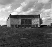
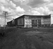
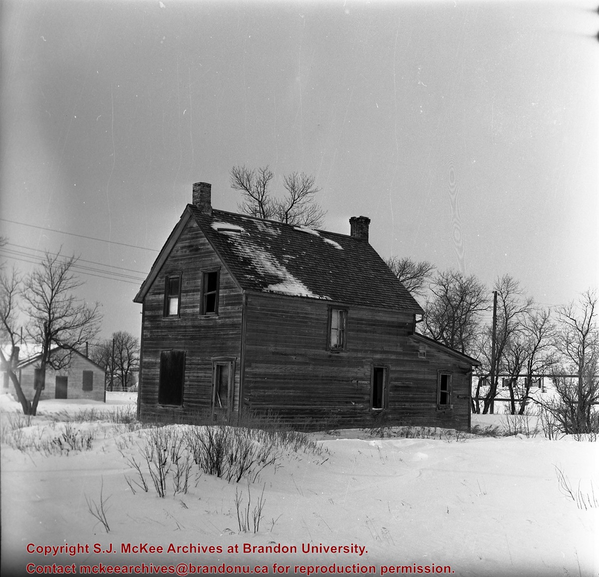
Image of an old frame house (2 chimneys), at Beulah, Manitoba [Mr. Stuckey consistently spelt it "Buelah"], taken along the CNR line, Rapid City substation.
Name Access
CNR
Beulah, Manitoba
Subject Access
railways
houses
Repro Restriction
The McKee Archives is the copyright holder of the Stuckey materials.
Storage Location
Lawrence Stuckey collection
Images
Show Less

ARCH 2: North Lauder locale

http://archives.brandonu.ca/en/permalink/descriptions12079
Part Of
RG 7 Beverley Nicholson fonds
Description Level
Series
GMD
multiple media
Date Range
1997 to present
Accession Number
1-2010
Part Of
RG 7 Beverley Nicholson fonds
Description Level
Series
Series Number
2
Accession Number
1-2010
GMD
multiple media
Date Range
1997 to present
History / Biographical
ARCH 2: North Lauder Locale The North Lauder locale has a long archaeological and geological history that is important for understanding the forces that shaped the region. Archaeological research in the locale shows that the area has been occupied by humans for at least the past 6,500 years. Environmental forces provided an area of diverse resources that attracted early peoples. Environment of the Lauder Sandhills The North Lauder locale is part of the greater Lauder Sandhills area. The glaciers that covered this region began to recede approximately 11,000 years ago leaving a large lake known as glacial Lake Hind. The Souris River, the Lauder Sandhills and the Oak Lake Aquifer are remnants of the environmental and geological forces that shaped the region. The Lauder Sandhills region is characterized by a landscape of sand sheets and stabilized sand dunes interspersed with a variety of wetlands. This complex topographic and hydrological situation favoured the development of an island mosaic of mixed forest, wetland and meadow, surrounded by mixed grass prairie. The result was a large, isolated ecotone which provided a rich variety of subsistence resources for hunter-gatherers. Research in the Lauder Sandhills Archaeologists from Brandon University have been conducting research in the Lauder Sandhills since 1991. Research in the North Lauder locale has focused on the Atkinson site, a 6,500 year old hunter-gatherer site and Flintstone Hill. The Atkinson site The Atkinson site is one of the oldest excavated sites in Manitoba and has been Radiocarbon dated to 6,500 years before present. The Atkinson site is located on the bank of the Souris River and was discovered when a hearth (fire pit) was seen eroding out of the bank. Based on the date of the site and the kind of lithics (stone tools) present it is considered a Gowen occupation. The Atkinson site is evidence that bison hunters were active on the northern plains at a very early date. Similar sites have also been found on the High Plains in the U.S. and are referred to as the Mummy Cave Complex. The Atkinson Site is of great importance as it is the first undisturbed site of this type to be excavated in Manitoba and extends the range of these sites south and east from the type-sites in central Saskatchewan. Flintstone Hill The geomorphology of the glacial Lake Hind Basin over the past 11,000 years is known primarily through the study of a cut bank along the Souris River. Flint Stone Hill contains the most complete stratigraphic record for the post-glacial period on the northern plains. The site has been extensively studied by geoarchaeologists, geologists and paleoenvironmentalists over many years and their findings have contributed to our understanding of the region. The North Lauder locale Borden designations of Atkinson site DiMe-27 and Flintstone Hill site DiMe-26. Borden System Archaeological sites in Canada are identified by the Borden system, which is a uniform site designation system. The country is divided into grids based on latitude and longitude in blocks of 10 x 20 minutes. The first 4 letters indicate the block and the following numbers indicate the actual site. For example the area of the Lauder Sandhills in southwestern Manitoba is identified by the letters DM and the North Lauder locale within that area is DiMe. The Atkinson site is DiMe-27 and the Flintstone Hill site DiMe-26. As new sites are discovered they will be numbered sequentially.
Scope and Content
The Series has been divided into two sub-series, including (1) Atkinson site DiMe-27 and Flintstone Hill site DiMe-26.
Name Access
North Lauder locale
Subject Access
Archaeology Atkinson site DiMe-27
Arrangement
Series is arranged by site and by year of field work.
Show Less

Graham site 2005 - Bone bed from XU 4, 5 & 6

http://archives.brandonu.ca/en/permalink/descriptions11917
Part Of
RG 7 Beverley Nicholson fonds
Description Level
Item
GMD
graphic
Date Range
2005
Accession Number
1-2010
Part Of
RG 7 Beverley Nicholson fonds
Description Level
Item
Series Number
1.4.2.5
Item Number
1
Accession Number
1-2010
GMD
graphic
Date Range
2005
Physical Description
2,750 x 2,125 (1,150 KB )
Material Details
JPEG
Scope and Content
Bone bed from excavation units 4, 5 and 6
Name Access
Graham site 2005 - Bone bed from XU 4, 5 & 6
Subject Access
Archaeology Crepeele locale Graham site 2005 Graham site 2005 - photographs
Images
Show Less

Town fire bell, town fire bell and CPR water tank, Oak Lake, Manitoba.

http://archives.brandonu.ca/en/permalink/descriptions10361
Part Of
RG 11 Lawrence Stuckey fonds
Description Level
Item
GMD
graphic
Date Range
January 8, 1979
Accession Number
1-2002
Part Of
RG 11 Lawrence Stuckey fonds
Creator
L.A. Stuckey
Description Level
Item
Series Number
3.3
Item Number
1-2002.3.3.CPR[36a]
Accession Number
1-2002
GMD
graphic
Date Range
January 8, 1979
Physical Description
2" x 2" (b/w)
Material Details
Negative
Custodial History
For custodial history see the collection level description of the Lawrence Stuckey collection.
Scope and Content
Image of a town fire bell, town fire bell and CPR water tank at Oak Lake, Manitoba, taken along the CPR Broadview substation.
Name Access
Oak Lake, Manitoba
CPR Broadview substation
Subject Access
railways
fire protection
Repro Restriction
The McKee Archives is the copyright holder of the Stuckey materials.
Storage Location
Lawrence Stuckey collection
Arrangement
[Mr. Stuckey put two negatives in same envelope. We have separated them and numbered them (36a) and (36b)].
Images
Show Less

Town fire bell, town fire bell and CPR water tank, Oak Lake, Manitoba.

http://archives.brandonu.ca/en/permalink/descriptions10362
Part Of
RG 11 Lawrence Stuckey fonds
Description Level
Item
GMD
graphic
Date Range
January 8, 1979
Accession Number
1-2002
Part Of
RG 11 Lawrence Stuckey fonds
Creator
L.A. Stuckey
Description Level
Item
Series Number
3.3
Item Number
1-2002.3.3.CPR[36b]
Accession Number
1-2002
GMD
graphic
Date Range
January 8, 1979
Physical Description
2" x 2" (b/w)
Material Details
Negative
Custodial History
For custodial history see the collection level description of the Lawrence Stuckey collection.
Scope and Content
Image of a town fire bell, town fire bell and CPR water tank at Oak Lake, Manitoba, taken along the CPR Broadview substation.
Name Access
Oak Lake, Manitoba
CPR Broadview substation
Subject Access
railways
fire protection
Repro Restriction
The McKee Archives is the copyright holder of the Stuckey materials.
Storage Location
Lawrence Stuckey collection
Arrangement
[Mr. Stuckey put two negatives in same envelope. We have separated them and numbered them (36a) and (36b)].
Images
Show Less

MPE B 3 Local Association minutes (microfilm) Box 2

http://archives.brandonu.ca/en/permalink/descriptions10019
Part Of
RG 4 Manitoba Pool Elevator fonds
Description Level
Box
GMD
microfilm
Date Range
1926-1957
Part Of
RG 4 Manitoba Pool Elevator fonds
Description Level
Box
Series Number
MPE B.3.2
File Number
2
GMD
microfilm
Date Range
1926-1957
Physical Description
28 cm
History / Biographical
See history/bio for sub-series B.3
Custodial History
See custodial history for sub-series B.3
Scope and Content
Box contains minutes geenrated by local MPE associations, collected and microfilmed by the central office. Rolls in this box include the following: Roll 13: Oakbank 1940-51; Oakburn 1940-51; Oak Lake 1928-51; Oakland 1928-51; Oakville 1928-51; Osbourne 1927-51; Rapid City 1926-51; Pierson 1928-51; Pilot Mound 1928-51; Pipestone 1929-51; Poplar Point 1947-51; Portage 1927-51; Purves 1928-51 Roll 14: Rapid City 1926-27; Rathwell 1928-51; Regent 1927-51; Reston 1927-51; Rhodes 1928-48; Riverton 1948-51; Sandy Lake 1943-51; Selkirk 1947-51; Roblin 1926-51; Rossburn 1929-51; Roundthwaite 1928-51; Russell 1940-51; Ste Agathe 1946-51; St Jean 1949-51; Sanford 1927-51; Scrick 1944-51 Roll 15: missing Roll 16: Starbuck 1927-40; Stonewall 1939-51; Strathclair 1947-51; Swan Lake 1928-51; Teulon 1940-51; Thorn Hill 1926-51; Tilston 1928-51; Treherne 1928-51; Vista 1940-51; Warren 1947-51; Waskada 1925-51; Wawanesa 1927-51; Wood Bay 1937-51; Wood Bay 1926-37; Wood North 1928-51 Roll 17: Side 1 Alexander to Birdtail Oct 1951 – June 1957; Side 2 Birnie to Cartwright Oct 1951 – June 1957 Roll 18: Side 1 Chillon to Ebor Oct 1951 – June 1957; Side 2 Eden to Fork River Oct 1951 – June 1957 Roll 19: Side 1 Forrest to Hamiota Oct 1951 – June 1957; Side 2 Harding to Kronsgart Oct 1951 – June 1957 Roll 20: Side 1 Landseer to Maples Oct 1951 – June 1957; Side 2 Margaret to Napinka Oct 1951 – June 1957 Roll 21: Side 1 Neelin to Purvis Oct 1951 – June 1957; Side 2 Rapid City to Silverton Oct 1951 – June 1957 Roll 22: Side 1 Sinclair to Warren Oct 1951 – June 1957; Side 2 Waskada to Woodnorth Oct 1951 – June 1957
Notes
Description by Jillian Sutherland (2009)
Name Access
Manitoba Pool Elevators
Central Office
Subject Access
Local Association
Storage Location
RG 4 Manitoba Pool Elevator fonds Series B: Central Office records
Show Less

Church, Smart, Manitoba (2 miles north, 1 mile east of)

http://archives.brandonu.ca/en/permalink/descriptions11412
Part Of
RG 11 Lawrence Stuckey fonds
Description Level
Item
GMD
graphic
Date Range
December 19, 1978; August 4, 1979
Accession Number
1-2002
Part Of
RG 11 Lawrence Stuckey fonds
Creator
L.A. Stuckey
Description Level
Item
Series Number
3.3
Item Number
1-2002.3.3.CNR[149b]
Accession Number
1-2002
GMD
graphic
Date Range
December 19, 1978; August 4, 1979
Physical Description
2.25" x 2.25" (b/w)
Material Details
Negative
History / Biographical
Stuckey's notes: St. George's, Elton district, built 1901.
Custodial History
For custodial history see the collection level description of the Lawrence Stuckey collection.
Scope and Content
Image of a church at Smart, Manitoba (2 miles north, 1 mile east), taken along the CNR mainline, Rivers substation.
Name Access
CNR
Smart, Manitoba
Subject Access
railways
Church buildings/Churches
Repro Restriction
The McKee Archives is the copyright holder of the Stuckey materials.
Storage Location
Lawrence Stuckey collection
Arrangement
[Mr. Stuckey put three negatives in same envelope. We have separated them and numbered them (149a) to (149c)].
Images
Show Less

Church, Smart, Manitoba (2 miles north, 1 mile east of)

http://archives.brandonu.ca/en/permalink/descriptions10454
Part Of
RG 11 Lawrence Stuckey fonds
Description Level
Item
GMD
graphic
Date Range
December 19, 1978; August 4, 1979
Accession Number
1-2002
Part Of
RG 11 Lawrence Stuckey fonds
Creator
L.A. Stuckey
Description Level
Item
Series Number
3.3
Item Number
1-2002.3.3.CNR[149a]
Accession Number
1-2002
GMD
graphic
Date Range
December 19, 1978; August 4, 1979
Physical Description
2.25" x 2.25" (b/w)
Material Details
Negative
History / Biographical
Stuckey's notes: St. George's, Elton district, built 1901.
Custodial History
For custodial history see the collection level description of the Lawrence Stuckey collection.
Scope and Content
Image of a church at Smart, Manitoba (2 miles north, 1 mile east), taken along the CNR mainline, Rivers substation.
Name Access
CNR
Smart, Manitoba
Subject Access
railways
Church buildings/Churches
Repro Restriction
The McKee Archives is the copyright holder of the Stuckey materials.
Storage Location
Lawrence Stuckey collection
Arrangement
[Mr. Stuckey put three negatives in same envelope. We have separated them and numbered them (149a) to (149c)].
Images
Show Less

Church, Smart, Manitoba (2 miles north, 1 mile east of)

http://archives.brandonu.ca/en/permalink/descriptions10455
Part Of
RG 11 Lawrence Stuckey fonds
Description Level
Item
GMD
graphic
Date Range
December 19, 1978; August 4, 1979
Accession Number
1-2002
Part Of
RG 11 Lawrence Stuckey fonds
Creator
L.A. Stuckey
Description Level
Item
Series Number
3.3
Item Number
1-2002.3.3.CNR[149c]
Accession Number
1-2002
GMD
graphic
Date Range
December 19, 1978; August 4, 1979
Physical Description
2.25" x 2.25" (b/w)
Material Details
Negative
History / Biographical
Stuckey's notes: St. George's, Elton district, built 1901.
Custodial History
For custodial history see the collection level description of the Lawrence Stuckey collection.
Scope and Content
Image of a church at Smart, Manitoba (2 miles north, 1 mile east), taken along the CNR mainline, Rivers substation.
Name Access
CNR
Smart, Manitoba
Subject Access
railways
Church buildings/Churches
Repro Restriction
The McKee Archives is the copyright holder of the Stuckey materials.
Storage Location
Lawrence Stuckey collection
Arrangement
[Mr. Stuckey put three negatives in same envelope. We have separated them and numbered them (149a) to (149c)].
Images
Show Less

Great Northern wedge snowplow at Minot, ND

http://archives.brandonu.ca/en/permalink/descriptions10004
Part Of
RG 11 Lawrence Stuckey fonds
Description Level
Item
GMD
graphic
Date Range
July 1938
Accession Number
1-2002
Part Of
RG 11 Lawrence Stuckey fonds
Creator
George H. Harris
Description Level
Item
Series Number
3.1
Item Number
1-2002.3.1PE27
Accession Number
1-2002
GMD
graphic
Date Range
July 1938
Physical Description
2" x 2 3/4"
Material Details
Negative
History / Biographical
According to Stuckey and Bain (1996), “The Brandon, Saskatchewan & Hudson’s Bay Railway was built and operated as a totally owned subsidiary of the Great Northern Railway. Construction commenced in late 1905 and by the end of 1905, less than a mile of track had been laid north of the boundary at St. John. In 1906, the remaining 68.6 miles to Brandon were laid and service commenced that year. During the Depression of the 1930s, traffic declined significantly and the entire branch was abandoned in 1936. Over much of the branch’s length, the ties and rails were laid on the prairie without ballast and today little remains of the line apart from traces where there were cuts and bridges.” (p. 18) Stuckey, L. A., & Bain, D. M. (1996). The Great Northern and Northern Pacific railways in Canada. Calgary, Alberta: British Railway Modellers of North America.
Custodial History
For custodial history see the collection level description of the Lawrence Stuckey collection.
Scope and Content
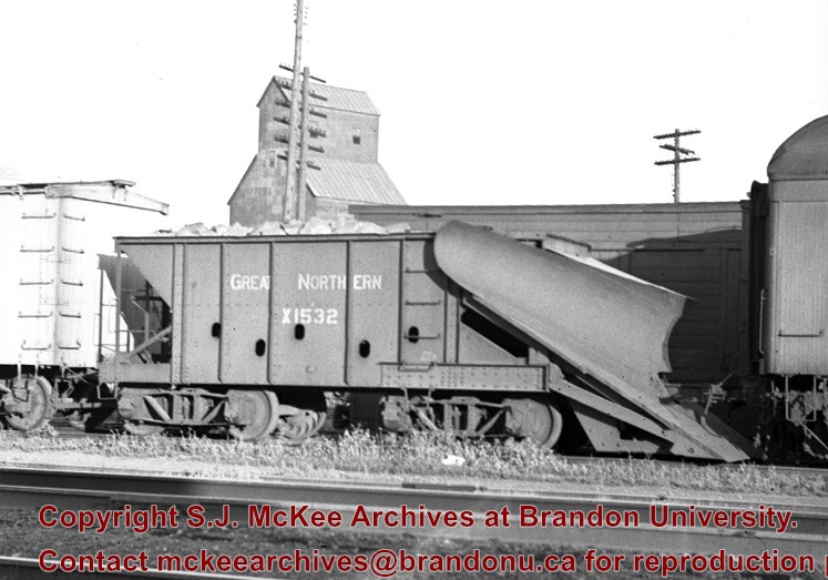
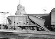
Great Northern wedge snowplow on ore gondola, Minot, ND.
Notes
From the collection of George H. Harris, Winnipeg, Manitoba.
Stuckey and Bain (1996, p. 21) note that "Built in the company shops, simply by adding a plow to an ore jenny which was filled with rocks, these vehicles were quite effective at removing snow from single tracks."
Name Access
Brandon, Saskatchewan & Hudson's Bay Railway
Great Northern Railway
Subject Access
railroads
railways
freight trains
Great Northern Railway from Church’s Ferry ND to Brandon MB
Repro Restriction
The McKee Archives is the copyright holder for the Stuckey materials.
Storage Location
Lawrence Stuckey collection
Images
Show Less

New CPR bridge over Souris River, east of Treesbank, Manitoba

http://archives.brandonu.ca/en/permalink/descriptions10407
Part Of
RG 11 Lawrence Stuckey fonds
Description Level
Item
GMD
graphic
Date Range
October 22, 1978
Accession Number
1-2002
Part Of
RG 11 Lawrence Stuckey fonds
Creator
L.A. Stuckey
Description Level
Item
Series Number
3.3
Item Number
1-2002.3.3.CPR[59a]
Accession Number
1-2002
GMD
graphic
Date Range
October 22, 1978
Physical Description
2.25" x 2.25 (b/w)
Material Details
Negative
Custodial History
For custodial history see the collection level description of the Lawrence Stuckey collection.
Scope and Content
Image of CPR bridge over Souris River, east of Treesbank, Manitoba, taken along the CPR lines south of mainline.
Name Access
CPR
Treesbank, Manitoba
Souris River
Subject Access
railways
bridges
Rivers
geographic features
Repro Restriction
The McKee Archives is the copyright holder of the Stuckey materials.
Storage Location
Lawrence Stuckey collection
Arrangement
[Mr. Stuckey put two negatives in same envelope. We have separated them and numbered them (59a) and (59b)].
Images
Show Less

New CPR bridge over Souris River, east of Treesbank, Manitoba

http://archives.brandonu.ca/en/permalink/descriptions10408
Part Of
RG 11 Lawrence Stuckey fonds
Description Level
Item
GMD
graphic
Date Range
October 22, 1978
Accession Number
1-2002
Part Of
RG 11 Lawrence Stuckey fonds
Creator
L.A. Stuckey
Description Level
Item
Series Number
3.3
Item Number
1-2002.3.3.CPR[59b]
Accession Number
1-2002
GMD
graphic
Date Range
October 22, 1978
Physical Description
2.25" x 2.25 (b/w)
Material Details
Negative
Custodial History
For custodial history see the collection level description of the Lawrence Stuckey collection.
Scope and Content
Image of CPR bridge over Souris River, east of Treesbank, Manitoba, taken along the CPR lines south of mainline.
Name Access
CPR
Treesbank, Manitoba
Souris River
Subject Access
railways
bridges
Rivers
geographic features
Repro Restriction
The McKee Archives is the copyright holder of the Stuckey materials.
Storage Location
Lawrence Stuckey collection
Arrangement
[Mr. Stuckey put two negatives in same envelope. We have separated them and numbered them (59a) and (59b)].
Images
Show Less

CPR no. 217 "Lenore mixed" engine 1290 crossing Cossar Bridge over Little Saskatchewan River east of Wheatland, Manitoba

http://archives.brandonu.ca/en/permalink/descriptions10267
Part Of
RG 11 Lawrence Stuckey fonds
Description Level
Item
GMD
graphic
Date Range
April 22, 1954
Accession Number
1-2002
Part Of
RG 11 Lawrence Stuckey fonds
Creator
L.A. Stuckey
Description Level
Item
Series Number
3.3
Item Number
1-2002.3.3.CPR[4]
Accession Number
1-2002
GMD
graphic
Date Range
April 22, 1954
Physical Description
5" x 3" (b/w)
Material Details
Copy negative
Custodial History
For custodial history see the collection level description of the Lawrence Stuckey collection.
Scope and Content
Image of CPR no. 217 "Lenore mixed" engine 1290 crossing Cossar Bridge over Little Saskatchewan River east of Wheatland, Manitoba.
Name Access
Cossar Bridge
CPR North
Little Saskatchewan River
Wheatland
Subject Access
bridges
rail transportation
Repro Restriction
The McKee Archives is the copyright holder of the Stuckey materials.
Storage Location
Lawrence Stuckey collection
Images
Show Less

20 records – page 13 of 1.