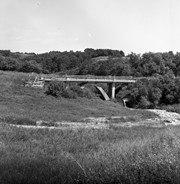
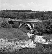
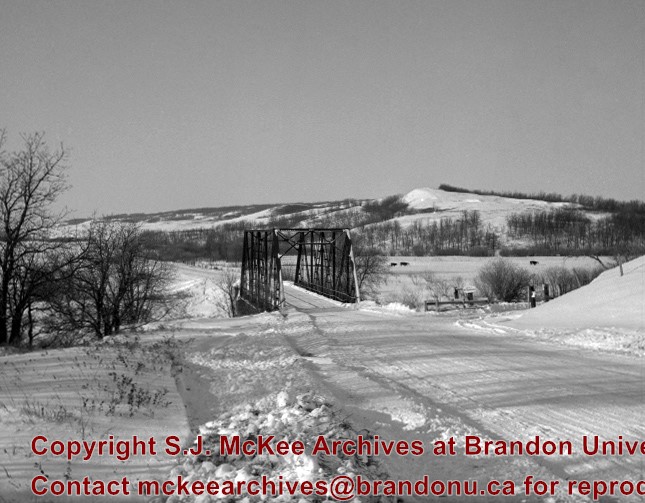
Kirkham's Bridge was built in 1906, to replace an earlier wooden bridge. The bridge was used until 1981, when it was purchased by the Town of Birtle and moved to a newsite. A former railway pridge was installed in its place.
Scope and Content
Photograph shows Kirkham's Bridge, a steel truss bridge that spanned the Little Saskatchewan River in the Municipality of Riverdale.
Notes
Identification of the bridge provided by Ken Storie (2023). Additional information taken from the Manitoba Historical Society website.
Some damage to matting, especially on the back. Photograph is good. There are two brads in the matting (one on the left edge, one on the right edge). The brads are connected to a (broken) red ribbon likely used to hang the photograph.
Custodial History
Kay Sullivan gave the photograph to Fred McGuinness in August 2007.
Scope and Content
Photograph was taken from the riverbank and shows the steel bridge in Souris, MB. A second wooden bridge is visible behind the steel bridge. The residence of Dr. W.A. Sherrin can be seen to the right of the bridges.
Notes
Dr. Sherrin's residence was identified using the Illustrated Souvenir of Souris, Manitoba (p. 38).
The first 18th Street Bridge was built in 1907 as the "King Edward Bridge." It was replaced the following year by the second 18th Street Bridge. The third 18th Street Bridge, called the David Thompson Bridge, was replaced by twin bridges; the first twin bridge opened in 2009, the second twin bridge opened c. 2010.
Custodial History
For custodial history see the collection level description of the Lawrence Stuckey collection.
Some damage to matting, especially on the back. There is also significant water damage to the image. There are two brads in the matting (one on the left edge, one on the right edge). The brads are connected to a red ribbon likely used to hang the photograph.
Custodial History
Kay Sullivan gave the photograph to Fred McGuinness in August 2007.
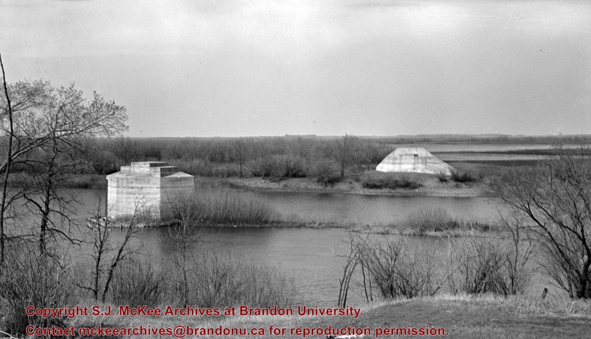
Scope and Content
Photograph was taken from the riverbank and shows the suspension foot-bridge in Souris, MB. A number of buildings, both commerial and possibly residential, can be seen on the far side of the river.
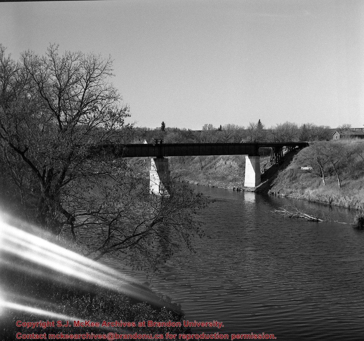
This bridge was condemned in the late 1930s but cyclists continued to use it until it was torn down (approximately 1940)
Until the early 1920s the Canadian Pacific Railway maintained a well and pumping station near the southeast corner of this bridge, which pumped water through a pipeline to a locomotive watering tank at Kemnay.
Custodial History
For custodial history see the collection level description of the Lawrence Stuckey collection.
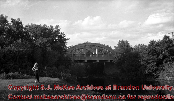
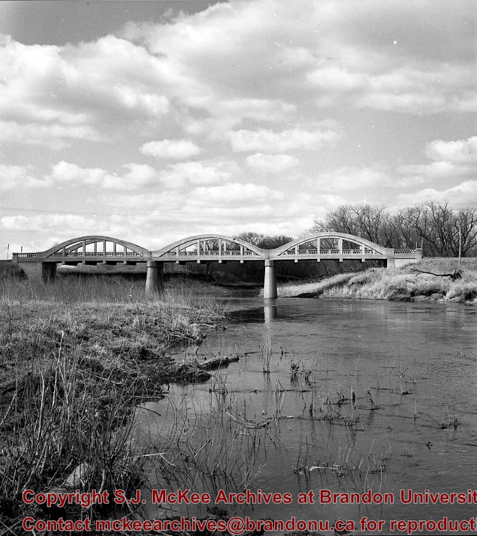
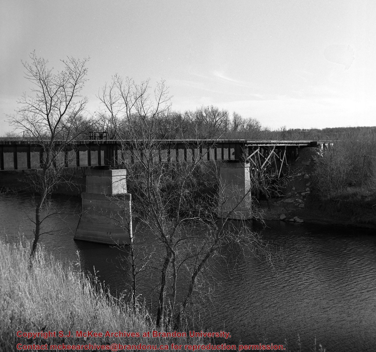
Scope and Content
Assiniboine River Bridge North of Kemnay
Notes
[Mr. Stuckey put a negative and print in the same envelope. We have separated them, numbering the negative OB5(1) and the print OB5(1a).]
This bridge was condemned in the late 1930s but cyclists continued to use it until it was torn down (approximately 1940)
Until the early 1920s the Canadian Pacific Railway maintained a well and pumping station near the southeast corner of this bridge, which pumped water through a pipeline to a locomotive watering tank at Kemnay.
Custodial History
For custodial history see the collection level description of the Lawrence Stuckey collection.
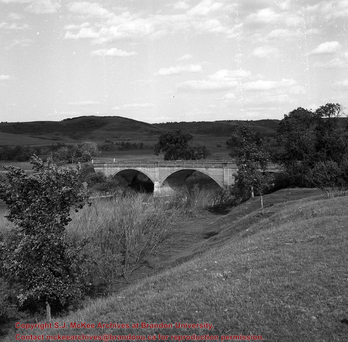
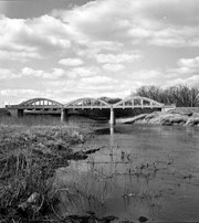
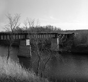
Scope and Content
Assiniboine River Bridge North of Kemnay
Notes
[Mr. Stuckey put a negative and print in the same envelope. We have separated them, numbering the negative OB5(1) and the print OB5(1a).]
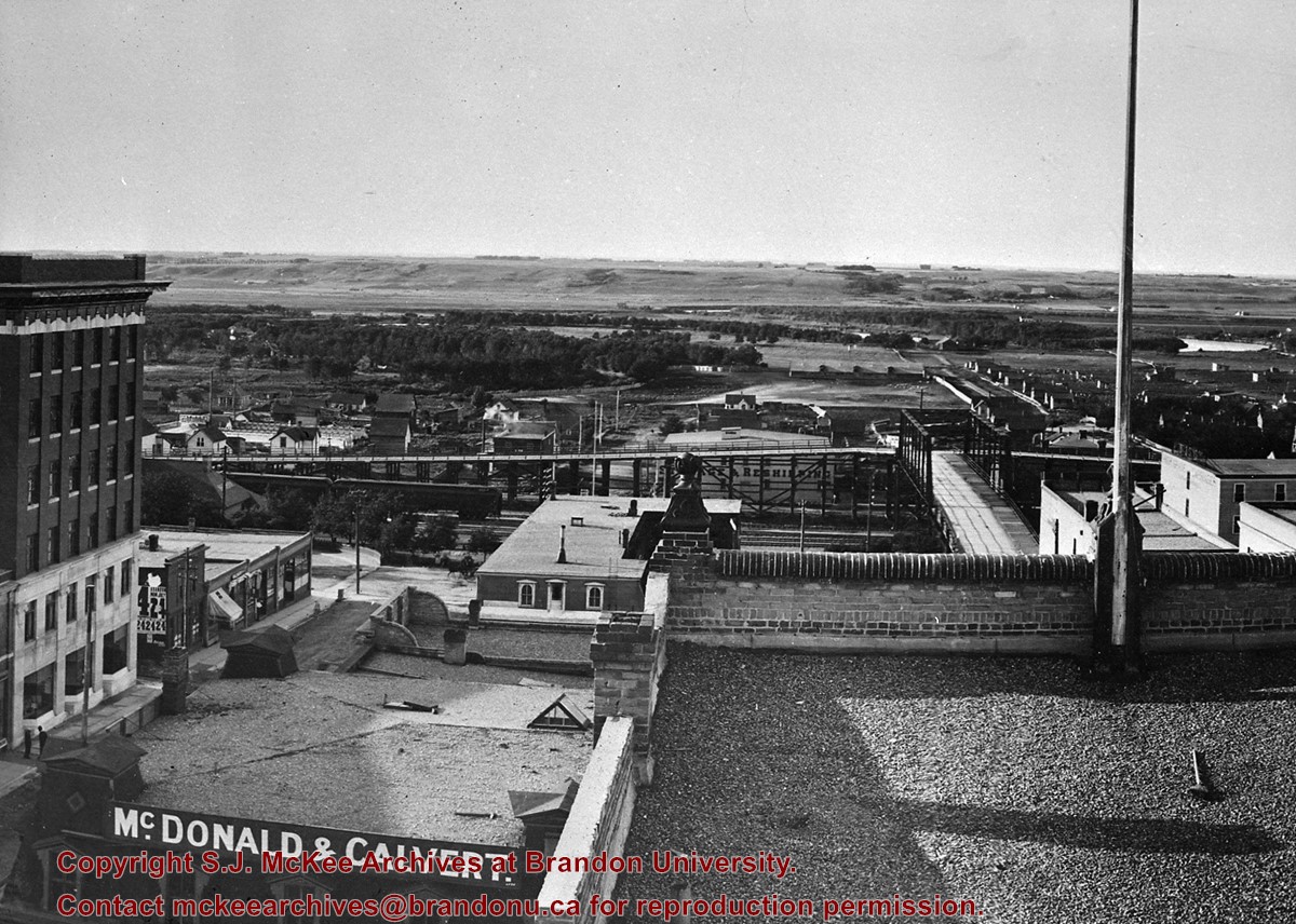
Bridge built by the Canadian Pacific Railway and presented to City of Brandon in 1904 in exchange for permission to close the level crossing at Sixth Street; Iron cantilever bridge over tracks; Two timber trestles each two blocks long running east and west connected to Assiniboine Avenue; Pedestrian stairway connected to Eight Street North
West approach torn down August 1934 and timber used to resurface East approach
Custodial History
For custodial history see the collection level description of the Lawrence Stuckey collection.
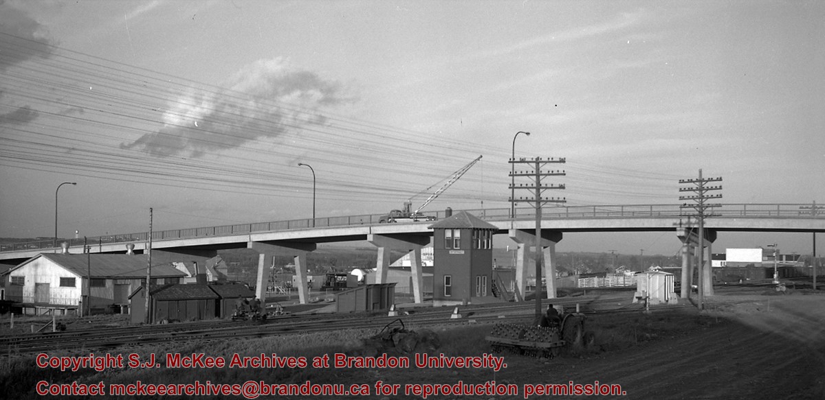
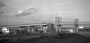
Scope and Content
View of original Eighth St. bridge from Christie Building, including East and West ramp approaches from Assiniboine Ave.
Notes
Photographer I.C. Barton from Chicago Illinois.
Additional historical information provided by Fred McGuinness collection (20-2009).


.jpg?width=1200&404=no-img.jpg&watermark=wmk)
.jpg?width=180&404=no-img.jpg)
.jpg?width=1200&404=no-img.jpg&watermark=wmk)
.jpg?width=180&404=no-img.jpg)


.jpg?width=1200&404=no-img.jpg&watermark=wmk)
.jpg?width=180&404=no-img.jpg)
.jpg?width=1200&404=no-img.jpg&watermark=wmk)
.jpg?width=180&404=no-img.jpg)


.jpg%3fmaxheight%3d1000%26maxwidth%3d1000%26watermark%3dwmk&description=Second+18th+Street+bridge)
.jpg%3fmaxheight%3d1000%26maxwidth%3d1000%26watermark%3dwmk&description=Second+18th+Street+bridge)
.jpg%3fmaxheight%3d1000%26maxwidth%3d1000%26watermark%3dwmk&description=Assiniboine+River+Bridge+North+of+Kemnay)
.jpg%3fmaxheight%3d1000%26maxwidth%3d1000%26watermark%3dwmk&description=Assiniboine+River+Bridge+North+of+Kemnay)