Donated to the Brandon College Library by Hilda Hesson in 1967.
Scope and Content
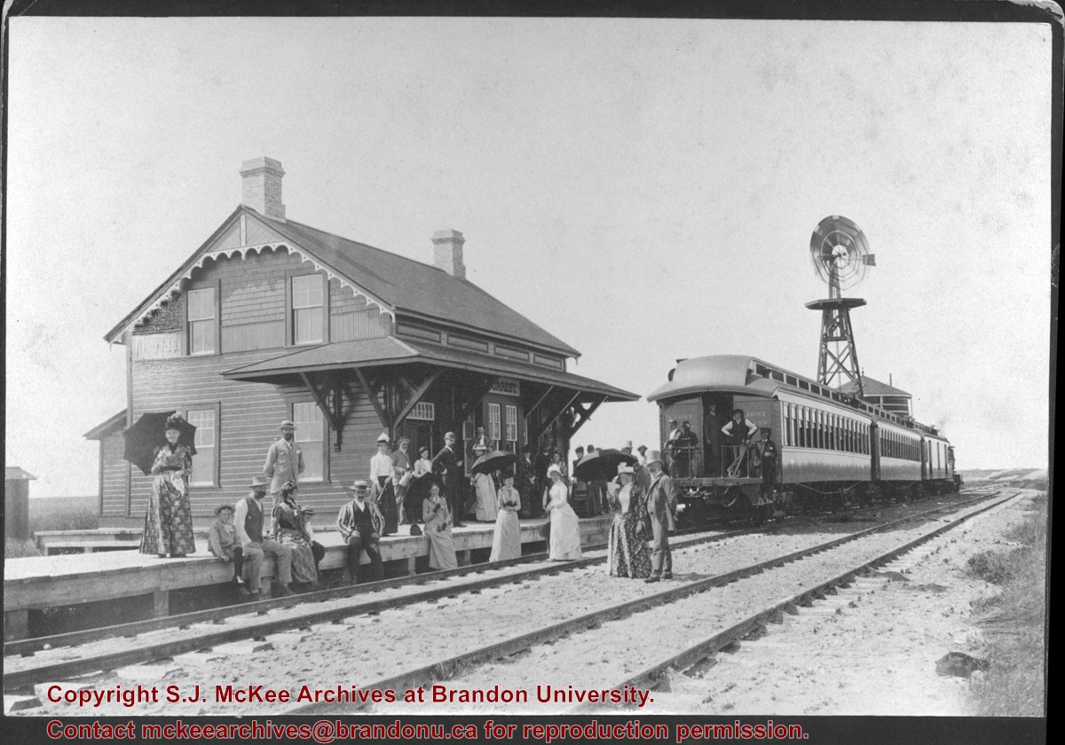
Photograph of an "outing" by train to Forrest, MB. Writing on the back of the photo states that the man in the striped blazer is very likely T. Mayne Daly. Photo was taken at the Great North West Railway station.
Bunclody, MB was located near Souris, MB. The bridge in question crossed the Souris River.
Custodial History
Photograph was donated by a "Mrs. Wilson" in 1989.
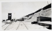
Scope and Content
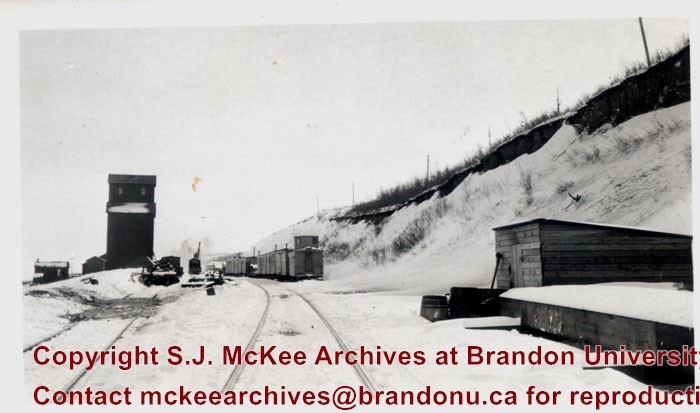
Photograph shows railroad tracks (presumably Great Northern Railway tracks near Bunclody) during winter. Also visible are an elevator, outbuildings and part of a train sitting beside the tracks.
Bunclody, MB was located near Souris, MB. The bridge in question crossed the Souris River.
Custodial History
Photograph was donated by a "Mrs. Wilson" in 1989.
Scope and Content
Photograph shows a portion of the Great Northern Railway track with the Bunclody bridge in the background. Also visible are a couple of houses, railway cars, lumber and part of the Souris River. The photograph was taken in early winter or early spring.
Bunclody, MB was located near Souris, MB. The bridge in question crossed the Souris River.
Custodial History
Photograph was donated by a "Mrs. Wilson" in 1989.
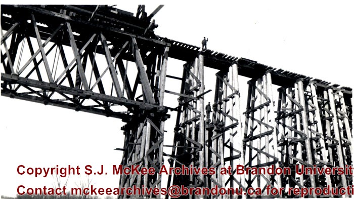
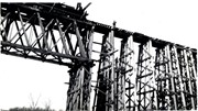
Scope and Content
Photograph is a close-up of the Great Northern Railroad bridge or trestle at Bunclody under construction. There are two men standing on the support structure.
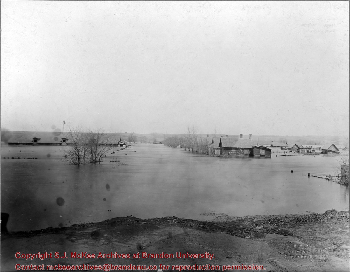
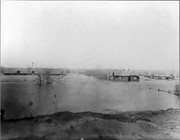
The "flats" refers to the Assiniboine River floodplane from 18th Street to First Street on either side of the river. See p. 223 of G.F. Barker's Brandon: A City for a description of the 1922 flood.
Custodial History
The photo was owned by Mrs. Wes Railton prior to its donation to the Archives.
Scope and Content
Photograph contains an image of houses on the Assiboine floodplane (Brandon's "flats") submerged in flood-waters.
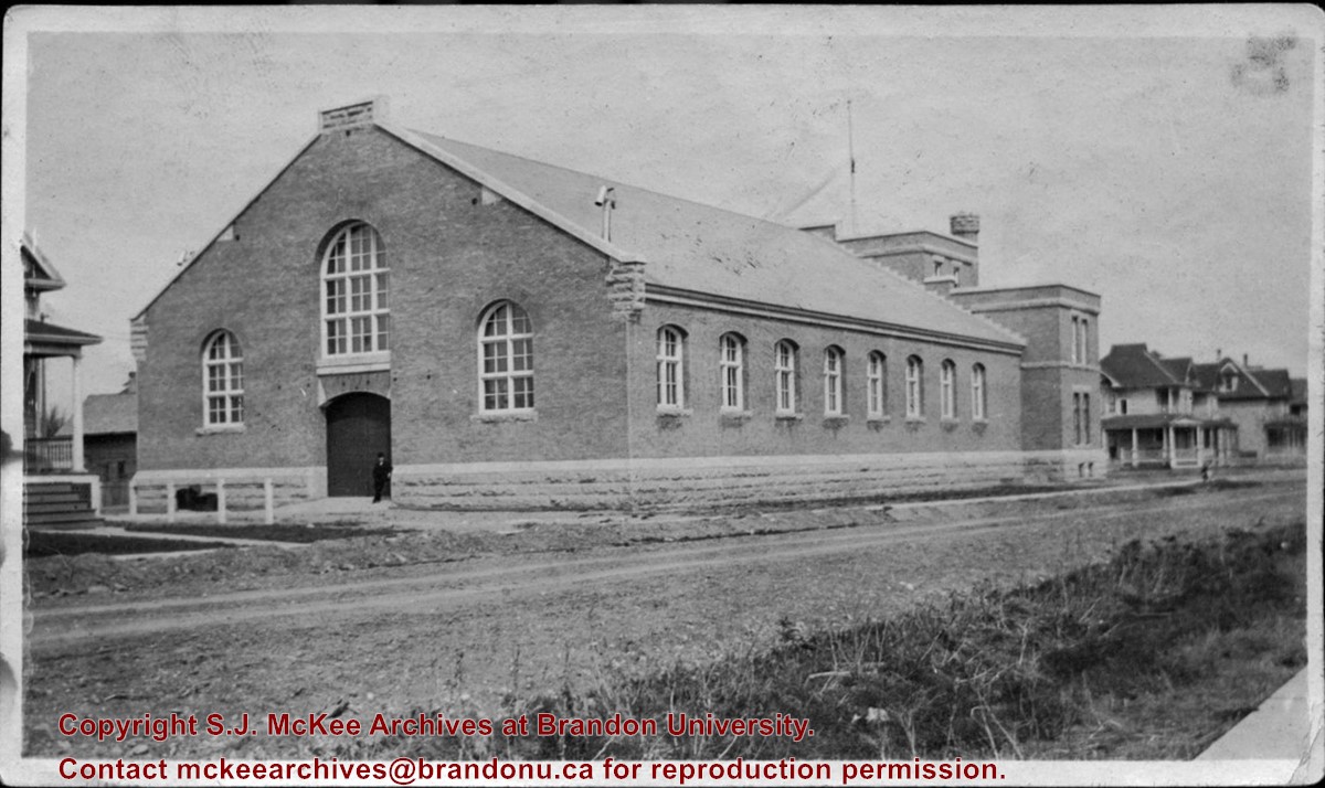
The Brandon Armoury was built in 1907. The extension on the southside was built in 1937.
Custodial History
The photograph was donated to the Archives by Cy Kenny in 2005.
Scope and Content
Photograph is looking northwest from the east side of 11th Street. It shows the back and east side of the Brandon Armoury, which is located on the at 1116 Victoria Avenue.
View is east northeast from the sidewalk on the southeast corner of the George T. Richardson Centre (John R. Robbins Library). Photographs shows the campus during winter, including the Physical Plant and Development H-Huts, as well as the Brandon College Building and Clark Hall after the majority of the renovations were completed.
View is southwest from 18th Street, just north of the Brandon University sign. Tken during the summer, the photograph shows the front lawn, a portion of the flower bed, the Citizens' Science Building, the Knowles Douglas Students' Union Centre, the John R. Brodie Science Centre and McMaster Hall.
View is northeast. Photograph shows the green space before the Library extension in 1993. Brandon College Building and the Development H-Hut in the background.
View is northwest from the roof of the John R. Brodie Science Centre. Photograph shows part of McMaster Hall, the H-Huts, the Citzens' Science Building, the Brandon College Building and Clark Hall, the driveway, the J.R.C. Evans Lecture Theatre, the A.E. McKenzie Building and the Queen Elizabeth II Music Building.
View is northwest from the sidewalk on the west side of 18th Street. Photograph shows the John R. Brodie Science Centre sign, McMaster Hall and its entrance, the lawn in from of McMaster Hall, a portion of the Knowles Douglas Students' Union Centre and the Citizens' Science Building.
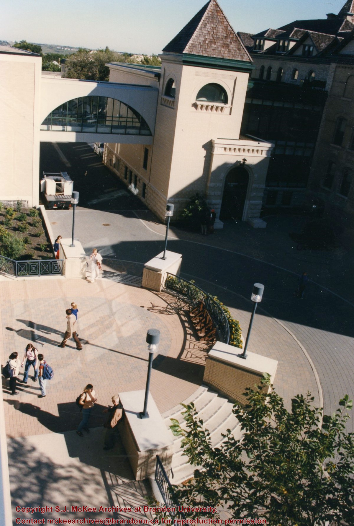
View is southwest from the corner of Clark Hall and the Clark Hall extension. Photograph shows students entering and exiting the George T. Richardson Centre and walking through the courtyard.
View is south from appromately the skywalk. Photograph shows the walkway that runs in front of the A.E. McKenzie Building south to the George T. Richardson Centre staircase and entrance. McMaster Hall in the background.
View is north northeast from the roof of the John E. Robbins Library in the George T. Richardson Centre. Photograph shows the entrance to the Richardson Building, part of the courtyard and the Clark Hall extension.
View is northeast from in front of the John E. Robbins Library in the George T. Richardson Centre. Photograph shows the entrance to the Richardson Building, most of the courtyard, Clark Hall and its extension.
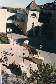
View is northeast from the roof of the George T. Richardson Centre (John E. Robbins Library). Photograph shows the courtyard and the west side of the Brandon College building and Clark Hall, as well as the Clark Hall extension and part of the skywalk.


