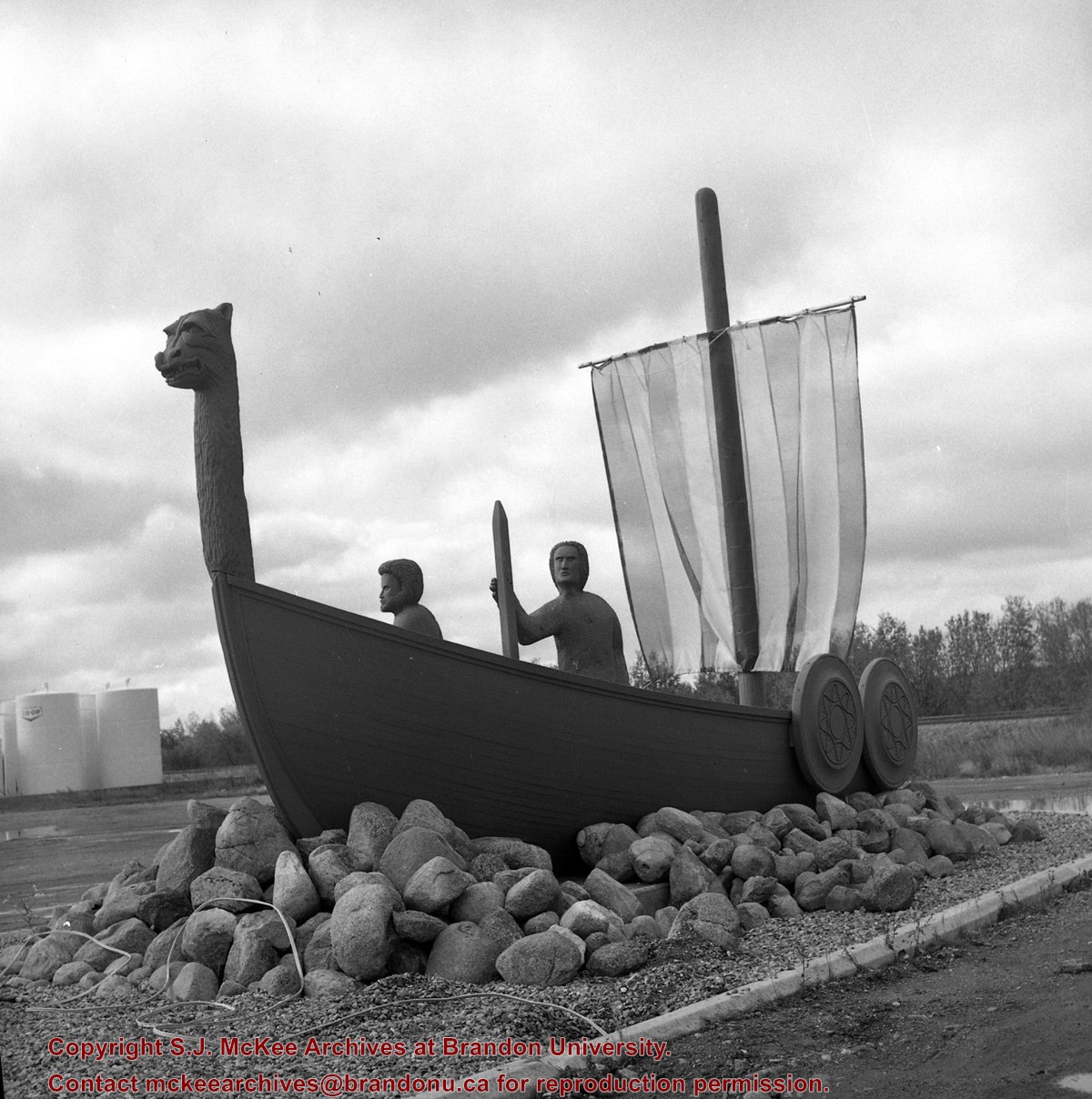
Saskatchewan's Fourth Meridian (meridian 110 degrees west of Greenwich) forms the western boundary of the province and is part of the world's longest surveyed straight line.
Scope and Content
Photograph shows two RCMP members in red serge standing next to a monument covered in the Union Jack flag.
Notes
A negative exists for this photo and is stored with the picture.
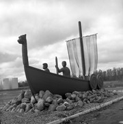
Saskatchewan's Fourth Meridian (meridian 110 degrees west of Greenwich) forms the western boundary of the province and is part of the world's longest surveyed straight line.
Scope and Content
Photograph shows two RCMP members in red serge standing next to a monument dedicated/marking the Fourth Meridian.
Notes
A negative exists for this photo and is stored with the picture.
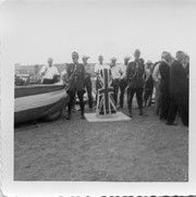
Saskatchewan's Fourth Meridian (meridian 110 degrees west of Greenwich) forms the western boundary of the province and is part of the world's longest surveyed straight line.
Scope and Content
Photograph shows the platform party at the dedication of the Fourth Meridian monument.
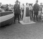
Saskatchewan's Fourth Meridian (meridian 110 degrees west of Greenwich) forms the western boundary of the province and is part of the world's longest surveyed straight line.
Scope and Content
Photograph shows the platform party at the dedication of the Fourth Meridian monument.
Saskatchewan's Fourth Meridian (meridian 110 degrees west of Greenwich) forms the western boundary of the province and is part of the world's longest surveyed straight line.
Scope and Content
Photograph shows the platform party at the dedication of the Fourth Meridian monument.
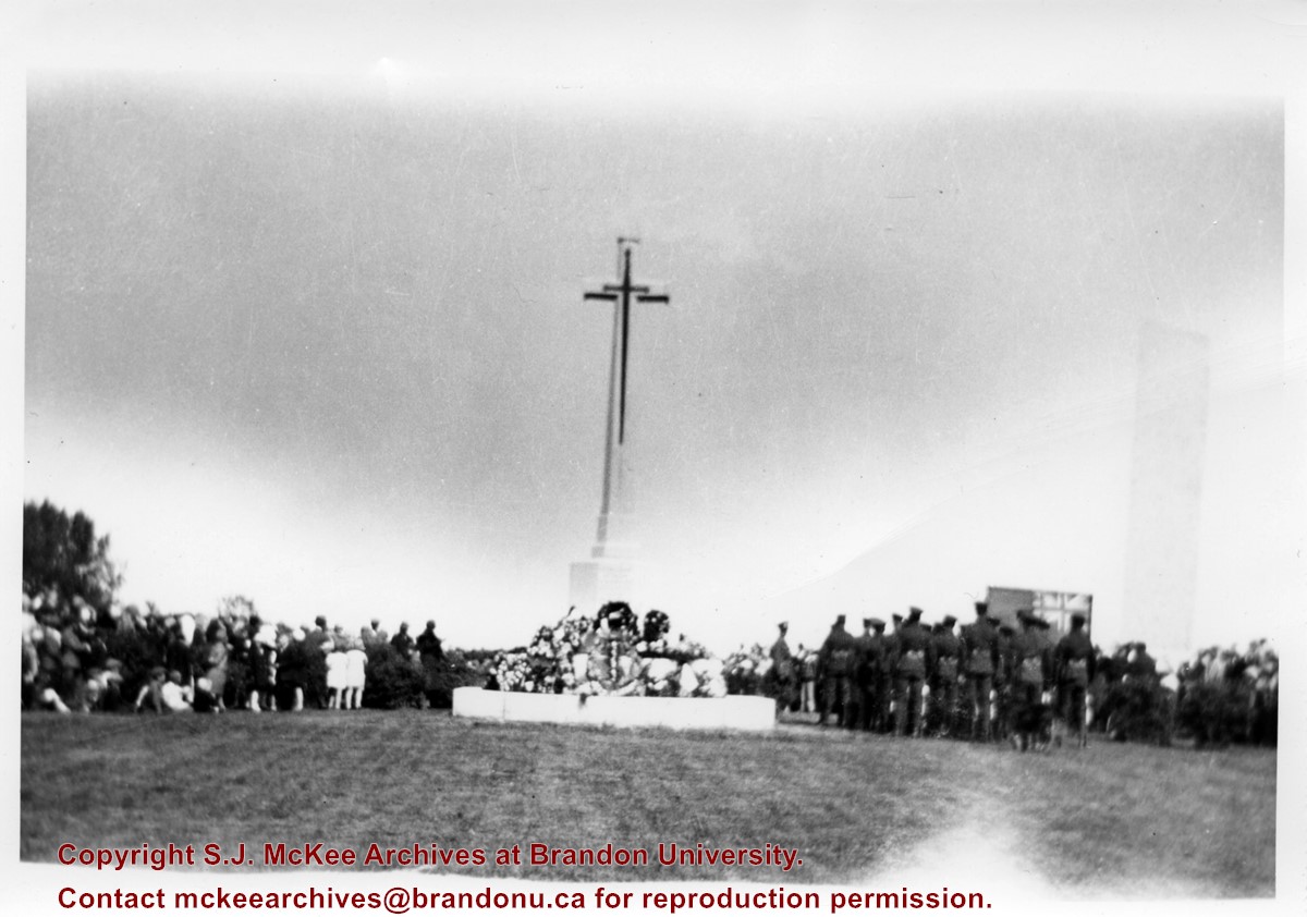
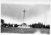
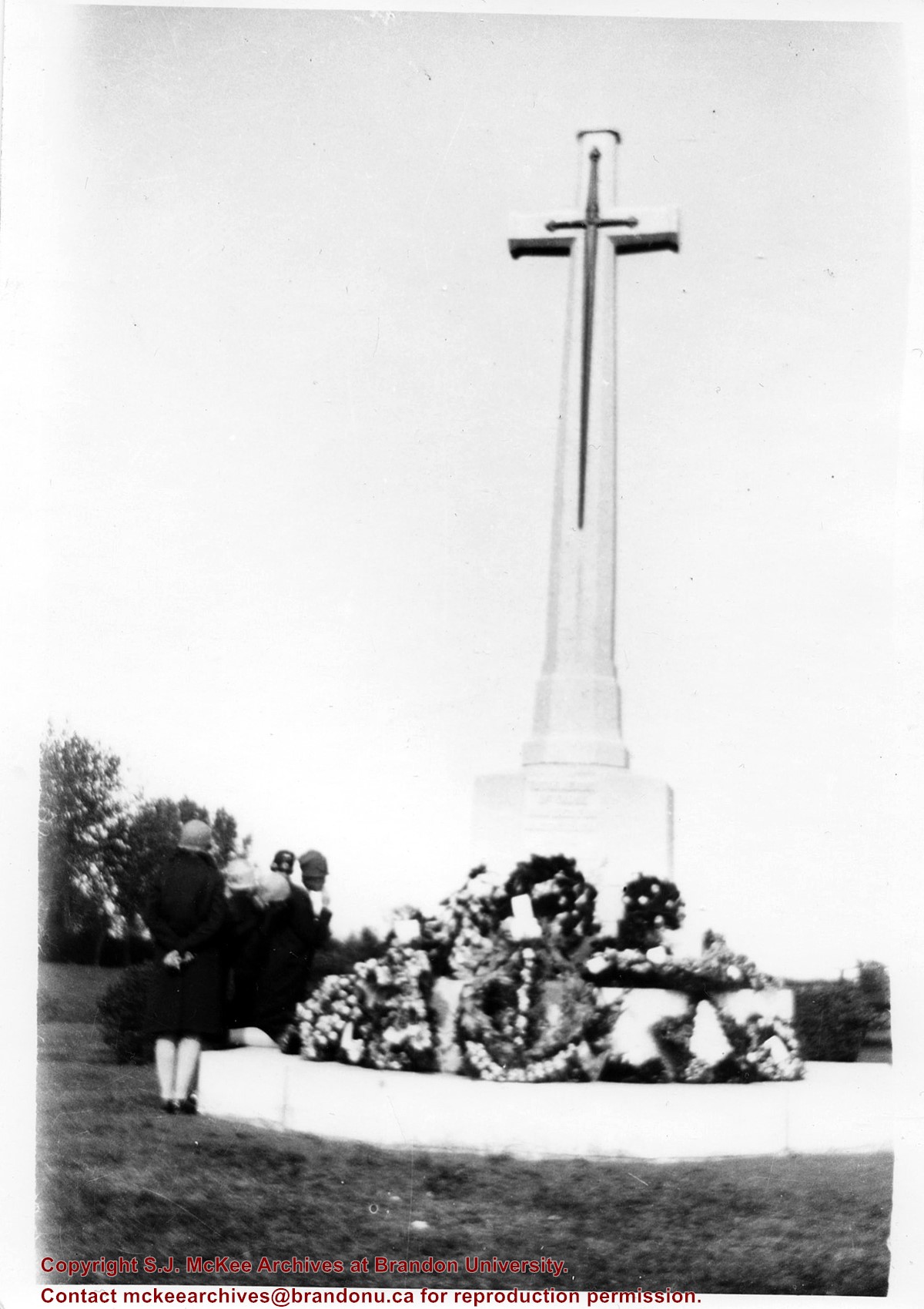
According to Veterans' Affairs Canada, there are 25 Crosses of Sacrifice in North America. The crosses were designed by the Canadian War Graves Commission's (CWGC) architect Sir Reginald Bloomfield, who designed a stone cross affixed with a bronze symbolic sword. The CWGC granted the Brandon Municipal Cemetery permission to privately erect the Cross of Sacrifice in its cemetery in exchange for maintaining the war graves in its cemetery.
The Brandon Great War Veterans Association erected the Cross of Sacrifice in the Brandon Municipal Cemetery in 1924 after a 10-day public fundraising campaign. At the time the Brandon Daily Sun reported that the Veterans Association required $5,000 to pay for the cross and the campaign ultimately raised $7,500. The memorial was initially dedicated to the local citizens who died as a result of the First World War.
Custodial History
Donated to Fred McGuinness by G. Baldock in 1971
Scope and Content
Photograph is of a memorial service at the Cross of Sacrifice in the Brandon Municipal Cemetery. Members of the public are standing to the north of the cross, while soldiers and veterans stand to the south. A number of wreaths have been placed at the base of the monument.
Notes
Writing on the back of the photograph reads: 5 prints. Dedication of the war memorial. around 1926-1927-28. I was scout master under Comissioner Harry Booth. P.E.H.
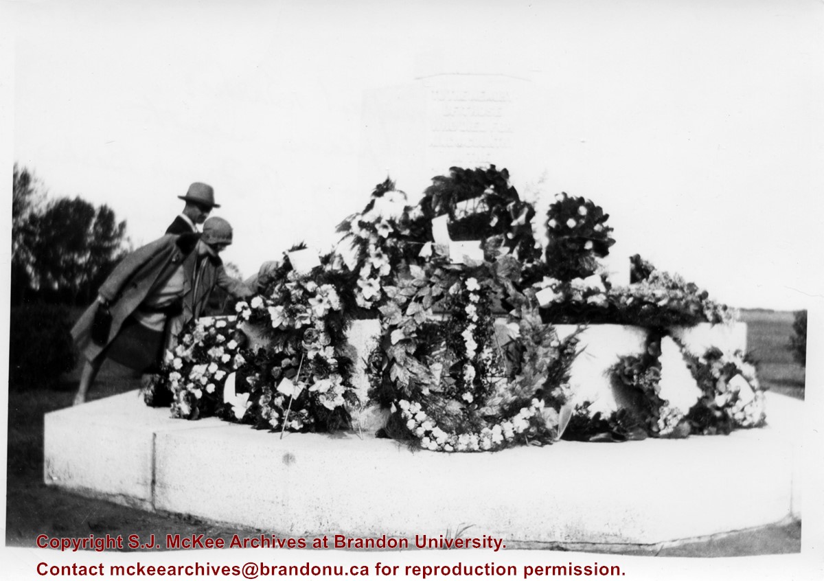
According to Veterans' Affairs Canada, there are 25 Crosses of Sacrifice in North America. The crosses were designed by the Canadian War Graves Commission's (CWGC) architect Sir Reginald Bloomfield, who designed a stone cross affixed with a bronze symbolic sword. The CWGC granted the Brandon Municipal Cemetery permission to privately erect the Cross of Sacrifice in its cemetery in exchange for maintaining the war graves in its cemetery.
The Brandon Great War Veterans Association erected the Cross of Sacrifice in the Brandon Municipal Cemetery in 1924 after a 10-day public fundraising campaign. At the time the Brandon Daily Sun reported that the Veterans Association required $5,000 to pay for the cross and the campaign ultimately raised $7,500. The memorial was initially dedicated to the local citizens who died as a result of the First World War.
Private Frank Barker (#33281) died on 27 June 1918. A member of the Canadian Army Medical Corps, Pte. Barker was on the Llandovery Castle Hospital Ship when it was torpedoed.
Custodial History
Donated to Fred McGuinness by G. Baldock in 1971
Scope and Content
Photograph is of a close-up of a number of wreaths laid at the base of the Cross of Sacrifice in the Brandon Municipal Cemetery during a memorial service.
Notes
Writing on the back of the photograph reads: Winnifred Barker places wreath in memory of Frank Barker (my uncle) 1st Field Ambulance, many decorations including the "Mons Star," lost on the Hospital Ship Landovery Castle, 1918. - G. Baldock 1971 -
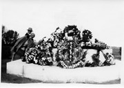
According to Veterans' Affairs Canada, there are 25 Crosses of Sacrifice in North America. The crosses were designed by the Canadian War Graves Commission's (CWGC) architect Sir Reginald Bloomfield, who designed a stone cross affixed with a bronze symbolic sword. The CWGC granted the Brandon Municipal Cemetery permission to privately erect the Cross of Sacrifice in its cemetery in exchange for maintaining the war graves in its cemetery.
The Brandon Great War Veterans Association erected the Cross of Sacrifice in the Brandon Municipal Cemetery in 1924 after a 10-day public fundraising campaign. At the time the Brandon Daily Sun reported that the Veterans Association required $5,000 to pay for the cross and the campaign ultimately raised $7,500. The memorial was initially dedicated to the local citizens who died as a result of the First World War.
Custodial History
Donated to Fred McGuinness by G. Baldock in 1971
Scope and Content
Photograph is of a group of people examining wreaths that have been laid at the base of the Cross of Sacrifice in the Brandon Municipal Cemetery during a memorial service.
The International Peace Garden is situated on the international border between Manitoba and North Dakota, adjacent to the Canadian Border Services Boissevain port of entry and the U.S. Customs and Border Protection Agency's Dunseith port of entry. The dedication for the International Peace Garden was held on July 14, 1932. It was estimated that 50,000 people were in attendance on opening day. The park is 9.5-square kilometers or 3.54-square miles.
Custodial History
Pictures were sent to Fred McGuinness in 1970 from E.M. Bergson of Brandon.
Scope and Content
Photograph shows large crowds surrounding a stone cairn draped in American and Union Jack flags. According to the International Peace Garden website, the pictured cairn was built from stones gathered from Manitoba and North Dakota. The crowds gathered for the 1932 dedication of the International Peace Garden.
Notes
The back of the photograph is stamped: Enameloid Velox Print by the Jul 27 1932, Chicago Postal Photo Supplies, Regina, Sask.
Postcard shows the 100 block of 10th Street facing north. The CPR train station can be seen at the end of 10th Street. The sign for the Rex Cafe is visible on the west side of 10th Street. On the east side of 10th Street, billboards for Campbell & Campbell furniture are visible as well as signs for Pianos and the Orpheum Theatre. Motorists and cyclists share the road. Street car tracks run the length of 10th Street.
Notes
Back of postcard reads: Morning reflection of Brandon's skyline on the Assiniboine River, photo by Sandy Black, printed in Brandno, Manitoba, Canada by Leech Printing Ltd.
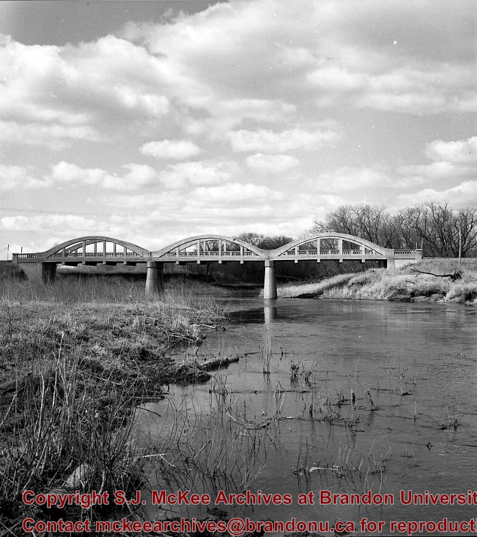
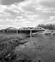
Kirkham's Bridge was built in 1906, to replace an earlier wooden bridge. The bridge was used until 1981, when it was purchased by the Town of Birtle and moved to a newsite. A former railway pridge was installed in its place.
Scope and Content
Photograph shows Kirkham's Bridge, a steel truss bridge that spanned the Little Saskatchewan River in the Municipality of Riverdale.
Notes
Identification of the bridge provided by Ken Storie (2023). Additional information taken from the Manitoba Historical Society website.
Situated in the R.M. of Whitehead on the Little Saskatchewan River, the 10 Mile Dam was a 14 kilometer transmission line that supplied the city of Brandon with power. The Brandon Electric Light Company built the dam in 1900 and it is considered Manitoba's first hydroelectic power generating station. The dam spanned approximately 80 meters and was constructed from timber and reinforced with clay and stone. The station was decommissioned in 1924.
Alonzo Archibald Rowe (b. 1862, London, ON; d. 22 Oct 1951, Brandon). The Rowes were considered Brandon area pioneers. Alonzo’s father, Alonzo L. Rowe, came to Brandon with his family in 1881, where the family had a furniture and undertaker business on the west side of 10th Street between Rosser and Princess Avenues. In 1885, the family began farming west of Brandon and Alonzo Archibald served as a councilor and then a reeve in the R.M. of Whitehead. He returned to Brandon in 1907 and served with the Brandon Police Department until 1910, when he returned to farming, this time in Arrow River. A.A. Rowe returned to Brandon in 1915 to work as a Provincial Licenses Inspector, a position he held until 1938. (Source: Obituary, Brandon Daily Sun 22 Oct 1951)
Custodial History
Photograph was in possession of Mrs. Ruby Miles, who passed the image on to Fred McGuinness. McGuinness makes reference to Mrs. Miles and this photograph in his Sunbeams column (Source: F.A. Rosser, "Another interesting chat with a daughter of the plains," Brandon Sun 18 Aug 1981).
Scope and Content
Photograph shows four fishermen at 10 Mile Dam, also known as the Brandon Dam or Minnedosa River Hydro Plant. The fishermen in the photo are identified as George H. Rowe and his father A.A. Rowe, Dr. Wilfred Bigelow, and Al Collins.
Notes
Writing on the back of the photograph reads: at Brandon Dam, [right to left] son and father - George H. ROWE, Mr. A.A. ROWE, Dr. BIGELOW, Al COLLINS (dam?, 1906?, George born March 1897); Jerrett's Photo-Services, May 7 1938.


)
)
)