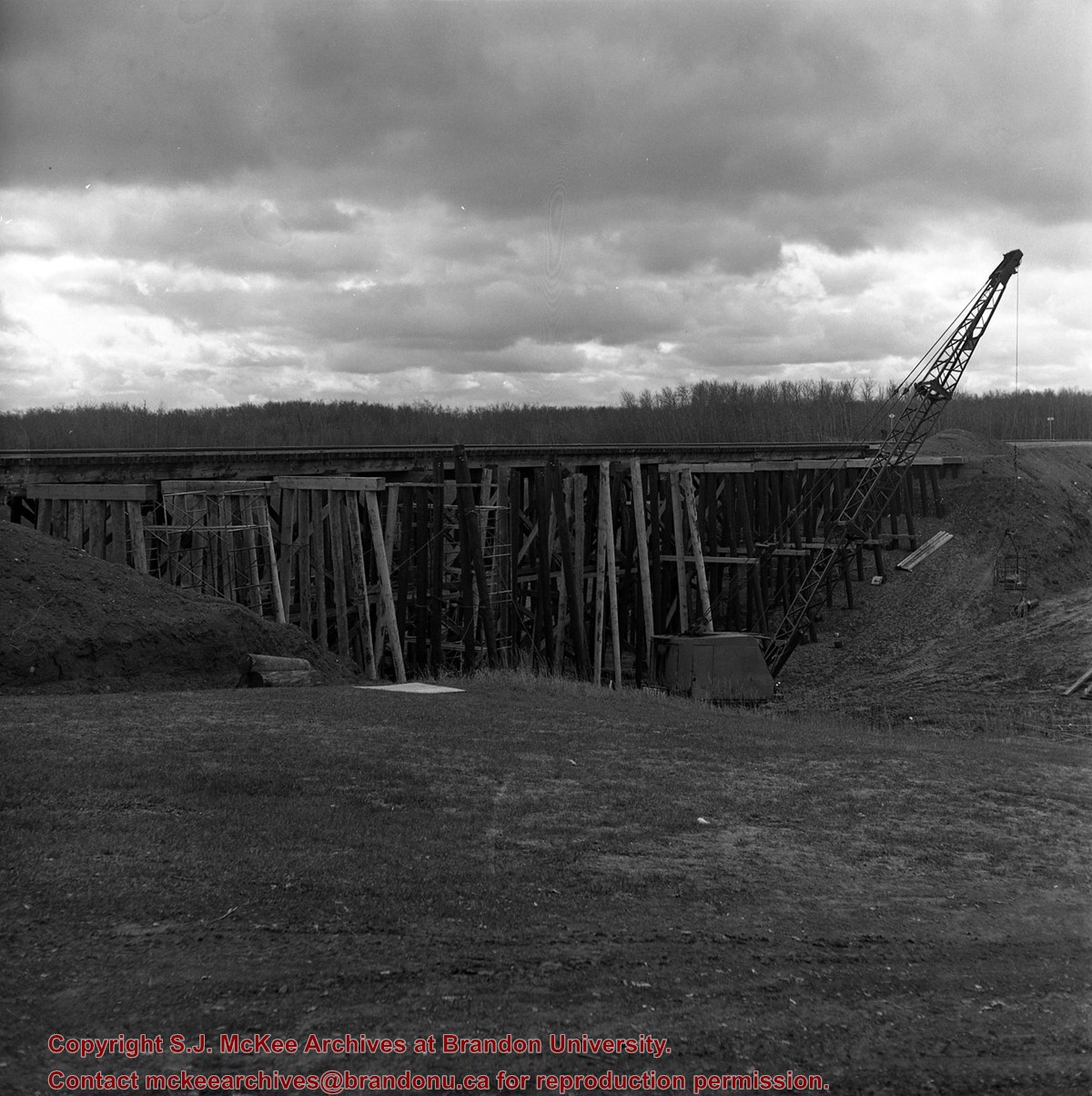
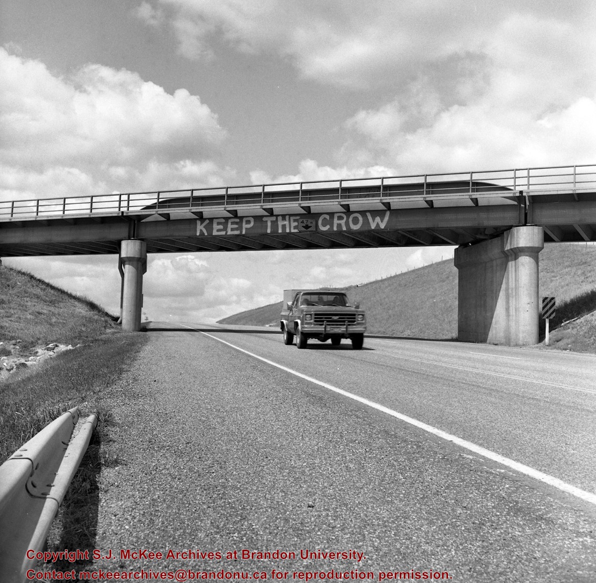
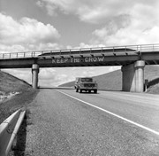
Mr. Stuckey's notes: Similar painting on other side "Refuse the Cruise." Bridge newly painted July or Aug. 83.
Custodial History
For custodial history see the collection level description of the Lawrence Stuckey collection.
Scope and Content
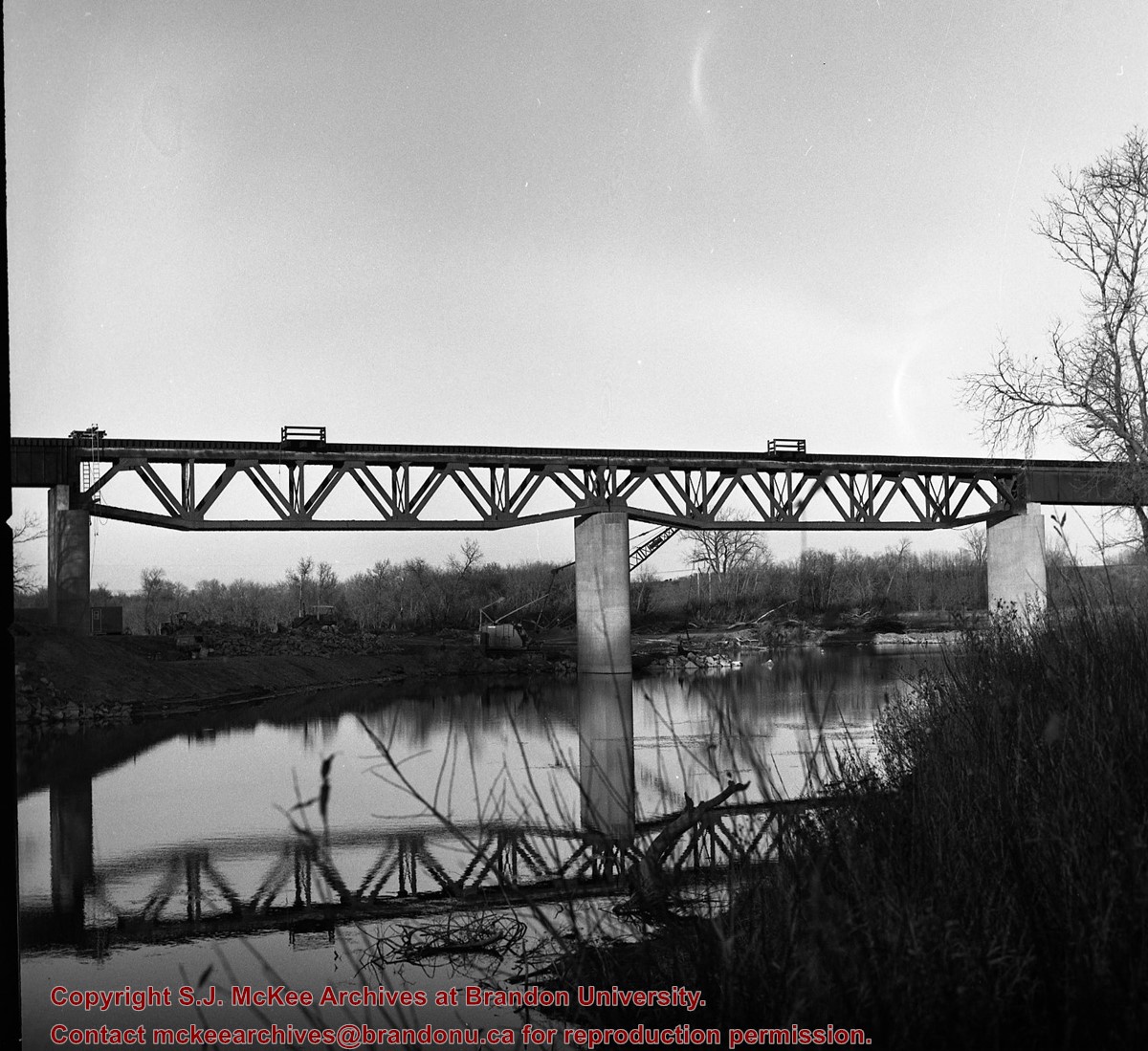
Image of CP Bridge over Hwy. 10 "KEEP THE CROW", Minnedosa, Manitoba. Image was taken along the CPR Minnedosa & Bredenbury subdivision (ex. Manitoba & N.W. Railway).
Notes
["KEEP THE CROW" appears to have been spray painted on the side of the bridge].
As a boy my father pointed out this pile of bricks, and pit beside it, and told me a small brick plant had been established here in the early days. The product was of poor quality and the business never became established. LAS.
Custodial History
For custodial history see the collection level description of the Lawrence Stuckey collection.
Scope and Content
Spring Park brick pile near the CPR grade
Notes
Located just south of the CPR mainline at Mile 3 [three miles west of Brandon. P.E.]
[Mr. Stuckey put three negatives in same envelope. We have separated them and numbered them H13(1), H13(2) and H13(3).]
As a boy my father pointed out an old pile of bricks, and pit beside it, and told me a small brick plant had been established here in the early days. The product was of poor quality and the business never became established. LAS.
Custodial History
For custodial history see the collection level description of the Lawrence Stuckey collection.
Scope and Content
Area nearby the Spring Park brick pile
Notes
Located just south of the CPR mainline at Mile 3 [three miles west of Brandon. P.E.]
[Mr. Stuckey put three negatives in same envelope. We have separated them and numbered them H13(1), H13(2) and H13(3).]
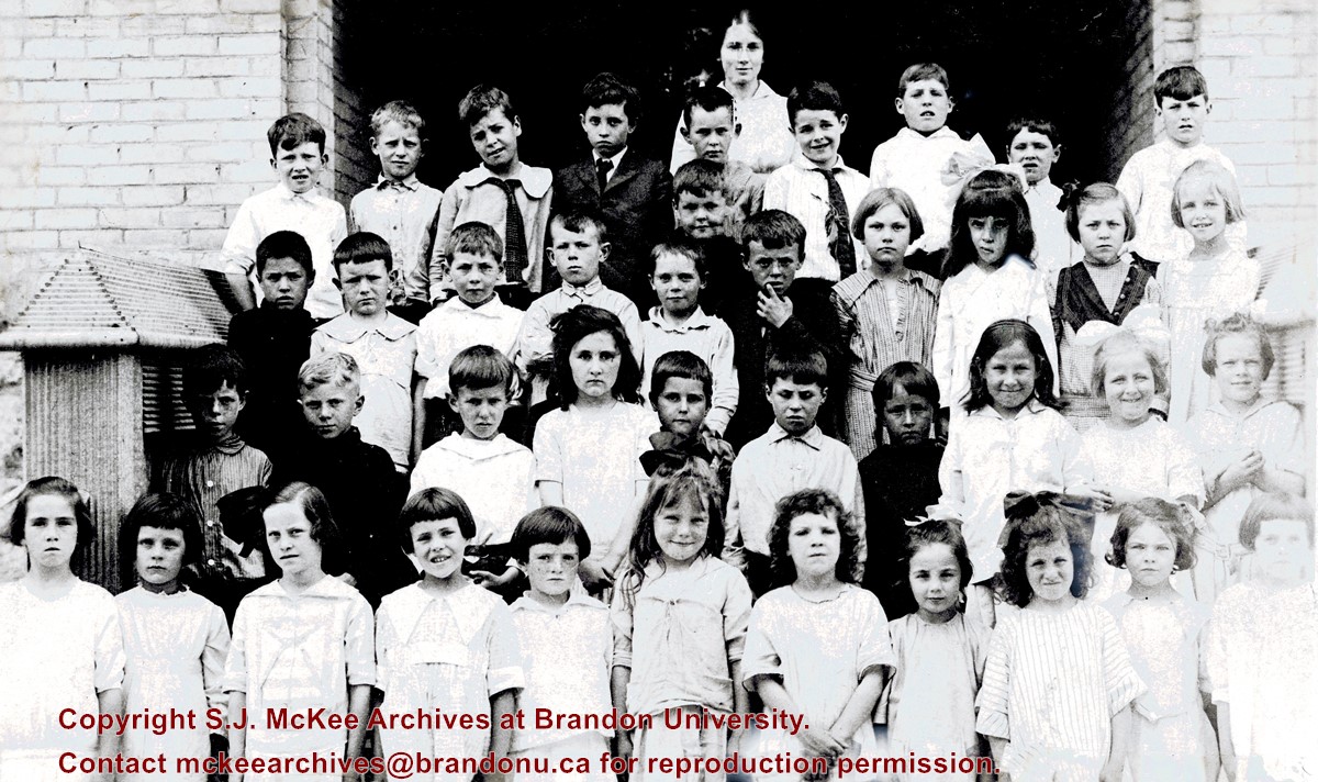
Given to Fred McGuinness by Stewart Tait (1912-1988) of Brandon.
Scope and Content
Photograph is an outdoor class picture of young students standing on the front steps of what appears to be Park School.
Notes
Mr. Tait provided Fred McGuinness with a photocopy of the photograph (see McG 1.2, file 19) on which he identified a number of students in his class, including: first/front row - Miss Fleming (fourth from right); second row - Stan Fraser (first from left), Stewart Tait (second on left), Mrs. Ron Relf (nee Stock?) (fourth on left); third row - Ed Bolton (fourth from left), G. Cranston (fifth from left), Ed McGill (offset, above G. Cranston), Mary McGregor, daughter of C.C. McGregor (third from right)
Due to the increasing volume of long-distance auto traffic in the 1920's, the city designated the block between Hill & Queen's Avenues and 9th & 10th streets as a "Tourist Camp" with a few basic facilities. After the demise of the Brandon Municipal Railway, several of the old car bodies were placed in the Tourist Camp to be used as cooking & eating shelters. Some may have had sleeping accommodations. Later (ca. 1938?) several were placed in a row along the south side of Victoria Avenue, approximately 28th or 29th St, and were used as the city's first drive-in hamburger place, "The Train Drive-in". This, I believe, only lasted one or two summer seasons. LAS.
Custodial History
For custodial history see the collection level description of the Lawrence Stuckey collection.
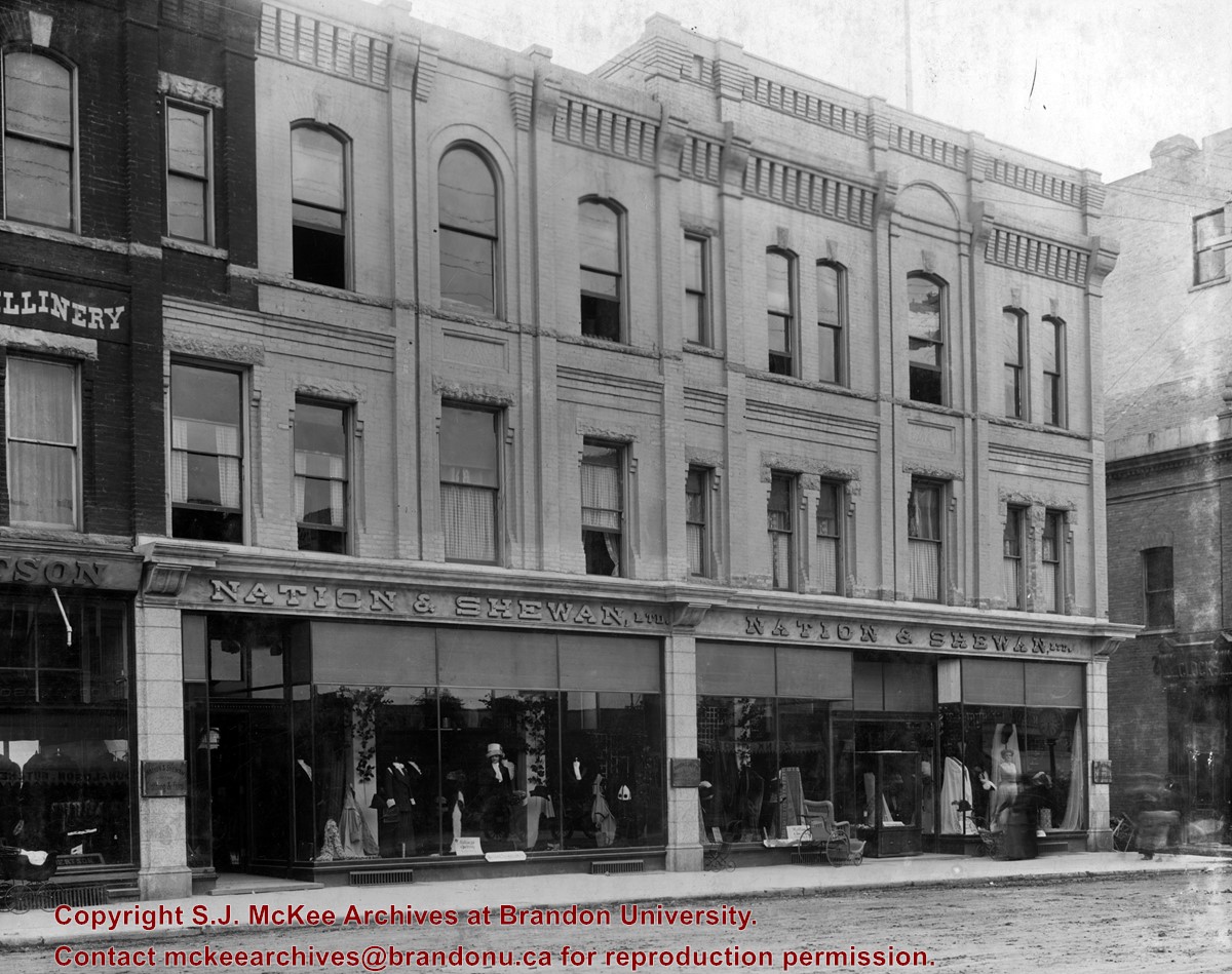
Erected in 1889, at 806 Rosser Avenue (the southeast corner of Rosser Avenue and 7th Street), the building was designed by Brandon architect W.H. Shillinglaw. At the time of its construction the structure housed the Nation Department Store, which became Nation & Shewan Department Store in 1894. One of Brandon’s largest and most successful drygoods businesses, the venture was owned and operated by Fred Nation and Alexander Shewan.
Built adjacent to an existing three storey brick building known as the A.D. Rankin Block (built sometime between 1885 and 1888), this smaller building was eventually absorbed by the Nation and Shewan Block after 1897, when Rankin Drygoods moved into the newly constructed Syndicate Block located farther east down Rosser Ave. Later, the Rankin Block became known as Nation Chambers. These two structures comprised what was known as the Nation and Shewan Block.
Major improvements were made to the store and an annex was added in 1910. Some of the renovation additions included, but were not limited to: an updated frontage with new copper sash windows and prismatic glass tops, plate glass windows, new fixtures and carpet. With the renovations the floor space of the business was almost doubled. The stock of the business also increased, with the Brandon Weekly Sun reporting that when finished, Nation & Shewan would be a “store of which the citizens of Brandon will be justly proud.”
The drygoods firm operated until Nation’s death 1926, when it became known as A. Shewan Limited. From 1933 to 1944, the business was known as Shewan and Son. Shortly thereafter, the Metropolitan Stores Ltd began operating out of the Nation & Shewan Block.
In 2000, the Town Centre prepared to knock down what was then known as the Red Apple Building, the former Nation & Shewan Block. The demolition was to make way for the new atrium and entrance for the mall, and begin a new period of redevelopment at the downtown shopping centre.
Custodial History
See fonds level description of the Alf Fowler collection for custodial history.
Scope and Content
Photo shows the front of the Nation & Shewan Block, which was located in the 800 block of Rosser Avenue on the southside.
Storage Range
RG 5 Western Manitoba Manuscript collection - photograph storage drawer
xxxii, 616 p., [3] leaves of plates : ill., maps, ports. ; 21 cm
Notes
Maps on end papers
"Authorised by the Minister of Education for use in the high schools and collegiate institutes of Ontario, and by the Advisory Board for use in Manitoba"


.jpg?width=1200&404=no-img.jpg&watermark=wmk)
.jpg?width=180&404=no-img.jpg)
.jpg?width=1200&404=no-img.jpg&watermark=wmk)
.jpg?width=180&404=no-img.jpg)
.jpg?width=1200&404=no-img.jpg&watermark=wmk)
.jpg?width=180&404=no-img.jpg)


.jpg%3fmaxheight%3d1000%26maxwidth%3d1000%26watermark%3dwmk&description=Spring+Park+Brick+Pile)
.jpg%3fmaxheight%3d1000%26maxwidth%3d1000%26watermark%3dwmk&description=Spring+Park+Brick+Pile)
.jpg%3fmaxheight%3d1000%26maxwidth%3d1000%26watermark%3dwmk&description=Spring+Park+Brick+Pile)