The United Farmers of Manitoba was founded in 1920. It was an inclusive farmers' organization established to replace the Manitoba Grain Growers' Association. The UFM supported farmer candidates in the 1920 provincial election. In 1922, it helped elect the UFM government of John Bracken (1922-42). The UFM also participated in federal politics, supporting twelve successful candidates in the 1921 federal election. The UFM was financed by its members. Its membership varied from 15,700 in 1923, to 3700 in 1931. In 1939, the UFM became the Manitoba Federation of Agriculture.
Custodial History
This fonds was accessioned by the McKee Archives in 1997. Prior custodial history is unknown.
Scope and Content
Fonds includes documents relating to the membership, both male and female, of the Wingham branch of the United Farmers of Manitoba and the United Farm Women of Manitoba. Documents dealing with the position of the branch on prohibition c. 1922, discussion within the branch of the "wheat pool" movement, annual reports for the organization, newsletters, correspondence on matters political and agrarian, and records relating to the activities of the branch as a cooperative buying agency are also included. Fonds also contains minutes of the provincial convention of the UFM and correspondence from the central office of the UFM.
Two works of art from the University Collection, south end Library Reading Room, McKenzie Building. Naming of the Robbins Library and opening of the Lightbody Reading area. L to R (numbered as on back of picture) 1) Dorothy Luchansky, 2) Lillian Phillips, 3) Prof. Marion Crowhurst ?, 4) Elsie Paterson (Stewart), 5) Stella Tolmie, 6) Shirley Gillespie, 7) Alice Gregory (Orr) (back), 8) Dr. Robert Brockway, 9) Dr. D.N.Wheeler (back), 10) Dr. R.F.B. King (part), 11) Marg. McKinnon Nos. 1-10 University Staff; 11-Mental Health Centre
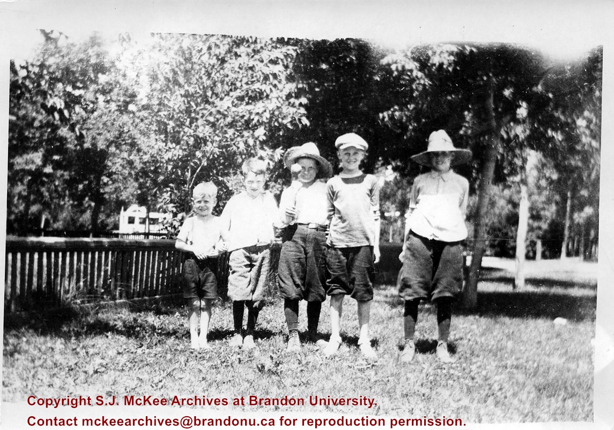
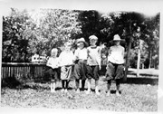
Photograph shows a group of five young boys standing shoulder-to-shoulder as they pose for the picture. Don McPherson has been identified as the boy in the middle. The boys appear to be standing in a residential backyard on a summer's day. The children are wearing shorts and some are wearing straw hats.
Notes
Writing on the back of the photograph reads: 300 block 14th St., ? Clement, ? Hill, Don McPherson, ?- , ?-, 1922
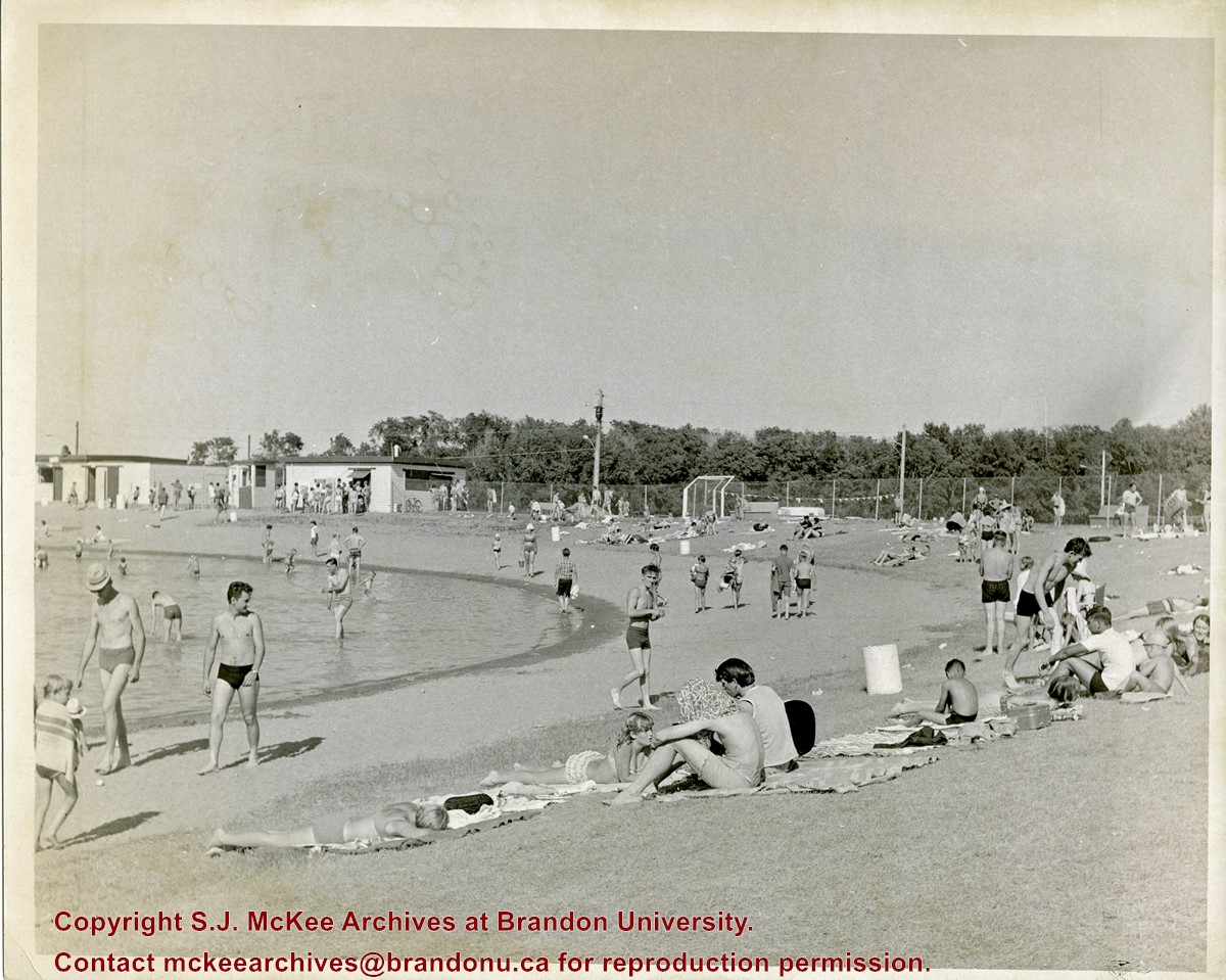
Curran Park is located at 4100 Grand Valley Rd, Brandon, MB. Originally called Suburban Park, it underwent a formal name change in 1934, in honour of J.P. Curran, a lawyer, civil servant and judge, who died in 1928.
The City of Brandon first set aside $6000 for the acquisition of a new park in 1911, but the acquisition of appropriate land stalled for a number of years. Finally in 1919, the city was able to acquire a parcel of Crown land the Brandon Industrial School was located on, to establish the park; the land was acquired through a 99-year lease. Suburban Park officialy opened in 1921.
The development of the park was gradual. Some of the work was completed as part of the Brandon Parks Board's unemployment relief planning; from 1931-1936, relief workers cleared underbrush, thinned trees, constructed a road and built latrines. In 1933 a refreshment stand was approved and a large cook stove was donated.
The City of Brandon and the Department of Agriculture (in right of the Crown) agreed to terminate the original park lease in March 1965, with the city purchasing the land outright. Curran Park was sold to Gretna businessman Gerald Voth in 2001, and renamed Turtle Crossing.
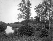
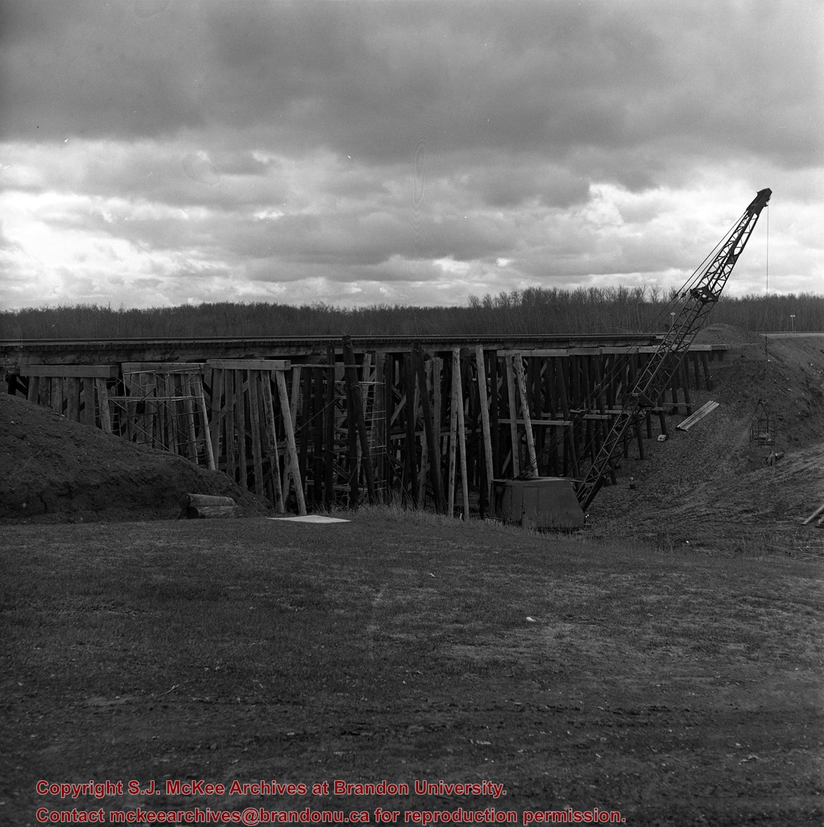
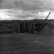
Scope and Content
Item is a photograph of the pool at Curran Park, Brandon, MB.
Notes
History/Bio information was taken from A Cup of Cold Water: Alfred Kirkness and the Brandon Residential School Cemeteries by Anne Lindsay, Clare Cook, and David Cuthbert (Manitoba History journal, Number 78, Summer 2015).
For custodial history see the collection level description of the Lawrence Stuckey collection.
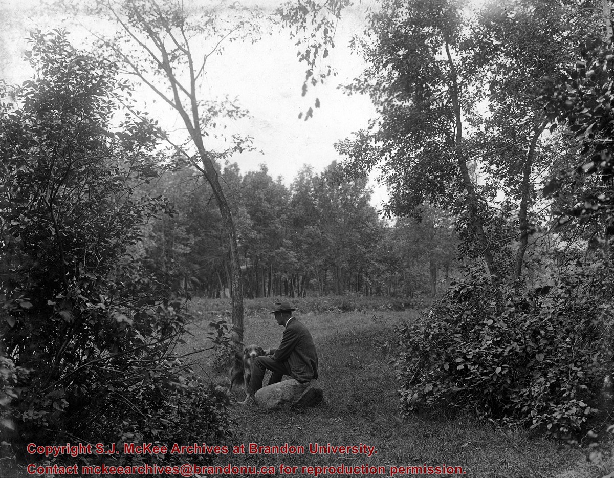
Scope and Content
Stanley Park from old PC.
Notes
Shows bandstand
[By "PC" Mr. Stuckey likely meant to indicate Park School (built 1904, demolished 1978). Park School was, at the time the photo was taken, located directly across Lorne Avenue from Stanley Park. P.E. 22/07/09]
West End Park, which was established in 1894, was renamed Stanley Park in 1907, in honour of Stanley McInnis, a local dentist and legislator. The city acquired the block of land from the Canadian Pacific Railway Company in 1894 for the price of one dollar, on the condition that it be set aside for public use. The park occupies the block between 14th and 15th Streets and Princess and Lorne Avenues.
Custodial History
See fonds level description of the Alf Fowler collection for custodial history.
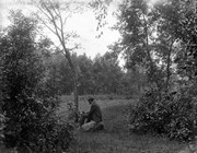
Scope and Content
Photos shows Stanley Park.
Notes
History/Bio information was taken from the Assiniboine Historical Society's Brandon: A Residential Walking Tour pamphlet (1993).
Storage Range
RG 5 Western Manitoba Manuscript collection - photograph storage drawer
West End Park, which was established in 1894, was renamed Stanley Park in 1907, in honour of Stanley McInnis, a local dentist and legislator. The city acquired the block of land from the Canadian Pacific Railway Company in 1894 for the price of one dollar, on the condition that it be set aside for public use. The park occupies the block between 14th and 15th Streets and Princess and Lorne Avenues.
Custodial History
See fonds level description of the Alf Fowler collection for custodial history.
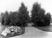
Scope and Content
Photos shows Stanley Park.
Notes
History/Bio information was taken from the Assiniboine Historical Society's Brandon: A Residential Walking Tour pamphlet (1993).
Storage Range
RG 5 Western Manitoba Manuscript collection - photograph storage drawer


.jpg?width=1200&404=no-img.jpg&watermark=wmk)
.jpg?width=180&404=no-img.jpg)
.jpg?width=1200&404=no-img.jpg&watermark=wmk)
.jpg?width=180&404=no-img.jpg)

.jpg%3fmaxheight%3d1000%26maxwidth%3d1000%26watermark%3dwmk&description=Park+School)
.jpg%3fmaxheight%3d1000%26maxwidth%3d1000%26watermark%3dwmk&description=Park+School)