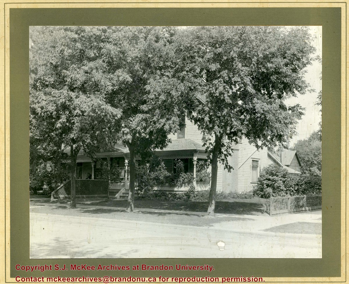
Photograph shows a two-storey wood-framed duplex. The building appears to be situated on a corner. The front verandas have wooden ornamentation and a lattice fence separates the front yards. Flowers and viriginia creeper appear in flower beds along the side of one house.
Notes
The location has been identified as the 7th Street Terrace between Lorne and Louise Avenues.
See collection level description for the James Douglas Wall collection.
Scope and Content
Image of the west end of Front Street in Baldur, MB. Business and buildings in the photo include (L-R): Cleghorn's drug store, Fowlers, Tom Johnson's John Deer Shop, barber shop, Royal Bank (Odd Fellows Hall upstairs), Lee's Chinese Cafe, Hunters Hardware, Folwer Block, L. Curtis Block, Sexsmith Block - boarding house and sample room.
See fonds level description of the Alf Fowler collection for custodial history.
Scope and Content
Photo was taken of 10th Street from Pacific Avenue looking sourth. Visible businesses include: the Cecil Hotel; the Canadian Bank of Commerce; Campbell and Campbell; and the Bank of British North America
Storage Range
RG 5 Western Manitoba Manuscript collection - photograph storage drawer
See fonds level description of the Alf Fowler collection for custodial history.
Scope and Content
Photo was taken of Rosser Avenue from 7th Street looking west. Visible businesses include: ? and Ball; Vincent & MacPherson; W.N. Finlay; Christie's; J. Burchill; the Empire Hotel; and Fleming's Drug Store. A number of people and vehicles are visible on both sides of the street.
Notes
A digital scan of the photograph is available on a CD located in the Archives' office.
Storage Range
RG 5 Western Manitoba Manuscript collection - photograph storage drawer
See fonds level description of the Alf Fowler collection for custodial history.
Scope and Content
Photo was taken of Rosser Avenue, looking east from 11th Street. Visible in the photo are the Merchant's Bank of Canada, A. Smith, and the Union Bank of Canada. A number of people and vehicles are also visible.
Storage Range
RG 5 Western Manitoba Manuscript collection - photograph storage drawer
Photograph shows the intersection, facing northwest, at 10th Street and Princess Avenue, Brandon, Manitoba. Fitwell Tailors can be seen on the south side of Princess Avenue. Doig's Home Furnishings and The Manufactuerers Life can be seen on the northwest corner. Traffic appears to be travelling both ways on Princess Avenue.
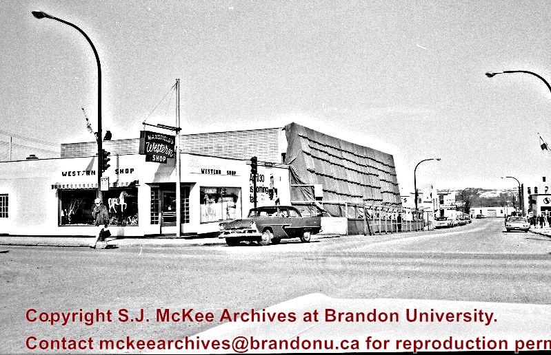
Photograph shows the west side of the 100-block of 10th Street facing northwest. Visible businesses include: Bottomley's Furniture, Recreation Bowling & Billiards, Fashion Fabrics, Brandon News & Record Shop, Bass' Storkland, Beneficial Finance Co., and the Kresge Store. The Johnny Smith Block is visible in the background.
Photograph shows the west side of 10th Street between Rosser and Princess Avenues. Visible businesses include: Brandon News & Record Shop, Fashion Fabrics, Recreation Bowling & Billiards, Bottomley's, Barry Neill Men's Wear, Simpsons-Sears. Painted on the north face of the Strathcona Block are two advertisements, one for Sutherland and Robertson [Grocery] and the other for Boyd Electric Co. Ltd. Union Jack flags hang from some businesses and light standards.
Photograph shows the Kresge store on the southwest corner of 10th Street and Rosser Avenue. Other 10th Street businesses that are visible on the west side of the street include: James Richardson & Son Investments, Beneficial Finance and Loans, Bass' Storkland, Brandon News & Record Shop, Recreation Bowling and Billiards, and Bottomley's. The Welcome Brandon sign can be seen in the top right corner of the photograph.
Stuckey's notes: Taken just before construction started on overpass. Towerman controlled crossing gates and switches and signals for all routes into and out of station and freight years. My grandfather Samuel Gilmour had for many years operated the previous tower which only operated the cross-ing gates and continued to operated the new tower for several years after it was built c. 1929. It was make obsolete with installation of Centralized Traffic Control in 1965. For better picture of tower see No. 53, engine 2911 in CP steam trains file.
Scope and Content
Photograph is looking northwest from just south of the train tracks on 18th Street. 18th Street to the North Hill is visible.
Notes
Corresponds with negative 1-2002.3.9.P20(1).
Repro Restriction
The McKee Archives is the copyright holder for the Stuckey materials.
For custodial history see the collection level description of the Lawrence Stuckey collection.
Scope and Content
CPR No. 3, the westbound "Dominion", with engine 2829 under 1st Street Bridge
Notes
View includes former Empire Brewery, [then] in use by Bell Bottling Co.; Safe crossing over the CPR eliminated the need for a flagman. "Telltails" warn switchmen riding on top of railcars of low overhead clearance. Old Empire Brewery was (late 1950's) a feed mill, making grain feeds for livestock.
/12-2004_12.jpg?width=1200&404=no-img.jpg&watermark=wmk)
/12-2004_12.jpg?width=180&404=no-img.jpg)


.jpg?width=1200&404=no-img.jpg&watermark=wmk)
.jpg?width=180&404=no-img.jpg)


)
)
)
%2f12-2004_12.jpg%3fmaxheight%3d1000%26maxwidth%3d1000%26watermark%3dwmk&description=Front+Street%2c+west+end+of+Baldur%2c+MB)
.jpg%3fmaxheight%3d1000%26maxwidth%3d1000%26watermark%3dwmk&description=CPR+eighteenth+street+crossing+%26+signal+tower)