Edward Walker was a native of England. In 1895, he left his home in Stockport England and traveled to the village of Millwood, Manitoba where, with three of his five children, he began a new life on the Canadian settlement frontier.
Walker was a professional photographer and his fonds contains a variety of images of Millwood and the surrounding agricultural community, its people, and life. These images were produced from gelatin dry plate negatives, a process introduced around 1880 to replace the wet collodin process in which a photographic solution was applied to a glass plate just prior to exposure. Edward Walker’s pictorial account of life in and around Millwood Manitoba circa 1900 is an important photographic legacy of pioneer life on the upper reaches of the Assiniboine Valley.
The village of Millwood was - and is - located in the Assiniboine River valley close to the Manitoba-Saskatchewan border just a few miles northwest of Binscarth and a similar distance southwest of Russell. It came into existence in 1887 with the construction of the Manitoba and North-Western Railway, a road that ran diagonally through the new West from Prince Albert, North West Territories to Portage la Prairie Manitoba.
Custodial History
These photographic images are drawn from the Edward Walker fonds held at the S.J. McKee Archives. They were used in an exhibit entitled "Millwood on the Assiniboine circa 1900" in 2005. The exhibit was located on The Curve Gallery in the John E. Robbins Library and curated by Tom Mitchell.
Scope and Content
Consists of 22 photographic prints mounted on foam board used by the Archives for the display.
Notes
A selection of thes images are on display in the S. J. McKee Archives. The balance are in storage at RG 6 Brandon University fonds, Series 8: Library Services, 8.2 S.J. McKee Archives.
Storage Location
RG 6 Brandon University fonds
Series 8: Library Services
8.2 S.J. McKee Archives
The Provincial Exhibition of Manitoba has been an institution almost as long as Brandon has been a city, although under the guise of several different names. The idea of an exhibition came from Charles Whitehead, who was the founder and first president of the fair. Whitehead was one of the earliest and most prominent businessmen in Brandon. The first Brandon fair was organized in October of 1882, by the Brandon Agricultural Society (BAS). The Board of Directors of the BAS offered up two hundred dollars in prize money, but poor weather and a subsequently small turnout of people and exhibits to the downtown location caused the fair to do poorly. Undeterred, the Board of Directors began to make plans for the second fair, in what was to become an annual event. This time, due to generous grants from the city, district, and province, the Board of Directors was able to purchase land just south of the city to hold the fair on and built a Crystal Palace to hold exhibits in. In October 1883, there were seven hundred and thirty entries, and the fair, the first to be held on the new fair grounds, was considered successful.
The Brandon Exhibition was not financially sound however, and by 1888, the Directors knew that major changes had to be made if they wanted to continue the fair. It was decided that October was not the best time to hold an agricultural exhibition because most farmers were in the middle of harvesting and did not have time to leave their farms for an exhibition. A decision was made to move the exhibition to the summer, when most farmers could get away for a few days. In July 1889, the first Brandon summer fair was held. The Directors had managed to revamp the fair in order to appeal to the wider public. The fair was a huge success, with both city and rural people attending.
The Board of Directors formally established the Western Agricultural and Arts Association (WAAA) in 1892 to take over management duties of the fair from the BAS. However, the first meeting of the WAAA was not until 1897. There is no explanation for the five year delay. The WAAA received generous donations from the various governments, and the citizens of Brandon. In 1897, the Board of Directors purchased another 42 acres of land from the city that was located beside the fair grounds. They erected a grandstand and new stables. Prize money was increased, there were special prizes offered for the first time, and special exhibition trains were available to transport fair goers at a reduced rate.
The 1897 fair was the major turning point for the Brandon exhibition. The fair appealed to both urban and rural dwellers. The Board wanted to put Brandon on the map, and accordingly, they brought forward events and entertainment that would do so. The first Traveller’s Day, still running strong today, was put on in 1912. The parade associated with it was unlike any Brandon had seen before. Despite the attractions, carnivals and midways that were beginning to dominate the fair, organizers insisted that it was still primarily an agricultural event. The promotion of agriculture was still prominent at the exhibition. As local historians have written, “the exhibition symbolized the accomplishments and potential of the region, and encouraged all agriculturists to strive towards higher standards.”
By 1912, all outstanding loans had been paid off, and the Board of Directors could boast an eleven thousand dollar surplus in funds. As well, the physical assets available to the summer fair were expanded dramatically in 1913. In 1913, Brandon was granted the honour of hosting the Dominion Exhibition. From the funding that came in for this prestigious event the Board of Directors was able to build a new grandstand, erect new display buildings, replace the racetrack, and generally expand and improve the fair grounds. Another 80 acres of land was bought from the city for the summer fair. The Brandon Dominion Exhibition was declared open on 15 July 1913 by Manitoba Premier Rodmond Roblin. Although it was a resounding success, the Directors ended up having to pay for parts of it out of their own pockets.
Canada entered World War One in the late summer of 1914. The WAAA reached an agreement with the military that the army could use the fairgrounds during the year if they allowed the WAAA use of the grounds for the fair week. Because of limitations put on the fair because of the war, the Brandon exhibition became more involved with the Western Canada Fair Circuit. This organization enabled the summer fair to join in the exhibitions that worked together to bring events like the midway to their exhibitions.
It was also during this time that moral reform became more prevalent in Canadian society. Due to this growing concern with moral purity and the desire for social reform, the Directors had to find ways to ensure that the summer exhibition did not cross the boundaries of good taste. There was a short-lived protest in 1913 against horseracing, but by 1916, then-president of the fair, R.M. Matheson, cast the tie breaking vote in favour of letting both the horseracing and the betting continue. By 1917, the Board had decided against allowing betting, but the horseracing was allowed to continue.
After the war ended, financial stress on the part of the winter fair brought forward a proposal to amalgamate the summer and winter fairs. The provincial government stated that they were interested in supporting an amalgamation, and the two fair boards resolved to consider the option. In spring of 1920, the winter fair backed out the deal because they felt they would lose out to the WAAA in the deal. Not to be deterred, the WAAA applied for incorporation with the provincial government. On 3 April 1920, the WAAA was incorporated as the Provincial Exhibition of Manitoba (PEM). In 1920, the official title of the summer fair was changed from the Inter-Provincial Exhibition to the Provincial Exhibition of Manitoba.
After incorporation the Board of Directors was increased to a membership of twenty. The provincial exhibition continued to increase and change with the times. The directors tried to make each fair interesting and stimulating for the people of Brandon and the surrounding areas. A Manitoba Government Building was opened in 1927, by Premier John Bracken, and an Automobile Building opened in 1927. By 1929, the Provincial Exhibition was one of the leading summer exhibitions in Western Canada. Unfortunately, 1929 was also the beginning of a decade-long Depression throughout Canada and the United States. The exhibition continued though, although at a less grandiose level. The exhibition was the site of some work relief programs throughout the thirties, but the grants were generally small.
It was also during the 1930s that people began wanting a change in the management of the Board. For many years, almost since the inception of the fair, the Board had been run by the same group of men who took turns in the various positions. In 1933, there were several men brought forward to run against the Directors at the annual general meeting. A total of forty four nominations went up for the twenty positions. After the dust had settled, seven new faces took seats around the Directors table.
During World War Two, the Provincial Exhibition managed to continue. The Board made an agreement with the military that while their buildings could be used by the military during the war, the fair would be able to take control of the buildings for fair week. While the fair remained open, its exhibits were hampered by the war. In 1942, for example, the Wartime Prices and Trades Board declared that farm machinery could not be exhibited for the duration. This was one of the fair’s bigger draws, and its absence was felt greatly. As another concession to the war, the livestock show had to be reduced from five days to three, although this decision was met by protest from many of the directors. Despite these impediments, the entries into the agricultural exhibits continued to increase. Horse racing, long a bone of contention among members of the Board was almost eliminated in 1942, but a compromise was made and the Directors allowed one day of racing at the 1943 fair.
After the war, the prize money increased by up to twenty-five percent in an effort to increase the number of exhibitors. Many new events were added to the fair roster, including an annual 4-H show and farm camps for children. A Trade Show was added in 1952 and became a large success. The fair always enjoyed support from the City of Brandon, although there were the occasional tensions between the two. In 1955 the Board approved a proposal by R.A. Hodges to sponsor a Dream Home contest. While the attraction was a big success, the Directors evidently did not receive the cut of the proceeds that Hodges had promised them. The fair Board ended up fifty-five hundred dollars in debt.
In 1958 an attempt was made to break the all male hold on the directorate. While no women were elected to the Board itself, a Women’s Advisory Committee was created to provide input into fair activities. The original committee was made up of Mrs. D. Elviss, Mrs. D. Graham, Mrs. G. McRae, and Mrs. F. Heeney.
It was also during this time that the Board began to face more direct competition from Winnipeg. The Red River Exhibition had been operating for several years, and its Board of Directors wanted their exhibition to be admitted into the Western Canadian Association of Exhibition. This would not have been particularly good for the Brandon Provincial Exhibition. Partly due to the Brandon Board’s vigorous protests, Winnipeg was only granted an associate membership.
By the end of 1958, the Brandon fair was once again facing financial difficulties. The Provincial Exhibition was at its peak at the end of the 1950s. By 1961 the fair recorded a net loss of sixty-five hundred dollars. Because of financial problems, the fair Board had to mortgage its property for $50 000. As well, the Royal American Shows left Brandon for Winnipeg in 1966, leaving the Directors scrambling to find another midway. It took several years and several different companies before the Directors settled on the Conklin Brothers Shows. To make matters worse, the grandstand was condemned in 1974, leaving the fair without a place to hold its grandstand show. This show was replaced by the Western Canada Rodeo Circuit, in an attempt to regain patrons.
By 1966 both the summer and winter fair Boards had decided that one facility could be used to house both the summer and winter fairs. Both financially and practically, it became an increasingly good idea to merge the two fairs together. In 1969, the Provincial Exhibition of Manitoba and the Manitoba Winter Fair were amalgamated to become the Manitoba Exhibition Association. Ground was broken a few years later on the summer fair grounds, and by 1972, the Keystone Centre was open for business. The official opening was at the 1973 Winter Fair. From then on, the Provincial Exhibition, Royal Manitoba Winter Fair and, later, AgEx, were housed in the same building, and run by the same board of directors.
Custodial History
These files were housed with the WAAA, the PEM, and the MEA until c1986 when they were transferred to the S.J. McKee Archives at Brandon University.
Scope and Content
The sous-fonds consists of textual records and photographs from the Provincial Exhibition of Manitoba. The textual records include prize lists, programs, minutes, financial, contracts, by laws, administrative files, original results, news releases, scrapbooks and tickets. The photographs include animal shows and events, dignitaries, entertainment, attractions, ceremonies, buildings and other events.
It has been divided into eleven series, including: (1) Documents; (2) Minutes; (3) Financial reocrds; (4) Administrative files; (5) Prize lists and programs; (6) News releases; (7) Original results; (8) Tickets; (9) Photographs; (10) Scrapbooks; and (11) Miscellaneous.
Storage Location
RG 2 Provincial Exhibition of Manitoba Association fonds
RG2SF1 Provincial Exhibition of Manitoba
Images of a Prairie City was a photography display of early Brandon circa 1912. The exhibition presented images of Brandon in the years immediately prior to the Great War when the city had moved beyond a pioneer stage and taken on the features of a modern North American urban centre, boasting parks, exhibitions, paved streets, and the latest trends in architecture and transportation.
Custodial History
These photographic images were drawn from the Alfred Fowler collection held at the S.J. McKee Archives. They were used in an exhibit entitled "Images of a Prairie City" in March 2004. The exhibit was located on The Curve Gallery in the John E. Robbins Library and curated by Christy Henry.
Scope and Content
Consists of 21 photographic prints (in frames) used by the Archives.
Notes
Seven photographs and the information page are on display in Student Services, McKenzie Building, Room 102. Six are on dislay in McKenzie Building, Room 117 and two are on display in McKenzie Building, Room 104. The remainder of the display is in storage at RG 6 Brandon University fonds
Series 8: Library Services 8.2, S.J. McKee Archives. The prints stored in the Archives should be handled with great care.
Storage Location
RG 6 Brandon University fonds
Series 8: Library Services
8.2 S.J. McKee Archives
Archaeological testing began in the Crepeele locale in May 2003. The Casselman survey in the Crepeele locale was directed by Bev Nicholson and James Graham supervised the crew. Crew members were Sarah Graham, Jollana Bishop, Lisa Sonnenburg, Todd Kristensen, Michael Evans, and Emily Ansell.
Scope and Content
The director, field supervisor and some field crew kept daily journals of activities during the survey including: excavation methods, items recovered, features, local environment and weather are noted.
Field journals were scanned in their entirety as one multi-page PDF. However, each journal may contain information that relates to multiple sites or individuals. The entire PDF journal is linked to each file level description with the relevant page numbers indicated in the Scope and Content note.
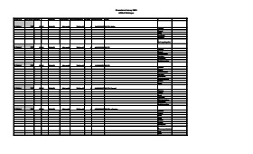
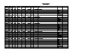
Artifact catalogue containing 597 records from the Casselman survey 2003.
Scope and Content
Spreadsheet containing information about the artifacts recovered, including: unit, level, artifact number, catalogue number, depth, co-ordinates, entry date, date recovered,count, weight, UTM co-ordinates, notes(excavators initials and comments) and artifact identification.
Field journals have been scanned in multi-page PDF files. Artifact catalogues are PDF files in spreadsheet format. Photographs are in jpeg format.
History / Biographical
Directed by Dr. Nicholson and with Ian Kuijt as crew chief, eight units were excavated in Block H in 1988. The vegetation is similar to other areas in the locale with an open oak forest with a light understory of saskatoon, hazelnut, poison ivy and sarsaparilla.
Radiocarbon dates from this block indicate two occupations separated in time by some 300 years. The excavation of the eight 1m2 units resulted in the recovery of over 650 ceramic fragments including 20 rim sherds from at least four vessels, a grooved maul, fire-cracked rock, lithic debitage and a reworked Avonlea projectile point. A large amount of bison bone, including a number of axial elements and a fragmented skull were also recovered.
The 650 ceramics recovered are of two kinds, representing at least four vessels. Stylistically, two of these vessels appear to be from the Vickers Focus and the third vessel may be Mortlach ware. The fourth vessel appears to be Blackduck and probably comes from the lower occupation. Also encountered were what is possibly a thin ash deposit in unit 180. The presence of a large number of bison axial elements is suggestive of primary butchering activities. Several canid bones were recovered scattered among the bison bone. Although there is no visible stratigraphic evidence, the 14C dates and the different ceramic types indicate more than one occupation in this area and it is likely that several types of behavior and use of space are represented.
High numbers of ceramic fragments are often assumed to be associated with activities characteristic of habitation areas, rather than hunting or butchering behavior. The lithic material assemblage is intermediate between Blocks G and E with KRF being the most frequent material category followed by local cherts.
Scope and Content
Sub-sub-sub series contains: Summary information of field methology, number and co-ordinates of excavations, personnel and their staff position; Field journals are daily records of recoveries, features and activities at the site; Site records include excavation level and unit summaries, feature sheets, profiles; sample records and maps; Artifact catalogues are lists and identifications of all artifacts recovered; Photographs are of excavation units, features, the landscape and personnel.
Field journals have been scanned in multi-page PDF files. Artifact catalogues are PDF files in spreadsheet format. Photographs are in jpeg format.
History / Biographical
Excavations took place in block E in 1987 and 1988 with 21 units opened. Ten further units were excavated in 1991 as part of the Brandon University Archaeological Field School, directed by Dr. Nicholson with Brett Waddell as crew chief and Theresa Hill as field assistant.
In 1991 a hearth was identified in Block E as well as a cluster of spoil dirt piles believed to represent material from a pit feature identified in the 1988 excavations. The pit feature is believed to be related to the recovery of clay that may have been used to build ceramic vessels.
Stratigraphic evidence of distinct activity areas at successive depths and radiocarbon dates indicate at least three occupations (380 BP, 700 BP and 860 B P). Three identified activity clusters occur stratigraphically, supporting these dated occupations.
Large numbers of lithics were recovered, forming an assemblage dominated by SRC and KRF with lesser amounts of porcellanite and quartzite. The upper occupation contained some Tongue River Silicified Sediment (TRSS). Eight Prairie Side-Notched points were recovered as well as a lunate biface and an end scraper. Fragments from a grey soapstone tube were also recovered.
Scope and Content
Sub-sub-sub series contains: Summary information of field methology, number and co-ordinates of excavations, personnel and their staff position; Field journals are daily records of recoveries, features and activities at the site; Site records include excavation level and unit summaries, feature sheets, profiles; sample records and maps; Artifact catalogues are lists and identifications of all artifacts recovered; Photographs are of excavation units, features, the landscape and personnel.
Field journals have been scanned in multi-page PDF files. Artifact catalogues are PDF files in spreadsheet format. Photographs are in jpeg format.
History / Biographical
Based on the recoveries at the Block H in 1988, further excavations took place in 1991. Nine excavation units were opened next to the previous excavations. Another 250 ceramic sherds were recovered in 1991. Nine vessels have been identified based on rim sherds. Vickers Focus and Woodland vessels have been identified and two vessels similar to Scattered Village Complex were recovered.
The lithic material assemblage is intermediate primarily KRF followed by local cherts. Two features, a hearth and a curvilinear arrangement of rock were recovered during the 1991 excavations.
The high numbers of ceramic fragments suggests a habitation area, rather than hunting or butchering behavior. However, the separation of occupations at the site is difficult to establish and there may be different uses of the site by successive occupations.
Scope and Content
Sub-sub-sub series contains: Summary information of field methology, number and co-ordinates of excavations, personnel and their staff position; Field journals are daily records of recoveries, features and activities at the site; Site records include excavation level and unit summaries, feature sheets, profiles; sample records and maps; Artifact catalogues are lists and identifications of all artifacts recovered; Photographs are of excavation units, features, the landscape and personnel.
Field journals have been scanned in multi-page PDF files. Artifact catalogues are PDF files in spreadsheet format. Photographs are in jpeg format.
History / Biographical
Block D is a wooded with oak and an understory of saskatoon and hazelnut with a thick ground cover of poison ivy and sarsaparilla. Root and rodent disturbance was extensive.
Directed by Dr. Nicholson and with Jane Gibson as crew chief, two units were opened in Block D in 1987. A hearth was identified with a ring of stones containing charcoal and burnt bone. Recoveries included two rim sherds with tool-impressed decorations along the outer edge and two prairie side-notched points. Associated bone was primarily appendicular, indicating secondary butchering.
A radiocarbon date of 230+/-90 B.P. recovered in 1987 from 17 cm below surface is consistent with a Protohistoric occupation.
Scope and Content
Sub-sub-sub series contains: Summary information of field methology, number and co-ordinates of excavations, personnel and their staff position; Field journals are daily records of recoveries, features and activities at the site; Site records include excavation level and unit summaries, feature sheets, profiles; sample records and maps; Artifact catalogues are lists and identifications of all artifacts recovered; Photographs are of excavation units, features, the landscape and personnel.
Field journals have been scanned in multi-page PDF files. Artifact catalogues are PDF files in spreadsheet format. Photographs are in jpeg format.
History / Biographical
Block D is a wooded with oak and an understory of saskatoon and hazelnut with a thick ground cover of poison ivy and sarsaparilla. Root and rodent disturbance was extensive.
Directed by Dr. Nicholson with Ian Kuijit as crew chief, five units were opened in Block D in 1988. Four units were excavated: 88, 91, 92 and 94. A feature in units 91 and 92 contained extensive deposits of large bison bone and fire-cracked rock. Several of the lower limb elements were articulated. Bone deposits were associated with numerous large fire-cracked rocks and were clustered in an area of one meter. Also recovered were a side-notched projectile point and two historic gun flints.
Judging from the association of the gun flints, projectile points, and bison bone, as well as the radiocarbon date of 230+/-90 B.P. recovered in 1987, it appears that this feature is from the Protohistoric period and related to refuse disposal.
Scope and Content
Sub-sub-sub series contains: Summary information of field methology, number and co-ordinates of excavations, personnel and their staff position; Field journals are daily records of recoveries, features and activities at the site; Site records include excavation level and unit summaries, feature sheets, profiles; sample records and maps; Artifact catalogues are lists and identifications of all artifacts recovered; Photographs are of excavation units, features, the landscape and personnel.
Field journals have been scanned in multi-page PDF files. Artifact catalogues are PDF files in spreadsheet format. Photographs are in jpeg format.
History / Biographical
Directed by Dr. Nicholson and with Jane Gibson as crew chief, two test units TU 107 and TU 108 were excavated six meters apart in 1987 and produced cultural materials which warranted a block excavation. Seven contiguous 1m2 units were opened in 1987 (XU 118, 119, 122, 123, 125, 126 (TU108) and 127). This block proved to be very productive of cultural remains. Large bison bone and fire-cracked rock indicated butchering/processing areas. Two bone tools, fabricated from scapulae were recovered. One is a bone knife – possibly a squash knife – and the other is a bifurcated scapula, which may have been a hoe.
Scope and Content
Sub-sub-sub series contains: Summary information of field methology, number and co-ordinates of excavations, personnel and their staff position; Field journals are daily records of recoveries, features and activities at the site; Site records include excavation level and unit summaries, feature sheets, profiles; sample records and maps; Artifact catalogues are lists and identifications of all artifacts recovered; Photographs are of excavation units, features, the landscape and personnel.
Field journals have been scanned in multi-page PDF files. Artifact catalogues are PDF files in spreadsheet format. Photographs are in jpeg format.
History / Biographical
Directed by Dr. Nicholson and with Ian Kuijt as crew chief, fourteen additional units were excavated in Block E in 1988. Stratigraphic evidence of distinct activity areas at successive depths and radiocarbon dates indicate at least three occupations (380 BP, 700 BP and 860 B P).
Three identified activity clusters occur stratigraphically, supporting these dated occupations. A clear distinction between Blackduck and Vickers Focus ceramics is evident in this Block. Sixteen small side-notched and un-notched points were recovered in this excavation series as well as numerous unifacial scrapers. Fragments from a grey soapstone tube were also recovered.
Scope and Content
Sub-sub-sub series contains: Summary information of field methology, number and co-ordinates of excavations, personnel and their staff position; Field journals are daily records of recoveries, features and activities at the site; Site records include excavation level and unit summaries, feature sheets, profiles; sample records and maps; Artifact catalogues are lists and identifications of all artifacts recovered; Photographs are of excavation units, features, the landscape and personnel.
Radiocarbon date reports have been scanned in multi-page PDF files.
History / Biographical
Crepeele locale Radiocarbon Dates. C14 report by IsoTrace Laboratory for Crepeele site 2005 XU 8.
From 2003 to 2008 field work took place at the Crepeele locale with 75 - 1m x1m units excavated.
To help establish the cultural sequence at the locale Radiocarbon dates were obtained from the three sites in the Crepeele locale.
Radiocarbon dating
The technique of radiocarbon dating was developed by Willard Libby and his colleagues at the University of Chicago in 1949.
Radiocarbon dating is used to estimate the age of organic remains from archaeological sites. Organic matter has a radioactive form of carbon (C14) that begins to decay upon death. C14 decays at a steady, known rate of a half life of 5,730 years. The technique is useful for material up to 50,000 years. Fluctuations of C14 in the atmosphere can affect results so dates are calibrated against dendrochronology. Radiocarbon dates are calibrated to calendar years.
Dates are reported in radiocarbon years or Before Present. Before Present refers to dates before 1950. The introduction of massive amounts of C14, due to atomic bomb and surface testing of atomic weapons, has widely increased the standard deviation on all dates after A.D. 1700 causing these dates to be unreliable.
Accelerated mass spectrometry can more accurately measure C14 with smaller samples and can date materials to 80,000 years.
Scope and Content
Sub sub series contains radiocarbon dates from: Crepeele, Sarah and Graham sites.
Radiocarbon date reports have been scanned in multi-page PDF files.
History / Biographical
Crepeele locale Radiocarbon Dates. C14 report by Beta Analytic Inc. for Crepeele site XU 48 and Graham site XU 54.
From 2003 to 2008 field work took place at the Crepeele locale with 75 - 1m x1m units excavated.
To help establish the cultural sequence at the locale Radiocarbon dates were obtained from the three sites in the Crepeele locale.
Radiocarbon dating
The technique of radiocarbon dating was developed by Willard Libby and his colleagues at the University of Chicago in 1949.
Radiocarbon dating is used to estimate the age of organic remains from archaeological sites. Organic matter has a radioactive form of carbon (C14) that begins to decay upon death. C14 decays at a steady, known rate of a half life of 5,730 years. The technique is useful for material up to 50,000 years. Fluctuations of C14 in the atmosphere can affect results so dates are calibrated against dendrochronology. Radiocarbon dates are calibrated to calendar years.
Dates are reported in radiocarbon years or Before Present. Before Present refers to dates before 1950. The introduction of massive amounts of C14, due to atomic bomb and surface testing of atomic weapons, has widely increased the standard deviation on all dates after A.D. 1700 causing these dates to be unreliable.
Accelerated mass spectrometry can more accurately measure C14 with smaller samples and can date materials to 80,000 years.
Scope and Content
Sub sub series contains radiocarbon dates from: Crepeele, Sarah and Graham sites.
Radiocarbon date reports have been scanned in multi-page PDF files.
History / Biographical
Crepeele locale Radiocarbon Dates. C14 report by Beta Analytic Inc. for Crepeele site XUs 8, 30, 50.
From 2003 to 2008 field work took place at the Crepeele locale with 75 - 1m x1m units excavated.
To help establish the cultural sequence at the locale Radiocarbon dates were obtained from the three sites in the Crepeele locale.
Radiocarbon dating
The technique of radiocarbon dating was developed by Willard Libby and his colleagues at the University of Chicago in 1949.
Radiocarbon dating is used to estimate the age of organic remains from archaeological sites. Organic matter has a radioactive form of carbon (C14) that begins to decay upon death. C14 decays at a steady, known rate of a half life of 5,730 years. The technique is useful for material up to 50,000 years. Fluctuations of C14 in the atmosphere can affect results so dates are calibrated against dendrochronology. Radiocarbon dates are calibrated to calendar years.
Dates are reported in radiocarbon years or Before Present. Before Present refers to dates before 1950. The introduction of massive amounts of C14, due to atomic bomb and surface testing of atomic weapons, has widely increased the standard deviation on all dates after A.D. 1700 causing these dates to be unreliable.
Accelerated mass spectrometry can more accurately measure C14 with smaller samples and can date materials to 80,000 years.
Scope and Content
Sub sub series contains radiocarbon dates from: Crepeele, Sarah and Graham sites.
Radiocarbon date reports have been scanned in multi-page PDF files.
History / Biographical
Crepeele locale Radiocarbon Dates. C14 report by IsoTrace Analytic Laboratory for Sarah site XU17.
From 2003 to 2008 field work took place at the Crepeele locale. The Crepeele, Graham and Sarah sites were excavated with 75 - 1m x1m units excavated
To help establish the cultural sequence at the locale Radiocarbon dates were obtained from the three sites in the Crepeele locale.
Radiocarbon dating
The technique of radiocarbon dating was developed by Willard Libby and his colleagues at the University of Chicago in 1949.
Radiocarbon dating is used to estimate the age of organic remains from archaeological sites. Organic matter has a radioactive form of carbon (C14) that begins to decay upon death. C14 decays at a steady, known rate of a half life of 5,730 years. The technique is useful for material up to 50,000 years. Fluctuations of C14 in the atmosphere can affect results so dates are calibrated against dendrochronology. Radiocarbon dates are calibrated to calendar years.
Dates are reported in radiocarbon years or Before Present. Before Present refers to dates before 1950. The introduction of massive amounts of C14, due to atomic bomb and surface testing of atomic weapons, has widely increased the standard deviation on all dates after A.D. 1700 causing these dates to be unreliable.
Accelerated mass spectrometry can more accurately measure C14 with smaller samples and can date materials to 80,000 years.
Scope and Content
Sub sub series contains radiocarbon dates from: Crepeele, Sarah and Graham sites.
Radiocarbon date reports have been scanned in multi-page PDF files.
History / Biographical
Crepeele locale Radiocarbon Dates. C14 report by IsoTrace Analytic Laboratory for Graham site XUs 5 and 8.
From 2003 to 2008 field work took place at the Crepeele locale. The Crepeele, Graham and Sarah sites were excavated with 75 - 1m x1m units excavated
To help establish the cultural sequence at the locale Radiocarbon dates were obtained from the three sites in the Crepeele locale.
Radiocarbon dating
The technique of radiocarbon dating was developed by Willard Libby and his colleagues at the University of Chicago in 1949.
Radiocarbon dating is used to estimate the age of organic remains from archaeological sites. Organic matter has a radioactive form of carbon (C14) that begins to decay upon death. C14 decays at a steady, known rate of a half life of 5,730 years. The technique is useful for material up to 50,000 years. Fluctuations of C14 in the atmosphere can affect results so dates are calibrated against dendrochronology. Radiocarbon dates are calibrated to calendar years.
Dates are reported in radiocarbon years or Before Present. Before Present refers to dates before 1950. The introduction of massive amounts of C14, due to atomic bomb and surface testing of atomic weapons, has widely increased the standard deviation on all dates after A.D. 1700 causing these dates to be unreliable.
Accelerated mass spectrometry can more accurately measure C14 with smaller samples and can date materials to 80,000 years.
Scope and Content
Sub sub series contains radiocarbon dates from: Crepeele, Sarah and Graham sites.
Field journals have been scanned in multi-page PDF files. Artifact catalogues are PDF files in spreadsheet format. Photographs are in jpeg format.
History / Biographical
Directed by Dr. Nicholson, a crew of five students from Brandon University under the supervision of Dr. Scott Hamilton excavated a total of 9 units in 1985. This testing indicated the presence of artifacts manufactured by Blackduck and Duckbay peoples from the boreal forest and northern parkland areas. Other ceramics diagnostic of groups from the Saskatchewan Basin and the Middle Missouri area were also recovered in surface collection from the cultivated area of the locale.
Scope and Content
Sub-sub-sub series contains: Summary information of field methology, number and co-ordinates of excavations, personnel and their staff position; Field journals are daily records of recoveries, features and activities at the site; Site records include excavation level and unit summaries, feature sheets, profiles; sample records and maps; Artifact catalogues are lists and identifications of all artifacts recovered; Photographs are of excavation units, features, the landscape and personnel.
Field journals have been scanned in multi-page PDF files. Artifact catalogues are PDF files in spreadsheet format. Photographs are in jpeg format.
History / Biographical
Directed by Dr. Nicholson with Brenda Kramarchuck as crew chief, two students from Brandon University were hired to excavate an additional sample of 15 1m2 units in 1986. This work confirmed the results of the first season, and resulted in an increased sample of faunal material, lithics, ceramics, and in the identification of distinctive ceramic clusters from different locations within the locale. These two seasons of testing satisfactorily demonstrated the presence of a large Prehistoric locale containing the remains of Late Woodland occupation which included lithics, ceramics and reasonably well preserved faunal remains.
Scope and Content
Sub-sub-sub series contains: Summary information of field methology, number and co-ordinates of excavations, personnel and their staff position; Field journals are daily records of recoveries, features and activities at the site; Site records include excavation level and unit summaries, feature sheets, profiles; sample records and maps; Artifact catalogues are lists and identifications of all artifacts recovered; Photographs are of excavation units, features, the landscape and personnel.