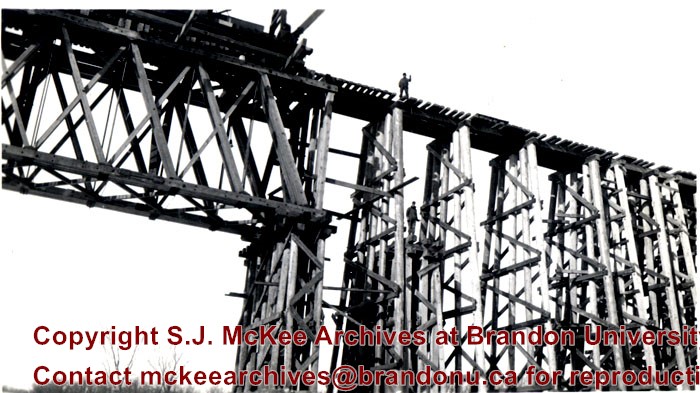
Bunclody, MB was located near Souris, MB. The bridge in question crossed the Souris River.
Custodial History
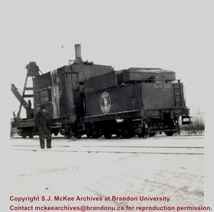
Photograph was donated by a "Mrs. Wilson" in 1989.
Scope and Content
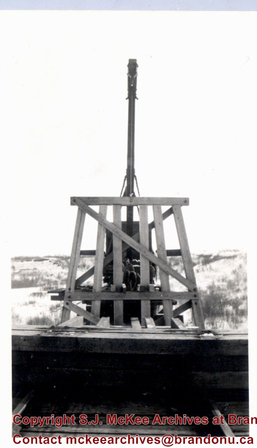
Photograph is a close-up of the Great Northern Railroad bridge or trestle at Bunclody under construction. There are two men standing on the support structure.
For custodial history see the collection level description of the Lawrence Stuckey collection.
Scope and Content
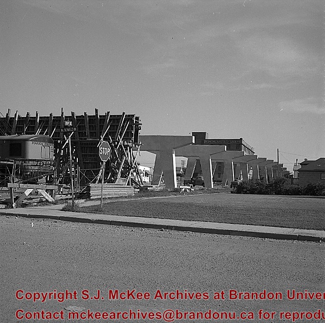
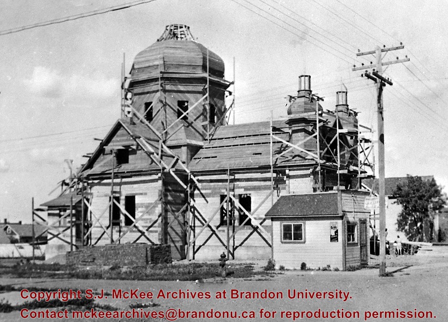
[View of Prince Edward Hotel under construction.]
Notes
[Mr. Stuckey put six negatives (3 combined negatives) in one envelope. We have separated them and numbered them DC6f(1) through DC6f(6). From a combined negative.]
Photograph shows the removal of one of the houses formerly located on 20th Street between Louise and Princess Avenues. The houses on those blocks were removed to create parking lots for the University. A Fed Zavislak Ltd. Well Drilling & Trucking pickup truck is visible at the curb.
Photograph shows the removal of one of the houses formerly located on 20th Street between Louise and Princess Avenues. The houses on those blocks were removed to create parking lots for the University.
See fonds level of the CKX records for custodial history.
Scope and Content
Image is looking southwest across Brandon College campus. Visible are Clark Hall, the Brandon College Building, the Citizens' Science Building and the A.E. McKenzie Building.
See fonds level of the CKX records for custodial history.
Scope and Content
Image is looking northwest across Brandon College campus. Visible are the H-Huts and the Citizen's Science Building. Behind the Citizen's Science Building are the Brandon College Building and Clark Hall.
See fonds level of the CKX records for custodial history.
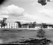
Scope and Content
Image is looking south southwest across Brandon College campus. Visible are Clark Hall, the Brandon College Building and the Citizens' Science Building.
See fonds level of the CKX records for custodial history.
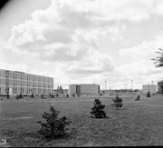
Scope and Content
Image is looking northwest across Brandon College campus. Visible is part of an H-Hut, the J.R.C. Evans Lecture Theatre and the A.E. McKenzie Building.
See fonds level of the CKX records for custodial history.
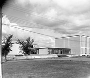
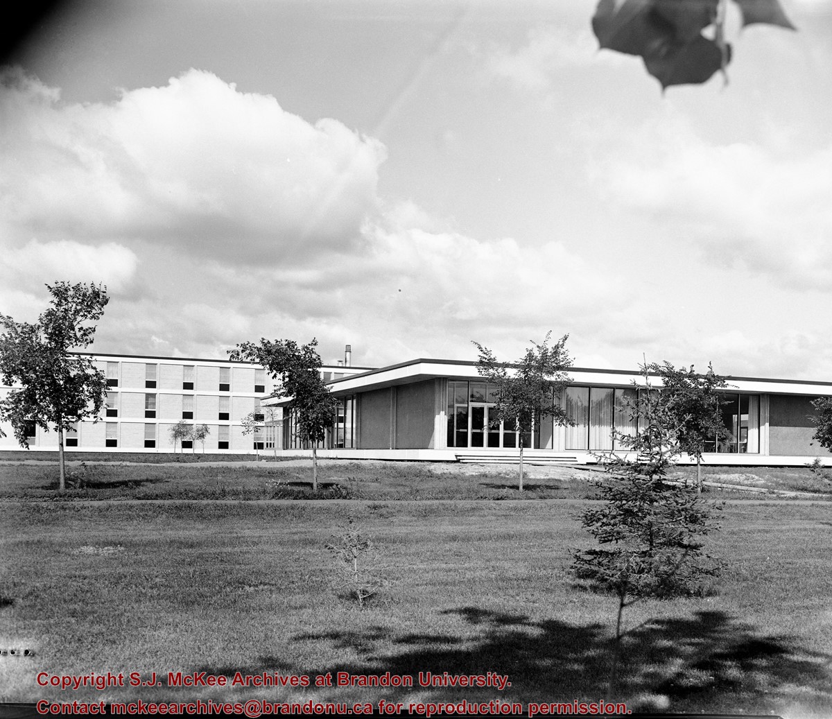
Scope and Content
Image is looking north northwest across Brandon College campus. Visible are the Dining Room, the J.R.C. Evans Lecture Theatre and the A.E. McKenzie Building.
See fonds level of the CKX records for custodial history.
Scope and Content
Image is looking southeast across the Brandon College campus. Visible are portions of the A.E. McKenzie Building, the J.R.C. Evans Lecture Theatre, the Dining Room, and Darrach Hall.
View is southwest from approximately Princess Avenue and 17th Street. Photograph shows the Brandon University campus in fall, as well as the southwest portion of the city.
View is south southwest from approximatley the east corner of 18th Street and Princess Avenue. Photograph shows the Brandon University campus, Kinsmen Stadium, Earl Oxford school and a number of residential blocks, particularly southwest of 18th Street.
View is southeast from approximatley 23rd Street and Rosser Avenue. Photograph shows the Brandon University campus, Kinsmen Stadium, Earl Oxford school, the Fair Grounds (including the Grandstand and Racetrack) and a number of residential blocks, particularly in the southeast part of the city.
.jpg?width=1200&404=no-img.jpg&watermark=wmk)
.jpg?width=180&404=no-img.jpg)


.jpg%3fmaxheight%3d1000%26maxwidth%3d1000%26watermark%3dwmk&description=Prince+Edward+Hotel+Construction)