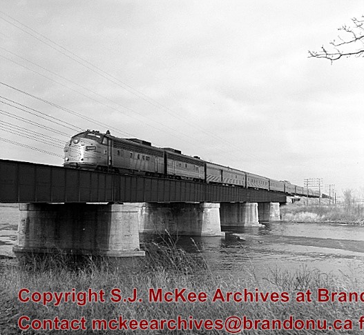
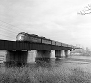
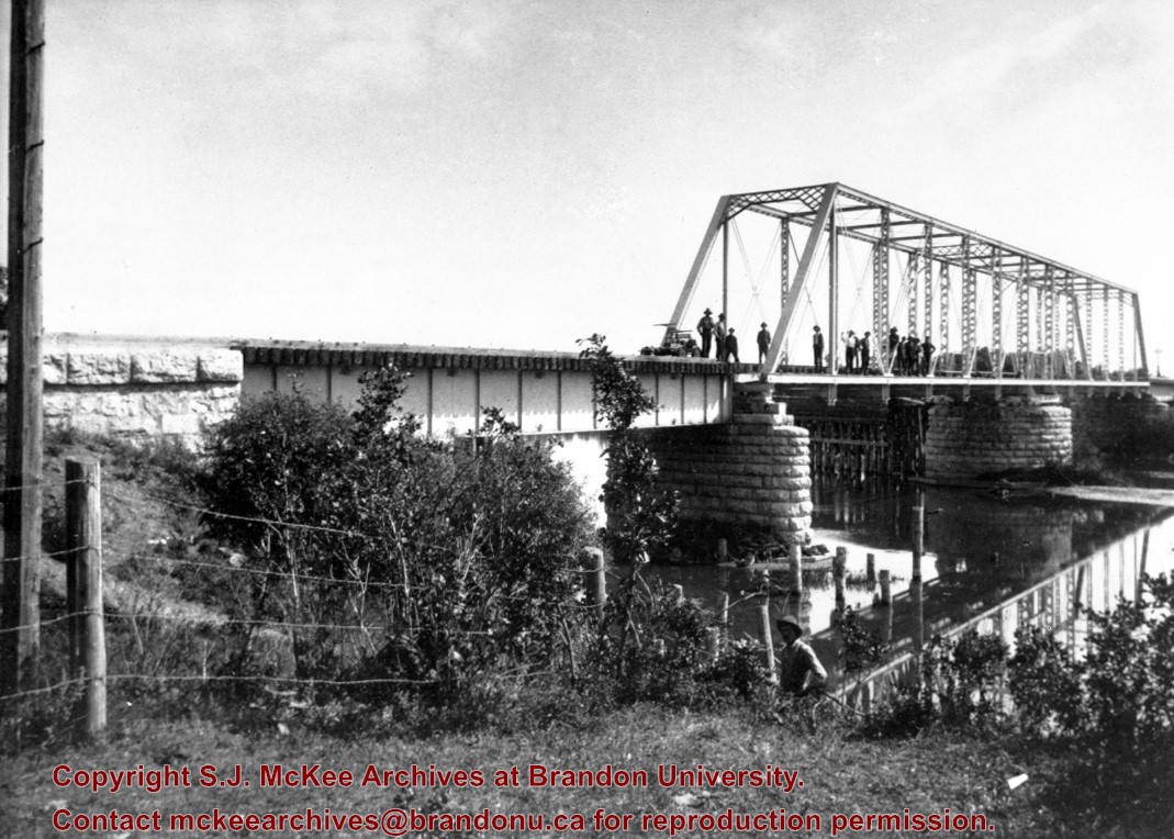
Stuckey's notes: Showing VIA No.1 "Canadian" power units 6507-6604 (ex. CNR GM model FP-9A and FP-9B). Bridge built c. 1912. The bridge was called "The Iron Bridge."
Scope and Content
Photograph shows the train crossing the bridge.
Notes
Corresponds with negative 1-2002.3.9.P26.
Repro Restriction
The McKee Archives is the copyright holder for the Stuckey materials.
These blocks of ice were used to fill the ice houses of the Wheat City Ice Co. (located north of Rosser Avenue on the west side of 15th Street, and south of Princess Avenue on the east side of 17th Street), the CPR icehouses (at the station and 3rd St. & Assiniboine Ave), and the CNR icehouse (at Forth Street and McTavish Avenue). In addition, large quantities of ice were shipped to smaller towns in railcars (usually old refrigerator cars).
Custodial History
For custodial history see the collection level description of the Lawrence Stuckey collection.
Scope and Content
Cutting ice from the Assiniboine River
Notes
This is one of five images that show the method in which ice is cut into blocks and loaded onto sleighs or trucks. Note the large draft horses still in use at this date.
[Mr. Stuckey put five negatives into the same envelope. We have separated them and numbered them H12(1) to H12(5).]
Additional information provided by the Fred McGuinness collection (20-2009).
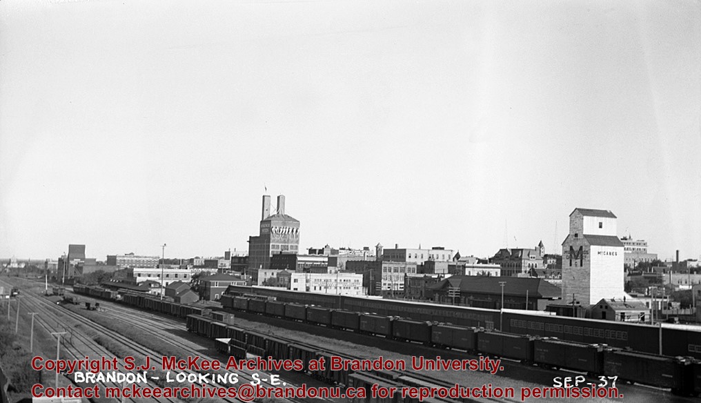
Postcard shows the 100 block of 10th Street facing north. The CPR train station can be seen at the end of 10th Street. The sign for the Rex Cafe is visible on the west side of 10th Street. On the east side of 10th Street, billboards for Campbell & Campbell furniture are visible as well as signs for Pianos and the Orpheum Theatre. Motorists and cyclists share the road. Street car tracks run the length of 10th Street.
Notes
Back of postcard reads: Morning reflection of Brandon's skyline on the Assiniboine River, photo by Sandy Black, printed in Brandno, Manitoba, Canada by Leech Printing Ltd.
For custodial history see the collection level description of the Lawrence Stuckey collection.
Scope and Content
Stanley Park from old PC.
Notes
Shows bandstand
[By "PC" Mr. Stuckey likely meant to indicate Park School (built 1904, demolished 1978). Park School was, at the time the photo was taken, located directly across Lorne Avenue from Stanley Park. P.E. 22/07/09]
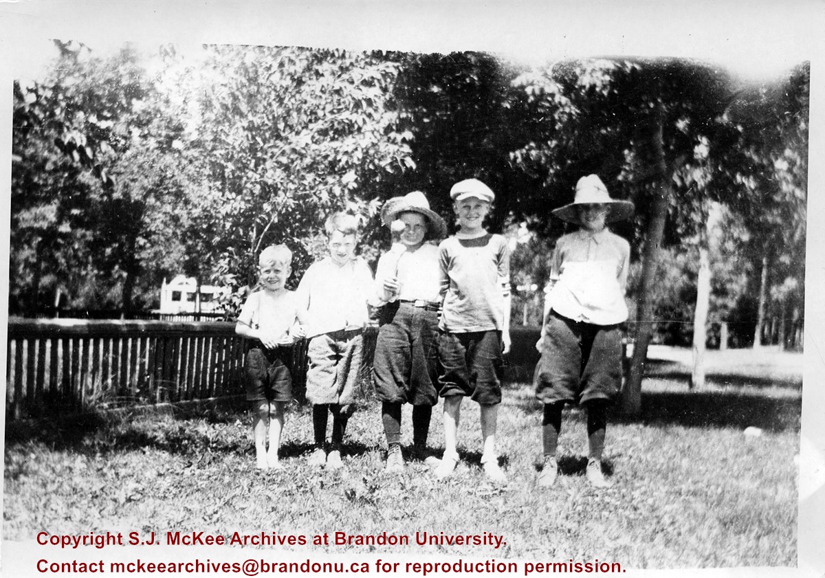
Photograph shows a group of five young boys standing shoulder-to-shoulder as they pose for the picture. Don McPherson has been identified as the boy in the middle. The boys appear to be standing in a residential backyard on a summer's day. The children are wearing shorts and some are wearing straw hats.
Notes
Writing on the back of the photograph reads: 300 block 14th St., ? Clement, ? Hill, Don McPherson, ?- , ?-, 1922
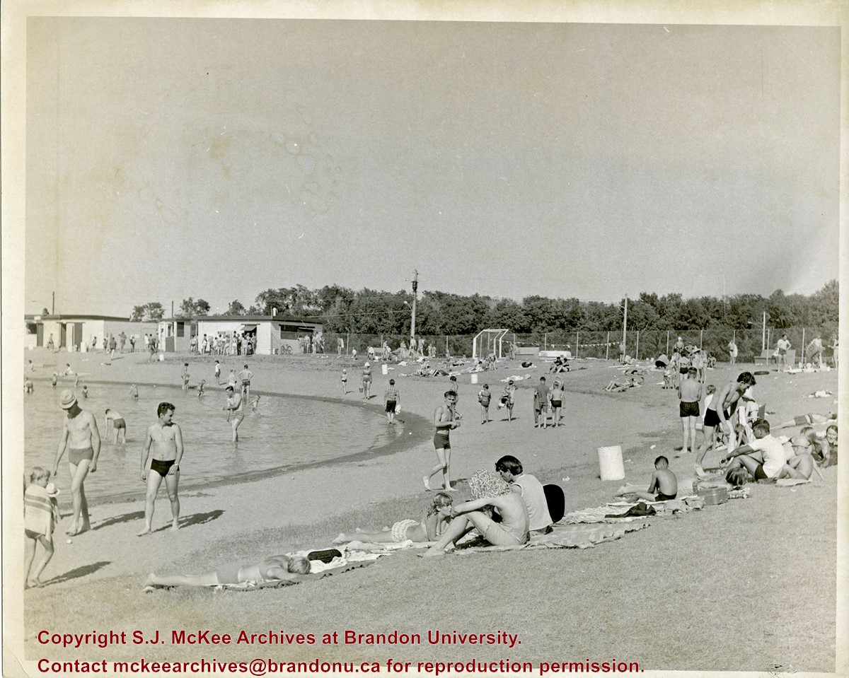
Curran Park is located at 4100 Grand Valley Rd, Brandon, MB. Originally called Suburban Park, it underwent a formal name change in 1934, in honour of J.P. Curran, a lawyer, civil servant and judge, who died in 1928.
The City of Brandon first set aside $6000 for the acquisition of a new park in 1911, but the acquisition of appropriate land stalled for a number of years. Finally in 1919, the city was able to acquire a parcel of Crown land the Brandon Industrial School was located on, to establish the park; the land was acquired through a 99-year lease. Suburban Park officialy opened in 1921.
The development of the park was gradual. Some of the work was completed as part of the Brandon Parks Board's unemployment relief planning; from 1931-1936, relief workers cleared underbrush, thinned trees, constructed a road and built latrines. In 1933 a refreshment stand was approved and a large cook stove was donated.
The City of Brandon and the Department of Agriculture (in right of the Crown) agreed to terminate the original park lease in March 1965, with the city purchasing the land outright. Curran Park was sold to Gretna businessman Gerald Voth in 2001, and renamed Turtle Crossing.
Scope and Content
Item is a photograph of the pool at Curran Park, Brandon, MB.
Notes
History/Bio information was taken from A Cup of Cold Water: Alfred Kirkness and the Brandon Residential School Cemeteries by Anne Lindsay, Clare Cook, and David Cuthbert (Manitoba History journal, Number 78, Summer 2015).
.jpg?width=1200&404=no-img.jpg&watermark=wmk)
.jpg?width=180&404=no-img.jpg)
.jpg?width=1200&404=no-img.jpg&watermark=wmk)
.jpg?width=180&404=no-img.jpg)
.jpg?width=1200&404=no-img.jpg&watermark=wmk)
.jpg?width=180&404=no-img.jpg)
.jpg?width=1200&404=no-img.jpg&watermark=wmk)
.jpg?width=180&404=no-img.jpg)
.jpg?width=1200&404=no-img.jpg&watermark=wmk)
.jpg?width=180&404=no-img.jpg)
.jpg?width=1200&404=no-img.jpg&watermark=wmk)
.jpg?width=180&404=no-img.jpg)
.jpg?width=1200&404=no-img.jpg&watermark=wmk)
.jpg?width=180&404=no-img.jpg)


.jpg%3fmaxheight%3d1000%26maxwidth%3d1000%26watermark%3dwmk&description=Cutting+Ice+from+the+Assiniboine+River)
.jpg%3fmaxheight%3d1000%26maxwidth%3d1000%26watermark%3dwmk&description=Cutting+Ice+from+the+Assiniboine+River)
.jpg%3fmaxheight%3d1000%26maxwidth%3d1000%26watermark%3dwmk&description=Cutting+Ice+from+the+Assiniboine+River)
.jpg%3fmaxheight%3d1000%26maxwidth%3d1000%26watermark%3dwmk&description=Cutting+Ice+from+the+Assiniboine+River)
.jpg%3fmaxheight%3d1000%26maxwidth%3d1000%26watermark%3dwmk&description=Cutting+Ice+from+the+Assiniboine+River)
.jpg%3fmaxheight%3d1000%26maxwidth%3d1000%26watermark%3dwmk&description=New+Culvert+and+Causeway+Across+Assiniboine+River)
.jpg%3fmaxheight%3d1000%26maxwidth%3d1000%26watermark%3dwmk&description=New+Culvert+and+Causeway+Across+Assiniboine+River)