According to Stuckey and Bain (1996), “The Brandon, Saskatchewan & Hudson’s Bay Railway was built and operated as a totally owned subsidiary of the Great Northern Railway. Construction commenced in late 1905 and by the end of 1905, less than a mile of track had been laid north of the boundary at St. John. In 1906, the remaining 68.6 miles to Brandon were laid and service commenced that year. During the Depression of the 1930s, traffic declined significantly and the entire branch was abandoned in 1936. Over much of the branch’s length, the ties and rails were laid on the prairie without ballast and today little remains of the line apart from traces where there were cuts and bridges.” (p. 18)
Stuckey, L. A., & Bain, D. M. (1996). The Great Northern and Northern Pacific railways in Canada. Calgary, Alberta: British Railway Modellers of North America.
Custodial History
For custodial history see the collection level description of the Lawrence Stuckey collection.
Scope and Content
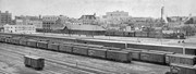
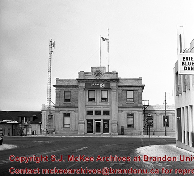
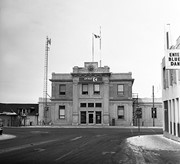
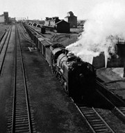
View of Canadian Pacific (foreground) and Great Northern (background) railway yards, as well as Great Northern station in Brandon, Manitoba.
Notes
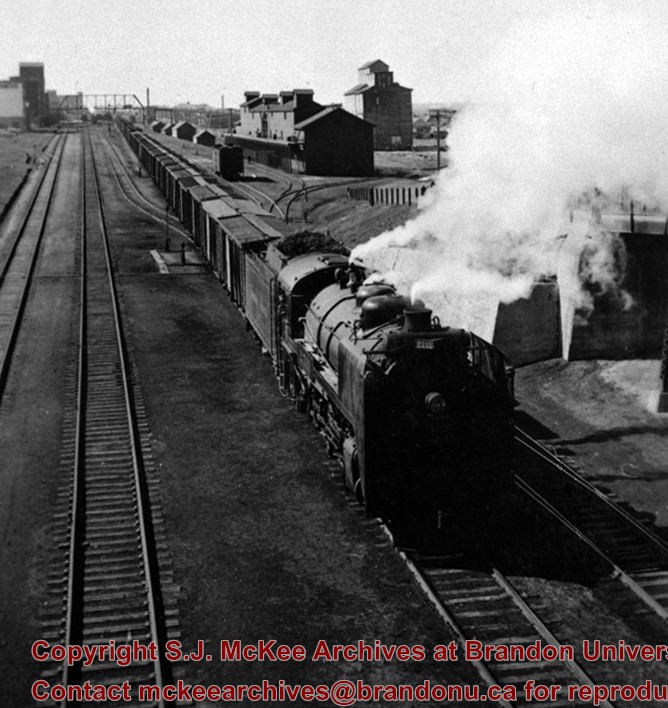
Shows a 500 series F-1 class 2-8-0 engine switching
Published in Canadian Rail, August 1975
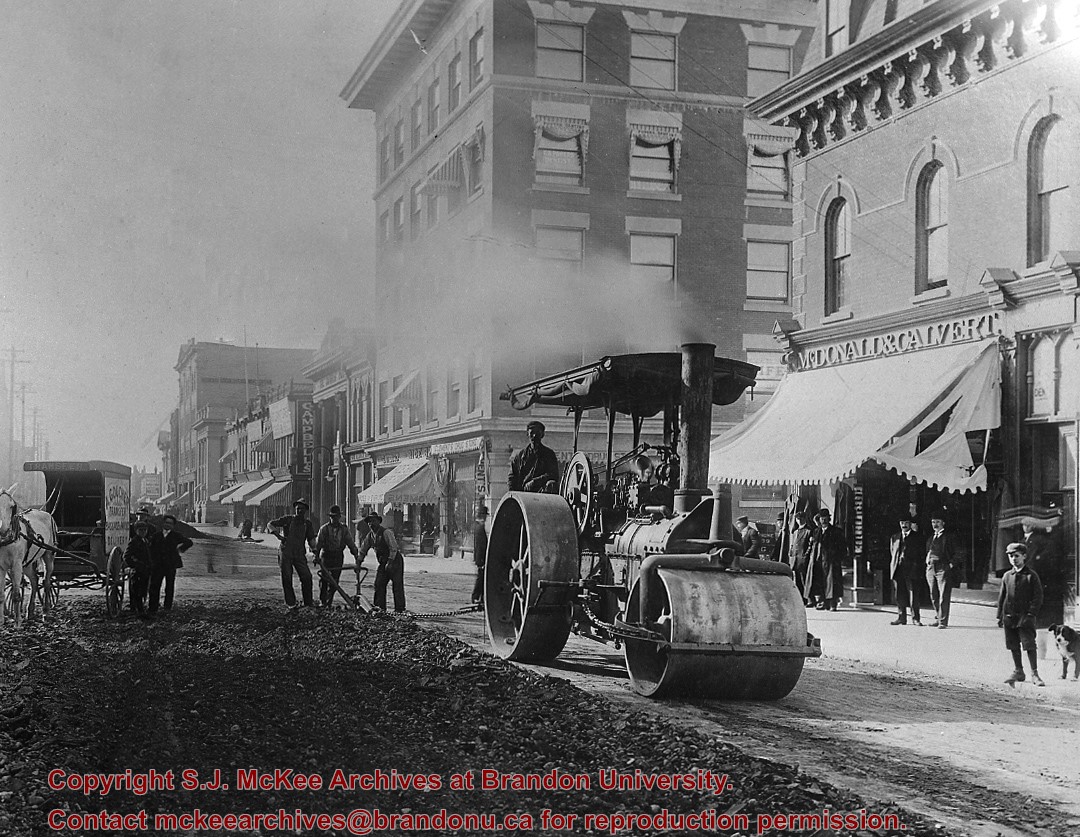
Buildings that are visible in this photo, but now gone (1987), include Codvilles, Western Grocers (Burbridge Saddlery), John E. Smith Block, Federal building, City Hall, and the Prince Edward Hotel [Fred McGuinness collection (20-2009)].
[This copy negative was produced using a previously published image. P.E. 30/07/09]
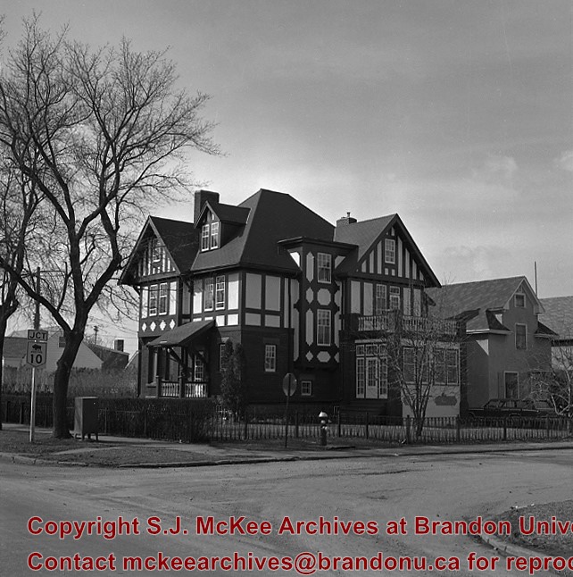
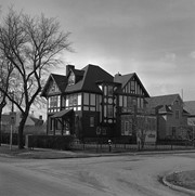
Casa Maley was constructed in 1912 by Henry F. Maley, founder and owner of the Brandon Brewery Company. Erected towards the end of Brandon’s great economic boom, the house is representative of those stately homes that grace the central area of the city. The Tudor styling, expressed in the half timbers and dramatic play of dark and light patterns, was a popular architectural expression of the era. The spacious interior includes an ornate staircase constructed in quarter cut oak and, throughout the house, wood detailing of exquisite craftsmanship. The house was purchased by Dr. McDiarmid, whose family occupied the home for the next sixty years. It is currently used as a bed and breakfast establishment.
Scope and Content
Photograph is looking northwest and shows 1605 Victoria Avenue.
Notes
Manitoba Municipal Heritage Site No. 80. History/Bio taken from the Manitoba Culture, Heritage, Tourism and Sport webpage, available at: http://www.gov.mb.ca/chc/hrb/mun/m080.html (August 2008).
Repro Restriction
The McKee Archives is the copyright holder for the Stuckey materials.
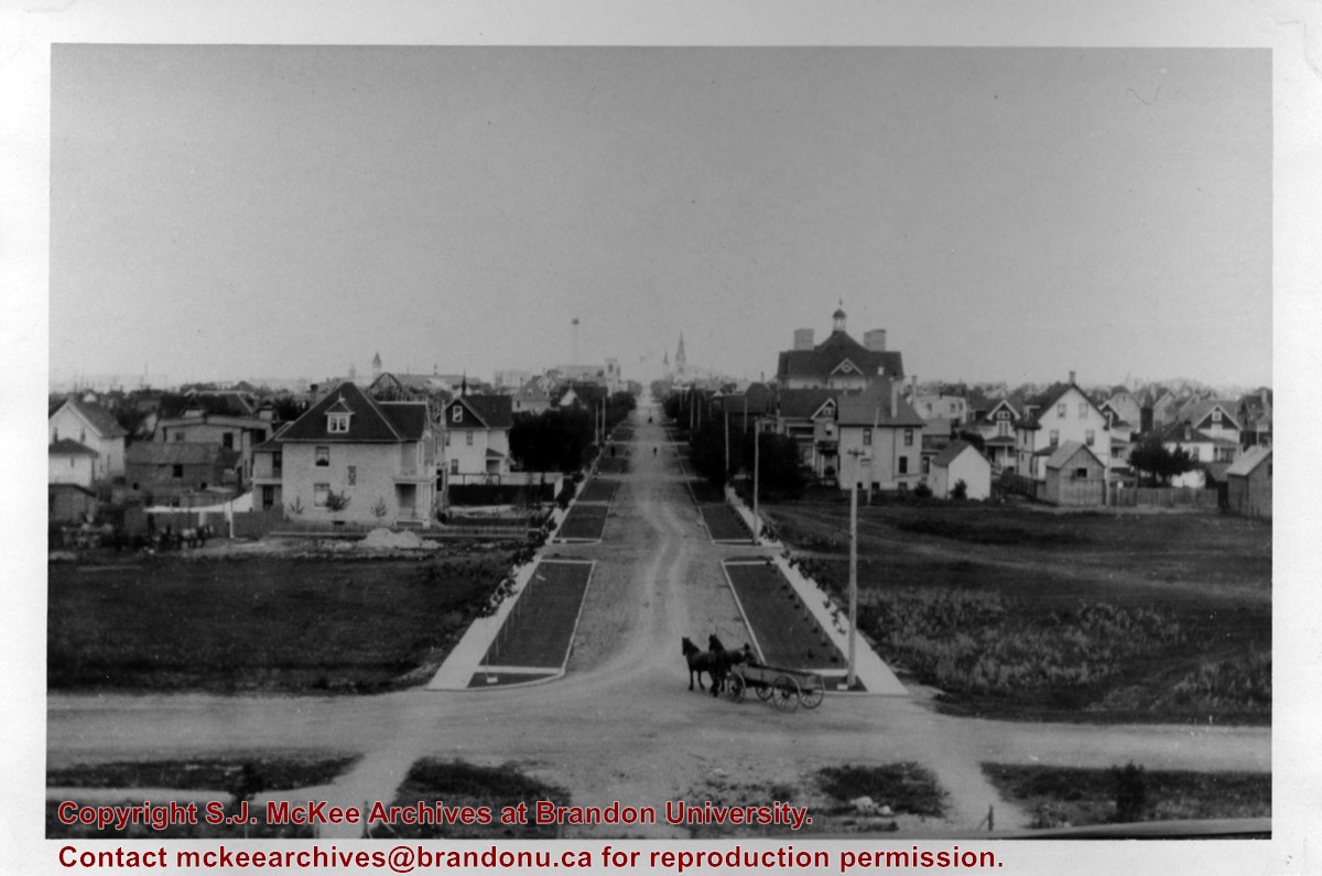
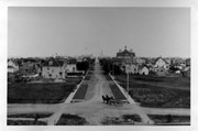
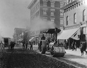
This negative provides an excellent view of Rosser Avenue (looking east from 10th Street) in the early 20th century, and shows one of the first runs for Brandon's streetcar system.
This image was used as the cover image for Lee Clark's Brandon's Politics & Politicians.
Custodial History
For custodial history see the collection level description of the Lawrence Stuckey collection.
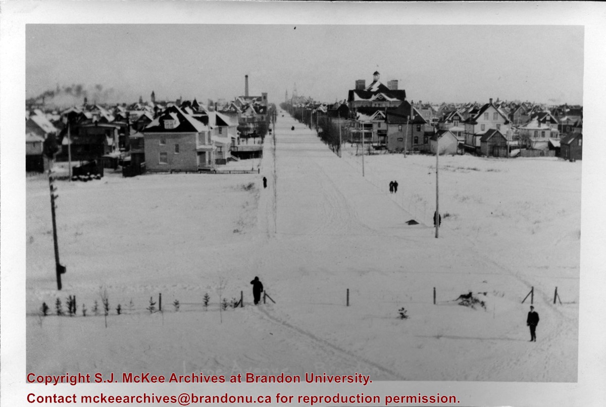
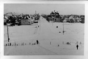
Image is looking east northeast from approximately the 300 block of 23rd Street between Lorne and Louise Avenues. Photograph shows the Brandon College campus after the opening of the original Music Building in 1963, but before the construction of the Education Building in 1966. A number of house on the 300 blocks of 22nd and 21st Streets are visible in the foreground, with the A.E. McKenzie Seed Co., the Prince Edward Hotel and various grain elevators on the horizon.
Photographs have been glued to a backing board that has warped over time
Scope and Content
Photograph shows street view of north side of Rosser Avenue, primarily the 700 block. Horse and buggies are travelling on the avenue and pedestrians fill the sidewalks. Union Jacks and English flags are mounted from the windows on the Fleming and Beaubier blocks. Flag banners are drapped across Rosser Avenue. Businesses visible in the Fleming Block include: Lowes Brothers Clothing and Spring Park Nurseries. Businesses visible in the Beaubier Block include the Empire Hotel. Businesses east of the Empire Hotel are grocer A.M. Percival and the Brandon Hardware Company. An advertisement for the Northern Bank is affixed to a telephone pole on the southside of the street.
Notes
Writing on the front of the photograph matting reads: July 1 1906, 314. One photograph (20-2009.8) is glued below and another, 20-2009.6, is glued on the reverse side. Page appears to be from a photo album.
Photographs have been glued to a backing board that has warped over time
Scope and Content
Photograph shows street view of north side of Rosser Avenue, primarily the 700 block. Horse and buggies are travelling on the avenue and pedestrians fill the sidewalks. Union Jacks and English flags are mounted from the windows on the Fleming and Beaubier blocks. Flag banners are drapped across Rosser Avenue. Businesses visible in the Fleming Block include: Lowes Brothers Clothing and Spring Park Nurseries. Businesses visible in the Beaubier Block include the Empire Hotel. Businesses east of the Empire Hotel are grocer A.M. Percival and the Brandon Hardware Company. An advertisement for the Northern Bank is affixed to a telephone pole on the southside of the street. The street is lined with litter and a number of dogs can be seen roaming the area.
Notes
Writing on the front of the photograph matting reads: 313 July 1906. One photograph (20-2009.8) is glued below and another, 20-2009.6, is glued on the reverse side. Page appears to be from a photo album.
Photographs have been glued to a backing board that has warped over time
History / Biographical
Photograph of possible Dakota from Sioux Valley in Brandon for the summer fair.
Scope and Content
Photograph shows street view of north side of Rosser Avenue, primarily the 700 block. Businesses visible in the Fleming Block include: Lowes Brothers Clothing, Robert Hall [Insurance Broker], Manitoba Farmers Hedge and Wire Fence Company. Businesses visible in the Beaubier Block include the Empire Hotel. Businesses east of the Empire Hotel are grocer A.M. Percival and the Brandon Hardware Company. A number of Aboriginal peoples are travelling on horseback west along Rosser Avenue as spectators look on.
Notes
Writing on the front of the photograph matting reads: 293. One photograph (20-2009.9) is glued above and two others are glued on the reverse side. Page appears to be from a photo album.
Photograph shows the 700-block of Rosser Avenue facing west. Visible businesses on the north side of Rosser Avenue include: Burchill's Music Store, E.W. Woolworth Co. Ltd. 5-10 and 15 Cent Store in the E.E. Evans Block, Empire Hotel, and W.A. Paterson Drugs. Automobiles are parked on both sides of the avenue and at the time the photograph was taken, Rosser Avenue was a two-way street.
Notes
Part of "Souvenir of Brandon, Manitoba, Canada [viewbook], Printed by Photogelatine Engraving Co. Limited, Ottawa." Dates obtained from the Burchill's Music Store Henderson's Brandon City Directory listings (1927-1929). Writing on the front of the photograph reads: Rosser St. [sic.] - Brandon, Man.


.jpg?width=1200&404=no-img.jpg&watermark=wmk)
.jpg?width=180&404=no-img.jpg)
.jpg?width=1200&404=no-img.jpg&watermark=wmk)
.jpg?width=180&404=no-img.jpg)
.jpg?width=1200&404=no-img.jpg&watermark=wmk)
.jpg?width=180&404=no-img.jpg)


+from+1st+street+bridge)
.jpg%3fmaxheight%3d1000%26maxwidth%3d1000%26watermark%3dwmk&description=Northeast+view+from+100+block+of+Tenth+Street)
.jpg%3fmaxheight%3d1000%26maxwidth%3d1000%26watermark%3dwmk&description=East+view+from+100+block+of+Tenth+Street)
.jpg%3fmaxheight%3d1000%26maxwidth%3d1000%26watermark%3dwmk&description=East+view+from+100+block+of+Tenth+Street)