See fonds level description of the Alf Fowler collection for custodial history.
Scope and Content
Photo was taken of 10th Street from Pacific Avenue looking sourth. Visible businesses include: the Cecil Hotel; the Canadian Bank of Commerce; Campbell and Campbell; and the Bank of British North America
Storage Range
RG 5 Western Manitoba Manuscript collection - photograph storage drawer
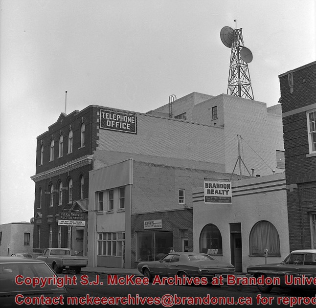
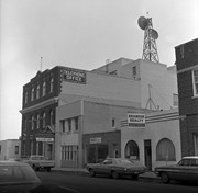
Photograph is looking northeast and shows Brandon Realty, ARM Industries Inc. (silk screen printers), Col. Ray Robinson's Auction Services, and the MTS building.
Repro Restriction
The McKee Archives is the copyright holder for the Stuckey materials.
Photograph is looking south and shows the paving of 9th Street between Pacific and Rosser Avenues. Visible are: work crews, spectators and a police officer on duty, King George Cafe, McKenzie Block, and Clement Block. The Prince Edward Hotel is under construction in the background. Also visible are signs for: Cat Cafe and Roseland.
Repro Restriction
The McKee Archives is the copyright holder for the Stuckey materials.
Red ink stain is on the front right corner of postcard
Scope and Content
Photograph shows 10th Street facing south from Princess Avenue. Visible landmarks and businesses include: Manitoba Power Commission (MPC)'s power sub-station, First Baptist Church, Wheat City Arena, and the grand stand at the Exhibition Grounds.
The partial sign visible at the bottom of the photograph on the east side of 10th Street reads Yates and Neale, which refers to a plumbing and heating company that dissolved in 1943 to be replaced by Neale, Stothard and Chapman.
Businesses on the west side of 10th Street include: Dominion Tire & Radio Co., Bolts Barber Shop, Elviss T.E. Co. Stables.
Notes
Information concerning Yates and Neale courtesy Jack Stothard. Writing on the front of the postcard reads: Brandon, Looking S.W., Jerrett Photo. This photograph shows a rare view of the 200-block of 10th Street.
Photograph shows the west side of the 200-block on 10th Street. Visible businesses include: Chamber of Commerce Tourist Information, Dominion Tire & Radio Co., Steve's Grill, Wally's Taxi, and the garage entrances to Western Motors Ltd. A Santa Claus Christmas ornament is displayed from a light standard.
Postcard shows an aerial view of 9th Street facing south in Brandon, Manitoba. Visible businesses and landmarks include: Beaubier Hotel, YMCA/police station, the original CKX Radio station towers on 8th Street (est. 1928 - moved 1940), the old City Hall, Prince Edward Hotel, and the original Manitoba Power commission smokestack on 10th Street.
Notes
Writing on the front of the photograph reads: Brandon, Man., Jerrett Photo. This photograph shows a rare view of the 800-block between Rosser and Princess Avenues.
See fonds level description of the Alf Fowler collection for custodial history.
Scope and Content
Photo was taken of Rosser Avenue from 7th Street looking west. Visible businesses include: ? and Ball; Vincent & MacPherson; W.N. Finlay; Christie's; J. Burchill; the Empire Hotel; and Fleming's Drug Store. A number of people and vehicles are visible on both sides of the street.
Notes
A digital scan of the photograph is available on a CD located in the Archives' office.
Storage Range
RG 5 Western Manitoba Manuscript collection - photograph storage drawer
See fonds level description of the Alf Fowler collection for custodial history.
Scope and Content
Photo was taken of Rosser Avenue, looking east from 11th Street. Visible in the photo are the Merchant's Bank of Canada, A. Smith, and the Union Bank of Canada. A number of people and vehicles are also visible.
Storage Range
RG 5 Western Manitoba Manuscript collection - photograph storage drawer
Photograph shows the Red Indian (Gasoline) Station on the north side Princess Avenue between 9th and 10th Streets, Brandon. Attached to the west side of the gas station is another shop which contains Hutchings' Drug Store. The Alexandra Block on 10th Street is visible in the background.
See fonds level description of the Alf Fowler collection for custodial history.
Scope and Content
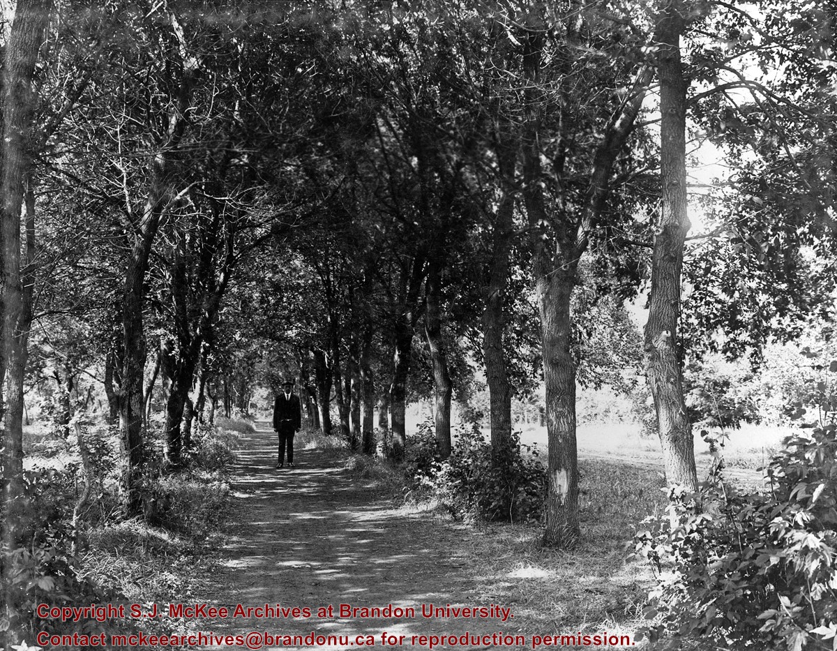
Photo shows a man standing in the middle of a lane, which is lined with trees. The parkland was south of Richmond Avenue and may be part of Patmore Nurseries.
Storage Range
RG 5 Western Manitoba Manuscript collection - photograph storage drawer
Photograph of west side of 10th Street, Brandon, Manitoba, facing northwest. Visible businesses in the Alexandra Block include Doig's, Box Brothers Hardware and Allied Hardware Stores, followed by Simpsons-Sears and Barry Neill Men's Wear in the Strathcona Block. The Johnny Smith Block is visible in the background.
Photograph of 10th Street facing north from Princess Avenue. Vehicles are parallel parked on both sides of the street. The Welcome Brandon sign can be seen at the Rosser Avenue intersection.
Visible businesses on the west side of 10th Street include: Doig's, Box Brothers Hardware and Allied Hardware Stores in the Alexandra Block; followed by Simpsons-Sears in the Strathcona Block. Barry Neill Men's Wear, Kresge's and the Cecil Hotel are also visible. The Johnny Smith Block is visible in the background.
Visible businesses on the east side of 10th Street include: Ollies Steaks and Chops, Elna Sewing Centre, Carlton Cafe, Chop Suey. At the base of the hill the Canadian Pacific train station is visible at the base of the hill.
Notes
Writing on the front of the postcard reads: Tenth St. Brandon, Man.
Photograph shows Princess Avenue facing east from 10th Street. On the north side of Princess Avenue, a B/A Service Station, Princess Cafe, Lindenberg Seeds, and the Central Fire Station are visible. Old City Hall with the war memorial and the Prince Edward Hotel are visible on the south side of Princess Avenue. Traffic is travelling one-way on Princess Avenue.


.jpg?width=1200&404=no-img.jpg&watermark=wmk)
.jpg?width=180&404=no-img.jpg)
.jpg?width=1200&404=no-img.jpg&watermark=wmk)
.jpg?width=180&404=no-img.jpg)
.jpg?width=1200&404=no-img.jpg&watermark=wmk)
.jpg?width=180&404=no-img.jpg)
.jpg?width=1200&404=no-img.jpg&watermark=wmk)
.jpg?width=180&404=no-img.jpg)


.jpg%3fmaxheight%3d1000%26maxwidth%3d1000%26watermark%3dwmk&description=Pacific+Avenue+-+west+of+Tenth+Street)
.jpg%3fmaxheight%3d1000%26maxwidth%3d1000%26watermark%3dwmk&description=Pacific+Avenue+-+west+of+Tenth+Street)
.jpg%3fmaxheight%3d1000%26maxwidth%3d1000%26watermark%3dwmk&description=Pacific+Avenue+-+west+of+Tenth+Street)
.jpg%3fmaxheight%3d1000%26maxwidth%3d1000%26watermark%3dwmk&description=Pacific+Avenue+-+west+of+Tenth+Street)
+north+side+Princess+Avenue+between+9th+Street+and+10th+Street%2c+Brandon%2c+Manitoba)