Skip header and navigation

Revise Search

20 records – page 1 of 1.

Aerial view: Brandon College

http://archives.brandonu.ca/en/permalink/descriptions594
Part Of
Brandon University Photograph collection
Description Level
Item
GMD
graphic
Date Range
[fall 1964?]
Part Of
Brandon University Photograph collection
Description Level
Item
Series Number
2.1
Item Number
BUPC 2.1.2
GMD
graphic
Date Range
[fall 1964?]
Physical Description
5" x 4" (b/w)
Scope and Content
Brandon College looking south from 19th Street. Photograph was taken after Flora Cowan Hall was built but before construction of the Education Building.
Subject Access
aerial photographs
campus photographs
campus buildings
Brandon streets
Images
Show Less

Aerial view - Brandon University campus

http://archives.brandonu.ca/en/permalink/descriptions7989
Part Of
Brandon University Photograph collection
Description Level
Item
GMD
graphic
Date Range
c. 2000
Part Of
Brandon University Photograph collection
Creator
Photograph commissioned by Brandon University and taken by Yourview Aerial Scenics Ltd.
Description Level
Item
Series Number
2.1
Item Number
BUPC 2.1.55
GMD
graphic
Date Range
c. 2000
Physical Description
6" x 4" (colour)
Scope and Content
View is southwest from approximatley 16th Street between Princess and Rosser Avenues. Photograph shows the Brandon University campus, as well as surrounding residential blocks, including Flemming, J.R. Reid and Vincent Massey schools.
Subject Access
aerial photographs
campus photographs
campus buildings
Brandon streets
Images
Show Less

Aerial view - Brandon University campus

http://archives.brandonu.ca/en/permalink/descriptions7990
Part Of
Brandon University Photograph collection
Description Level
Item
GMD
graphic
Date Range
c. 2000
Part Of
Brandon University Photograph collection
Creator
Photograph commissioned by Brandon University and taken by Yourview Aerial Scenics Ltd.
Description Level
Item
Series Number
2.1
Item Number
BUPC 2.1.56
GMD
graphic
Date Range
c. 2000
Physical Description
6" x 4" (colour)
Scope and Content
View is west southwest from approximatley 16th Street between Princess and Lorne Avenues. Photograph shows the Brandon University campus, as well as surrounding residential blocks between 16th and 23rd Streets, Princess and Louise Avenues..
Subject Access
aerial photographs
campus photographs
campus buildings
Brandon streets
Images
Show Less

Aerial view - Brandon University campus

http://archives.brandonu.ca/en/permalink/descriptions7991
Part Of
Brandon University Photograph collection
Description Level
Item
GMD
graphic
Date Range
c. 2000
Part Of
Brandon University Photograph collection
Creator
Photograph commissioned by Brandon University and taken by Yourview Aerial Scenics Ltd.
Description Level
Item
Series Number
2.1
Item Number
BUPC 2.1.57
GMD
graphic
Date Range
c. 2000
Physical Description
6" x 4" (colour)
Scope and Content
View is west from approximatley 17th Street between Lorne and Louise Avenues. Photograph shows a portion of the Brandon University campus (excluding the Education Building and anything north of it), as well as surrounding residential blocks from approximatley 17th Street to 22nd Street.
Subject Access
aerial photographs
campus photographs
campus buildings
Brandon streets
Images
Show Less

Aerial view - Brandon University campus

http://archives.brandonu.ca/en/permalink/descriptions7992
Part Of
Brandon University Photograph collection
Description Level
Item
GMD
graphic
Date Range
c. 1990
Part Of
Brandon University Photograph collection
Description Level
Item
Series Number
2.1
Item Number
BUPC 2.1.58
GMD
graphic
Date Range
c. 1990
Physical Description
5" x 3.5" (colour)
Scope and Content
View is west northwest from approximatley 16th Street and Louise Avenue. Photograph shows the Brandon University campus, prior to the Library Extension, and a large portion of the city to the west of the campus.
Subject Access
aerial photographs
campus photographs
campus buildings
Brandon streets
Images
Show Less

Aerial view: Brandon University campus

http://archives.brandonu.ca/en/permalink/descriptions8064
Part Of
Brandon University Photograph collection
Description Level
Item
GMD
graphic
Date Range
[1972-1978]
Part Of
Brandon University Photograph collection
Description Level
Item
Series Number
2.1
Item Number
BUPC 2.1.133
GMD
graphic
Date Range
[1972-1978]
Physical Description
10" x 8" (b/w)
Scope and Content
View is southwest from approximatley 16th Street between Lorne Avenue and Princess Avenue. The view extends to approximately 26th Street. Photograph shows the Brandon University campus, Kinsmen Stadium, Fleming School, Coronation Park and residential blocks.
Images
Show Less

Aerial view - Brandon College looking southwest

http://archives.brandonu.ca/en/permalink/descriptions601
Part Of
Brandon University Photograph collection
Description Level
Item
GMD
graphic
Date Range
[1963-1966]
Part Of
Brandon University Photograph collection
Description Level
Item
Series Number
2.1
Item Number
BUPC 2.1.8
GMD
graphic
Date Range
[1963-1966]
Physical Description
5" x 4" (b/w)
Scope and Content
Image shows the Brandon College campus from 17th Street looking southwest. The photo was taken after the completion of the original Music Building in 1963, but construction of the Education Building. Also visible are a number of properties on the 200 block of 18th Street and the 200 block of 20th Street.
Subject Access
aerial photographs
campus photographs
campus buildings
Brandon streets
Images
Show Less

Aerial view: Brandon College from 23rd Street

http://archives.brandonu.ca/en/permalink/descriptions602
Part Of
Brandon University Photograph collection
Description Level
Item
GMD
graphic
Date Range
[1963-1966]
Part Of
Brandon University Photograph collection
Description Level
Item
Series Number
2.1
Item Number
BUPC 2.1.9
GMD
graphic
Date Range
[1963-1966]
Physical Description
5" x 4" (b/w)
Scope and Content
Image is looking east northeast from approximately the 300 block of 23rd Street between Lorne and Louise Avenues. Photograph shows the Brandon College campus after the opening of the original Music Building in 1963, but before the construction of the Education Building in 1966. A number of house on the 300 blocks of 22nd and 21st Streets are visible in the foreground, with the A.E. McKenzie Seed Co., the Prince Edward Hotel and various grain elevators on the horizon.
Subject Access
aerial photographs
campus photographs
campus buildings
Brandon streets
Grain elevators
Images
Show Less

9th Street aerial view facing south, Brandon, Manitoba

http://archives.brandonu.ca/en/permalink/descriptions8419
Part Of
Joseph H. Hughes collection
Description Level
Item
GMD
graphic
Date Range
c. 1940
Accession Number
3-1997
Part Of
Joseph H. Hughes collection
Creator
Photographer: Jerrett Photo
Description Level
Item
Series Number
3-1997.1
Item Number
3-1997.1.41
Accession Number
3-1997
GMD
graphic
Date Range
c. 1940
Physical Description
5.5" x 3.5" (b/w)
Material Details
postcard
Physical Condition
good
Scope and Content
Postcard shows an aerial view of 9th Street facing south in Brandon, Manitoba. Visible businesses and landmarks include: Beaubier Hotel, YMCA/police station, the original CKX Radio station towers on 8th Street (est. 1928 - moved 1940), the old City Hall, Prince Edward Hotel, and the original Manitoba Power commission smokestack on 10th Street.
Notes
Writing on the front of the photograph reads: Brandon, Man., Jerrett Photo. This photograph shows a rare view of the 800-block between Rosser and Princess Avenues.
Name Access
Beaubier Hotel
City Hall
CKX
Prince Edward Hotel
Manitoba Power Company
Subject Access
downtowns
street scenes
Brandon business buildings & facilities before 1940
aerial views
building exteriors
Storage Location
RG 5 photograph storage drawer
Images
Show Less

Aerial view of 10th Street facing south from Princess Avenue

http://archives.brandonu.ca/en/permalink/descriptions8420
Part Of
Joseph H. Hughes collection
Description Level
Item
GMD
graphic
Date Range
c.1940
Accession Number
3-1997
Part Of
Joseph H. Hughes collection
Creator
Photographer: Jerrett Photo
Description Level
Item
Series Number
3-1997.1
Item Number
3-1997.1.42
Accession Number
3-1997
GMD
graphic
Date Range
c.1940
Physical Description
5.5" x 3.5" (b/w)
Material Details
postcard
Physical Condition
Red ink stain is on the front right corner of postcard
Scope and Content
Photograph shows 10th Street facing south from Princess Avenue. Visible landmarks and businesses include: Manitoba Power Commission (MPC)'s power sub-station, First Baptist Church, Wheat City Arena, and the grand stand at the Exhibition Grounds. The partial sign visible at the bottom of the photograph on the east side of 10th Street reads Yates and Neale, which refers to a plumbing and heating company that dissolved in 1943 to be replaced by Neale, Stothard and Chapman. Businesses on the west side of 10th Street include: Dominion Tire & Radio Co., Bolts Barber Shop, Elviss T.E. Co. Stables.
Notes
Information concerning Yates and Neale courtesy Jack Stothard. Writing on the front of the postcard reads: Brandon, Looking S.W., Jerrett Photo. This photograph shows a rare view of the 200-block of 10th Street.
Name Access
Manitoba Power Company
10th Street
Dominion Tire & Radio Co.
T.E. Elviss Co. Stables
First Baptist Church
Subject Access
downtowns
street scenes
Brandon business buildings & facilities before 1940
aerial views
building exteriors
residences
churches
Storage Location
RG 5 photograph storage drawer
Images
Show Less

A.E. McKenzie Building

http://archives.brandonu.ca/en/permalink/descriptions860
Part Of
Brandon University Photograph collection
Description Level
Item
GMD
graphic
Date Range
c. mid 1980s
Part Of
Brandon University Photograph collection
Description Level
Item
Series Number
2.4
Item Number
BUPC 2.4.2
GMD
graphic
Date Range
c. mid 1980s
Physical Description
3.5" x 5" (colour)
Scope and Content
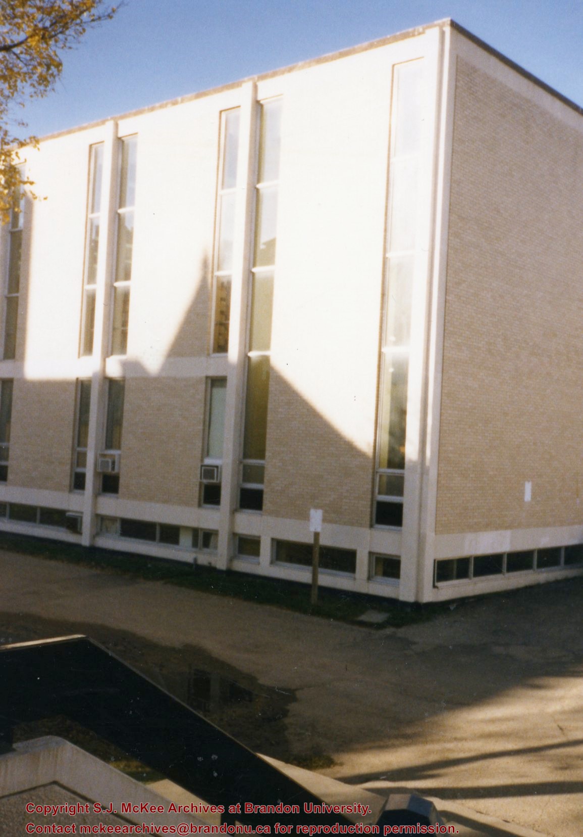
Photograph is looking southwest from the back steps of the Education Building and shows the northeast corner of the A.E. McKenzie Building, which housed the Library and Faculty of Arts.
Images
Show Less

John R. Brodie Science Centre flower beds

http://archives.brandonu.ca/en/permalink/descriptions3026
Part Of
Brandon University Photograph collection
Description Level
Item
GMD
graphic
Date Range
May 1978
Part Of
Brandon University Photograph collection
Description Level
Item
Series Number
2.1
Item Number
BUPC 2.1.42
GMD
graphic
Date Range
May 1978
Physical Description
5" x 3.5" (colour)
Scope and Content
Photograph shows a number of flower beds located on the north side of the John R. Brodie Science Centre.
Subject Access
campus photographs
Images
Show Less

Hughes Building, Brandon, Manitoba

http://archives.brandonu.ca/en/permalink/descriptions8403
Part Of
Joseph H. Hughes collection
Description Level
Item
GMD
graphic
Date Range
c. 1955
Accession Number
3-1997
Part Of
Joseph H. Hughes collection
Description Level
Item
Series Number
3-1997.1
Item Number
3-1997.1.25
Accession Number
3-1997
GMD
graphic
Date Range
c. 1955
Physical Description
4.5" x 6.75" (b/w)
Physical Condition
good
Scope and Content
Photograph shows the northwest corner of 10th Street and Princess Avenue. Traffic on the west side of Princess Avenue appears to travelling both ways. A taxi waits at the intersection. Above the west entrance on the corner building is an electric sign that spells "Hughes Bldg." A second storey has been added to the portion of the Doig's shop that is adjacent to the Alexandra Block.
Notes
A negative accompanies the photograph.
Name Access
Doig's
Hughes Building
Alexandra Block
Princess Avenue
10th Street
Subject Access
downtowns
street scenes
Brandon business buildings & facilities after 1940
building exteriors
taxi
Storage Location
RG 5 photograph storage drawer
Images
Show Less

A.E. McKenzie Building construction

http://archives.brandonu.ca/en/permalink/descriptions627
Part Of
Brandon University Photograph collection
Description Level
Item
GMD
graphic
Date Range
[1959-1960]
Part Of
Brandon University Photograph collection
Description Level
Item
Series Number
2.4
Item Number
BUPC 2.4.6
GMD
graphic
Date Range
[1959-1960]
Physical Description
5" x 7" (b/w)
Scope and Content
Photograph is looking northeast (?) and shows the construction of the A.E. McKenzie Building (Library and Arts Building) during the winter.
Subject Access
campus buildings
Images
Show Less

A.E. McKenzie Building construction

http://archives.brandonu.ca/en/permalink/descriptions628
Part Of
Brandon University Photograph collection
Description Level
Item
GMD
graphic
Date Range
[1959-1960]
Part Of
Brandon University Photograph collection
Description Level
Item
Series Number
2.4
Item Number
BUPC 2.4.7
GMD
graphic
Date Range
[1959-1960]
Physical Description
5" x 7" (b/w)
Scope and Content
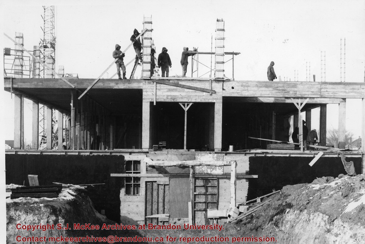
Photograph is looking either north or south into the A.E. McKenzie Building (Library and Arts Building) during construction. A number of the members of the construction crew are visible.
Images
Show Less

A.E. McKenzie Building construction

http://archives.brandonu.ca/en/permalink/descriptions629
Part Of
Brandon University Photograph collection
Description Level
Item
GMD
graphic
Date Range
[1959-1960]
Part Of
Brandon University Photograph collection
Description Level
Item
Series Number
2.4
Item Number
BUPC 2.4.8
GMD
graphic
Date Range
[1959-1960]
Physical Description
5" x 7" (b/w)
Scope and Content
Photograph shows the construction of the A.E. McKenzie Building (Library and Arts Building) during winter.
Images
Show Less

A.E. McKenzie Building construction

http://archives.brandonu.ca/en/permalink/descriptions630
Part Of
Brandon University Photograph collection
Description Level
Item
GMD
graphic
Date Range
[1959-1960]
Part Of
Brandon University Photograph collection
Description Level
Item
Series Number
2.4
Item Number
BUPC 2.4.9
GMD
graphic
Date Range
[1959-1960]
Physical Description
5" x 7" (b/w)
Scope and Content
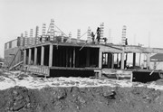
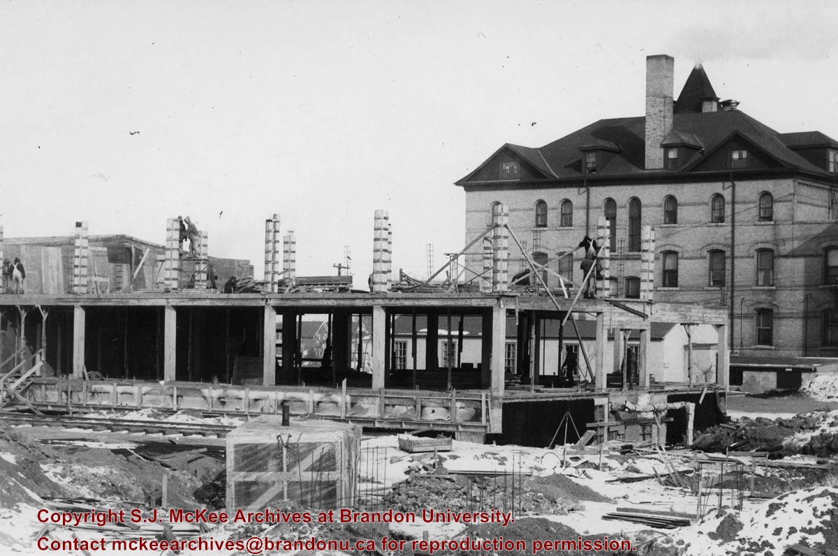
Photograph is looking east northeast and shows the construction of the A.E. McKenzie Building (Library and Arts Building). Clark Hall is in the background.
Images
Show Less

A.E. McKenzie Building opening

http://archives.brandonu.ca/en/permalink/descriptions631
Part Of
Brandon University Photograph collection
Description Level
Item
GMD
graphic
Date Range
January 6, 1961
Part Of
Brandon University Photograph collection
Description Level
Item
Series Number
2.4
Item Number
BUPC 2.4.10
GMD
graphic
Date Range
January 6, 1961
Physical Description
9" x 7" (b/w)
Scope and Content
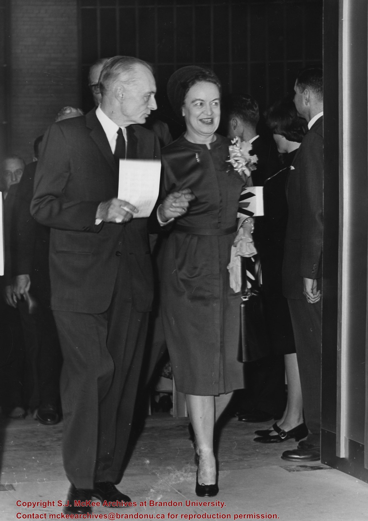
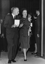
Photograph was taken at the opening of the A.E. McKenzie Building (including the Evans Theatre) and shows the J.R.C. Evans Lecture Theatre doorway. L to R Dr. John E. Robbins, Mrs. Olive (Freeman) Diefenbaker (Class of 1923 and wife of Prime Minister John George Diefenbaker)
Notes
The opening of the A.E. McKenzie Building took place the same day as the installation of John E. Robbins as President of Brandon College.
Images
Show Less

North side of the A.E. McKenzie Building

http://archives.brandonu.ca/en/permalink/descriptions770
Part Of
Brandon University Photograph collection
Description Level
Item
GMD
graphic
Date Range
c. mid 1980s
Part Of
Brandon University Photograph collection
Description Level
Item
Series Number
2.4
Item Number
BUPC 2.4.3
GMD
graphic
Date Range
c. mid 1980s
Physical Description
3.5" x 5" (colour)
Scope and Content
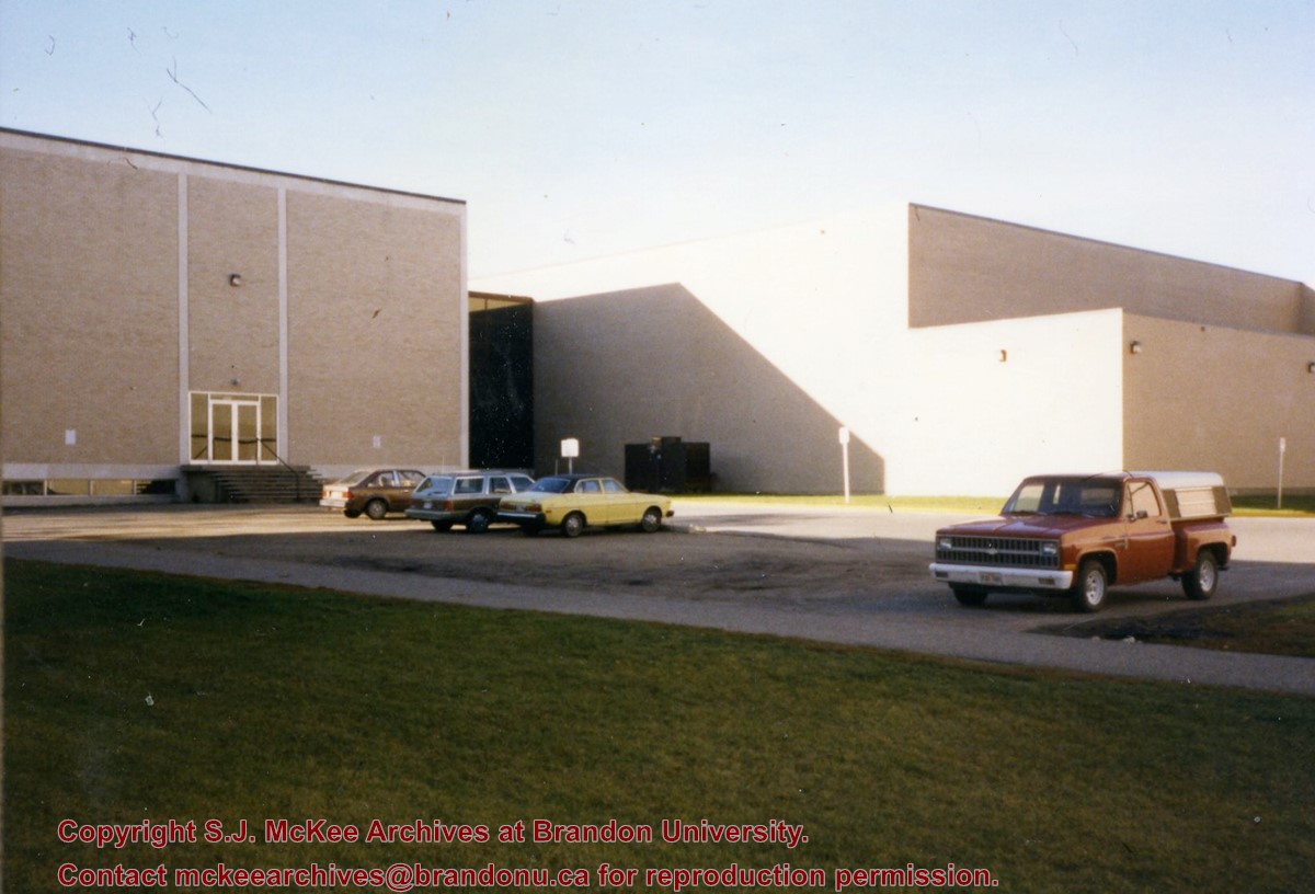
Photograph is looking southwest from in front of the Original Music Building and shows the north side of the A.E. McKenzie Building and the west side of the Queen Elizabeth II Music Building (including the link). A number of cars in the parking lot are also visible.
Images
Show Less

East side of the A.E. McKeznie Building

http://archives.brandonu.ca/en/permalink/descriptions861
Part Of
Brandon University Photograph collection
Description Level
Item
GMD
graphic
Date Range
c .1985
Part Of
Brandon University Photograph collection
Description Level
Item
Series Number
2.4
Item Number
BUPC 2.4.1
GMD
graphic
Date Range
c .1985
Physical Description
3.5" x 5" (colour)
Scope and Content
Photograph is looking west from the sidewalk between Clark Hall and the Education Building and shows the east side of the A.E. McKenzie Building as well as a trailer that housed the Canada Manpower office (career councelling) in the 1960s. The trailer was later moved near the Kinsmen Stadium where it housed the Quill office.
Images
Show Less

20 records – page 1 of 1.