Brandon College looking south from 19th Street. Photograph was taken after Flora Cowan Hall was built but before construction of the Education Building.
Image shows the Brandon College campus from 17th Street looking southwest. The photo was taken after the completion of the original Music Building in 1963, but construction of the Education Building. Also visible are a number of properties on the 200 block of 18th Street and the 200 block of 20th Street.
Image is looking east northeast from approximately the 300 block of 23rd Street between Lorne and Louise Avenues. Photograph shows the Brandon College campus after the opening of the original Music Building in 1963, but before the construction of the Education Building in 1966. A number of house on the 300 blocks of 22nd and 21st Streets are visible in the foreground, with the A.E. McKenzie Seed Co., the Prince Edward Hotel and various grain elevators on the horizon.
View is southwest from approximatley 16th Street between Princess and Rosser Avenues. Photograph shows the Brandon University campus, as well as surrounding residential blocks, including Flemming, J.R. Reid and Vincent Massey schools.
View is west southwest from approximatley 16th Street between Princess and Lorne Avenues. Photograph shows the Brandon University campus, as well as surrounding residential blocks between 16th and 23rd Streets, Princess and Louise Avenues..
View is west from approximatley 17th Street between Lorne and Louise Avenues. Photograph shows a portion of the Brandon University campus (excluding the Education Building and anything north of it), as well as surrounding residential blocks from approximatley 17th Street to 22nd Street.
View is west northwest from approximatley 16th Street and Louise Avenue. Photograph shows the Brandon University campus, prior to the Library Extension, and a large portion of the city to the west of the campus.
View is southwest from approximatley 16th Street between Lorne Avenue and Princess Avenue. The view extends to approximately 26th Street. Photograph shows the Brandon University campus, Kinsmen Stadium, Fleming School, Coronation Park and residential blocks.
See MG 1 Brandon College Teaching and Administration, 1.11 Martin Johns fonds for custodial history.
Scope and Content
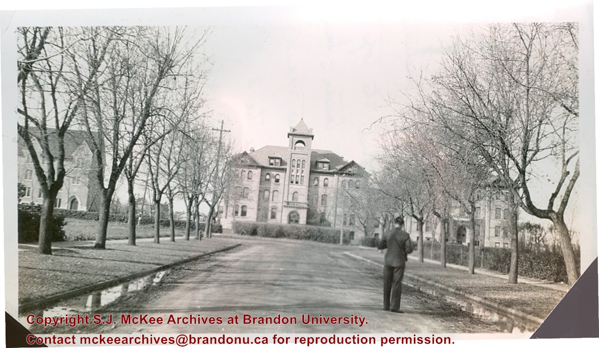
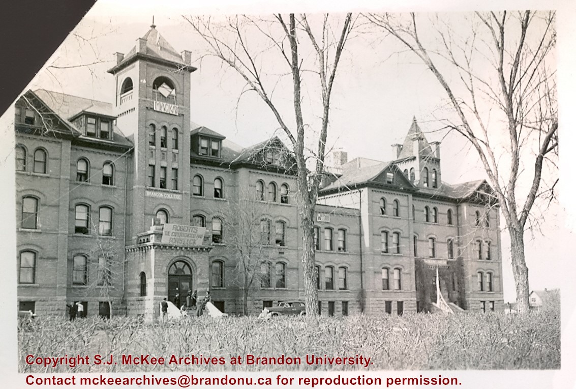
Photograph is looking west down Lorne Avenue towards the Brandon College Building. Clark Hall and the Citzens' Science Building are visible through the trees.
Notes
Writing on the back of the photo reads: "Brandon College from 16th Street and Lorne Ave. Looking up Lorne Ave (i.e. looking west). Laurie is in the foreground taking a picture. My room is behind the top 3 windows of the tower. Laurie's directly below me and Dalton's are the 3 at the extreme right on the same floor. Science building is at the left." Laurie may be a reference to Lawrence H. Cragg who taught Chemistry at Brandon College from 1937-1943. Dalton refers to W.H. Dalton Vernon who taught Philosophy and Psychology at Brandon College from 1938-1940.
See MG 1 Brandon College Teaching and Administration, 1.11 Martin Johns fonds for custodial history.
Scope and Content
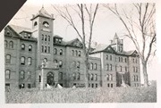
Photograph is looking northwest from 18th Street and shows the Brandon College Building and Clark Hall. There are a number of handmade election signs on the buildings.
See MG 1 Brandon College Teaching and Administration, 1.11 Martin Johns fonds for custodial history.
Scope and Content
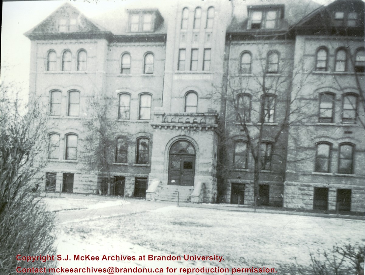
Photograph is looking southwest from 18th Street and shows Clark Hall and the Brandon College Building with the Citizens' Science Building partially visible on the lefthand side of the photo.
Notes
Writing on the back of the photo reads: "Brandon College and boys' res. is joined to Clark Hall" "from Marion(?)/Marvin(?) McLure(?)"
View is northwest from the roof of the John R. Brodie Science Centre. Photograph shows the roof of the Knowles Douglas Students' Union Centre, the Citizens' Science Building, and the Brandon College Building and Clark Hall during renovation.
Photograph was taken from the roof of the Library and shows the walkway and flower bed on the southeast corner of the George T. Richardson Centre. The Physical Plant H-Hut is visible in the top right hand corner.
View is southwest from the roof of the George T. Richardson Centre. Photograph shows the curved glass wall of the John E. Robbins Library, the walkway between the Library and the Dining Hall, the Dining Hall and Darrach Hall.
See MG 1 Brandon College Teaching and Administration, 1.11 Martin Johns fonds for custodial history.
Scope and Content
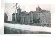
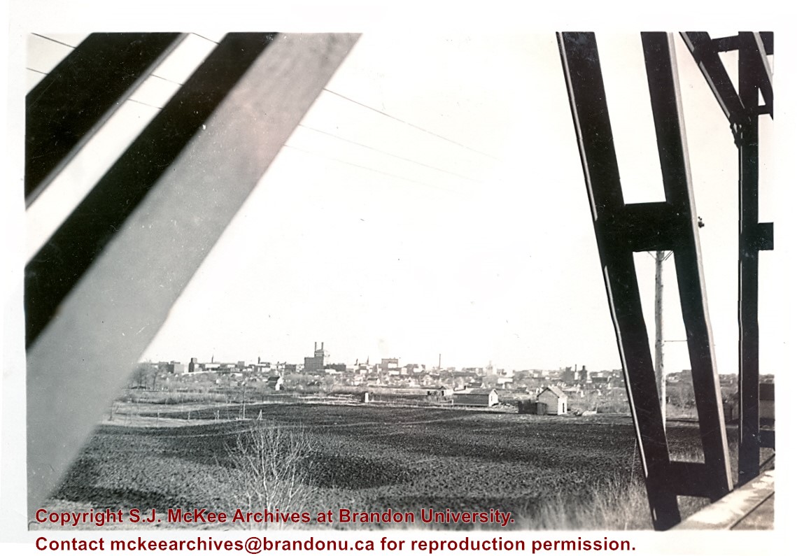
Photograph is looking south southeast from the Assiniboine bridge on 18th Street and shows the Brandon cityscape in the background.
Notes
Writing on the back of the photo reads: "Brandon from the Assiniboine bridge. The 2 girls were just local coloring. Don't ask me who they were or are? The College is just off the street on the right away in the background."
View is north probably from the roof of McMaster Hall. Photograph shows the construction of the new roof on Clark Hall and the Brandon College Building.


