Peace Garden. Student activity: International Relations Conference. study group L-R Mellanie Berthume (?), Marion McGregor (?), ?, Dave Halstead, ?, Nora Malyn (centre at head of the table)
The International Peace Garden is situated on the international border between Manitoba and North Dakota, adjacent to the Canadian Border Services Boissevain port of entry and the U.S. Customs and Border Protection Agency's Dunseith port of entry. The dedication for the International Peace Garden was held on July 14, 1932. It was estimated that 50,000 people were in attendance on opening day. The park is 9.5-square kilometers or 3.54-square miles.
Custodial History
Pictures were sent to Fred McGuinness in 1970 from E.M. Bergson of Brandon.
Scope and Content
Photograph shows large crowds surrounding a stone cairn draped in American and Union Jack flags. According to the International Peace Garden website, the pictured cairn was built from stones gathered from Manitoba and North Dakota. The crowds gathered for the 1932 dedication of the International Peace Garden.
Notes
The back of the photograph is stamped: Enameloid Velox Print by the Jul 27 1932, Chicago Postal Photo Supplies, Regina, Sask.
The International Peace Garden is situated on the international border between Manitoba and North Dakota, adjacent to the Canadian Border Services Boissevain port of entry and the U.S. Customs and Border Protection Agency's Dunseith port of entry. The dedication for the International Peace Garden was held on July 14, 1932. It was estimated that 50,000 people were in attendance on opening day. The park is 9.5-square kilometers or 3.54-square miles.
Custodial History
Pictures were sent to Fred McGuinness in 1970 from E.M. Bergson of Brandon.
Scope and Content
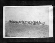
Photograph shows the crowded parking lot at the International Peace Garden's 1932 dedication ceremony. People mill amongst the automobiles and tents can be seen in the background.
Notes
The back of the photograph is stamped: Enameloid Velox Print by the Jul 27 1932, Chicago Postal Photo Supplies, Regina, Sask.
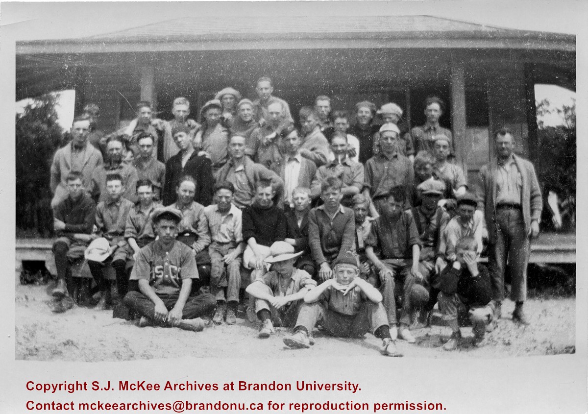
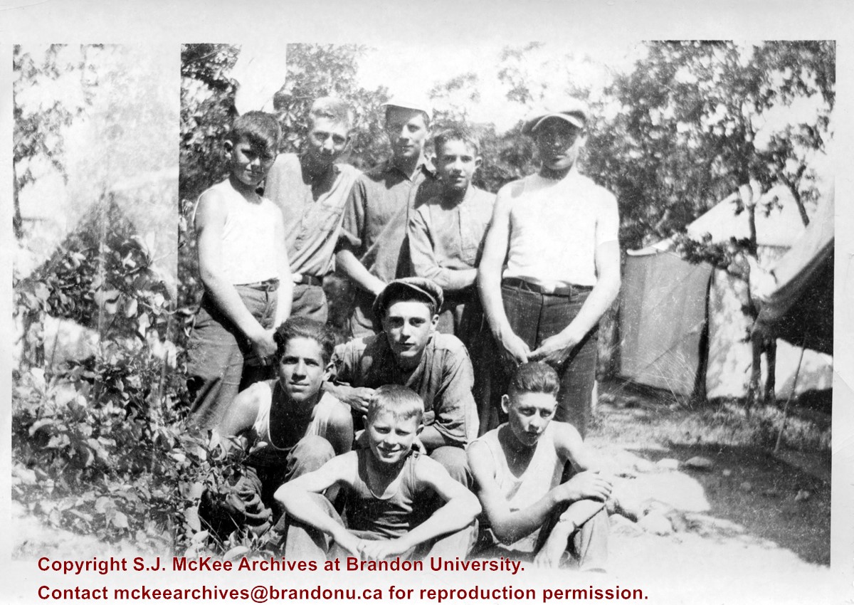
Photograph shows a group of boys posing for a picture in front of a wooden cabin. Photo possibly taken at the YMCA Camp located at "Y" Point, Pelican Lake.
Notes
Writing on the back of the photograph reads: 1923. Note affixed to photograph reads: "Y" camp, ~1924, standing center dark sweater Don Snyder. next Lance Muirhead on end. Mr. Yeomans Physical Director. Front. chin on hands. Charles McNaughton. (now Minister of Ont Highways)
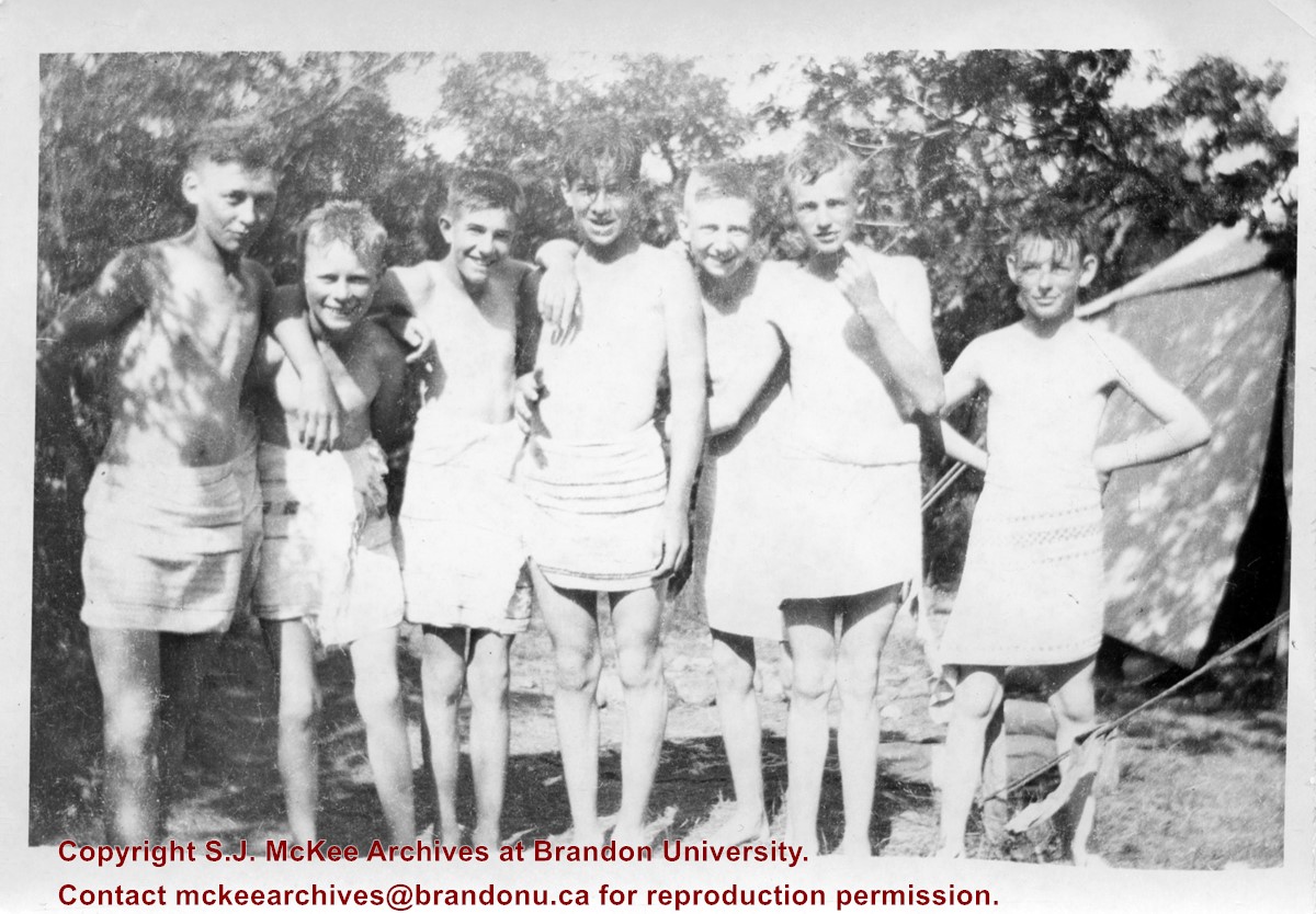
Photograph shows a group of boys posing for a picture in the brush in front of canvas tents. Photo possibly taken at the YMCA Camp located at "Y" Point, Pelican Lake.
Notes
Writing on the back of the photograph reads: 1922-1923.
Published by Western News Agency Ltd., Winnipeg, (46 pp.)
Physical Description
9.25" x 6.75" (b/w)
Material Details
Small pamphlet containing photo essay
History / Biographical
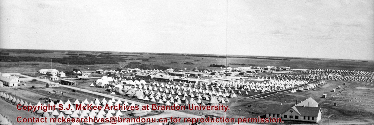
Established as Sewell Camp in 1909, it was renamed after Major-General Sir Sam Hughes, Canada's Minister of Militia and Defence, in 1915. During World War I (1914–1918), more than 38,000 troops of the Canadian Expeditionary Force trained there. Many of the soldiers later distinguished themselves at the battle of Vimy Ridge, in April 1917.
Extensive trench systems, grenade and rifle ranges, and military structures were built in 1915 and 1916. A variety of retail stores on a double-avenued area close to the main camp formed a lively commercial midway. Camp Hughes was dismantled in the 1930s as part of an unemployment relief project.
The Camp Hughes Military Training Site, located at NE 34-10-16 W, 10 kms west of Carberry,
R.M. of North Cypress, was designated Manitoba Provincial Heritage Site No. 82 on April 18, 1994.
Custodial History
Donated by Earl Johnson, publisher of the Baldur Gazette, through the "good offices" of Fred McGuinness.
Scope and Content
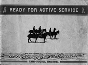
Item is a small pamphlet containing 50 black & white photographs in a photo essay entitled: Ready for Active Service, Camp Hughes Manitoba.
Notes
McGuinness wrote about Camp Hughes and how he acquired the pamphlet in a Viewpoint column in the November 1, 2001 edition of the Brandon Sun. A copy of the article is with the pamphlet. History/Bio information taken from the Manitoba Government Exlpore Our Heritage Website at: http://www.gov.mb.ca/chc/hrb/prov/p082.html (December 14, 2009).
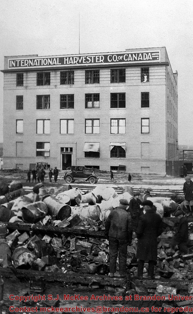
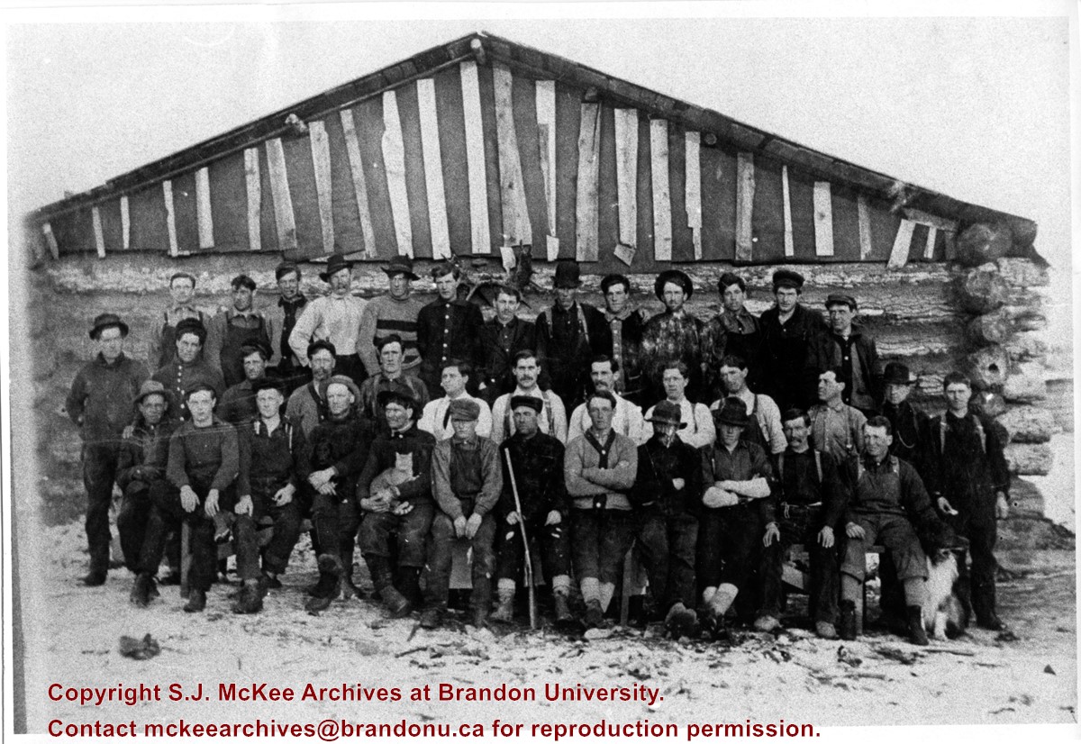
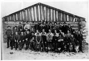
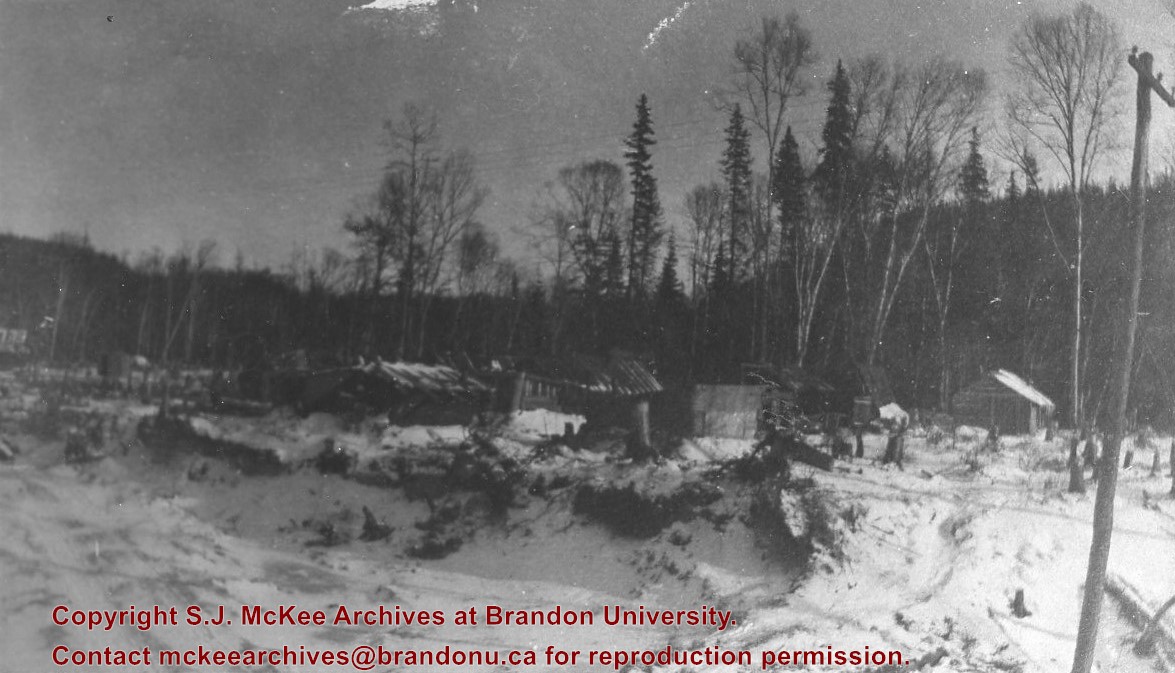
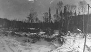
Photograph shows a group of 38 loggers outside their camp. The men are wearing long-sleeved shirts, sweaters, and coveralls. One man is holding a cat on his lap, another appears to be holding a rifle.
Due to the increasing volume of long-distance auto traffic in the 1920's, the city designated the block between Hill & Queen's Avenues and 9th & 10th streets as a "Tourist Camp" with a few basic facilities. LAS.
Custodial History
For custodial history see the collection level description of the Lawrence Stuckey collection.
Scope and Content
First Tourist Camp
Notes
Courtesy of the Brandon Sun
[Mr. Stuckey put two negatives in the same envelope, numbered N4 and N4a. We have separated them.]


