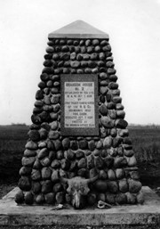
Photograph shows the cairn and the plaque on it. There is a skull at the base of the cairn. Plaque reads: Brandon House No. 2 established on this site 10am Oct. 7, 1828 by Chief Trader Francis Heron of the H.B. Co. Abandoned 1832. This cairn dedicated Oct. 7, 1928 - erected by The Brandon Rotary Club.
Repro Restriction
The McKee Archives is the copyright holder for the Stuckey materials.
For custodial history see the collection level description of the Lawrence Stuckey collection.
Scope and Content
Brandon House No. 2 Cairn
Notes
[Cairn reads: "Brandon House No. 2 established on this site 10 A.M. Oct. 7 1828 by Chief Trader Francis Heron of the H.B. Co.; Abandoned 1832; This cairn Dedicated Oct. 7 1928; Erected by The Brandon Rotary Club" (P.E. 23/07/09).]
Photograph shows the west side of 10th Street between Rosser and Princess Avenues. Visible businesses include: Recreation Bowling & Billiards, Bottomley's, Barry Neill Men's Wear, Simpsons-Sears, Allied Hardware Stores, Box Brothers Hardware, Doig's. Painted on the north face of the Strathcona Block are two advertisements, one for Sutherland and Robertson [Grocery] and the other for Boyd Electric Co. Ltd.
Photograph shows a view of downtown Brandon from the northeast corner of 10th Street and Princess Avenue. Thunderbird Bowl is in the foreground. Painted advertisements on the sides of buildings include: The Mitrou's Cafe and Tea Room and Brandon Musical Supply Ltd. Vehicles parked on 10th Street are facing north.
Notes
Photograph dated from "Tara's Bulba," the movie playing at the Strand Theatre and similiar vehicles captured in the photograph.
For custodial history see the collection level description of the Lawrence Stuckey collection.
Scope and Content
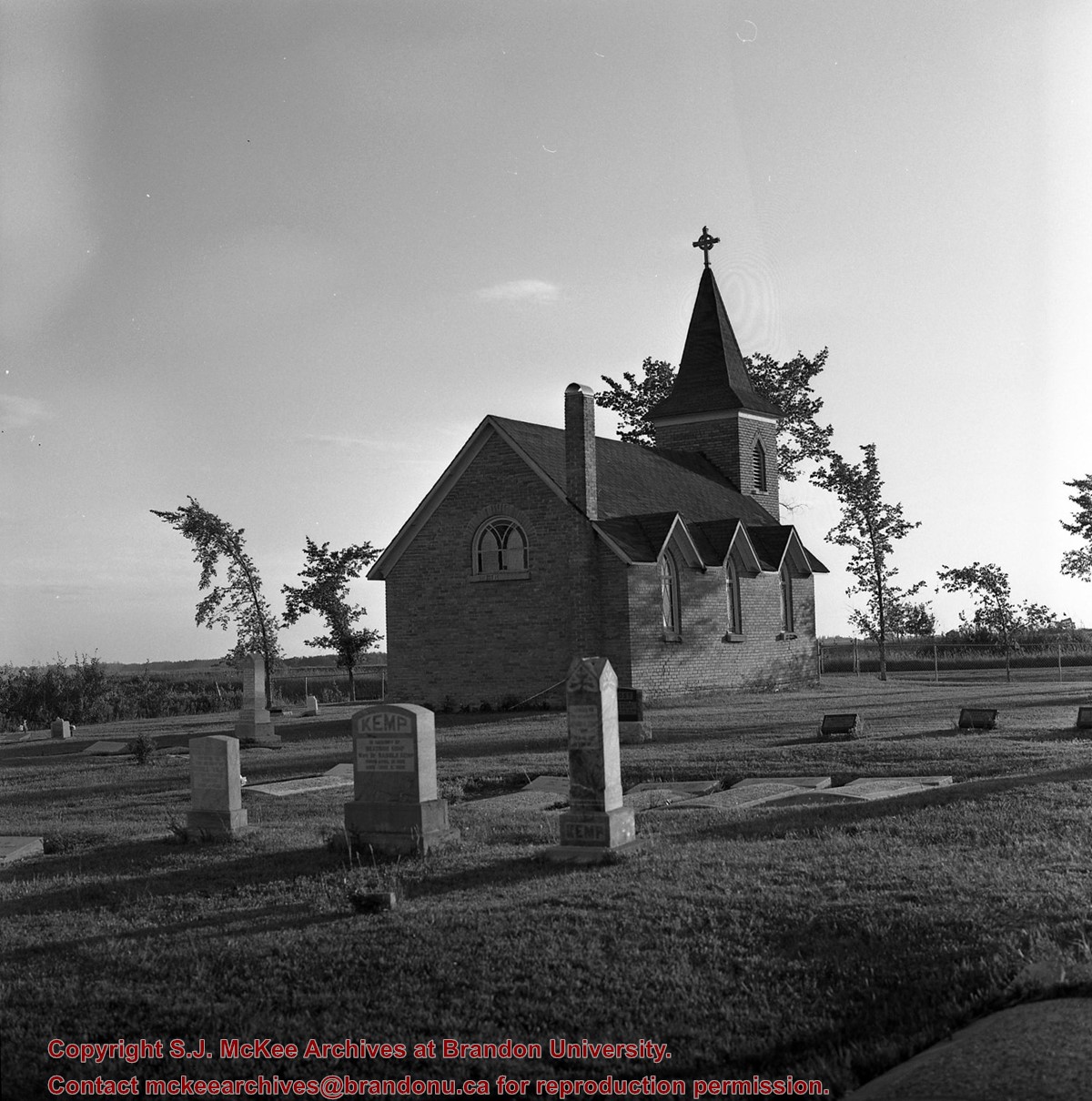
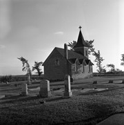
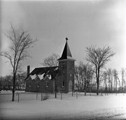
Image of Bethel Church (1895) on Highways 2 & 21 west of Deleau, Manitoba.
Notes
[Brandon SW includes communities south of Trans-Canada #1 highway and west of PTH #10.] [Images 349a and 349b are images of the exterior of the church, and images 349c-349-e are images of the stained glass windows.]
For custodial history see the collection level description of the Lawrence Stuckey collection.
Scope and Content
Image of Bethel Church (1895) on Highways 2 & 21 west of Deleau, Manitoba.
Notes
[Brandon SW includes communities south of Trans-Canada #1 highway and west of PTH #10.] [Images 349a and 349b are images of the exterior of the church, and images 349c-349-e are images of the stained glass windows.]


.jpg?width=1200&404=no-img.jpg&watermark=wmk)
.jpg?width=180&404=no-img.jpg)
.jpg?width=1200&404=no-img.jpg&watermark=wmk)
.jpg?width=180&404=no-img.jpg)


.jpg%3fmaxheight%3d1000%26maxwidth%3d1000%26watermark%3dwmk&description=Brandon+House+No.+2+Cairn)
.jpg%3fmaxheight%3d1000%26maxwidth%3d1000%26watermark%3dwmk&description=Brandon+House+No.+2+Cairn)
)
)
%0a)
%0a)
%0a)
+on+Highways++2+%26+21+west+of+Deleau%2c+Manitoba.)
+on+Highways++2+%26+21+west+of+Deleau%2c+Manitoba.)
+on+Highways++2+%26+21+west+of+Deleau%2c+Manitoba.)
+on+Highways++2+%26+21+west+of+Deleau%2c+Manitoba.)
+on+Highways++2+%26+21+west+of+Deleau%2c+Manitoba.)