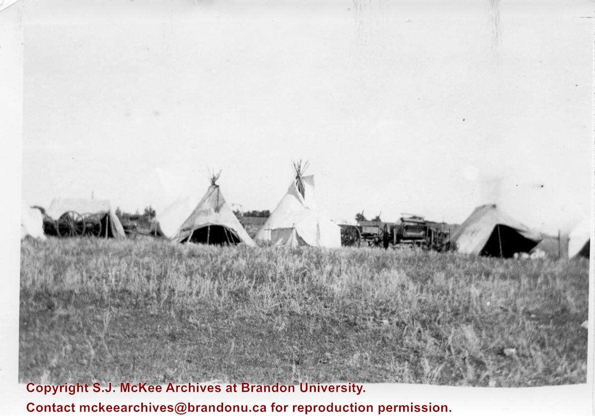
Photograph shows the Aboriginal camp site at the Brandon Fair. Pictured are wagon carts, tipis, and canvas tents.
Notes
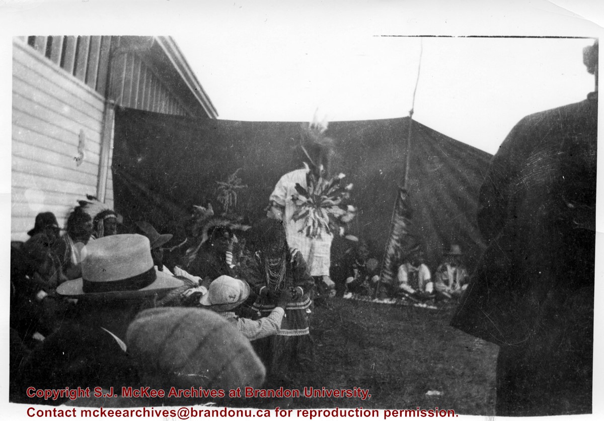
Writing on back of photograph reads: 6 prints [20-2009.145 to 20-2009.150]. Indians at the Brandon Fair. Camping off 18th St. back of fair grounds. 1923
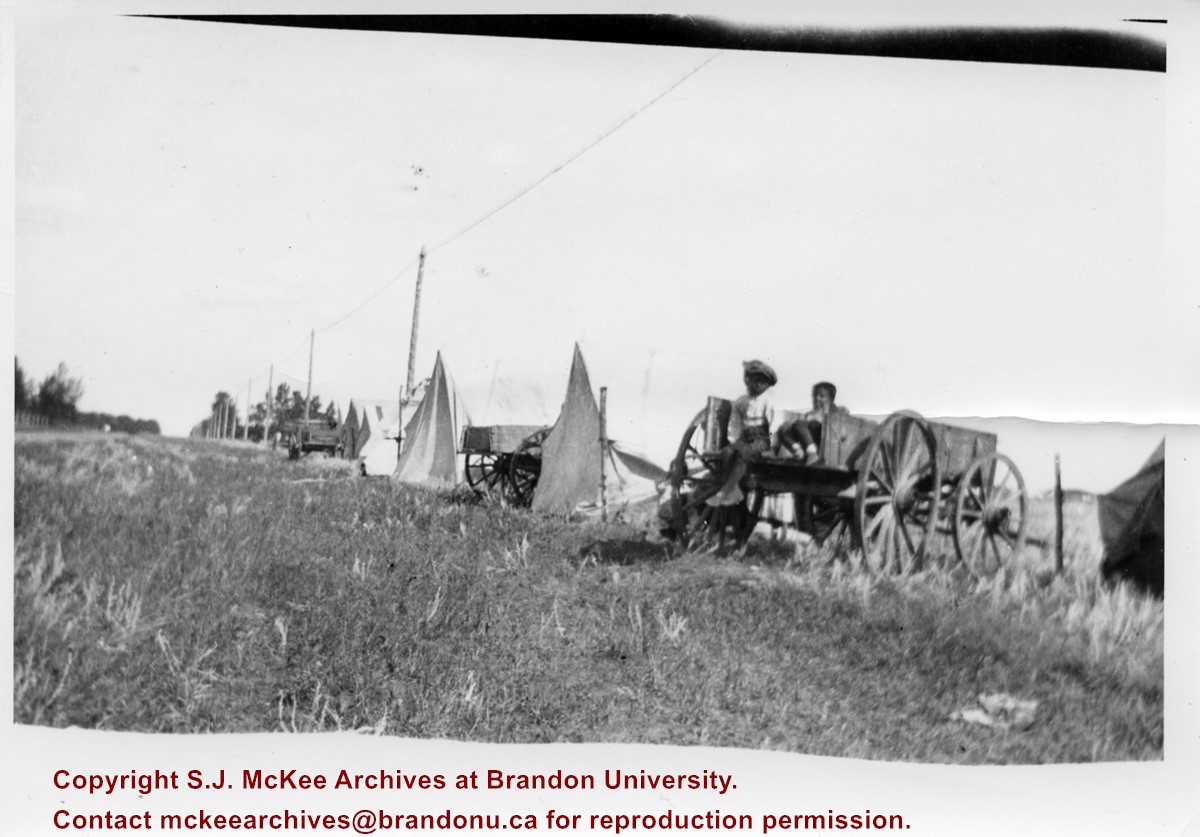
Photograph shows the Aboriginal camp site at the Brandon Fair. Pictured are wagon carts and canvas tents. Two children can be seen sitting in a wagon.
Notes
Writing on back of photograph reads: 6 prints [20-2009.145 to 20-2009.150]. Indians at the Brandon Fair. Camping off 18th St. back of fair grounds. 1923
Photograph shows a group of Aboriginal peoples sitting near a fair building. Several members are dressed in regalia.
Notes
Writing on back of photograph reads: 6 prints [20-2009.145 to 20-2009.150]. Indians at the Brandon Fair. Camping off 18th St. back of fair grounds. 1923
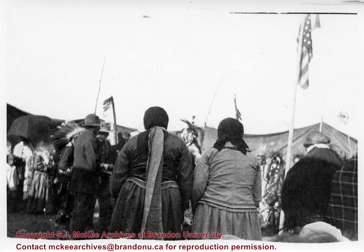
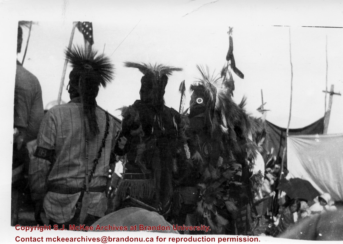
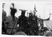
Photograph shows a group of Aboriginal peoples standing in a circle surrounding a group in traditional regalia. An American flag is visible in the foreground.
Notes
Writing on back of photograph reads: 6 prints [20-2009.145 to 20-2009.150]. Indians at the Brandon Fair. Camping off 18th St. back of fair grounds. 1923
Photograph shows the backside of a group Aboriginal peoples dressed in traditional regalia. An American flag is visible in the background
Notes
Writing on back of photograph reads: 6 prints [20-2009.145 to 20-2009.150]. Indians at the Brandon Fair. Camping off 18th St. back of fair grounds. 1923
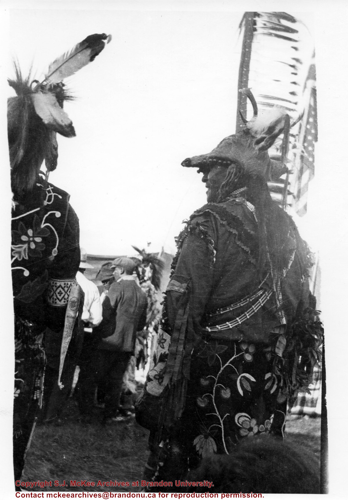
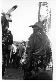
Photograph shows the backside of a pair of Aboriginal men dressed in traditional regalia. Both are wearing beaded clothing and one is wearing a deer head headdress. An American flag is visible in the background
Notes
Writing on back of photograph reads: 6 prints [20-2009.145 to 20-2009.150]. Indians at the Brandon Fair. Camping off 18th St. back of fair grounds. 1923
For custodial history see the collection level description of the Lawrence Stuckey collection.
Scope and Content
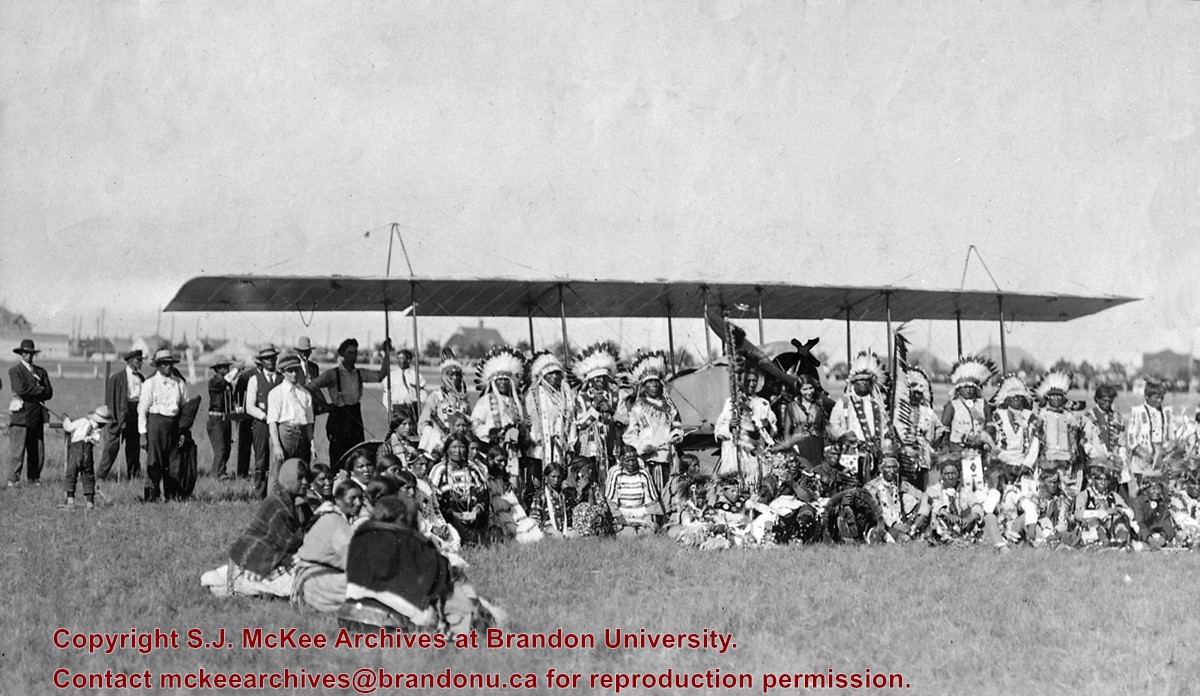
Katherine Stinson & aircraft with Indigenous peoples
Notes
Photo taken in Brandon, Manitoba
Miss Stinson was half Indigenous
See Lawrence Stuckey file (Finding Aids) for biography of Katherine Stinson.
[Please note that in the title we have chosen to maintain the original terminology used by Mr. Stuckey in order to maintain the original context and order of the record. P.E. 08/07/09.]
Photographs have been glued to a backing board that has warped over time
History / Biographical
Photograph of possible Dakota from Sioux Valley in Brandon for the summer fair.
Scope and Content
Photograph shows street view of north side of Rosser Avenue, primarily the 700 block. Businesses visible in the Fleming Block include: Lowes Brothers Clothing, Robert Hall [Insurance Broker], Manitoba Farmers Hedge and Wire Fence Company. Businesses visible in the Beaubier Block include the Empire Hotel. Businesses east of the Empire Hotel are grocer A.M. Percival and the Brandon Hardware Company. A number of Aboriginal peoples are travelling on horseback west along Rosser Avenue as spectators look on.
Notes
Writing on the front of the photograph matting reads: 293. One photograph (20-2009.9) is glued above and two others are glued on the reverse side. Page appears to be from a photo album.
Photographs have been glued to a backing board that has warped over time
History / Biographical
Photograph of possible Dakota from Sioux Valley in Brandon for the summer fair.
Scope and Content
Photograph shows street view of north side of Rosser Avenue, primarily the 700 block. Businesses visible in the Beaubier Block include the Empire Hotel. Businesses east of the Empire Hotel are grocer A.M. Percival, the Brandon Hardware Company, and the Arlington Hotel. A number of Aboriginal peoples are driving horse and buggies east along Rosser Avenue as large numbers of spectators look on.
Notes
Writing on the front of the photograph matting reads: 298. One photograph (20-2009.79) is glued above, another (20-2009.81) adjacent. One other is glued on the reverse side. Page appears to be from a photo album.
Photographs have been glued to a backing board that has warped over time
History / Biographical
Photograph of possible Dakota from Sioux Valley in Brandon for the summer fair.
Scope and Content
Photograph shows street view of north side of Rosser Avenue, primarily the 700 block. Businesses visible in the Fleming Block include: Lowes Brothers Clothing, Robert Hall [Insurance Broker], Manitoba Farmers Hedge and Wire Fence Company. Businesses visible in the Beaubier Block include the Empire Hotel. Businesses east of the Empire Hotel are grocer A.M. Percival and the Brandon Hardware Company. A number of Aboriginal peoples are driving horse and carriages west along Rosser Avenue as spectators look on.
Notes
Writing on the front of the photograph matting reads: 295 July 1906. One photograph (20-2009.11) is glued above and two others are glued on the reverse side. Page appears to be from a photo album.
Photographs have been glued to a backing board that has warped over time
History / Biographical
Photograph of possible Dakota from Sioux Valley in Brandon for the summer fair.
Scope and Content
Photograph shows street view of north side of Rosser Avenue, primarily the 700 block. Businesses visible in the Fleming Block include: Lowes Brothers Clothing, Robert Hall [Insurance Broker], Manitoba Farmers Hedge and Wire Fence Company. Businesses visible in the Beaubier Block include the Empire Hotel. Businesses east of the Empire Hotel are grocer A.M. Percival and the Brandon Hardware Company. A number of Aboriginal peoples are driving horse and buggies west along Rosser Avenue as spectators look on.
Notes
Writing on the front of the photograph matting reads: 294 July 1906. One photograph (20-2009.10) is glued below and two others are glued on the reverse side. Page appears to be from a photo album.
For custodial history see the collection level description of the Lawrence Stuckey collection.
Scope and Content
CPR No. 3, the westbound "Dominion", with engine 2829 under 1st Street Bridge
Notes
View includes former Empire Brewery, [then] in use by Bell Bottling Co.; Safe crossing over the CPR eliminated the need for a flagman. "Telltails" warn switchmen riding on top of railcars of low overhead clearance. Old Empire Brewery was (late 1950's) a feed mill, making grain feeds for livestock.
Brient was a point along the Algoma Central Railway line that connected the Helen Mine to the Michipicoten Harbour. It is located southwest of Wawa, Ontario.
Scope and Content
Photograph shows ore box cars in a railway yard.
Notes
Writing beneath the photograph in the album reads: yard at Brient
Brient was a point along the Algoma Central Railway line that connected the Helen Mine to the Michipicoten Harbour. It is located southwest of Wawa, Ontario.
Scope and Content
Photograph shows several men standing on railway tracks before a wood-framed train station in the winter. A sign attached to the station reads: British American Express Co. The man in the foreground appears to have a mailbag over on his back and several newspapers tucked beneath his arm.
Notes
Writing beneath the photograph in the album reads: station at Brient
After demise of the streetcars, a transit system was started by MacArthur Transportation Co. with three routes, an east end loop, a south end loop, and a west end loop, with terminal at 8th St. & Rosser Ave. The E & W was operated as a continuous route with two locally built coach bodies on new Maple Leaf trucks. A secondhand, larger, Leland coach was acquired for the S. end, which was replaced by a large GMC about 1938.
Custodial History
For custodial history see the collection level description of the Lawrence Stuckey collection.
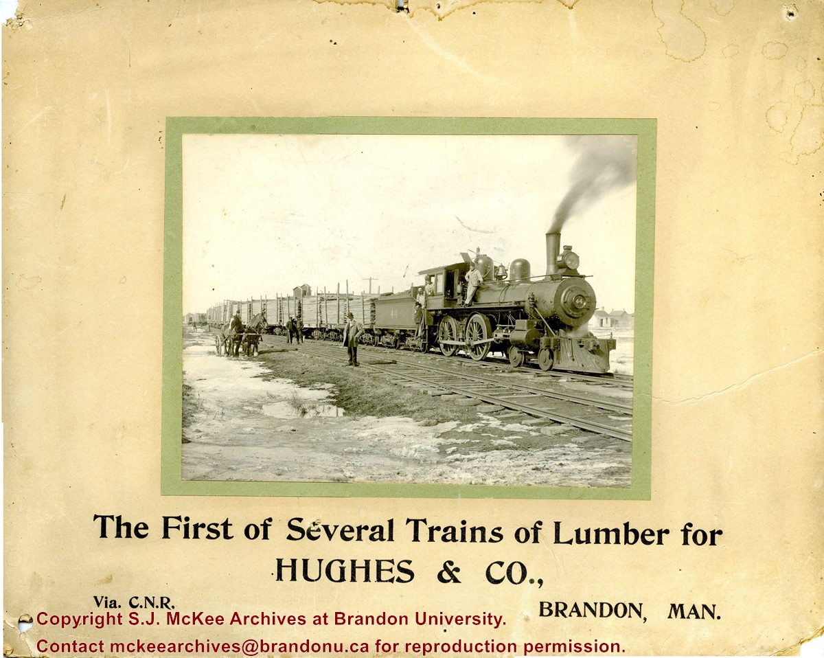
Photograph shows CNR train No.44 carrying loads of lumber. Engineers pose with the locomotive. Several men pose on the railway tracks. Snow and ice appear in the ditch.
Notes
Writing on the front of the photograph reads: The First of Several Trains of Lumber for HUGHES & CO., Via C.N.R., Brandon, Man. Photograph is stamped on the back: Huhges & Co. Ltd., 1009 Princess Ave., Brandon, Man.


