The Royal Bank moved to this location on 26 October 1929. An existing building was renovated to accomodate the bank. On 28 May 1976 fire destroyed the buildings from the lane west to the Royal Bank.
Scope and Content
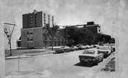
Photograph shows the south side of Rosser Avenue between 7th and 8th Streets, west of the Eaton's building. Visible shops include: Vogue [Ladies Wear], Smith's Drugs, Sobie's Tailored Undergarnments, Household Finance Loans, and The Royal Bank of Canada.
See fonds level of the CKX records for custodial history.
Scope and Content
Image consists of an aerial view looking north at the intersection of Highways 1 and 10 and shows the British American dealer located at the intersection.
See fonds level of the CKX records for custodial history.
Scope and Content
Image of the southside of the 1100 block of Rosser Avenue in winter. Visible are O.L. Harwood Ltd., the Key Kafe and Northern Auto Parts. The Perth's building, located in the 1200 block, can be seen on the righthand side in the background. A number of vehicles, a pedestrian and a man shovelling snow are also visible.
Photograph shows the exterior of the Winter Fair Arena on 10th Street.
Notes
Part of "Souvenir of Brandon, Manitoba, Canada [viewbook], Printed by Photogelatine Engraving Co. Limited, Ottawa." Dates obtained from the Burchill's Music Store Henderson's Brandon City Directory listings (1927-1929). Writing on the front of the photograph reads: Winter Fair Arena, Brandon, Man.
See fonds level of the CKX records for custodial history.
Scope and Content
Image consists of an aerial view looking southeast at the intersection of Highways 1 and 10 and shows the British American dealer located at the intersection.
See fonds level of the CKX records for custodial history.
Scope and Content
Image consists of an aerial view looking northeast at the intersection of Highways 1 and 10 and shows the British American dealer located at the intersection.
Photograph is looking northeast from the south side of Louise Avenue and shows portions of Darrach Hall, Flora Cowan Hall and McMaster Hall. Part of the John R. Brodie Science Centre is also visible behind the trees along the street.
Photograph was found by Al Mitchell, a City of Brandon employee.
Scope and Content
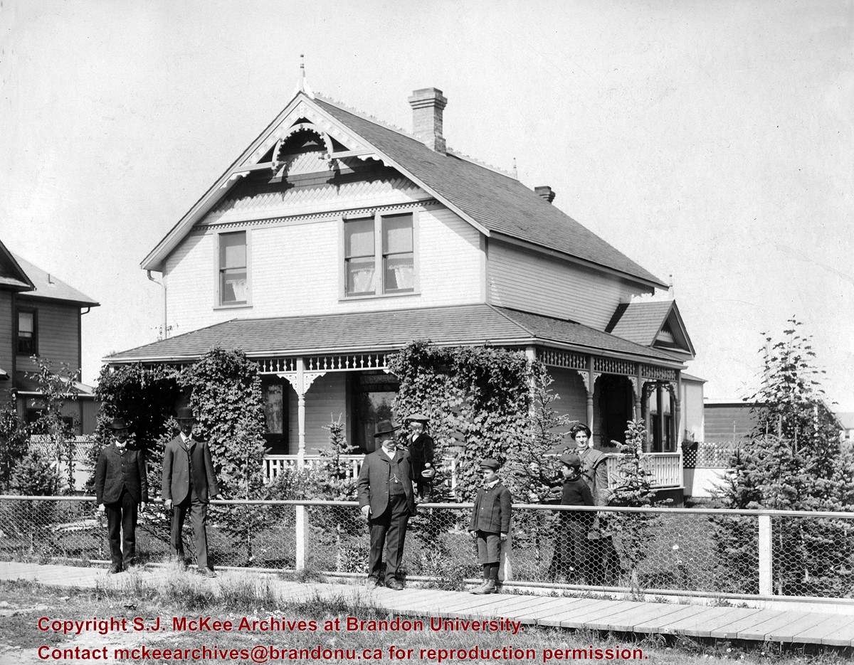
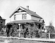
Photograph shows a family residence in the city. Four adults (three men and one woman) and three male children are standing at the property's fence or on the wooden sidewalk.
Repro Restriction
The McKee Archives is the copyright holder for the Stuckey materials.
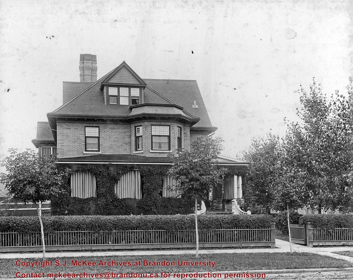
Designed by W.A. Elliott, this house was built in 1905 for the Christie family. Ernest (E.L.) Christie was a stationer and founder of Christie's School Supplies, now Christie's Office Plus. It has been designated a heritage property by the City of Brandon.
Custodial History
See fonds level description of the Alf Fowler collection for custodial history.
Scope and Content
Photo shows a Brandon residence located at 404 13th Street.
Notes
History/Bio information taken from the Assiniboine Historical Society's Brandon: A Residential Walking Tour pamphlet (1993).
Storage Range
RG 5 Western Manitoba Manuscript collection - photograph storage drawer
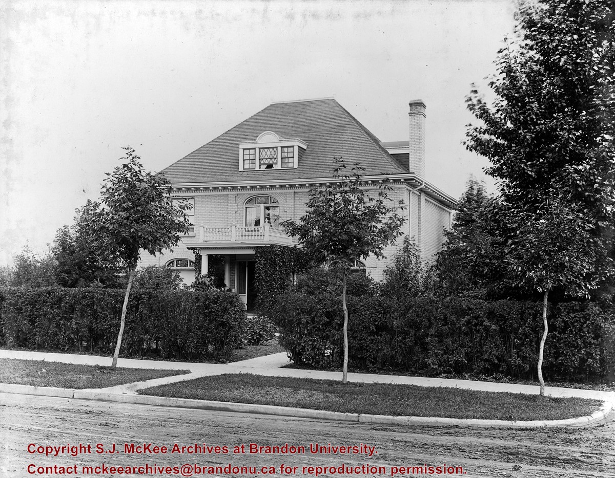
This house was built in 1910, for W.D. Clement, the son of Brandon's first sheriff and a local pharmacist. In 1919, it served as Clark Hall Annex for Brandon College students. It was subdivided during the 1930s.
Custodial History
See fonds level description of the Alf Fowler collection for custodial history.
Scope and Content
Photo shows a Brandon residence located at 1335 Lorne Avenue.
Notes
History/Bio information taken from the Assiniboine Historical Society's Brandon: A Residential Walking Tour pamphlet (1993).
Storage Range
RG 5 Western Manitoba Manuscript collection - photograph storage drawer


