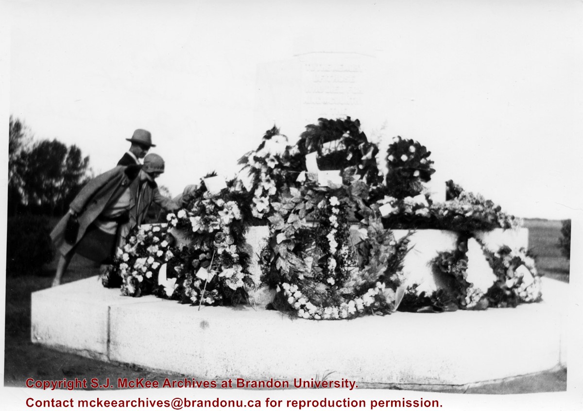
According to Veterans' Affairs Canada, there are 25 Crosses of Sacrifice in North America. The crosses were designed by the Canadian War Graves Commission's (CWGC) architect Sir Reginald Bloomfield, who designed a stone cross affixed with a bronze symbolic sword. The CWGC granted the Brandon Municipal Cemetery permission to privately erect the Cross of Sacrifice in its cemetery in exchange for maintaining the war graves in its cemetery.
The Brandon Great War Veterans Association erected the Cross of Sacrifice in the Brandon Municipal Cemetery in 1924 after a 10-day public fundraising campaign. At the time the Brandon Daily Sun reported that the Veterans Association required $5,000 to pay for the cross and the campaign ultimately raised $7,500. The memorial was initially dedicated to the local citizens who died as a result of the First World War.
Private Frank Barker (#33281) died on 27 June 1918. A member of the Canadian Army Medical Corps, Pte. Barker was on the Llandovery Castle Hospital Ship when it was torpedoed.
Custodial History
Donated to Fred McGuinness by G. Baldock in 1971
Scope and Content
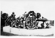
Photograph is of a close-up of a number of wreaths laid at the base of the Cross of Sacrifice in the Brandon Municipal Cemetery during a memorial service.
Notes
Writing on the back of the photograph reads: Winnifred Barker places wreath in memory of Frank Barker (my uncle) 1st Field Ambulance, many decorations including the "Mons Star," lost on the Hospital Ship Landovery Castle, 1918. - G. Baldock 1971 -
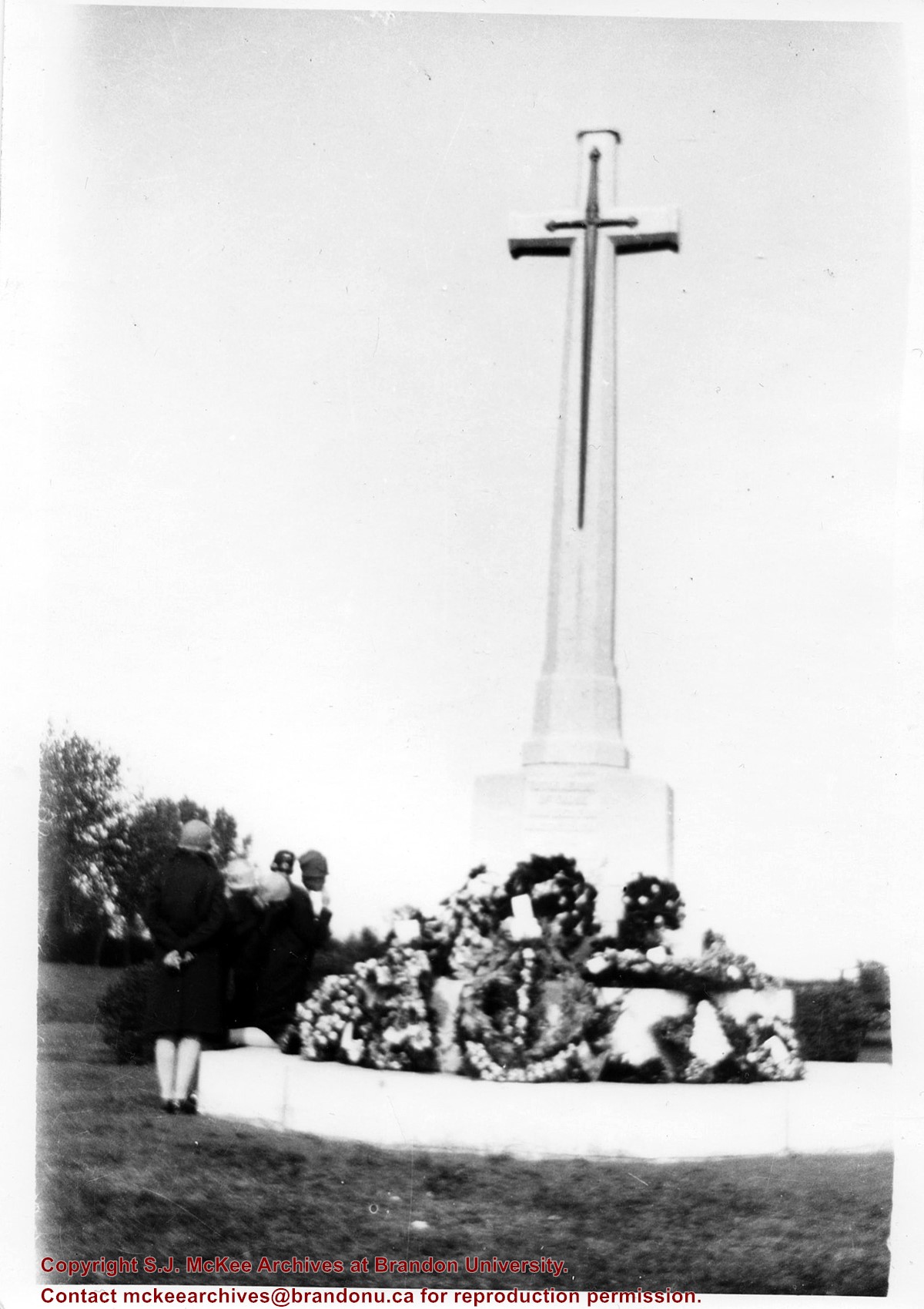
According to Veterans' Affairs Canada, there are 25 Crosses of Sacrifice in North America. The crosses were designed by the Canadian War Graves Commission's (CWGC) architect Sir Reginald Bloomfield, who designed a stone cross affixed with a bronze symbolic sword. The CWGC granted the Brandon Municipal Cemetery permission to privately erect the Cross of Sacrifice in its cemetery in exchange for maintaining the war graves in its cemetery.
The Brandon Great War Veterans Association erected the Cross of Sacrifice in the Brandon Municipal Cemetery in 1924 after a 10-day public fundraising campaign. At the time the Brandon Daily Sun reported that the Veterans Association required $5,000 to pay for the cross and the campaign ultimately raised $7,500. The memorial was initially dedicated to the local citizens who died as a result of the First World War.
Custodial History
Donated to Fred McGuinness by G. Baldock in 1971
Scope and Content
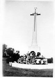
Photograph is of a group of people examining wreaths that have been laid at the base of the Cross of Sacrifice in the Brandon Municipal Cemetery during a memorial service.
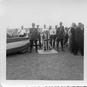
Saskatchewan's Fourth Meridian (meridian 110 degrees west of Greenwich) forms the western boundary of the province and is part of the world's longest surveyed straight line.
Scope and Content
Photograph shows two RCMP members in red serge standing next to a monument covered in the Union Jack flag.
Notes
A negative exists for this photo and is stored with the picture.
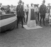
Saskatchewan's Fourth Meridian (meridian 110 degrees west of Greenwich) forms the western boundary of the province and is part of the world's longest surveyed straight line.
Scope and Content
Photograph shows two RCMP members in red serge standing next to a monument dedicated/marking the Fourth Meridian.
Notes
A negative exists for this photo and is stored with the picture.
Saskatchewan's Fourth Meridian (meridian 110 degrees west of Greenwich) forms the western boundary of the province and is part of the world's longest surveyed straight line.
Scope and Content
Photograph shows the platform party at the dedication of the Fourth Meridian monument.
Saskatchewan's Fourth Meridian (meridian 110 degrees west of Greenwich) forms the western boundary of the province and is part of the world's longest surveyed straight line.
Scope and Content
Photograph shows the platform party at the dedication of the Fourth Meridian monument.
Saskatchewan's Fourth Meridian (meridian 110 degrees west of Greenwich) forms the western boundary of the province and is part of the world's longest surveyed straight line.
Scope and Content
Photograph shows the platform party at the dedication of the Fourth Meridian monument.
Image submitted to Fred McGuinness by T. Horobin of Brandon
Scope and Content
Photograph shows a man, perhaps an engineer standing next to a Brandon Municipal Railway car covered in snow. A Brandon Municipal Railway token/tag is affixed to the image.
The International Peace Garden is situated on the international border between Manitoba and North Dakota, adjacent to the Canadian Border Services Boissevain port of entry and the U.S. Customs and Border Protection Agency's Dunseith port of entry. The dedication for the International Peace Garden was held on July 14, 1932. It was estimated that 50,000 people were in attendance on opening day. The park is 9.5-square kilometers or 3.54-square miles.
Custodial History
Pictures were sent to Fred McGuinness in 1970 from E.M. Bergson of Brandon.
Scope and Content
Photograph shows large crowds surrounding a stone cairn draped in American and Union Jack flags. According to the International Peace Garden website, the pictured cairn was built from stones gathered from Manitoba and North Dakota. The crowds gathered for the 1932 dedication of the International Peace Garden.
Notes
The back of the photograph is stamped: Enameloid Velox Print by the Jul 27 1932, Chicago Postal Photo Supplies, Regina, Sask.
According to the Manitoba Historical Society, the Volunteer Monument was unveiled at Winnipeg's Old City Hall on September 28, 1886. The monument commemorated the soldiers of 90th Winnipeg Rifles (also known as the "Little Black Devils") who were killed during the 1885 North West Rebellion. In 1968, the monument was moved to the east side of Main Street, between the Centennial Concert Hall and the Manitoba Museum.
Scope and Content
Photograph shows a parade marching south along Main Street in front of the Volunteer Monument on Winnipeg's Old City Hall grounds (1886-1962). The parade was in honour of Queen Victoria's Diamond Jubilee that was held June 22, 1899. Businesses visible on the west (left) side of Main Street include: the Great Northern Railway Line, Gurney Stove & Range Co., Sherman House, The Arlington Hotel, Hurtley & Co., Central Drug Hall, Inman Optical Co. On the east side of Main Street, the Conferation Life Block is draped with bunting and a large ensign flag is flying from its tower. Specators line the streets and can be seen on roof tops and leaning from windows.
Notes
The front of the photograph reads: Jublee [sic.] Procession June 22/99 Winnipeg
Photograph shows a panorama, bird's-eye-view of downtown Brandon, between Pacific and Rosser Avenues and 7th Street facing east. Photoraph likely taken from the McKenzie Seeds Building. Visible businesses include: Western Canada Flour Mills, Hanbury Hardware Co. Ltd., Cockshutt Plow Co., New Pacific Hotel, Gordon McKay Building, and Arlington Hotel.
Notes
Part of "Souvenir of Brandon, Manitoba, Canada [viewbook], Printed by Photogelatine Engraving Co. Limited, Ottawa." Dates obtained from the Burchill's Music Store Henderson's Brandon City Directory listings (1927-1929). Writing on the front of the photograph reads: Panorama of Brandon, Man.
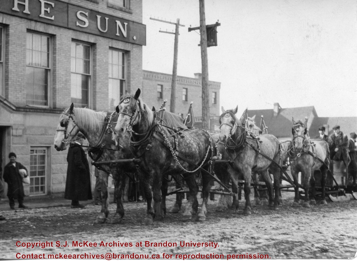
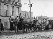
Photograph shows the Brandon Wheat Market along Pacific Avenue on November 30, 1885. Farmers can be seen driving wagon teams loaded with bags of grain in line on Pacific Avenue from 10 Street to at least 7th Street. On the north side of Pacific Avenue the CPR Land Office and grain elevators are pictured. On the south side of Pacific Avenue, the general merchant/hardware store Bower, Blackburn, Mundell & Porter is situated on the corner of Pacific Avenue and 10th Street. A 10th Street sign is affixed to the merchants' store. On the east side of the general store, Edie House, the Grand View Hotel, and a Farmers' boarding and lodging house can be seen. Most of the buildings appear to be woodframed except for the Grand View, which is constructed of brick. Sidewalks appear to be in place on the south side of Pacific and snow dusts the streets. A baby swathed in winter clothing sits in a pram/baby carriage in front of the general store.
Notes
Writing on the front of the photograph reads: Novemeber 30th, 1885, Brandon Wheat Market
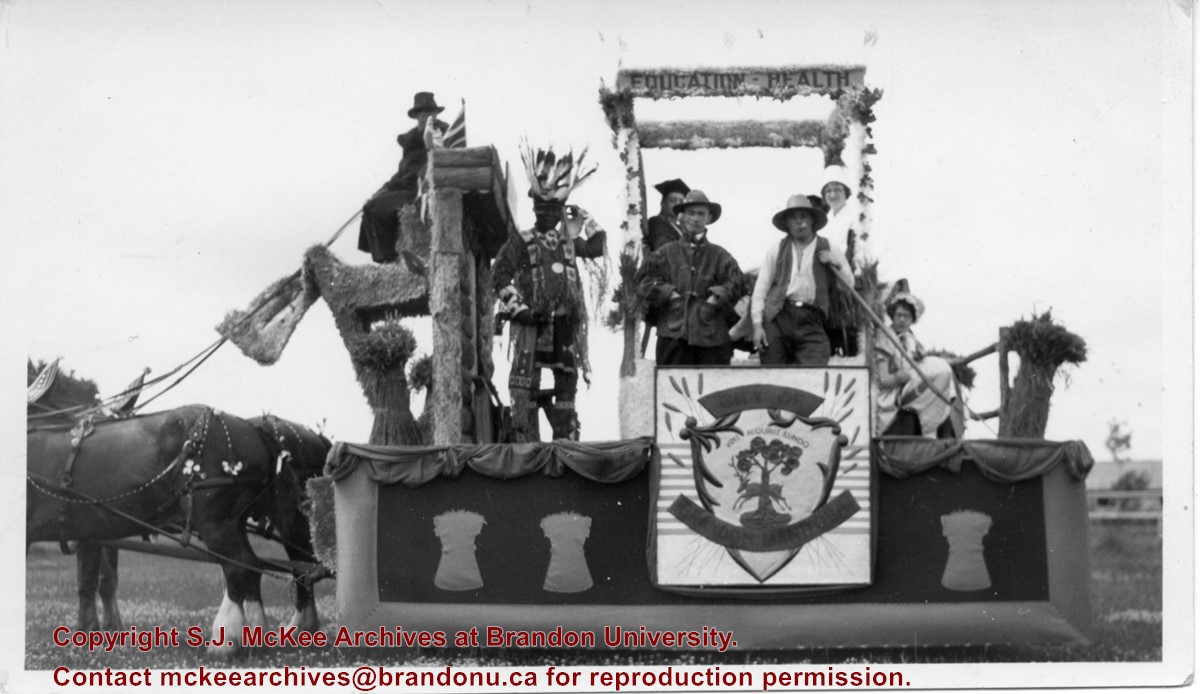
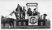
Photograph shows the City of Brandon parade float pulled by two clydesdale horses. The parade is in honour of the diamond anniversary of Canada's Confederation. The float is decorated with wheat sheaves, the city's coat of arms, and the words "education" and "health" adorn a pergola or arbour in the centre of the float. Seven people are on the float and appear to be in costume. An Aboriginal man is dressed in full regalia, one man appears to be in academic robes, another dressed as a farmer. One woman appears to be dressed like a nurse while another may be wearing a pioneer costume.
Notes
Writing on the back of the photograph reads: Brandon City's foat in 1927, Celebrating 60 years of Confederation, The lady in white is Miss Ann Carnahan who was on the city staff for a number of years and now resides in Victoria. She is my husbands [sic.] sister.
According to Russ Gourluck (Silver Screens on the Prairie, Winnipeg: Great Plains Publications, 2012, 26), the Orpheum Theatre was in operation from 1917 to 1920 when it then became the Willis Theatre.
Scope and Content
Postcard shows the 100 block of 10th Street facing north. The CPR train station can be seen at the end of 10th Street. The sign for the Rex Cafe is visible on the west side of 10th Street. On the east side of 10th Street, billboards for Campbell & Campbell furniture are visible as well as signs for Pianos and the Orpheum Theatre. Motorists and cyclists share the road. Street car tracks run the length of 10th Street.
Notes
Postcard was manufactured by T.B. [Tichnor Brothers, Inc., 1908-1987] Cambridge, Massachusetts.
According to the Brandon Daily Sun (07 May 1913), the first three street cars (Nos. 10, 9, and 7) arrived in Brandon on the evening of May 6, 1913. The cars were shipped via Canadian National Rail to Brandon from Winnipeg and stored at the railway siding on McTavish Avenue between 8th and 9th Streets. The daily paper (15 May 1915) reported that a test run for the street cars was scheduled for May 16, 1913. The City Clerk published a public notice in the paper (29 May 1913) announcing the formal opening of the "Brandon Municipal Street Raily" for on Monday, June 2, from 2 p.m. to 4 p.m. at city hall where the cars would be displayed.
Custodial History
Donated to Fred McGuinness by Allena Strath (nee Coombs).
Scope and Content
Postcard depicts three municipal street cars parked on the 10th Street tracks in front of the Winter Fair Building. In front of the cars are a group of men wearing suits, hats, and top coats. Two automobiles are parked alongside the street cars. According to Archivist Emeritus Tom Mitchell, the group of men are members of the Brandon Municipal Street Railway Committee. The chairman of the committee, Harry Cater, can be seen in the center-left of the group wearing a watch fob. The committee had assembled for a test run of the street car service, which the Brandon Daily Sun reported to have occured on Sunday, May 16, 1913.
Notes
Back of postcard reads: First Street Car in Brandon in front of Winter Fair building 1910.


