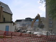
Located at the centre of the Brandon University campus, the Physical Plant H-Hut was destroyed following the opening of the new $3.9M, 13,600 square-foot physical plant on 07 April 2010.
Custodial History
Photograph was taken by McKee Archives project archivist Jill Sutherland.
Scope and Content
Photograph shows the demolition of the Physical Plant H-Hut. The photograph is looking south/southeast.
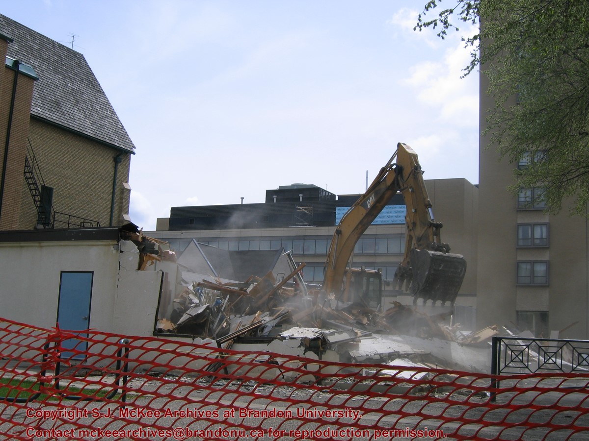
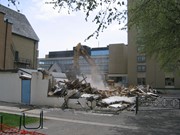
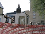
Located at the centre of the Brandon University campus, the Physical Plant H-Hut was destroyed following the opening of the new $3.9M, 13,600 square-foot physical plant on 07 April 2010.
Custodial History
Photograph was taken by McKee Archives project archivist Jill Sutherland.
Scope and Content
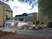
Photograph shows the demolition of the Physical Plant H-Hut. The photograph is looking southeast. The John R. Brodie Science Centre, the Geology H-Hut, and portions of the Citizens' Science Building (BUSU Building), Knowles-Douglas expansion (KDC) and McMaster Hall are visible in the background.
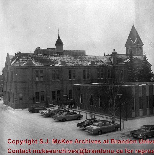
Image shows the Brandon College campus from 17th Street looking southwest. The photo was taken after the completion of the original Music Building in 1963, but construction of the Education Building. Also visible are a number of properties on the 200 block of 18th Street and the 200 block of 20th Street.
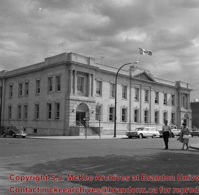
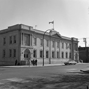
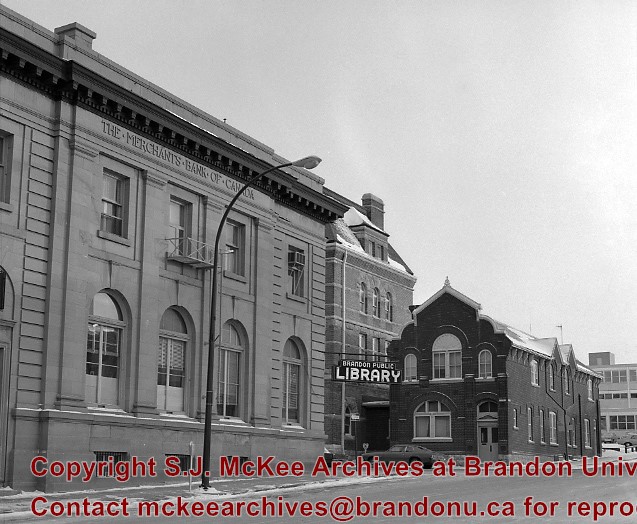
The original Merchants Bank of Canada building (built 1890) was, at one time, used by St. John's Ambulance.
The second Merchants Bank of Canada building (built 1906) was used as the Brandon branch of the Western Manitoba Regional Library, and now is home to the Brandon Chamber of Commerce (P.E. 23/06/09).
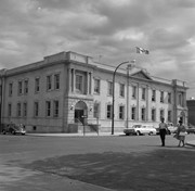
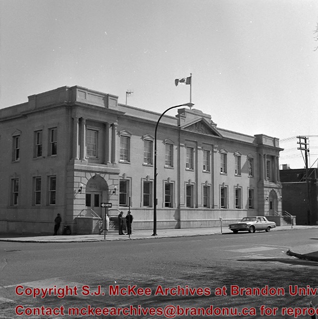
The original Federal Building and Post Office was built in 1891
Custodial History
For custodial history see the collection level description of the Lawrence Stuckey collection.
Scope and Content
The original Merchants Bank of Canada building (right); The second Merchants Bank of Canada building (left); The original Federal Building and Post Office (centre)
Encyclopedia of World Art Library Reading Room, 2nd floor Library and Arts Building. Presentation by the Brandon College Alumni Association of a cheque for the final payment on the Encyclopedia of World Art as a memorial to Ernestine R.W. Whiteside, former Lady Principal of Clark Hall. L to R William Bridgett, President, BCAA; F. Joan Garnett, General Secretary, BCAA; Eileen McFadden, College Librarian; Dr. R.F. B. King, Associate Dean of Arts and Chairman, Faculty Library Committee
Two works of art from the University Collection, south end Library Reading Room, McKenzie Building. Naming of the Robbins Library and opening of the Lightbody Reading area. L to R (numbered as on back of picture) 1) Dorothy Luchansky, 2) Lillian Phillips, 3) Prof. Marion Crowhurst ?, 4) Elsie Paterson (Stewart), 5) Stella Tolmie, 6) Shirley Gillespie, 7) Alice Gregory (Orr) (back), 8) Dr. Robert Brockway, 9) Dr. D.N.Wheeler (back), 10) Dr. R.F.B. King (part), 11) Marg. McKinnon Nos. 1-10 University Staff; 11-Mental Health Centre
A series of five blueprints containing plans for the library addition c. 1991. Blueprints include main floor of addition including existing foyer, second floor including existing arts building and the mezzanine floor of the existing library and arts building.
Storage Location
RG 6 Brandon University fonds
Series 2: Board of Governors
2.1 Documents
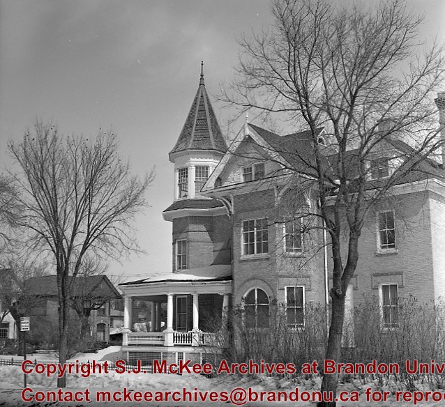
Former home of J.E. Smith, early farmer, horse breeder and businessman - died 1919. Became city property. To Allied Arts Council 1950's. Arts Centre moved to former Co-op Store, 600 block of Princess Ave. 1984.
[In 2000, the renamed Art Gallery of Southwestern Manitoba moved to the former Eaton’s building attached to The Town Centre (former Gallery Mall). P.E. 05/06/09]
Custodial History
For custodial history see the collection level description of the Lawrence Stuckey collection.


