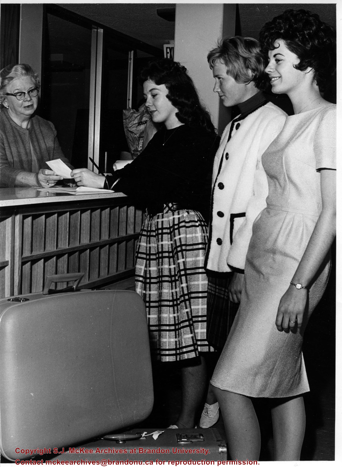
Sub-series consists of registration cards for Brandon College, some of which were filled out in the students' own handwriting. Over time the format of the cards changed but at various times they contained information on: name; address (home and in Brandon); parents' names; age; religious denomination; date of entrance; course of study; birthdate; last school attended; whether or not the student was a church member (and if so where they attended church); occupation in view; phone number; and college department.
In 1924-1925, some of the students' registration cards are McMaster University initial registration cards, rather than the Brandon College registration card format. The reason for the use of the McMaster cards is unknown, however Brandon College was affiliated with McMaster University at the time. These particular cards contain information that is not included on the cards created by Brandon College. Additional information fields include: prepatory schools attended; how admitted to Brandon College (name of examination); where the examination was written and if the student obtained complete standing on that Examination; father's nationality; and mother's nationality.
Some years (1899-1908) also have a breakdown of the different denominations as represented by students attending Brandon College.
Storage Location
RG 1 Brandon College fonds
Series 4: Office of the Registrar
4.11 Registration cards
Arrangement
The sub-series is arranged by year. Some of the years are arranged numerically, while others are arranged alphabetically. Original order was maintained.
Photographs have been glued to a backing board that has warped over time
Scope and Content
Photograph shows street view of north side of Rosser Avenue, primarily the 700 block. Horse and buggies are travelling on the avenue and pedestrians fill the sidewalks. Union Jacks and English flags are mounted from the windows on the Fleming and Beaubier blocks. Flag banners are drapped across Rosser Avenue. Businesses visible in the Fleming Block include: Lowes Brothers Clothing and Spring Park Nurseries. Businesses visible in the Beaubier Block include the Empire Hotel. Businesses east of the Empire Hotel are grocer A.M. Percival and the Brandon Hardware Company. An advertisement for the Northern Bank is affixed to a telephone pole on the southside of the street.
Notes
Writing on the front of the photograph matting reads: July 1 1906, 314. One photograph (20-2009.8) is glued below and another, 20-2009.6, is glued on the reverse side. Page appears to be from a photo album.
Photographs have been glued to a backing board that has warped over time
Scope and Content
Photograph shows street view of north side of Rosser Avenue, primarily the 700 block. Horse and buggies are travelling on the avenue and pedestrians fill the sidewalks. Union Jacks and English flags are mounted from the windows on the Fleming and Beaubier blocks. Flag banners are drapped across Rosser Avenue. Businesses visible in the Fleming Block include: Lowes Brothers Clothing and Spring Park Nurseries. Businesses visible in the Beaubier Block include the Empire Hotel. Businesses east of the Empire Hotel are grocer A.M. Percival and the Brandon Hardware Company. An advertisement for the Northern Bank is affixed to a telephone pole on the southside of the street. The street is lined with litter and a number of dogs can be seen roaming the area.
Notes
Writing on the front of the photograph matting reads: 313 July 1906. One photograph (20-2009.8) is glued below and another, 20-2009.6, is glued on the reverse side. Page appears to be from a photo album.
Ivan Richard Day was born on May 17, 1911 in Dand, MB. He lived and farmed in the Dand area his entire life. Ivan married Wilma Mildred Sutton (1909-2004) on October 1, 1936 in Winnipeg, MB. Together they had three sons: David, Garfield and John. Ivan was very interested in co-operative movements and was active with the local Manitoba Pool Elevator, the Dand Consolidated School, the Harntey Credit Union and Co-op Implements. Ivan Day died on May 5, 1982 in Deloraine Memorial Hospital. He is buried at Deloraine Cemetery.
Custodial History
As part of the Westman Oral History Collection, this collection was accessioned by the McKee Archives in 1998. The original tapes from the Westman Oral History project were deposited in the Brandon Public Library. Copies of these originals were made by Margaret Pollex of the Brandon University Language Lab at the request of Eileen McFadden, University Archivist in the early 1990s. These copies compose the collection held in the McKee Archives.
Scope and Content
Item is an audiocassette tape containing an interview with Ivan Day about recollections of life in the Dand Community during the 20th century. Interviewer is Eva Cassils.
Notes
History/bio information from the records, Dand local history "More golden memories: 1967-1991" and Ivan Day's obituary. Description by Christy Henry.
Language Note
English
Audio Tracks
Media missing or recording not available.
An unexpected error occurred.
Update Required
To play the media you will need to update your
browser to a recent version, or update your Flash plugin.
The Medicine Hat Exhibition and Stampede Parade Day was held on Thursday, July 19, 1962, at 9:30 a.m. The local newspaper reported that approximately 24,000 people were in attendance to see parade marshall Rod Ashburner leading 175 entries consisting of 90 floats, 75 horses, and 10 bands. There were 19 parade categories eligible for $12,000 in prize money and included: junior and senior cowboys and cowgirls; fancy and Shetland ponies; sulky class open; comic, commercial, industrial and organizational floats; decorated cars; special ranch class; 4-H Clubs; and a non-competitive class.
The parade route started at Second St. and Allowance Ave., from Second St. to Ash Ave., north on Ash to First St. SE., from First St. S.E. to Fourth Ave., south to Second St. to South Railway St., south on South Railway St. to Third St., with a finish at McLeod Trail. A route map was published in the Medicine Hat News the day before the parade.
Aerial photographs of the parade were taken by Medicine Hat News photographer Howard Heid (1930-2005) from the private helicopter of John Bourn. Bourn was a pilot from Woodville, Wisconsin, who chartered his four-seater helicopter for sight-seers at exhibitions and stampedes across the county.
(Sources: Pat Currie, "Let 'Er Go!," Medicine Hat News, 19 July 1962,1; Harald Gunderson, "'Eye in the Sky' Best Parade View," Medicine Hat News, 19 July 1962,1; "Parade Starts at 9:30 Sharp," 18 July 1962)
Scope and Content
Photograph shows an aerial view of the Medicine Hat Exhibition and Stampede Parade route, with a focus on Second Street SE. A residential area showing homes with extensive backyard gardens can be seen. The South Saskatchewan River can be see on the right of the photograph.
Notes
This photograph shows the neighbourhood before rezoning and commercial development.


)