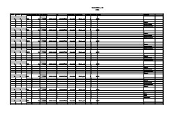
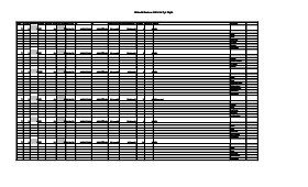
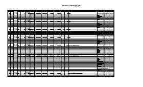
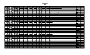
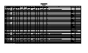
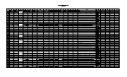
Artifact catalogue containing 2910 records from Sarah site 2004.
Scope and Content
Spreadsheet containing information about the artifacts recovered, including: unit, level, artifact number, catalogue number, depth, co-ordinates, entry date, date recovered,count, weight, UTM co-ordinates, notes(excavators initials and comments) and artifact identification.
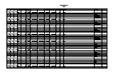
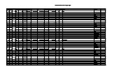
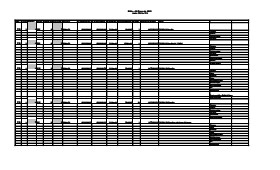
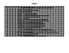
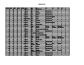
Artifact catalogue containing 522 records from Graham site 2004.
Scope and Content
Spreadsheet containing information about the artifacts recovered, including: unit, level, artifact number, catalogue number, depth, co-ordinates, entry date, date recovered,count, weight, UTM co-ordinates, notes(excavators initials and comments) and artifact identification.
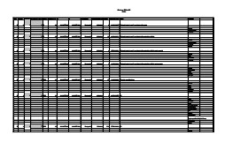
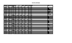
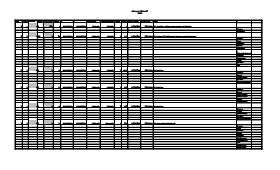
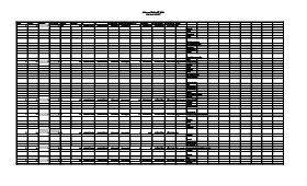
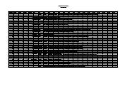
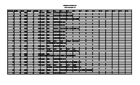
Artifact catalogue containing 2284 records from Graham site 2005.
Scope and Content
Spreadsheet containing information about the artifacts recovered, including: unit, level, artifact number, catalogue number, depth, co-ordinates, entry date, date recovered,count, weight, UTM co-ordinates, notes(excavators initials and comments) and artifact identification.
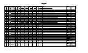
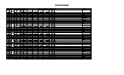
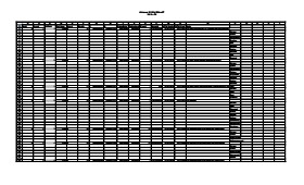
Artifact catalogue containing 694 records from Graham site 2006.
Scope and Content
Spreadsheet containing information about the artifacts recovered, including: unit, level, artifact number, catalogue number, depth, co-ordinates, entry date, date recovered,count, weight, UTM co-ordinates, notes(excavators initials and comments) and artifact identification.
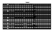
Artifact catalogue containing 628 records from Graham site 2008.
Scope and Content
Spreadsheet containing information about the artifacts recovered, including: unit, level, artifact number, catalogue number, depth, co-ordinates, entry date, date recovered,count, weight, UTM co-ordinates, notes(excavators initials and comments) and artifact identification.
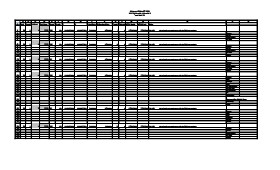
Artifact catalogue containing 636 records from Crepeele site 2003.
Scope and Content
Spreadsheet containing information about the artifacts recovered, including: unit, level, artifact number, catalogue number, depth, co-ordinates, entry date, date recovered,count, weight, UTM co-ordinates, notes(excavators initials and comments) and artifact identification.
Artifact catalogue containing 646 records from Atkinson site 2003.
Scope and Content
Spreadsheet containing information about the artifacts recovered, including: unit, level, artifact number, catalogue number, depth, co-ordinates, entry date, date recovered,count, weight, UTM co-ordinates, notes(excavators initials and comments) and artifact identification.
Artifact catalogue containing 556 records from Atkinson site 2004.
Scope and Content
Spreadsheet containing information about the artifacts recovered, including: unit, level, artifact number, catalogue number, depth, co-ordinates, entry date, date recovered,count, weight, UTM co-ordinates, notes(excavators initials and comments) and artifact identification.
Artifact catalogue containing 343 records from Atkinson site 2006.
Scope and Content
Spreadsheet containing information about the artifacts recovered, including: unit, level, artifact number, catalogue number, depth, co-ordinates, entry date, date recovered,count, weight, UTM co-ordinates, notes(excavators initials and comments) and artifact identification.
Artifact catalogue containing 455 records from Atkinson II site 2004.
Scope and Content
Spreadsheet containing information about the artifacts recovered, including: unit, level, artifact number, catalogue number, depth, co-ordinates, entry date, date recovered,count, weight, UTM co-ordinates, notes(excavators initials and comments) and artifact identification.
The Lovstrom locale first came to the attention of Dr. Nicholson through conversations with landowners Mr. and Mrs. Herb Lovstrom in 1985. Lovstrom is a multi-component archaeological locale located 25km south of Brandon overlooking the Souris River channel. The landowner’s surface collection and the presence of bone and artifacts in a cultivated field indicated the presence of one or more sites.
Limited testing was conducted in 1985 and 1986, followed by major excavations in 1987, 1988 and 1991. Eight sites of block excavations with a total of 132 1m2 excavation units were completed. The locale area extends approximately 500m north from the edge of the Souris Valley escarpment and over 200m east from the Jock’s Creek escarpment.
Physical and biological environment As has been noted above, the locale is bounded on the south by the Souris channel and on the west by the incised channel of Jock’s Creek and a till plain extends to the north and the east. This plain is characterized by buff colored glacial till with numerous rocks embedded in the surface. Surrounding these rocky knolls are dark-soil hollows where the various cultural occupations are found. The depth of the topsoil layer suggests a long term grassland cover with the present oak forest likely developing in historic times due to the elimination of bison grazing and the controlling of prairie fires in late historic times. A small cleared patch of farmland is found within the boundaries of the locale area. This area has provided a substantial surface collection of artifacts.
Present vegetation in the area is a mosaic of aspen/oak forest groves and mesic grass prairie that includes introduced species such as brome grass. In poorly drained areas, willow and red osier dogwood are present. The Lovstrom locale is found in a forested area dominated by oak with an under story of saskatoon, chokecherry, pin cherry, and hazelnut brush. Poison ivy is abundant as well as sarsaparilla.
The major faunal resources in Precontact times would have been bison, with elk and mule deer playing a minor role. Antelope may have been present also. Small animals included snowshoe hare, cottontails, porcupines and beaver. Canids, including wolf, coyote, fox and domesticated dog were present, as well as mustelids such as badger, mink, and weasel. Fragments from a fisher were also recovered in the excavations.
Summation.
The Lovstrom locale has eight sites. The sites were designated and excavated as Blocks A, B, C, D, E, F, G and H. Many of the sites are multi-occupations.
The Vickers materials are primarily confined to Blocks D, E, F, G and H. Vickers Focus materials overlie Blackduck/Duck Bay materials. Blackduck and Duck Bay materials are found in the lower levels of all excavation blocks and in most test units. The Vickers occupations at the Lovstrom locale, based upon ceramic wares and an overlapping of C14 dates, appear to have been contemporary with the Lowton type site to the east, near Belmont. A small protohistoric occupation was identified overlying part of Block D. Faunal remains are abundant with bison clearly dominating the assemblages. Lesser amounts of canid are present as well as small mammals including beaver, hare and mustelids. Small amounts of avian species are also present.
Publications
Nicholson, B.A.
2011 The Role of Pocket Gophers (Thomomys talpoides) in Restructuring Stratigraphic Relationships at the Lovstrom Site. Canadian Journal of Archaeology 35:323-331.
Nicholson, Bev, Scott Hamilton, Matthew Boyd and Sylvia Nicholson
2008 A Late Plains Woodland Adaptive Strategy in the Northern Parklands: the Vickers Focus Forager-Horticulturists. Invited Paper for Papers in Northeastern Plains Prehistory, eds. Michael G. Michlovic and Dennis L. Toom, North Dakota Journal of Archaeology Vol. 8:19-34.
Nicholson, Bev and Scott Hamilton
2001 Cultural Continuity and Changing Subsistence Strategies During the Late Precontact Period in Southwestern Manitoba. Canadian Journal of Archaeology 25:53-73.
Nicholson, Bev
1996 Plains Woodland Influx and the Blackduck Exodus in South-Western Manitoba During the Late Precontact Period. Manitoba Archaeological Journal 6(1):69-85.
Nicholson, Bev and Mary Malainey
1991 Report on the 1991 Field School Excavations at the Lovstrom Site (DjLx-1), Southwestern Manitoba. Manitoba Archaeological Journal 1(2): 51-93.
Nicholson, Bev and Jane Gibson
1990-91 Lovstrom Site Field Report, 1987 Excavations. Saskatchewan Archaeology 11&12:46-68.
Nicholson, Bev and Ian Kuiijt
1990 Field Report and Interpretations of the 1988 Archaeological Excavations at the Lovstrom Site (DjLx-1) in Southwestern Manitoba. North Dakota Journal of Archaeology 4:166-205.
Nicholson, Bev
1990 Ceramic Affiliations and the Case for Incipient Horticulture in Southwestern Manitoba. Canadian Journal of Archaeology 14:33-60.
Nicholson, Bev
1986 The Lovstrom Site: Culture Contact in Prehistory. Manitoba Archaeological Quarterly 10(1):35-71.
Scope and Content
The Series has been divided into nine sub-series, including (1) Survey (2) Block A; (3) Block B (4) Block C; (5) Block D; (6) Block E; (7) Block F; (8) Block G; (9) Block H
The Lovstrom surface collection came from small fields cleared within, and adjacent to, the major portions of the site which were excavated. The Lovstroms initial collection has since been added to by field personnel from Brandon University. The initial collections consisted of lithics and ceramics. A collection of faunal remains from the cultivated area was made by a Brandon University zooarchaeology class in 1986 which yielded specimens of elk, canid, mussels, and sucker, in addition to an expected abundance of bison. Since these materials were in a surface context, it may be that some of the faunal remains were historic.
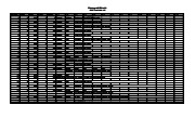
The high biodiversity and evidence of pre-Europeon contact prompted the decision to test the Lovstrom locale. Nine 1m2 units were excavated in 1985 and, in 1986, an additional 15 1m2 units were excavated for a total of 24 test units. This testing indicated the presence of a large precontact locale with lithics, woodland ceramics and large amounts of reasonably well-preserved faunal materials.
The lithics indicated a late Prehistoric occupation (Nicholson 1986:35). However, the ceramics were more useful in that they identified the presence of Late Woodland cultures (Blackduck and Duckbay) and a single Middle Missouri vessel. It is believed that the Middle Missouri vessel was imported since the paste and construction/decorative technology differ distinctively from that of all other vessels recovered from the site. It was on the basis of an examination of these surface finds that the decision to test the Lovstrom site was made. These test excavations were conducted during the summers of 1985 and 1986.
Field investigations through shovel tests, excavation units, and examination of rodent mounds, indicated that the cultural deposits at the Lovstrom locale extend approximately 500m north from the edge of the Souris channel and eastward for over two hundred meters from the escarpment along Jock’s Creek. The presence of dense forest vegetation covering much of the locale, and the subsurface nature of the archaeological deposits obscured surface indications.
Radiocarbon dates: Test Unit 4: 1215/320 BP and Test Unit 8 1280/190 BP
Scope and Content
Sub-series has been divided into sub sub series including: Lovstrom survey 1985 and Lovstrom survey 1986
Field journals have been scanned in multi-page PDF files. Artifact catalogues are PDF files in spreadsheet format. Photographs are in jpeg format.
History / Biographical
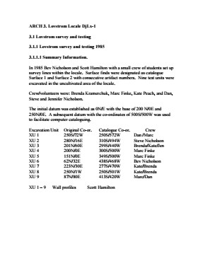
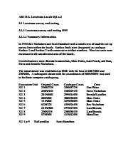
In 1985 the Lovstrom locale was tested by Drs. Nicholson and Hamilton with 5 students. An extensive survey and nine excavations units were opened. This testing indicated the presence of artifacts manufactured by Blackduck and Duckbay peoples from the boreal forest and northern parkland areas. Other ceramics diagnostic of groups from the Saskatchewan Basin and the Middle Missouri area were also recovered in surface collection from the cultivated area of the locale.
Scope and Content
Sub-sub-sub series contains: Summary information of field methology, number and co-ordinates of excavations, personnel and their staff position.
Field journals have been scanned in multi-page PDF files. Artifact catalogues are PDF files in spreadsheet format. Photographs are in jpeg format.
History / Biographical
Under Dr. Nicholson’s direction and crew chief Brenda Kramarchuk with crew of Kate Peach and Blaine Frenette an additional sample of 15 units were excavated in 1986. This work confirmed the results of the first season, and resulted in an increased sample of faunal material, lithics, ceramics, and in the identification of distinctive ceramic clusters from different locations within the locale. These two seasons of testing satisfactorily demonstrated the presence of a large Prehistoric locale that warranted further exploration.
Scope and Content
Sub-sub-sub series contains: Summary information of field methology, number and co-ordinates of excavations, personnel and their staff position.
Radiocarbon date reports have been scanned in multi-page PDF files.
History / Biographical
The Crepeele locale is located within the larger Lauder Sandhills area, located in southwestern Manitoba. The area is a complex region of high biodiversity made up of stabilized sand dunes and wetlands that encourage the development of mixed forest and grass prairie. This area provided a variety of subsistence resources for pre-European hunter-gatherers. At the present time the grass prairie is now farm land but the areas of vegetated sand dunes have not been cultivated and have revealed numerous pre-contact archaeological sites.
Archaeological surveying was conducted in 2003. The results of the 2003 Casselman survey showed over 300 test uints contained cultural material and indicated several areas for further examination including the Crepeele site DiMe-29, Sarah site DiMe-28 and Graham sites DiMe-30.
From 2003 to 2008 field work took place at the locale with 75 - 1m x1m units excavated. The Crepeele locale is a complex region of high biodiversity made up of stabilized sand dunes and wetlands that encourage the development of mixed forest and grass prairie. This area provided a variety of subsistence resources for pre-European hunter-gatherers. At the present time the grass prairie is now farm land but the areas of vegetated sand dunes have not been cultivated and have revealed numerous pre-contact archaeological sites.
To help establish the cultural sequence at the locale Radiocarbon dates were obtained from the three sites in the Crepeele locale.
Radiocarbon dating
The technique of radiocarbon dating was developed by Willard Libby and his colleagues at the University of Chicago in 1949.
Radiocarbon dating is used to estimate the age of organic remains from archaeological sites. Organic matter has a radioactive form of carbon (C14) that begins to decay upon death. C14 decays at a steady, known rate of a half life of 5,730 years. The technique is useful for material up to 50,000 years. Fluctuations of C14 in the atmosphere can affect results so dates are calibrated against dendrochronology. Radiocarbon dates are calibrated to calendar years.
Dates are reported in radiocarbon years or Before Present. Before Present refers to dates before 1950. The introduction of massive amounts of C14, due to atomic bomb and surface testing of atomic weapons, has widely increased the standard deviation on all dates after A.D. 1700 causing these dates to be unreliable.
Accelerated mass spectrometry can more accurately measure C14 with smaller samples and can date materials to 80,000 years.
Scope and Content
Sub sub series contains radiocarbon dates from: Crepeele, Sarah and Graham sites.
The high biodiversity and evidence of pre-Europeon contact prompted the decision to test the Crepeele locale. The survey was named in recognition of the Casselman family, the original landowners.
Archaeological testing began in the Crepeele locale in May 2003 on property now owned by the Crepeele family. The locale covers over 6 sections or approximately 3,800 acres of land in an area of stabilized sand dunes and wetlands covered with mixed forest and prairie grass. Given the terrain, the size of the crew and time constrains, an area of approximately 60 acres was chosen for the survey. The survey used the established archaeological methodology of walking the selected area and using a shovel test surveyed grid. The use of GIS technology to locate the exact test spot and record the information into a GIS database was a significant advance and was one of the advantages of the integration of multi-disciplinary techniques encouraged by the SCAPE project. Over one half of the test pits resulted in the recovery of cultural materials. The results of the Casselman survey indicated several areas for further examination including areas that became the Crepeele, Sarah and Graham sites.
Scope and Content
Sub sub series has been divided into five sub sub sub series including: (1) Summary information; (2) Field journals; (3) Site records; (4) Artifact catalogues; and (5) Photographs.
Radiocarbon date reports have been scanned in multi-page PDF files.
History / Biographical
The North Lauder locale has a long archaeological and geological history that is important for understanding the forces that shaped the region. Archaeological research in the locale shows that the area has been occupied by humans for at least the past 6,500 years. Environmental forces provided an area of diverse resources that attracted early peoples.
Archaeologists from Brandon University have been conducting research in the North Lauder locale that has focused on the Atkinson site, a 6,500 year old hunter-gatherer site and Flintstone Hill.
The geomorphology of the glacial Lake Hind Basin over the past 11,000 years is known primarily through the study of a cut bank along the Souris River. Flintstone Hill contains the most complete stratigraphic record for the post-glacial period on the northern plains. The site has been extensively studied by geoarchaeologists, geologists and paleoenvironmentalists over many years and their findings have contributed to our understanding of the region.
Radiocarbon dates were obtained from the Atkinson site and Flintstone Hill.
Radiocarbon dating
The technique of radiocarbon dating was developed by Willard Libby and his colleagues at the University of Chicago in 1949.
Radiocarbon dating is used to estimate the age of organic remains from archaeological sites. Organic matter has a radioactive form of carbon (C14) that begins to decay upon death. C14 decays at a steady, known rate of a half life of 5,730 years. The technique is useful for material up to 50,000 years. Fluctuations of C14 in the atmosphere can affect results so dates are calibrated against dendrochronology. Radiocarbon dates are calibrated to calendar years.
Dates are reported in radiocarbon years or Before Present. Before Present refers to dates before 1950. The introduction of massive amounts of C14, due to atomic bomb and surface testing of atomic weapons, has widely increased the standard deviation on all dates after A.D. 1700 causing these dates to be unreliable.
Accelerated mass spectrometry can more accurately measure C14 with smaller samples and can date materials to 80,000 years.
Scope and Content
Sub sub series contains radiocarbon dates from: the Atkinson site and Flintstone Hill.