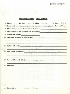
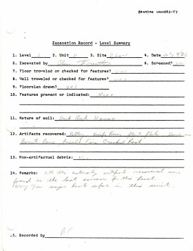
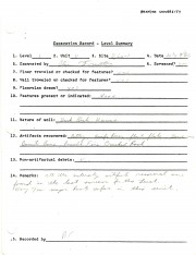
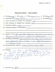
Record of site excavation unit 20 during the 1986 Lovstrom survey.
Scope and Content
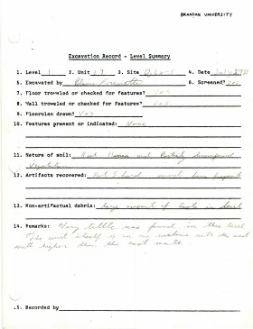
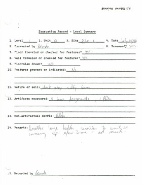
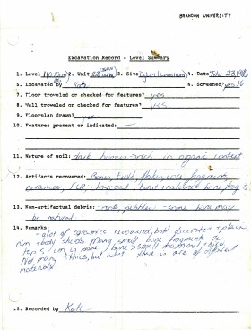
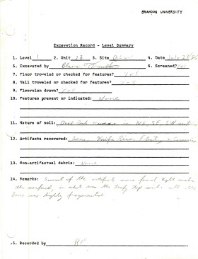
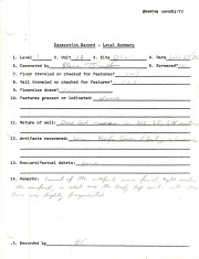
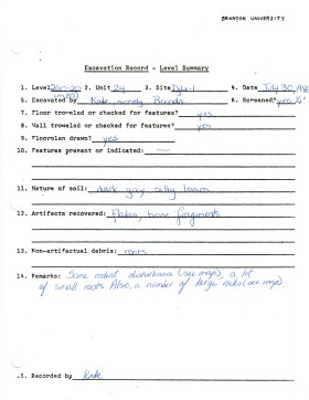
Site records of excavation units may include: level summaries, floor plans, feature sheets, wall profiles, unit summaries and any other additional information relating to the unit.
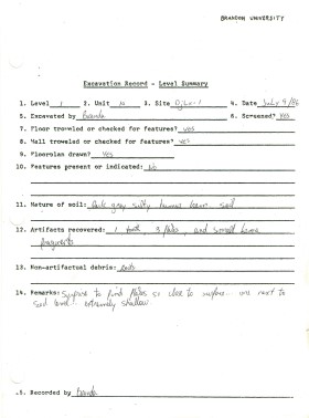
Record of site excavation unit 10 at the Lovstrom survey 1986.
Scope and Content
Site records of excavation units may include: level summaries, floor plans, feature sheets, wall profiles, unit summaries and any other additional information relating to the unit.
Record of site excavation unit 11 at the Lovstrom survey 1986.
Scope and Content
Site records of excavation units may include: level summaries, floor plans, feature sheets, wall profiles, unit summaries and any other additional information relating to the unit.
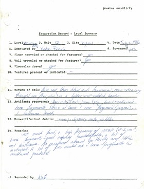
Record of site excavation unit 12 during the 1986 Lovstrom survey.
Scope and Content
Site records of excavation units may include: level summaries, floor plans, feature sheets, wall profiles, unit summaries and any other additional information relating to the unit.
Record of site excavation unit 13 during the 1986 Lovstrom survey.
Scope and Content
Site records of excavation units may include: level summaries, floor plans, feature sheets, wall profiles, unit summaries and any other additional information relating to the unit.
Record of site excavation unit 14 during the 1986 Lovstrom survey.
Scope and Content
Site records of excavation units may include: level summaries, floor plans, feature sheets, wall profiles, unit summaries and any other additional information relating to the unit.
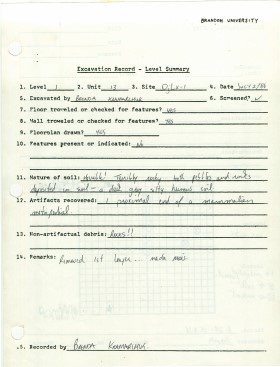
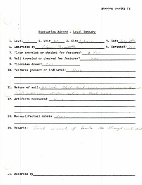
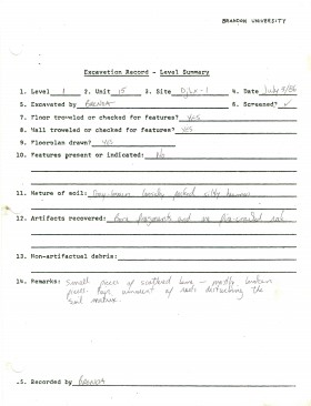
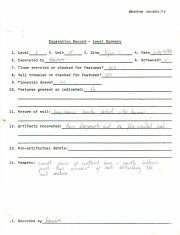
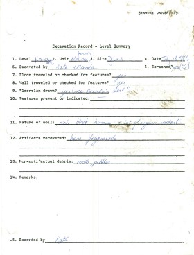
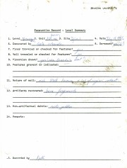
Record of site excavation unit 15 during the 1986 Lovstrom survey.
Scope and Content
Site records of excavation units may include: level summaries, floor plans, feature sheets, wall profiles, unit summaries and any other additional information relating to the unit.
Record of site excavation unit 16 during the 1986 Lovstrom survey.
Scope and Content
Site records of excavation units may include: level summaries, floor plans, feature sheets, wall profiles, unit summaries and any other additional information relating to the unit.
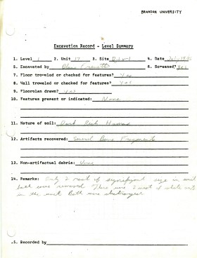
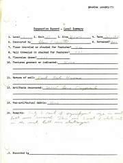
Record of site excavation unit 17 during the 1986 Lovstrom survey.
Scope and Content
Site records of excavation units may include: level summaries, floor plans, feature sheets, wall profiles, unit summaries and any other additional information relating to the unit.
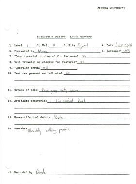
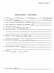
Record of site excavation unit 18 during the 1986 Lovstrom survey.
Scope and Content
Site records of excavation units may include: level summaries, floor plans, feature sheets, wall profiles, unit summaries and any other additional information relating to the unit.
Record of site excavation unit 19 during the 1986 Lovstrom survey.
Scope and Content
Site records of excavation units may include: level summaries, floor plans, feature sheets, wall profiles, unit summaries and any other additional information relating to the unit.
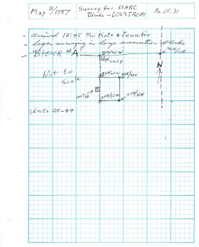
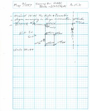
Record of site excavation unit 21 during the 1986 Lovstrom survey.
Scope and Content
Site records of excavation units may include: level summaries, floor plans, feature sheets, wall profiles, unit summaries and any other additional information relating to the unit.
Record of site excavation unit 22 during the 1986 Lovstrom survey.
Scope and Content
Site records of excavation units may include: level summaries, floor plans, feature sheets, wall profiles, unit summaries and any other additional information relating to the unit.
Record of site excavation unit 23 during the 1986 Lovstrom survey.
Scope and Content
Site records of excavation units may include: level summaries, floor plans, feature sheets, wall profiles, unit summaries and any other additional information relating to the unit.
Record of site excavation unit 24 during the 1986 Lovstrom survey.
Scope and Content
Site records of excavation units may include: level summaries, floor plans, feature sheets, wall profiles, unit summaries and any other additional information relating to the unit.
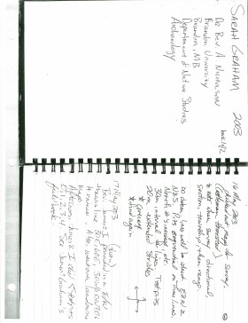
The high biodiversity and evidence of pre-Europeon contact prompted the decision to test the Crepeele locale. The survey was named in recognition of the Casselman family, the original landowners.
Archaeological testing began in the Crepeele locale in May 2003 on property now owned by the Crepeele family. The locale covers over 6 sections or approximately 3,800 acres of land in an area of stabilized sand dunes and wetlands covered with mixed forest and prairie grass. Given the terrain, the size of the crew and time constrains, an area of approximately 60 acres was chosen for the survey. The survey used the established archaeological methodology of walking the selected area and using a shovel test surveyed grid. The use of GIS technology to locate the exact test spot and record the information into a GIS database was a significant advance and was one of the advantages of the integration of multi-disciplinary techniques encouraged by the SCAPE project. Over one half of the test pits resulted in the recovery of cultural materials. The results of the Casselman survey indicated several areas for further examination including areas that became the Crepeele, Sarah and Graham sites.
Scope and Content
Sub sub series has been divided into five sub sub sub series including: (1) Summary information; (2) Field journals; (3) Site records; (4) Artifact catalogues; and (5) Photographs.