Situated in the R.M. of Whitehead on the Little Saskatchewan River, the 10 Mile Dam was a 14 kilometer transmission line that supplied the city of Brandon with power. The Brandon Electric Light Company built the dam in 1900 and it is considered Manitoba's first hydroelectic power generating station. The dam spanned approximately 80 meters and was constructed from timber and reinforced with clay and stone. The station was decommissioned in 1924.
Scope and Content
Photograph shows 10 Mile Dam, also known as the Brandon Dam or Minnedosa River Hydro Plant.
Notes
Writing on the back of the photograph reads: "10 mile dam". Biographical information obtained from Manitoba Historical Society.
Situated in the R.M. of Whitehead on the Little Saskatchewan River, the 10 Mile Dam was a 14 kilometer transmission line that supplied the city of Brandon with power. The Brandon Electric Light Company built the dam in 1900 and it is considered Manitoba's first hydroelectic power generating station. The dam spanned approximately 80 meters and was constructed from timber and reinforced with clay and stone. The station was decommissioned in 1924.
Alonzo Archibald Rowe (b. 1862, London, ON; d. 22 Oct 1951, Brandon). The Rowes were considered Brandon area pioneers. Alonzo’s father, Alonzo L. Rowe, came to Brandon with his family in 1881, where the family had a furniture and undertaker business on the west side of 10th Street between Rosser and Princess Avenues. In 1885, the family began farming west of Brandon and Alonzo Archibald served as a councilor and then a reeve in the R.M. of Whitehead. He returned to Brandon in 1907 and served with the Brandon Police Department until 1910, when he returned to farming, this time in Arrow River. A.A. Rowe returned to Brandon in 1915 to work as a Provincial Licenses Inspector, a position he held until 1938. (Source: Obituary, Brandon Daily Sun 22 Oct 1951)
Custodial History
Photograph was in possession of Mrs. Ruby Miles, who passed the image on to Fred McGuinness. McGuinness makes reference to Mrs. Miles and this photograph in his Sunbeams column (Source: F.A. Rosser, "Another interesting chat with a daughter of the plains," Brandon Sun 18 Aug 1981).
Scope and Content
Photograph shows four fishermen at 10 Mile Dam, also known as the Brandon Dam or Minnedosa River Hydro Plant. The fishermen in the photo are identified as George H. Rowe and his father A.A. Rowe, Dr. Wilfred Bigelow, and Al Collins.
Notes
Writing on the back of the photograph reads: at Brandon Dam, [right to left] son and father - George H. ROWE, Mr. A.A. ROWE, Dr. BIGELOW, Al COLLINS (dam?, 1906?, George born March 1897); Jerrett's Photo-Services, May 7 1938.
Situated in the R.M. of Whitehead on the Little Saskatchewan River, the 10 Mile Dam was a 14 kilometer transmission line that supplied the city of Brandon with power. The Brandon Electric Light Company built the dam in 1900 and it is considered Manitoba's first hydroelectic power generating station. The dam spanned approximately 80 meters and was constructed from timber and reinforced with clay and stone. The station was decommissioned in 1924.
Scope and Content
Photograph shows 10 Mile Dam, also known as the Brandon Dam or Minnedosa River Hydro Plant. The dam's timber construction is quite evident in the picture.
Notes
Writing on the back of the photograph reads: McGuinness (Manitoba Hydro), on Little Saskatchewan.
Stuckey left a variety of materials in his collection in an unsorted state. Rather than allocate those materials to one of the existing sub-series, the McKee Archives chose to artificially create this sub-series, which has been designated "unsorted materials."
For history/bio information for Lawrence Stuckey see the collection level description of the Lawrence Stuckey collection.
Custodial History
For custodial history see the collection level description of the Lawrence Stuckey collection.
Scope and Content
Sub-series consists of photographic prints, photograph albums, postcards and negatives covering a variety of subjects including Brandon, ships, boats, threshermens' reunions, and rural Manitoba. Some of the prints correspond with negatives held in other sub-series in the Stuckey collection. If possible, the connection between the print and negative has been made at the item level. Some of the items are original and quite rare.
The dates given for many of the prints in this sub-series refer to the date the photograph was taken and not the date the print was made from the original negative.
Notes
Unidentifiable photographs not taken by Lawrence Stuckey and redundant prints were culled.
Repro Restriction
The McKee Archives is the copyright holder for the Stuckey materials.
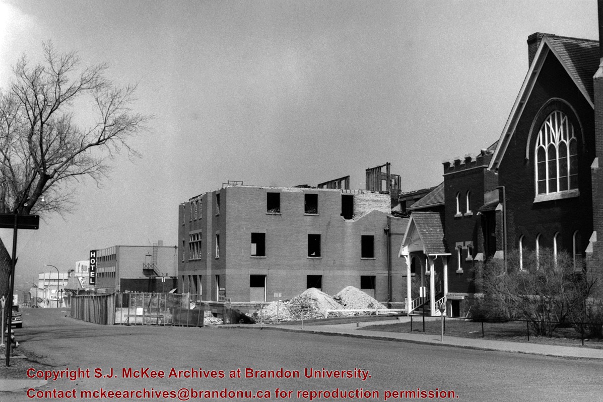
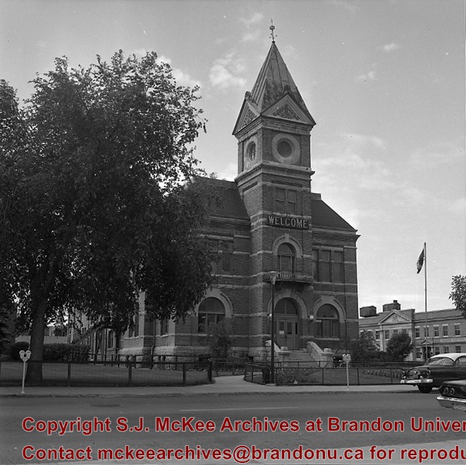
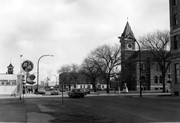
First Church United began as the First Methodist Church. It was renamed in c. 1925 and was located on the corner of 8th Street and Lorne Avenue, just south of the YMCA. From 1913-1919, A.E. Smith was the Methodist minister. The church was demolished c. 1975.
Scope and Content
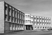
Photograph is looking northeast and shows First Church United.
Repro Restriction
The McKee Archives is the copyright holder for the Stuckey materials.
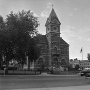
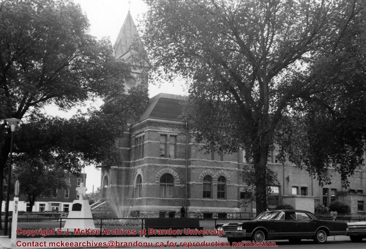
Photograph is looking northeast and shows the east side of the 200 block of 8th Street. Visible are First Church United, the YMCA under construction and the Beaubier Hotel.
Repro Restriction
The McKee Archives is the copyright holder for the Stuckey materials.
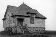
Bethel Temple was an evangelical Protestant church. The Elspeth Reid Family Resource Centre, at 255 9th Street, has been located at the same location as the former Bethel Temple since 1995.
Scope and Content
Photograph is looking northeast and shows Bethel Temple with Princess Park Apartments under construction in the background.
Repro Restriction
The McKee Archives is the copyright holder for the Stuckey materials.
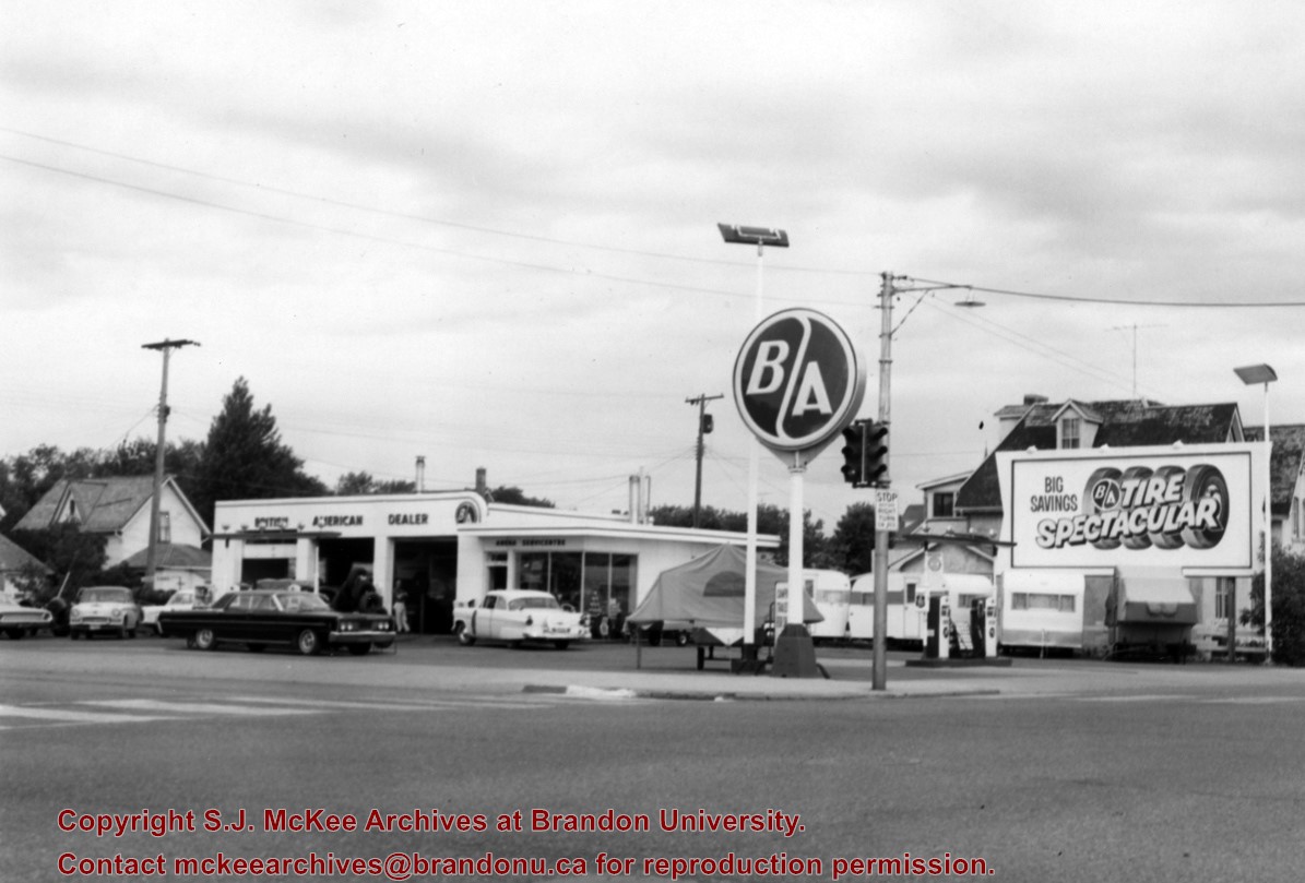
The British American gas station was located on the north side of Victoria Avenue between 10th and 11th Streets. An Esso gas station later occupied the site; at present it is the parking lot and building for the Manitoba Liquor Commission retail outlet.
Scope and Content
Photograph is looking northwest from across Victoria Avenue and shows the British American station building, signs, gas pumps and various cars in the lot.
Repro Restriction
The McKee Archives is the copyright holder for the Stuckey materials.
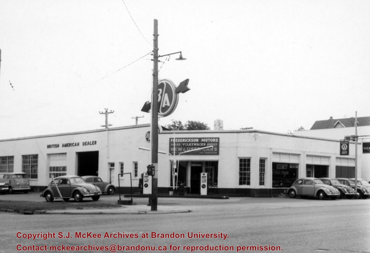
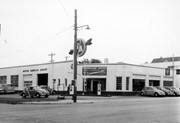
Frederickson Motors was located on the east side of 10th Street and Louise Avenue. It was a British American and Volkswagon dealer. It was later bought by Charlie Tosch and Doug McGill and renamed Tosch-McGill Motors. The location is currently a parking lot for City Hall.
Scope and Content
Photograph is looking northwest from across Victoria Avenue and shows the British American station building, signs, gas pumps and various cars in the lot.
Repro Restriction
The McKee Archives is the copyright holder for the Stuckey materials.


.jpg?width=1200&404=no-img.jpg&watermark=wmk)
.jpg?width=180&404=no-img.jpg)
.jpg?width=1200&404=no-img.jpg&watermark=wmk)
.jpg?width=180&404=no-img.jpg)
.jpg?width=1200&404=no-img.jpg&watermark=wmk)
.jpg?width=180&404=no-img.jpg)
.jpg?width=1200&404=no-img.jpg&watermark=wmk)
.jpg?width=180&404=no-img.jpg)

.jpg?width=1200&404=no-img.jpg&watermark=wmk)
.jpg?width=180&404=no-img.jpg)


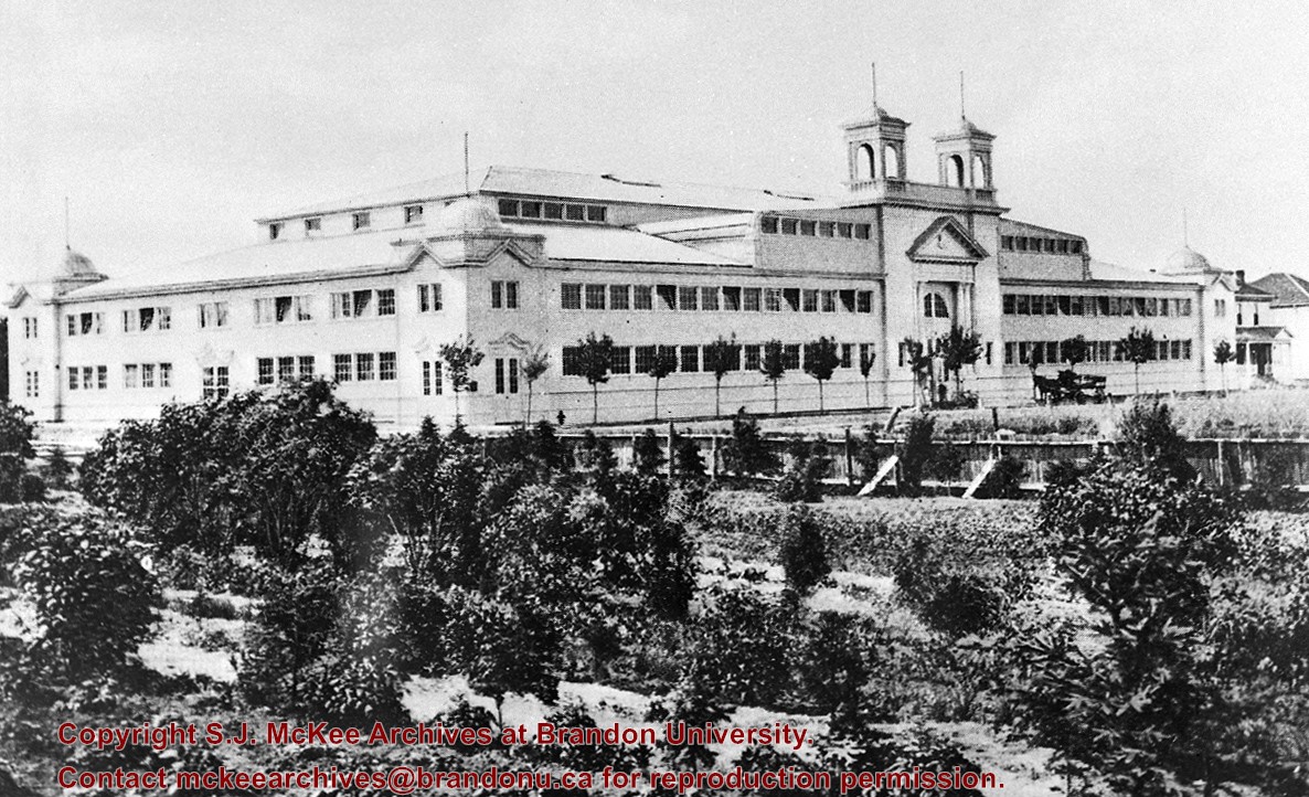
.jpg%3fmaxheight%3d1000%26maxwidth%3d1000%26watermark%3dwmk&description=Education+building)
.jpg%3fmaxheight%3d1000%26maxwidth%3d1000%26watermark%3dwmk&description=Education+building)
.jpg%3fmaxheight%3d1000%26maxwidth%3d1000%26watermark%3dwmk&description=First+church+united)
.jpg%3fmaxheight%3d1000%26maxwidth%3d1000%26watermark%3dwmk&description=Bethel+temple)
.jpg%3fmaxheight%3d1000%26maxwidth%3d1000%26watermark%3dwmk&description=Brandon+college+building+and+clark+hall)