Staff summary of evidence : hearing concerning the transportation of dangerous commodities and recommendations contained in the report of the Mississauga Railway Accident Inquiry
Block B consisted of 20 contiguous 1m2 units excavated to 30 cm below surface. (except unit 58 which was excavated to 35 cm bs to obtain extended soil profile). The block is situated in recent oak and poplar forest at the head of a ravine leading to Jock’s Creek, adjacent to an area cleared for market gardening. As was the case with Block A, the understory is heavily overgrown with hazelnut, chokecherry, saskatoon, and a poison ivy/sarsaparilla ground cover.
The soil levels below the sod in Block B consisted of a black, silty, and gritty loam layer from 5 cm to 23 cm below surface, a yellow and sandy clay from 23 cm to 30 cm below surface, and glacial till at 30 cm below surface. As in Block A, limestone cobbles were found throughout the occupation level around the bone. It is evident that bioturbation – primarily tree roots and rodent burrowing – have significantly altered patterns of original deposition of lithics, ceramics and small bone.
The faunal layer lay close to the surface, situated entirely in the black loam 5 cm – 23 cm below surface. The 23 cm depth also marked the end of the dark silty loam. At 10 cm below surface, a discernible patterning of the bone appeared. Concentrations of bone in narrow rows ran in an irregular pattern from the northwest to the southeast part of the block. This pattern was most apparent in the north end of the block which is the highest point in the block. In the same 1m2 unit, patches of weathered, very poorly preserved bone would be found lying close to patches of well preserved bone. It is believed that this variability in preservation results from uneven rates of burial due to taphic activities of pocket gophers or other agents of bioturbation. The same pattern of uneven preservation occurs over much of the locale but is most evident in Block B.
Diagnostic lithics included eleven projectile points that were predominantly Plains or Prairie Side-notch types, but included two unnotched triangular points. Cord-wrapped impressed rim sherds and body sherds were recovered. The ceramics are variants of the Woodland Blackduck horizon.
RC dates: XU49 – 675/80 BP XU 59 – 705/75BP.
Scope and Content
Sub-sub-sub series contains: Summary information of field methology, number and co-ordinates of excavations, personnel and their staff position; Field journals are daily records of recoveries, features and activities at the site; Site records include excavation level and unit summaries, feature sheets, profiles; sample records and maps; Artifact catalogues are lists and identifications of all artifacts recovered; Photographs are of excavation units, features, the landscape and personnel.
In 1901, American entrepreneur Francis Hector Clergue (1856-1939) obtained the charter for the Ontario, Hudson Bay and Western Railway. Following his purchase, he reincoporated the Algoma Central Railway to the Algoma Central and Hudson's Bay Railway. (Source: Sault St. Mairie Public Library, "Transportation - Algoma Central Railway," Sault History Online, 2008)
Scope and Content
Photograph shows railroad tracks cutting through the Canadian Shield.
Notes
Writing beneath the photograph in the album reads: Algoma Central & Hundson Bay Ry.
The Lake Talbot tresle was a point along the Algoma Central Railway line that connected the Helen Mine to the Michipicoten Harbour. It is located north of Wawa and southwest of the Helen Mine.
Scope and Content
Photograph shows several men walking a railway line. Before them is a tresle bridge.
Notes
Writing beneath the photograph in the album reads: Lake Talbott Tresle [sic.]
See fonds level description of RG 4 for history/bio of MPE
Scope and Content
This sub-series consists of summaries of elevator operations. The records include the following:
Box 1:
Summary of Operations 1925-1968 Alexander-Gretna
Summary of Operations 1925-1968 Hamiota-Morris
Summary of Operations 1925-1968 Napinka-Woodnorth
Box 2:
Association Financial and Debt Repayment Summary 1925-1963
Association Financial and Debt Repayment Summary 1925-1963
Box 3:
Summary of Operations 1964-1968
Summary of Operations 1964-1968
Summary of Operations 1964-1968
Box 4:
Summary of Operations A-K 1925-1996
Summary of Operations L-Z 1925-1996
Elevator Points Closed A-L 1926-1987
Elevator Points Closed M-Z 1926-1987
According to Stuckey and Bain (1996), “The Brandon, Saskatchewan & Hudson’s Bay Railway was built and operated as a totally owned subsidiary of the Great Northern Railway. Construction commenced in late 1905 and by the end of 1905, less than a mile of track had been laid north of the boundary at St. John. In 1906, the remaining 68.6 miles to Brandon were laid and service commenced that year. During the Depression of the 1930s, traffic declined significantly and the entire branch was abandoned in 1936. Over much of the branch’s length, the ties and rails were laid on the prairie without ballast and today little remains of the line apart from traces where there were cuts and bridges.” (p. 18)
Stuckey, L. A., & Bain, D. M. (1996). The Great Northern and Northern Pacific railways in Canada. Calgary, Alberta: British Railway Modellers of North America.
Custodial History
For custodial history see the collection level description of the Lawrence Stuckey collection.
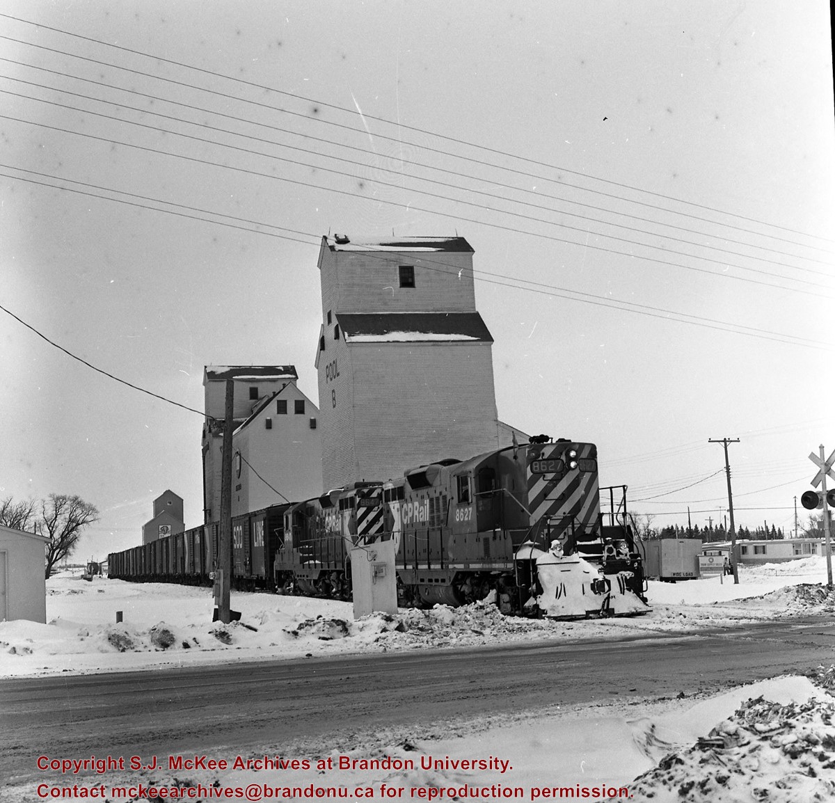
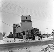
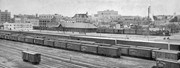
Scope and Content
View of Canadian Pacific (foreground) and Great Northern (background) railway yards, as well as Great Northern station in Brandon, Manitoba.
Notes
Shows a 500 series F-1 class 2-8-0 engine switching
Published in Canadian Rail, August 1975
Buildings that are visible in this photo, but now gone (1987), include Codvilles, Western Grocers (Burbridge Saddlery), John E. Smith Block, Federal building, City Hall, and the Prince Edward Hotel [Fred McGuinness collection (20-2009)].
[This copy negative was produced using a previously published image. P.E. 30/07/09]


