See fonds level description of the Alf Fowler collection for custodial history.
Scope and Content
Photo was taken from the 100 block of 10th Street looking north. At the bottom of 10th Street is the CPR Station. Also visible are the Canadian Bank of Commerce, the Cecil Hotel, The Sun, the Royal Bank of Canada and the awning on Davidson & Gowen.
Notes
An 11.75" x 8" (b/w) print of this photograph is located with the orignal at 6-1999.2. A digital scan of the photograph is available on a CD located in the Archives' office.
Storage Range
RG 5 Western Manitoba Manuscript collection - photograph storage drawer
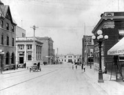
See fonds level description of the Alf Fowler collection for custodial history.
Scope and Content
Photo shows the the corner of 10th Street and Rosser Avenue, looking northwest. Visible businesses include: the Canadian Bank of Commerce; The Sun; Canadian Pacific; Brandon Brick Co.; T. Bronson; Fraser and Co.; and the John E. Smith Block.
Storage Range
RG 5 Western Manitoba Manuscript collection - photograph storage drawer
See fonds level description of the Alf Fowler collection for custodial history.
Scope and Content
Photo was taken of 10th Street from Pacific Avenue looking sourth. Visible businesses include: the Cecil Hotel; the Canadian Bank of Commerce; Campbell and Campbell; and the Bank of British North America
Storage Range
RG 5 Western Manitoba Manuscript collection - photograph storage drawer
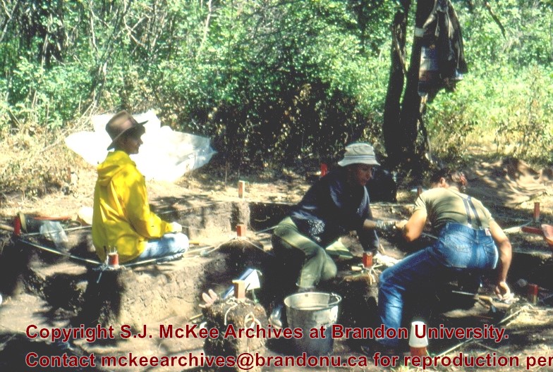
Block A was the most southern site in the locale. The excavation block consisted of 12 contiguous 1m2 units dug in a 3m x 4m rectangle. The block was the least productive of cultural materials, and bone preservation was the poorest. Under the sod, the black loam layer appeared at 5 cm below surface, and the glacial clay at 25 cm below surface. Excavators described the soil matrix as gritty and silty, and it became concrete hard when dried.
The occupation or bone layer extended from 10 to 25 cm below surface and consisted of a contiguous scatter of FCR and unidentifiable large ungulate bone which was heavily processed and intensively scavenged by carnivores. Most cultural materials were recovered within this layer. Fire cracked rock (FCR) and small burnt bone fragments were present but no intact hearths or processing features were evident.
Non-cultural materials included limestone and other natural pebbles derived from the parent till. (These small limestone pebbles were apparent in the occupation layers in other blocks as well). Root and rodent disturbance was extensive throughout Block A. Most units were excavated to gravelly clay till. Nine of the twelve units were dug to level 4b, which ended at 40 cm b.s.
No further excavations were done at this site. No C14 dates were taken.
Scope and Content
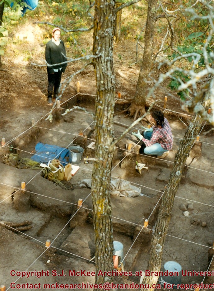
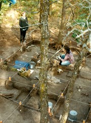
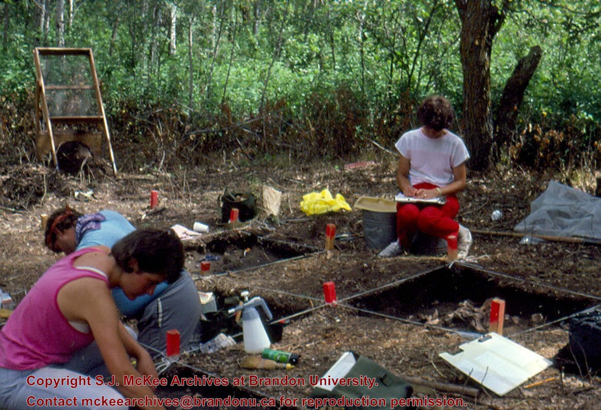
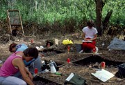
Sub-sub-sub series contains: Summary information of field methology, number and co-ordinates of excavations, personnel and their staff position; Field journals are daily records of recoveries, features and activities at the site; Site records include excavation level and unit summaries, feature sheets, profiles; sample records and maps; Artifact catalogues are lists and identifications of all artifacts recovered; Photographs are of excavation units, features, the landscape and personnel.
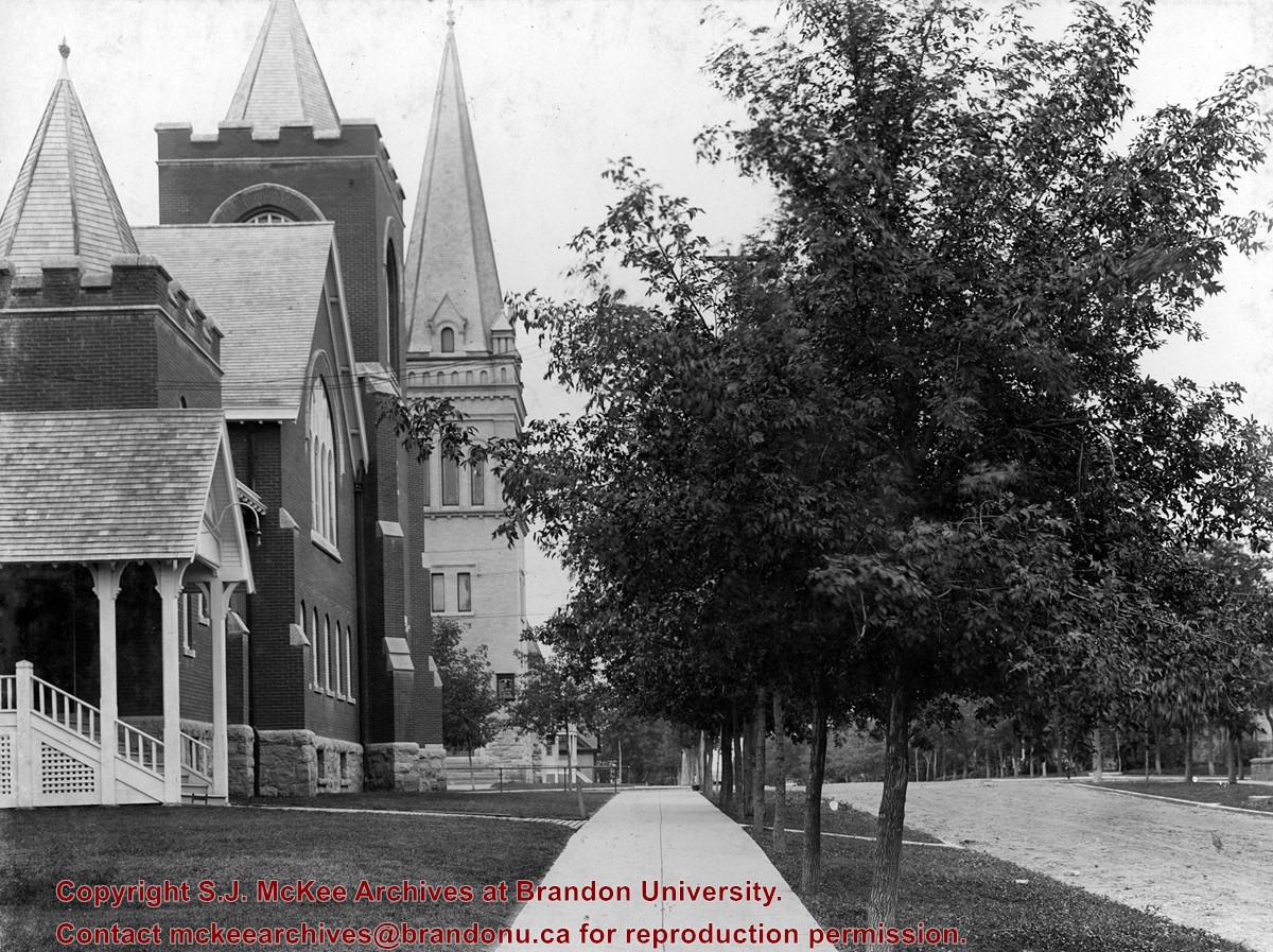
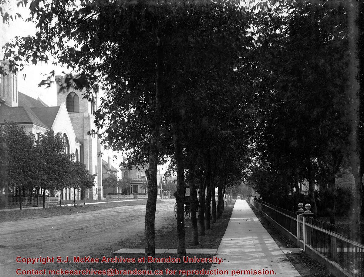
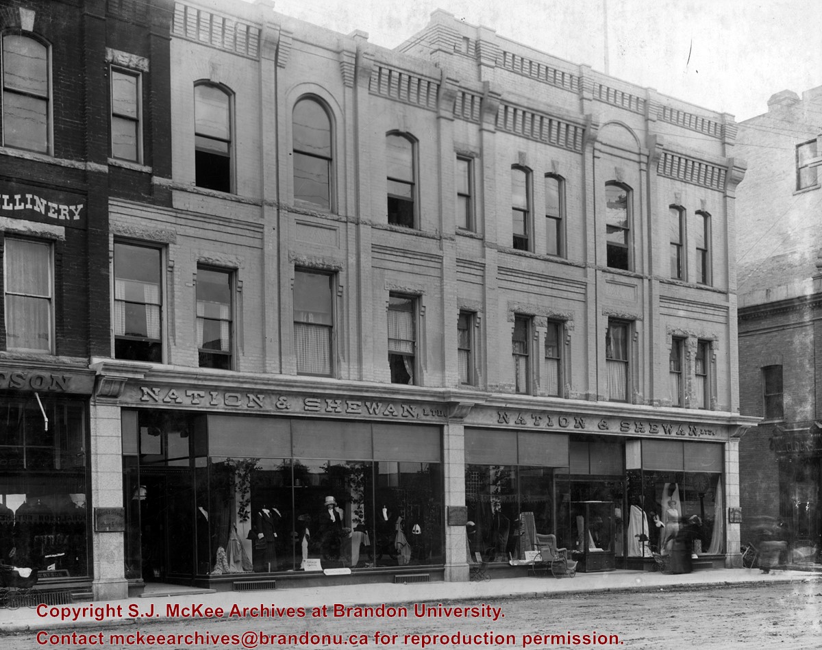
Erected in 1889, at 806 Rosser Avenue (the southeast corner of Rosser Avenue and 7th Street), the building was designed by Brandon architect W.H. Shillinglaw. At the time of its construction the structure housed the Nation Department Store, which became Nation & Shewan Department Store in 1894. One of Brandon’s largest and most successful drygoods businesses, the venture was owned and operated by Fred Nation and Alexander Shewan.
Built adjacent to an existing three storey brick building known as the A.D. Rankin Block (built sometime between 1885 and 1888), this smaller building was eventually absorbed by the Nation and Shewan Block after 1897, when Rankin Drygoods moved into the newly constructed Syndicate Block located farther east down Rosser Ave. Later, the Rankin Block became known as Nation Chambers. These two structures comprised what was known as the Nation and Shewan Block.
Major improvements were made to the store and an annex was added in 1910. Some of the renovation additions included, but were not limited to: an updated frontage with new copper sash windows and prismatic glass tops, plate glass windows, new fixtures and carpet. With the renovations the floor space of the business was almost doubled. The stock of the business also increased, with the Brandon Weekly Sun reporting that when finished, Nation & Shewan would be a “store of which the citizens of Brandon will be justly proud.”
The drygoods firm operated until Nation’s death 1926, when it became known as A. Shewan Limited. From 1933 to 1944, the business was known as Shewan and Son. Shortly thereafter, the Metropolitan Stores Ltd began operating out of the Nation & Shewan Block.
In 2000, the Town Centre prepared to knock down what was then known as the Red Apple Building, the former Nation & Shewan Block. The demolition was to make way for the new atrium and entrance for the mall, and begin a new period of redevelopment at the downtown shopping centre.
Custodial History
See fonds level description of the Alf Fowler collection for custodial history.
Scope and Content
Photo shows the front of the Nation & Shewan Block, which was located in the 800 block of Rosser Avenue on the southside.
Storage Range
RG 5 Western Manitoba Manuscript collection - photograph storage drawer
See fonds level description of the Alf Fowler collection for custodial history.
Scope and Content
Photo was taken of Rosser Avenue from 7th Street looking west. Visible businesses include: ? and Ball; Vincent & MacPherson; W.N. Finlay; Christie's; J. Burchill; the Empire Hotel; and Fleming's Drug Store. A number of people and vehicles are visible on both sides of the street.
Notes
A digital scan of the photograph is available on a CD located in the Archives' office.
Storage Range
RG 5 Western Manitoba Manuscript collection - photograph storage drawer
See fonds level description of the Alf Fowler collection for custodial history.
Scope and Content
Photo was taken of Rosser Avenue, looking east from 11th Street. Visible in the photo are the Merchant's Bank of Canada, A. Smith, and the Union Bank of Canada. A number of people and vehicles are also visible.
Storage Range
RG 5 Western Manitoba Manuscript collection - photograph storage drawer
Block C was situated in sparse oak forest with an understory of saskatoon, hazelnut and a thick ground cover of poison ivy and sarsaparilla. The block measured 3m and 3m and contained nine excavation units. All units were excavated to 35cm below surface. The soil horizons were much like the other blocks, except for a rusty brown stain in the first level, giving the upper black loam a mottled appearance. The brown patches were clay mixed with loam and were harder than the surrounding matrix. No definitive interpretation of these phenomena was attempted but this effect may be the result of natural brush or forest fires. Under the 5cm so d/humus (Ah) layer, the loam horizon extended approximately 5cm – 25 cm below surface, and averaged 20 cm thick. Bone was concentrated within this horizon between 10 cm – 20 cm below surface.
Block C was notable for its concentrations of articulated bison bone. Most noteworthy was an articulated unit composed of lumbar vertebrae, pelvis, and sacrum. Several thoracic vertebra/proximal rib end concentrations were also recovered. There were more vertebrae and rib sections recovered in the units in proportion to other bones. A few sherds, some debitage and a single Prairie Side-Notched point fragment were among the recoveries. Based on the quantity of bone, the density of the bone layer, and the articulated butchering units the area has been interpreted as a bone midden.
Faunal material was analysed by Jessica MacKenzie for her Honours Thesis: "A reconstruction of butchering processes in Block C from the Lovstrom site DjLx-1 in Southwestern Manitoba."
Radiocarbon date: 850/115BP XU 79.
Scope and Content
Sub-sub-sub series contains: Summary information of field methology, number and co-ordinates of excavations, personnel and their staff position; Field journals are daily records of recoveries, features and activities at the site; Site records include excavation level and unit summaries, feature sheets, profiles; sample records and maps; Artifact catalogues are lists and identifications of all artifacts recovered; Photographs are of excavation units, features, the landscape and personnel.
Block D was wooded with oak and an understory of saskatoon and hazelnut with a thick ground cover of poison ivy and sarsaparilla. Root and rodent disturbance was extensive.
Based on the recoveries from Test Unit 22 during the survey, further excavations were carried out. Two units 87 and 93 were excavated in 1987. A further four units were excavated in 1988. There appears to be a pre contact occupation and a protohistoric feature within the block.
Diagnostic lithics included a chert Plains Side-notch projectile point, and a large Woodland side-notched point. The lithic materials from Block D are primarily local cherts followed in abundance by Knife River Flint and Tongue River Silicified Sediment – both of which are exotics imported from the southwest. Faunal remains were primarily bison.
Thin-walled obliterated fabric impressed pottery with grit temper was recovered in all units. Diagnostic ceramics included two rims, one with a fabric impressed exterior and the lip notched with dowel impressions, and a second thick walled rim was fabric impressed to the lip. The ceramic wares appear to be essentially a Woodland complex with overtones of Plains influence.
RC date: 230/90 BP.
Scope and Content
Sub-series has been divided into sub sub series including: Lovstrom Block D 1987 and Lovstrom Block D 1988.
Field journals have been scanned in multi-page PDF files. Artifact catalogues are PDF files in spreadsheet format. Photographs are in jpeg format.
History / Biographical
Block D is a wooded with oak and an understory of saskatoon and hazelnut with a thick ground cover of poison ivy and sarsaparilla. Root and rodent disturbance was extensive.
Directed by Dr. Nicholson and with Jane Gibson as crew chief, two units were opened in Block D in 1987. A hearth was identified with a ring of stones containing charcoal and burnt bone. Recoveries included two rim sherds with tool-impressed decorations along the outer edge and two prairie side-notched points. Associated bone was primarily appendicular, indicating secondary butchering.
A radiocarbon date of 230+/-90 B.P. recovered in 1987 from 17 cm below surface is consistent with a Protohistoric occupation.
Scope and Content
Sub-sub-sub series contains: Summary information of field methology, number and co-ordinates of excavations, personnel and their staff position; Field journals are daily records of recoveries, features and activities at the site; Site records include excavation level and unit summaries, feature sheets, profiles; sample records and maps; Artifact catalogues are lists and identifications of all artifacts recovered; Photographs are of excavation units, features, the landscape and personnel.
Field journals have been scanned in multi-page PDF files. Artifact catalogues are PDF files in spreadsheet format. Photographs are in jpeg format.
History / Biographical
Block D is a wooded with oak and an understory of saskatoon and hazelnut with a thick ground cover of poison ivy and sarsaparilla. Root and rodent disturbance was extensive.
Directed by Dr. Nicholson with Ian Kuijit as crew chief, five units were opened in Block D in 1988. Four units were excavated: 88, 91, 92 and 94. A feature in units 91 and 92 contained extensive deposits of large bison bone and fire-cracked rock. Several of the lower limb elements were articulated. Bone deposits were associated with numerous large fire-cracked rocks and were clustered in an area of one meter. Also recovered were a side-notched projectile point and two historic gun flints.
Judging from the association of the gun flints, projectile points, and bison bone, as well as the radiocarbon date of 230+/-90 B.P. recovered in 1987, it appears that this feature is from the Protohistoric period and related to refuse disposal.
Scope and Content
Sub-sub-sub series contains: Summary information of field methology, number and co-ordinates of excavations, personnel and their staff position; Field journals are daily records of recoveries, features and activities at the site; Site records include excavation level and unit summaries, feature sheets, profiles; sample records and maps; Artifact catalogues are lists and identifications of all artifacts recovered; Photographs are of excavation units, features, the landscape and personnel.


