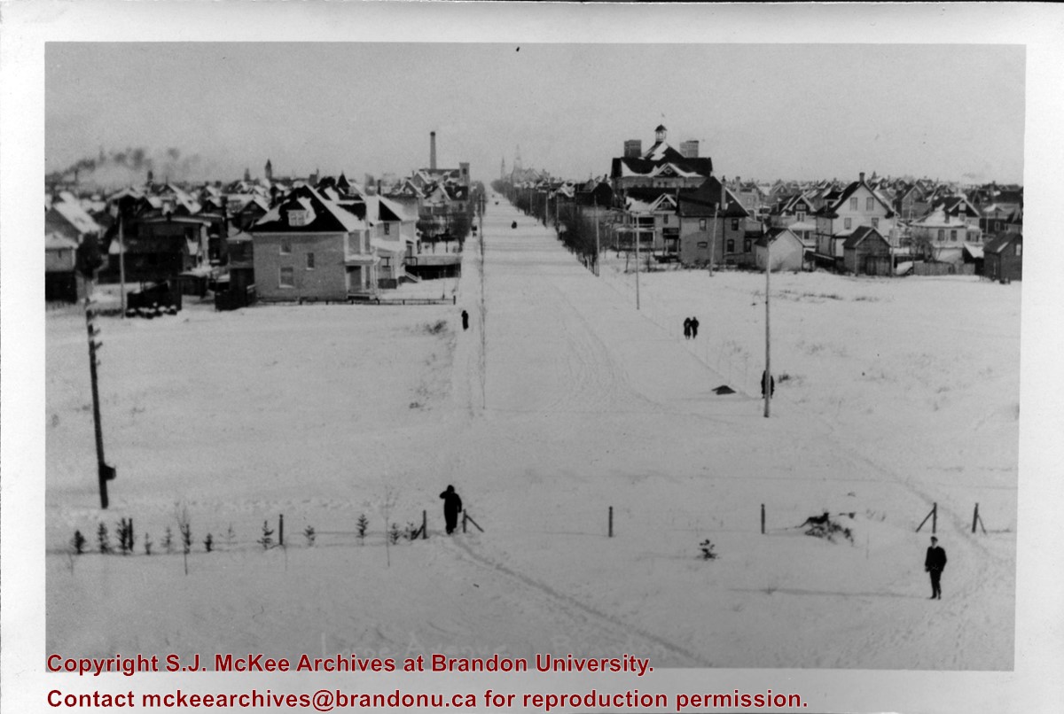
Image is looking east northeast from approximately the 300 block of 23rd Street between Lorne and Louise Avenues. Photograph shows the Brandon College campus after the opening of the original Music Building in 1963, but before the construction of the Education Building in 1966. A number of house on the 300 blocks of 22nd and 21st Streets are visible in the foreground, with the A.E. McKenzie Seed Co., the Prince Edward Hotel and various grain elevators on the horizon.
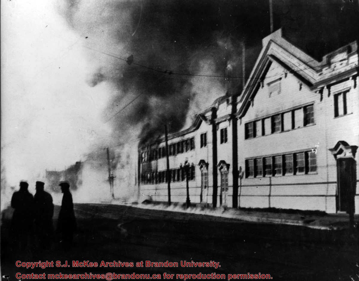
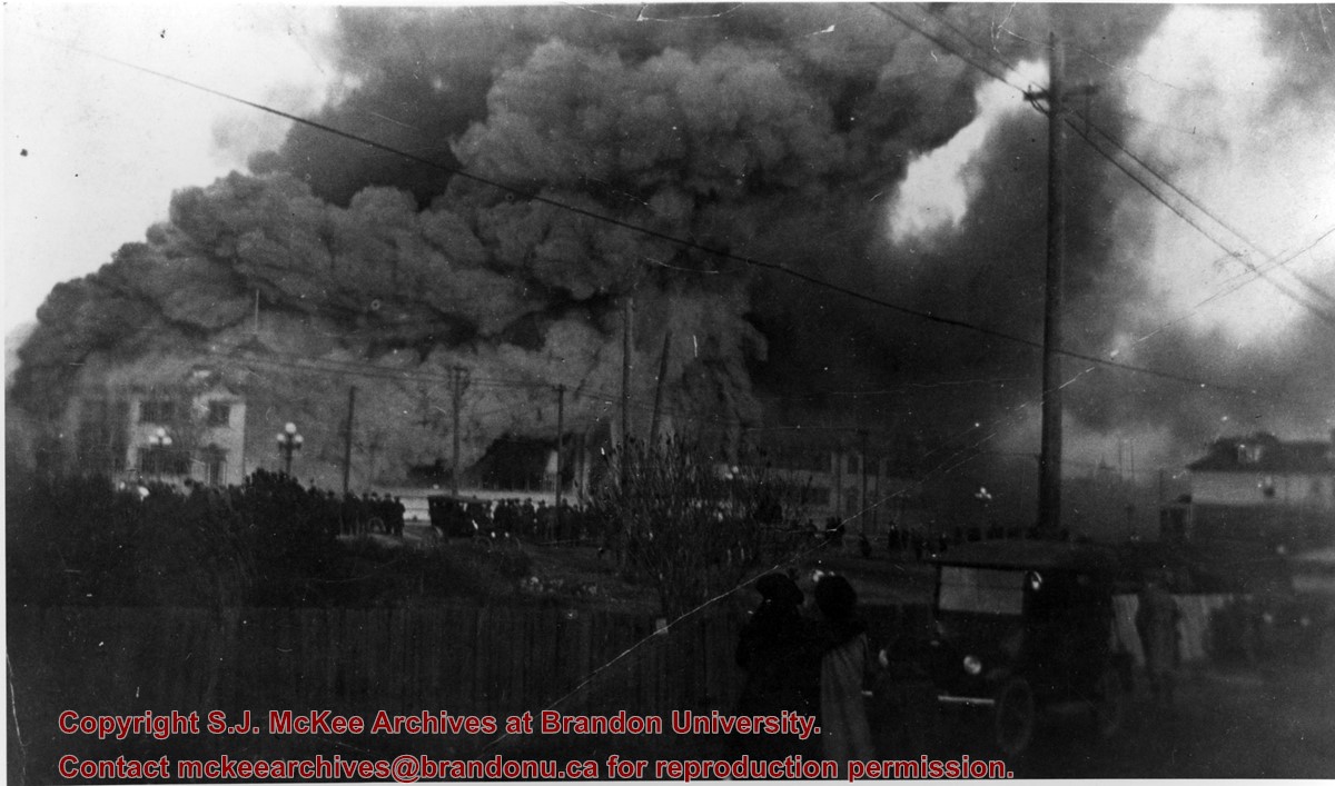
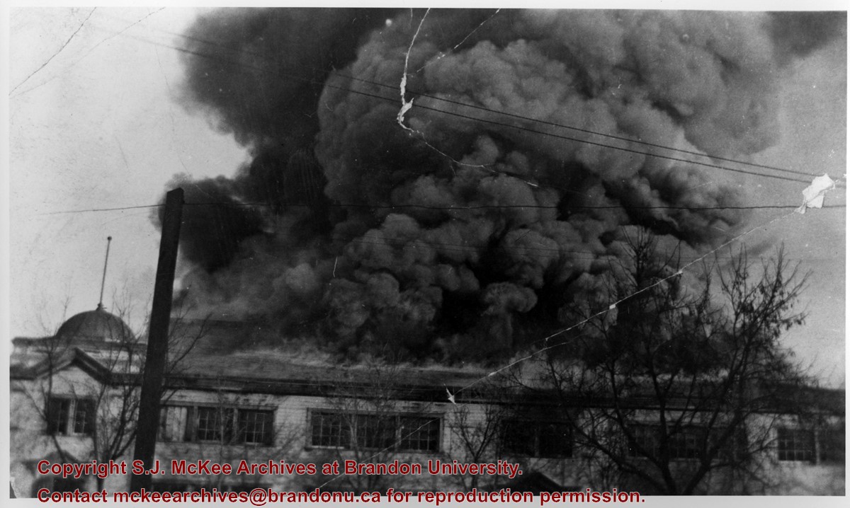
Photograph of spectators gathered to watch the Royal North-West Mounted Police (RNWMP) horse barns on fire. The barns were located in the Winter Fair Building on the Fair Grounds.
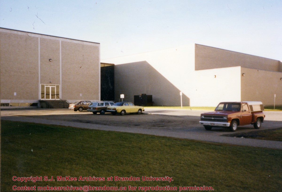
Photograph is looking southwest from in front of the Original Music Building and shows the north side of the A.E. McKenzie Building and the west side of the Queen Elizabeth II Music Building (including the link). A number of cars in the parking lot are also visible.
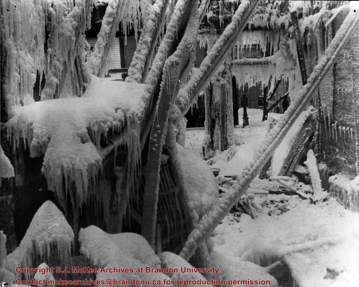
The Brandon Armoury is located at the southwest corner of Victoria Avenue and 11th Street.
Custodial History
Donated by Ron Brown.
Scope and Content
Photograph is a portrait of the Royal North-West Mounted Police C squadron returned from World War I. The photo was taken at the Brandon Armoury where the squadron was housed before being restationed.
Notes
Information on the photo was taken from G.F. Barker's Brandon: A City (p. 200).
Brandon Hardware Co. Ltd. founded in 1882, making it one of Brandon's earliest mercantiles. It was incorporated in 1902, and their location on Rosser Avenue at the corner of 7th Street was constructed in 1903. For a number of years, J.B. Curran was the managing director. The building was destroyed by fire in 1983.
Custodial History
Katy Singleton was given this photo in her role as Heritage Coordinator for the City of Brandon. She transferred it to the McKee Archives in 2013.
Scope and Content
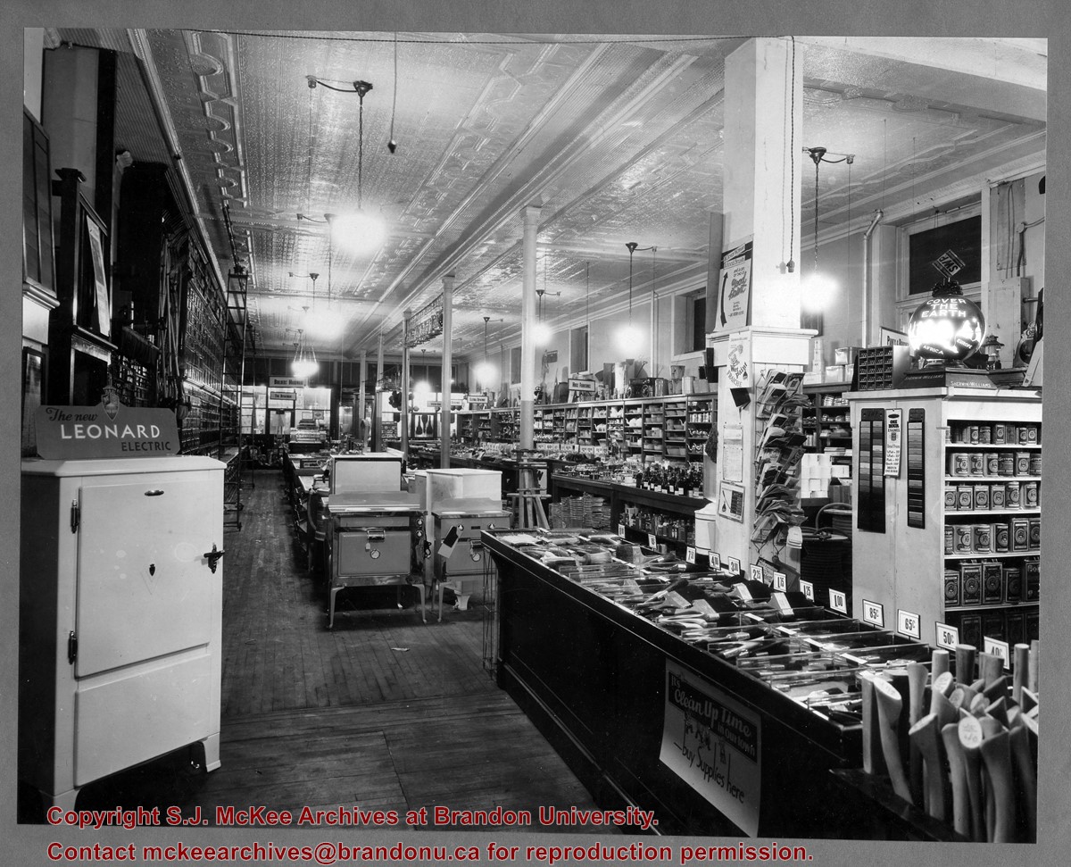
Item is a photograph of of the interior of the Brandon Hardware Co. Ltd. looking towards the front of the store from the back.
Brandon Hardware Co. Ltd. founded in 1882, making it one of Brandon's earliest mercantiles. It was incorporated in 1902, and their location on Rosser Avenue at the corner of 7th Street was constructed in 1903. For a number of years, J.B. Curran was the managing director. The building was destroyed by fire in 1983.
Custodial History
Katy Singleton was given this photo in her role as Heritage Coordinator for the City of Brandon. She transferred it to the McKee Archives in 2013.
Scope and Content
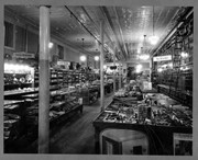
Item is a photograph of of the interior of the Brandon Hardware Co. Ltd. looking towards the back of the store from the front.
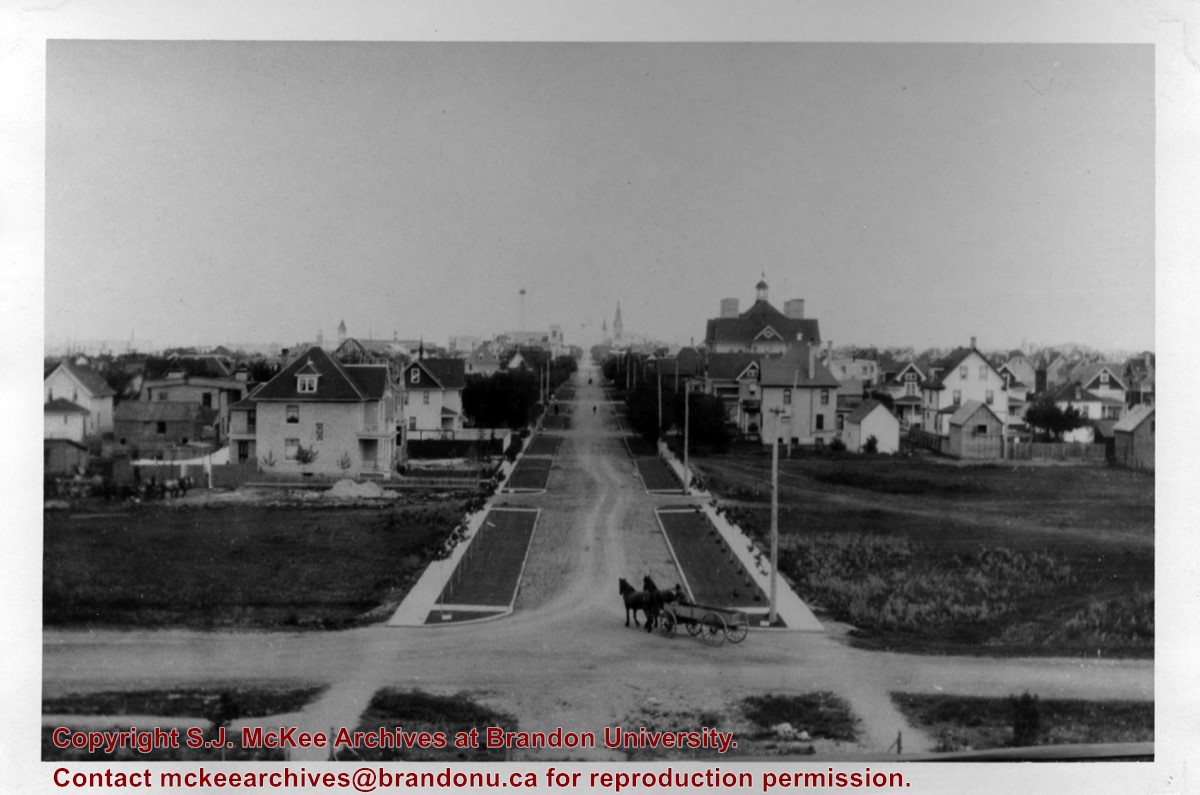
Brandon College looking south from 19th Street. Photograph was taken after Flora Cowan Hall was built but before construction of the Education Building.
View is northeast probably from the roof of McMaster Hall. Photograph shows the construction of the new roof on Clark Hall and the Brandon College Building. A portion of the east side of the 000 and 100 blocks of 18th Street, as well as the corner of 18th Street and Rosser Avenue are visible in the upper left hand corner. This includes the "Downtown Brandon" sign.
View is north northeast probably from the roof of McMaster Hall. Photograph shows the construction of the new roof on Clark Hall and the Brandon College Building, as well as the construction of the extension to Clark Hall and the skywalk. Portions of the city as far north as the Assiniboine River are also visible.
View is north northeast from the roof of McMaster Hall. Photograph shows the campus under construction during the renovation of the Brandon College Building and Clark Hall. The photograph was taken in late fall after the roof had been removed from the buildings but before the construction of the extension of Clark Hall. Construction materials litter the courtyard and driveway. The view looking north extends to The North Hill - a number of residential blocks, particularly to the northeast of 18th Street are visible. Buildings include the International Harvester Building and Kin Village.
View is north northeast probably from the roof of McMaster Hall. Photograph shows the construction of the new roof on Clark Hall and the Brandon College Building, as well as the construction of the extension to Clark Hall and the skywalk. The view looking north extends to The North Hill - a number of residential blocks, particularly to the northeast of 18th Street are visible. Buildings include the International Harvester Building and Kin Village.
View is southwest from approximatley 16th Street between Princess and Rosser Avenues. Photograph shows the Brandon University campus, as well as surrounding residential blocks, including Flemming, J.R. Reid and Vincent Massey schools.
View is west southwest from approximatley 16th Street between Princess and Lorne Avenues. Photograph shows the Brandon University campus, as well as surrounding residential blocks between 16th and 23rd Streets, Princess and Louise Avenues..
View is west from approximatley 17th Street between Lorne and Louise Avenues. Photograph shows a portion of the Brandon University campus (excluding the Education Building and anything north of it), as well as surrounding residential blocks from approximatley 17th Street to 22nd Street.


