Skip header and navigation

Revise Search

20 records – page 4 of 1.

McGuinness Medicine Hat residence - winter aerial

http://archives.brandonu.ca/en/permalink/descriptions14116
Part Of
Fred McGuinness collection
Description Level
Item
GMD
graphic
Date Range
[1960-1965]
Accession Number
1-2015
Part Of
Fred McGuinness collection
Description Level
Item
Series Number
McG 9
Item Number
1-2015.185
Accession Number
1-2015
GMD
graphic
Date Range
[1960-1965]
Physical Description
10" x 8" (b/w)
Scope and Content
Photograph shows the McGuinness home in a new housing development in Medicine Hat, 492 6th Street Northeast. Aerial view shows that neighbouring blocks have yet to be constructed and the backyard to the McGuinness home is completed.
Name Access
Fred McGuinness
Frederick George McGuinness
Medicine Hat
Subject Access
residences
street scenes
residential streets
winter
aerial views
aerial photography
Storage Location
RG 5 photograph storage drawer 2 (hanging photos)
Arrangement
BR #3 Family photos
Images
Show Less

McGuinness Medicine Hat residence - 6th Street Northeast

http://archives.brandonu.ca/en/permalink/descriptions14117
Part Of
Fred McGuinness collection
Description Level
Item
GMD
graphic
Date Range
[1960-1965]
Accession Number
1-2015
Part Of
Fred McGuinness collection
Description Level
Item
Series Number
McG 9
Item Number
1-2015.186
Accession Number
1-2015
GMD
graphic
Date Range
[1960-1965]
Physical Description
10" x 8" (b/w)
Scope and Content
Photograph shows the intersection by the McGuinness home (492 6th Street Northeast) in a new housing development in Medicine Hat.
Notes
A negative exists for this photo and is stored with the picture.
Name Access
Fred McGuinness
Frederick George McGuinness
Medicine Hat
Subject Access
residences
street scenes
residential streets
winter
Storage Location
RG 5 photograph storage drawer 2 (hanging photos)
Arrangement
BR #3 Family photos
Images
Show Less

Architectural drawing of the John R. Brodie Science Centre and student residence

http://archives.brandonu.ca/en/permalink/descriptions689
Part Of
John R. Brodie Science Centre
Description Level
Item
GMD
graphic
Date Range
c. 1970
Part Of
John R. Brodie Science Centre
Creator
Drawing by: Green Blankstein Russell Associates - Architects & Engineers, Winnipeg, MB.
Description Level
Item
Series Number
2.9
Item Number
2.9.16
GMD
graphic
Date Range
c. 1970
Physical Description
8" x 10" (b/w)
Scope and Content
Item is an architectural drawing of the proposed John R. Brodie Science Centre and student residence at Brandon University.
Show Less
Part Of
Residences and dining rooms
Description Level
Item
GMD
graphic
Date Range
c. 1970
Part Of
Residences and dining rooms
Description Level
Item
Series Number
2.6
Item Number
2.6.54
GMD
graphic
Date Range
c. 1970
Physical Description
6.5" x 10" (b/w)
Scope and Content
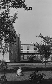
Photograph is looking west from where the John R. Brodie Science Centre currently stands. It shows a girl sitting on the grass with portions of Flora Cowan Hall, the Flora Cowan link and Darrach Hall in the background.
Images
Show Less

Flora Cowan Hall and McMaster Hall

http://archives.brandonu.ca/en/permalink/descriptions888
Part Of
Residences and dining rooms
Description Level
Item
GMD
graphic
Date Range
c. 1975
Part Of
Residences and dining rooms
Description Level
Item
Series Number
2.6
Item Number
2.6.14
GMD
graphic
Date Range
c. 1975
Physical Description
3.75" x 5" (b/w)
Scope and Content
Photograph is looking northeast and shows portions of Flora Cowan Hall (foreground) and McMaster Hall (background).
Images
Show Less
Part Of
Brandon University Photograph Collection
Description Level
Item
Date Range
c. 1967
Part Of
Brandon University Photograph Collection
Description Level
Item
Series Number
5
File Number
5.3.26A
Item Number
5.3.26A
Date Range
c. 1967
Physical Description
b/w, 5.5" x 7.5"
Scope and Content
Dining hall (?) Student activities. seated: Prof. Norma Walinsley
Show Less
Part Of
Brandon University Photograph Collection
Description Level
Item
Date Range
c. 1970
Part Of
Brandon University Photograph Collection
Description Level
Item
Series Number
5
File Number
5.4.11A
Item Number
5.4.11A
Date Range
c. 1970
Physical Description
b/w, 3" x 4"
Scope and Content
Dining Hall. Getting Drinks off Bar?, Keith Poulson ? (top edge of bar)
Show Less
Part Of
Alf Fowler collection
Description Level
Item
GMD
graphic
Date Range
ca. 1911
Accession Number
6-1999
Part Of
Alf Fowler collection
Creator
Davidson & Gowen
Description Level
Item
Item Number
6-1999.5
Accession Number
6-1999
GMD
graphic
Date Range
ca. 1911
Physical Description
9.25" x 7.25" (b/w)
History / Biographical
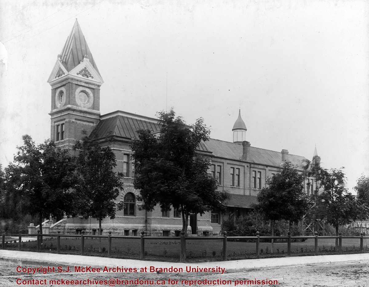
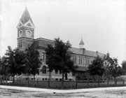
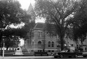
Brandon's City Hall and Opera House opened on New Year's Day 1892 with the Annual Fireman's Ball. The exterior of the building was designed by Brandon architect W.R. Marshall. At the south end was the Opera House, an auditorium formed by an internally exposed framework of delicate iron pillars and trusses. Demonlished in 1971, the limestone rubble of the foundations were turned into a sunken garden located in Princess Park.
Custodial History
See fonds level description of the Alf Fowler collection for custodial history.
Scope and Content
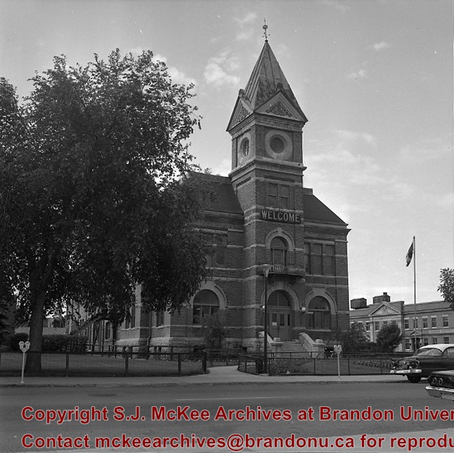
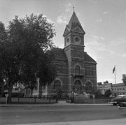
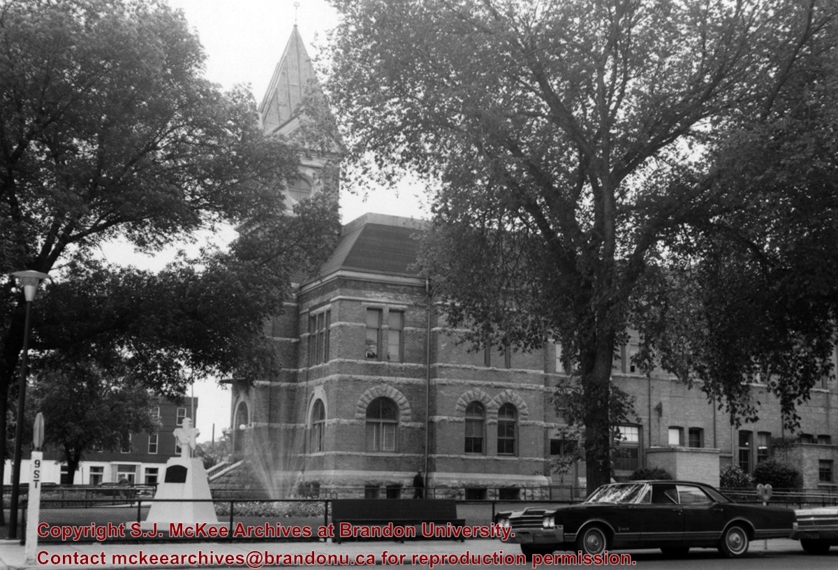
Photo was taken from the northwest corner of 9th Street and Princess Avenue and shows the west side of City Hall.
Notes
History/Bio information taken from the Assiniboine Historical Society's Brandon: An Architectural Walking Tour pamphlet (1982).
Location Copy
A 5" x 7" (b/w) reproduction of the photograph is located with the original.
Storage Range
RG 5 Western Manitoba Manuscript collection - photograph storage drawer
Images
Show Less
Part Of
RG 11 Lawrence Stuckey fonds
Description Level
Item
GMD
graphic
Date Range
c. 1966
Accession Number
1-2002
Part Of
RG 11 Lawrence Stuckey fonds
Creator
Lawrence Stuckey
Description Level
Item
Series Number
3.9
Item Number
1-2002.3.9.26
Accession Number
1-2002
GMD
graphic
Date Range
c. 1966
Physical Description
4.5" x 3.25" (b/w)
History / Biographical
The original City Hall was located on Princess Avenue between 8th and 9th Streets.
Scope and Content
Photograph is looking south southwest and shows the main entrance of City Hall.
Repro Restriction
The McKee Archives is the copyright holder for the Stuckey materials.
Location Original
1-2002.3.1D2
Storage Location
RG 5 photograph storage drawer
Images
Show Less
Part Of
RG 11 Lawrence Stuckey fonds
Description Level
Item
GMD
graphic
Date Range
c. 1966
Accession Number
1-2002
Part Of
RG 11 Lawrence Stuckey fonds
Creator
Lawrence Stuckey
Description Level
Item
Series Number
3.9
Item Number
1-2002.3.9.27
Accession Number
1-2002
GMD
graphic
Date Range
c. 1966
Physical Description
4.5" x 3.25" (b/w)
History / Biographical
The original City Hall was located on Princess Avenue between 8th and 9th Streets.
Scope and Content
Photograph is looking east southeast from 9th street and shows the the west side of City Hall. The Beaubier Hotel is in the background.
Repro Restriction
The McKee Archives is the copyright holder for the Stuckey materials.
Storage Location
RG 5 photograph storage drawer
Images
Show Less
Part Of
RG 11 Lawrence Stuckey fonds
Description Level
Item
GMD
graphic
Date Range
[190-?]
Accession Number
1-2002
Part Of
RG 11 Lawrence Stuckey fonds
Description Level
Item
Series Number
3.1
Item Number
1-2002.3.1A9
Accession Number
1-2002
GMD
graphic
Date Range
[190-?]
Physical Description
3 1/2" x 5"
Material Details
Negative
History / Biographical
Hall served as mayor from 1903-1904.
Custodial History
For custodial history see the collection level description of the Lawrence Stuckey collection.
Scope and Content
Item is a portrait of Brandon mayor Robert Hall.
Name Access
Robert Hall
Subject Access
government
political figures
mayors
mayors of Brandon
Repro Restriction
The McKee Archives is the copyright holder for the Stuckey materials.
Storage Location
Lawrence Stuckey collection
Images
Show Less
Part Of
Residences and dining rooms
Description Level
Item
GMD
graphic
Date Range
c. 1961
Part Of
Residences and dining rooms
Description Level
Item
Series Number
2.6
Item Number
2.6.43
GMD
graphic
Date Range
c. 1961
Physical Description
8" x 10" (b/w)
Scope and Content
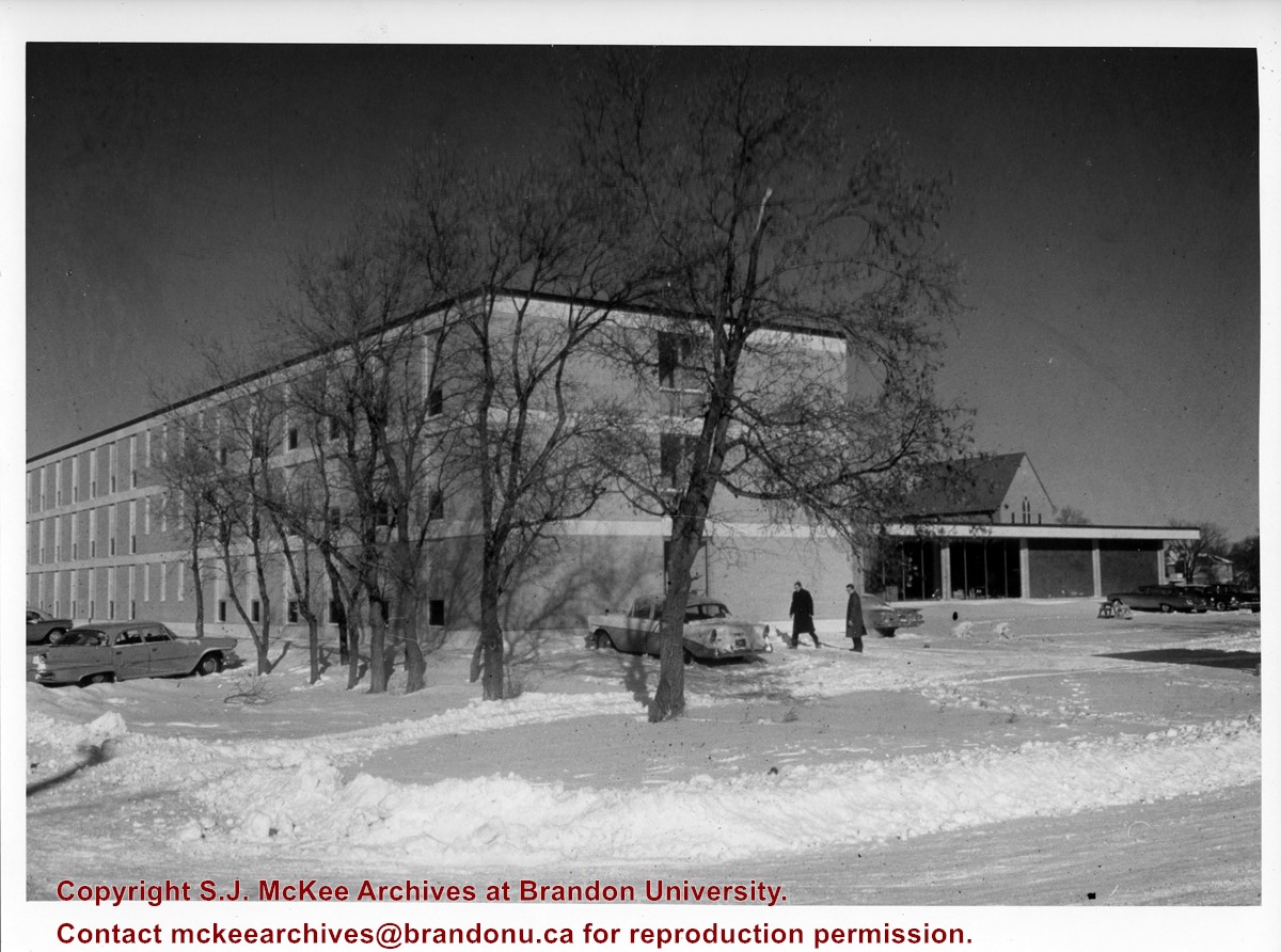
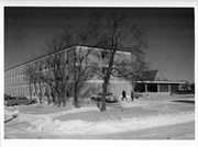
Photograph is looking north northeast and shows Darrach Hall with the Main Dining Room and the Citizens' Science Building in the background during winter. A number of cars are parked along the street and on the campus grounds.
Images
Show Less
Part Of
Residences and dining rooms
Description Level
Item
GMD
graphic
Date Range
c. 1971
Part Of
Residences and dining rooms
Description Level
Item
Series Number
2.6
Item Number
2.6.48
GMD
graphic
Date Range
c. 1971
Physical Description
8" x 10" (b/w)
Material Details
Contact prints
Scope and Content
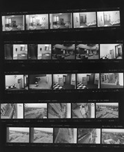
Item consists of twenty five contact prints. Images include photographs of campus taken from the roof of McMaster Hall as well as photographs of residence rooms, bathrooms and common rooms in McMaster Hall.
Images
Show Less
Part Of
Residences and dining rooms
Description Level
Item
GMD
graphic
Date Range
c. 1970s
Part Of
Residences and dining rooms
Description Level
Item
Series Number
2.6
Item Number
2.6.33
GMD
graphic
Date Range
c. 1970s
Physical Description
4" x 5.25" (b/w)
Scope and Content
Photograph is looking southwest and shows McMaster Hall.
Images
Show Less
Part Of
Residences and dining rooms
Description Level
Item
GMD
graphic
Date Range
c. 1971
Part Of
Residences and dining rooms
Description Level
Item
Series Number
2.6
Item Number
2.6.53
GMD
graphic
Date Range
c. 1971
Physical Description
8" x 10" (b/w)
Scope and Content
Photograph is looking north northwest and shows the south and east sides of Darrach Hall.
Images
Show Less
Part Of
Brandon University Photograph Collection
Description Level
Item
GMD
graphic
Date Range
c. 1930s
Part Of
Brandon University Photograph Collection
Creator
Photographer: R.M. Coleman
Description Level
Item
Series Number
2.2
Item Number
2.2.41
GMD
graphic
Date Range
c. 1930s
Physical Description
10" x 8" (b/w)
Scope and Content
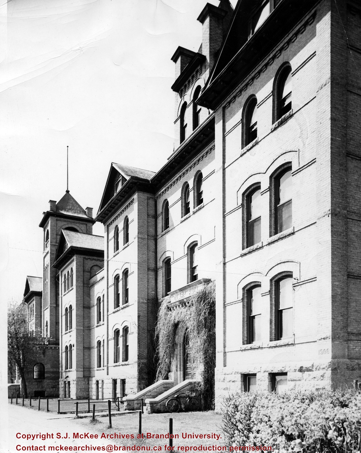
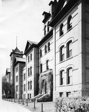
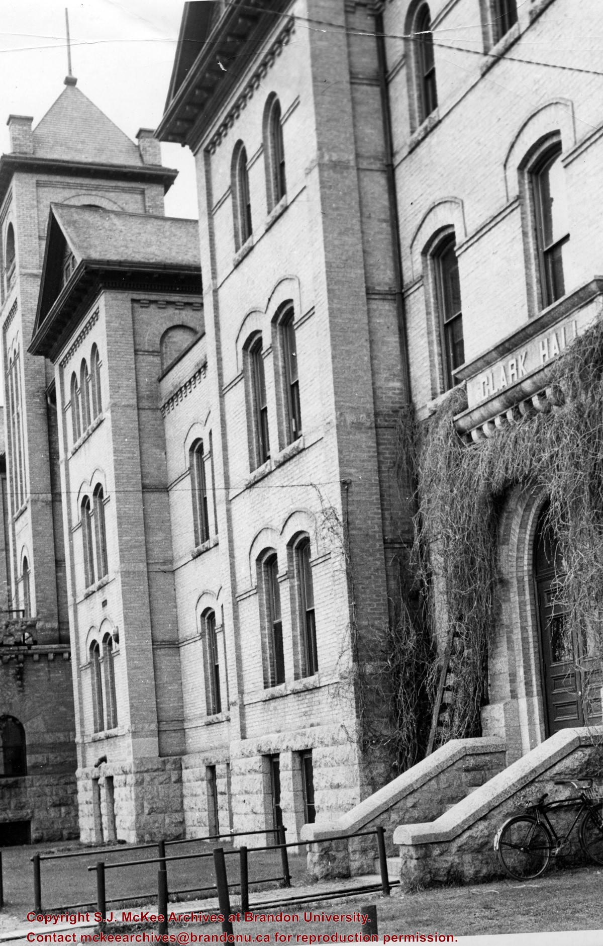
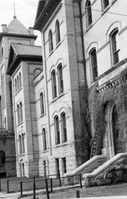
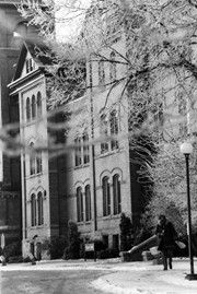
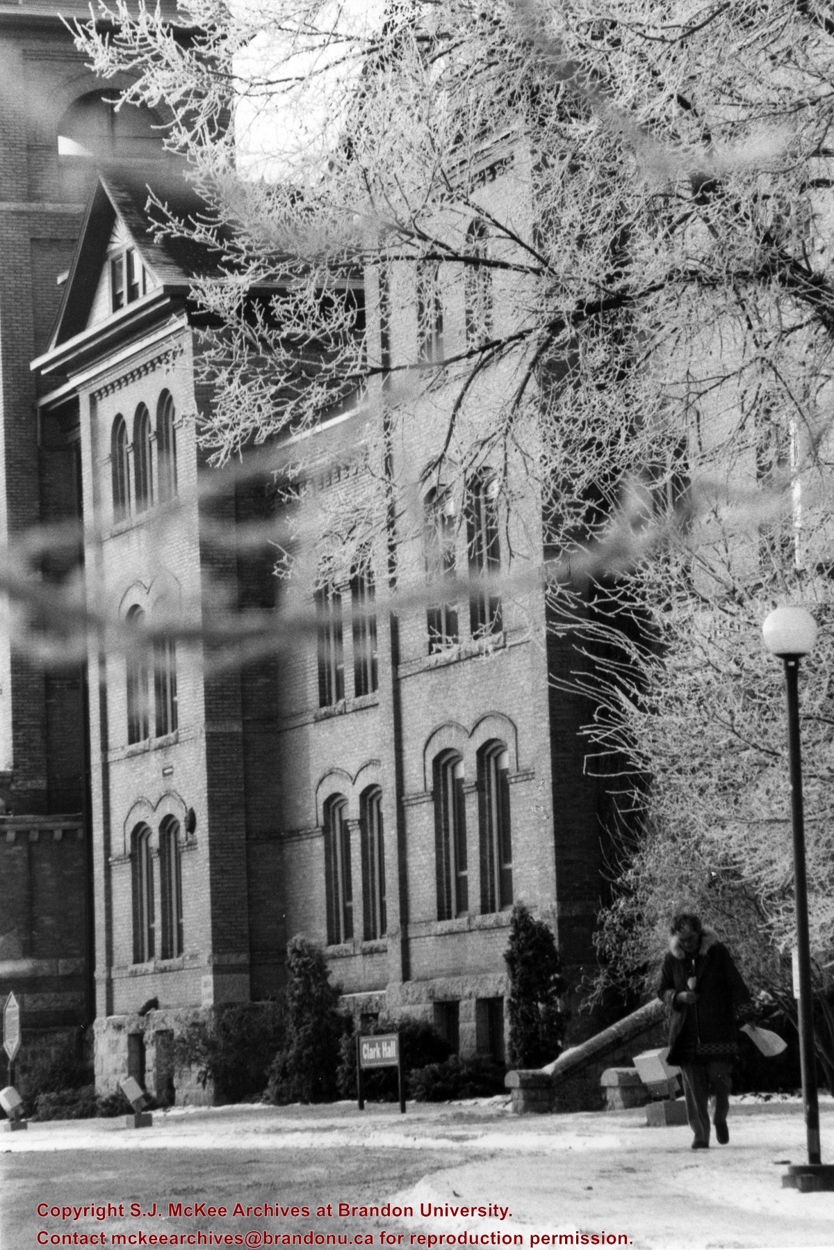
View is south southwest from the driveway. Photograph primarily shows Clark Hall, although the Brandon College Building is visible. The photograph pre-dates the sidewalk in front of the building.
Images
Show Less
Part Of
Brandon University Photograph Collection
Description Level
Item
GMD
graphic
Date Range
c. early 1960s
Part Of
Brandon University Photograph Collection
Description Level
Item
Series Number
2.2
Item Number
BUPC 2.2.30
GMD
graphic
Date Range
c. early 1960s
Physical Description
5" x 7.5" (b/w)
Scope and Content
View is southwest from the sidewalk in front of Clark Hall. Photograph shows the east side of the building, including the entrance.
Images
Show Less
Part Of
Brandon University Photograph Collection
Description Level
Item
GMD
graphic
Date Range
c. 1970s
Part Of
Brandon University Photograph Collection
Description Level
Item
Series Number
2.2
Item Number
2.2.32
GMD
graphic
Date Range
c. 1970s
Physical Description
5" x 7" (b/w)
Scope and Content
View is southwest from the driveway. Photograph shows Clark Hall in winter.
Images
Show Less
Part Of
Residences and dining rooms
Description Level
Item
GMD
graphic
Date Range
c. 1970s
Part Of
Residences and dining rooms
Description Level
Item
Series Number
2.6
Item Number
2.6.58
GMD
graphic
Date Range
c. 1970s
Physical Description
8" x 10" (b/w)
Scope and Content
Photograph is looking south from the present day Kavanagh Courtyard and shows McMaster Hall, two H-Huts and a number of walkways.
Images
Show Less
Part Of
Residences and dining rooms
Description Level
Item
Date Range
c. 1975
Part Of
Residences and dining rooms
Description Level
Item
Series Number
2.6
Item Number
2.6.41
Date Range
c. 1975
Physical Description
5" x 8" (b/w)
Scope and Content
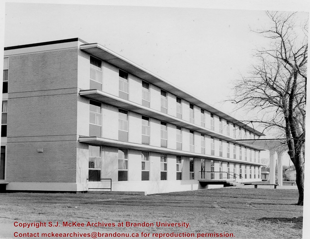
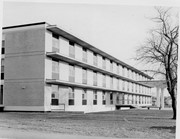
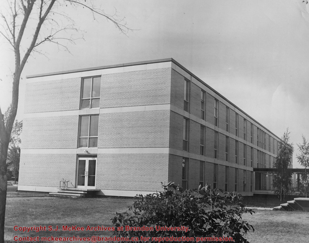
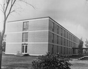
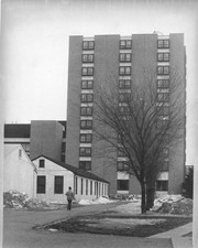
Photograph is looking west and shows the north half of McMaster Hall, as well as the walkway between McMaster and the H-Huts. Portions of the Main Dining Room and Darrach Hall are visible in the background.
Show Less

20 records – page 4 of 1.