Situated in the R.M. of Whitehead on the Little Saskatchewan River, the 10 Mile Dam was a 14 kilometer transmission line that supplied the city of Brandon with power. The Brandon Electric Light Company built the dam in 1900 and it is considered Manitoba's first hydroelectic power generating station. The dam spanned approximately 80 meters and was constructed from timber and reinforced with clay and stone. The station was decommissioned in 1924.
Scope and Content
Photograph shows 10 Mile Dam, also known as the Brandon Dam or Minnedosa River Hydro Plant. The dam's timber construction is quite evident in the picture.
Notes
Writing on the back of the photograph reads: McGuinness (Manitoba Hydro), on Little Saskatchewan.
Situated in the R.M. of Whitehead on the Little Saskatchewan River, the 10 Mile Dam was a 14 kilometer transmission line that supplied the city of Brandon with power. The Brandon Electric Light Company built the dam in 1900 and it is considered Manitoba's first hydroelectic power generating station. The dam spanned approximately 80 meters and was constructed from timber and reinforced with clay and stone. The station was decommissioned in 1924.
Alonzo Archibald Rowe (b. 1862, London, ON; d. 22 Oct 1951, Brandon). The Rowes were considered Brandon area pioneers. Alonzo’s father, Alonzo L. Rowe, came to Brandon with his family in 1881, where the family had a furniture and undertaker business on the west side of 10th Street between Rosser and Princess Avenues. In 1885, the family began farming west of Brandon and Alonzo Archibald served as a councilor and then a reeve in the R.M. of Whitehead. He returned to Brandon in 1907 and served with the Brandon Police Department until 1910, when he returned to farming, this time in Arrow River. A.A. Rowe returned to Brandon in 1915 to work as a Provincial Licenses Inspector, a position he held until 1938. (Source: Obituary, Brandon Daily Sun 22 Oct 1951)
Custodial History
Photograph was in possession of Mrs. Ruby Miles, who passed the image on to Fred McGuinness. McGuinness makes reference to Mrs. Miles and this photograph in his Sunbeams column (Source: F.A. Rosser, "Another interesting chat with a daughter of the plains," Brandon Sun 18 Aug 1981).
Scope and Content
Photograph shows four fishermen at 10 Mile Dam, also known as the Brandon Dam or Minnedosa River Hydro Plant. The fishermen in the photo are identified as George H. Rowe and his father A.A. Rowe, Dr. Wilfred Bigelow, and Al Collins.
Notes
Writing on the back of the photograph reads: at Brandon Dam, [right to left] son and father - George H. ROWE, Mr. A.A. ROWE, Dr. BIGELOW, Al COLLINS (dam?, 1906?, George born March 1897); Jerrett's Photo-Services, May 7 1938.
Postcard shows the 100 block of 10th Street facing north. The CPR train station can be seen at the end of 10th Street. The sign for the Rex Cafe is visible on the west side of 10th Street. On the east side of 10th Street, billboards for Campbell & Campbell furniture are visible as well as signs for Pianos and the Orpheum Theatre. Motorists and cyclists share the road. Street car tracks run the length of 10th Street.
Notes
Back of postcard reads: Morning reflection of Brandon's skyline on the Assiniboine River, photo by Sandy Black, printed in Brandno, Manitoba, Canada by Leech Printing Ltd.
Kirkham's Bridge was built in 1906, to replace an earlier wooden bridge. The bridge was used until 1981, when it was purchased by the Town of Birtle and moved to a newsite. A former railway pridge was installed in its place.
Scope and Content
Photograph shows Kirkham's Bridge, a steel truss bridge that spanned the Little Saskatchewan River in the Municipality of Riverdale.
Notes
Identification of the bridge provided by Ken Storie (2023). Additional information taken from the Manitoba Historical Society website.
60 photographs (b/w) and 18 negatives; 3 cm textual records
History / Biographical
Rubina Isabella Miles (née McGregor) was born October 9th, 1909, in Maple Creek, Saskatchewan, the only child of Kate (née Rowe) and William McGregor. Her father, William Thom McGregor was a native of Scotland who, before coming to Canada, travelled to Australia and New Zealand, and served in the Boer War. Ruby Miles and her parents migrated to Australia in 1921. In 1925, the family moved to Papua New Guinea where Mr. McGregor was employed as Head Stockman on the Giligili Estate, part of the Commonwealth Copra Company. The family returned to Canada in 1929. In 1940, Ruby married Leonard "Len" Miles, a native of Moose Jaw, Saskatchewan. Following the Second World War, they settled in Brandon, Manitoba. Ruby spent her adult life as a homemaker. She died in April 2003.
Custodial History
The records came into Ruby Miles' possession through her husband (correspondence while he was overseas) and through the death of various family members. Following the death of Ruby Miles, the collection was donated to the S.J. McKee Archives by Errol Black, the executor of her estate.
Scope and Content
Collection includes c. 15 letters from Kate McGregor, to her parents Mr. and Mrs. A.A. Rowe of Brandon, Manitoba. The letters were written in the years 1925-1929, when Mrs. McGregor and her family were living in Papua New Guinea. Collection also includes photographs and photographic negatives containing images of the Giligili Estate in New Guinea. Collection contains correspondence with Len Miles during his service overseas in the Second World War, as well as Len Miles' service record, death certificate and various memorabilia from his time in military service. Finally, the collection includes various news clippings, documents and correspondence received or retained by Ruby Miles.
The Medicine Hat Exhibition and Stampede Parade Day was held on Thursday, July 19, 1962, at 9:30 a.m. The local newspaper reported that approximately 24,000 people were in attendance to see parade marshall Rod Ashburner leading 175 entries consisting of 90 floats, 75 horses, and 10 bands. There were 19 parade categories eligible for $12,000 in prize money and included: junior and senior cowboys and cowgirls; fancy and Shetland ponies; sulky class open; comic, commercial, industrial and organizational floats; decorated cars; special ranch class; 4-H Clubs; and a non-competitive class.
The parade route started at Second St. and Allowance Ave., from Second St. to Ash Ave., north on Ash to First St. SE., from First St. S.E. to Fourth Ave., south to Second St. to South Railway St., south on South Railway St. to Third St., with a finish at McLeod Trail. A route map was published in the Medicine Hat News the day before the parade.
Aerial photographs of the parade were taken by Medicine Hat News photographer Howard Heid (1930-2005) from the private helicopter of John Bourn. Bourn was a pilot from Woodville, Wisconsin, who chartered his four-seater helicopter for sight-seers at exhibitions and stampedes across the county.
(Sources: Pat Currie, "Let 'Er Go!," Medicine Hat News, 19 July 1962,1; Harald Gunderson, "'Eye in the Sky' Best Parade View," Medicine Hat News, 19 July 1962,1; "Parade Starts at 9:30 Sharp," 18 July 1962)
Scope and Content
Photograph shows an aerial view of the Medicine Hat Exhibition and Stampede Parade route with a focus west of the railway allowance, showing First Street SE, Second Street SE, and Third Street SE.
Notes
This photograph shows the neighbourhood before rezoning and commercial development.
John C. Cousins was the son of Thomas Cousins (b. August 17, 1882 in Truro, Nova Scotia - d. March 5, 1914) and Mary Margaret Craig (b. April 14, 1824 - d. April 25, 1903). He married Eunice Eliza Nixon from London Township, County of Middlesex, Ontario. Together they had three children: Eunice M., Eric O. and Kathleen. J.C. Cousins was Reeve of the Rural Municipality of Daly from 1905 to 1910 and Assessor for the Town of Rivers from 1931-1938.
Custodial History
Record was accessioned in 2007 by the McKee Archives. Prior custodial history unknown.
Scope and Content
This document is a rambling memoir of John C. Cousins' recollections of life in the Rural Municipality of Daly from the settlement era in the early 1880s, through to the 1940s. He touches on various themes, including: his family history; the activities of the R.M. of Daly and his role as Reeve; the history of school districts in the municipality (lists names of first teachers and early students); the history of churches in the municipality; tragedies in the municipality; lists members of the Council of the municipality for the years 1885-1946; and the devastating impact of the Spanish Influenza on Aboriginal people in the municipality.
In addition, the memoir includes documentary records, such as minutes and copies of letters. There are also many photographs of both events and individuals (virtually all of the photographs are labelled and names are provided). The memoir goes beyond a simple recounting of facts. Cousins is discursive and thoughtful, often making references to developments happening in other parts of North America and Canada. There is also a link to the Maritimes, from which his family originated.
The Blyth Protestant School District #471 was founded in 1886. It became the Blyth School District following the elimination of the denominational school system in Manitoba in 1890. The District was located south of Brandon in the Rural Municipality of Cornwallis. The District existed until the mid-1960s, when it was incorporated into the Rolling River School Division.
Custodial History
This fonds was accessioned by the McKee Archives in 1997. Prior custodial history is unknown.
Scope and Content
Fonds includes the minute books, financial records (1886-1955), attendance registers (1887-1906), and related documents of the Blyth School District, Rural Municipality of Cornwallis. Aside from attendance records, the fonds contains documents relating to issues of teachers salaries, attendance policies, and holidays.
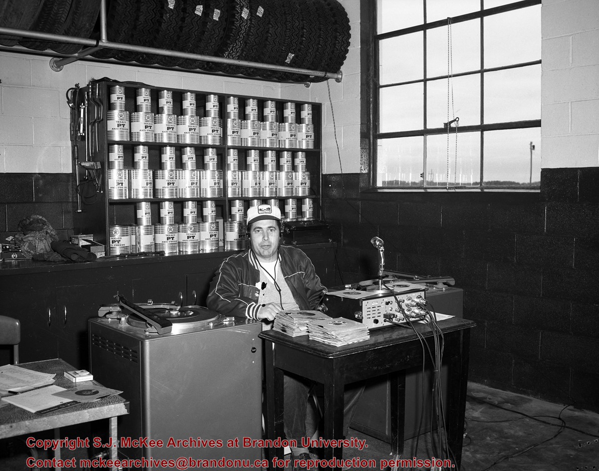
See fonds level of the CKX records for custodial history.
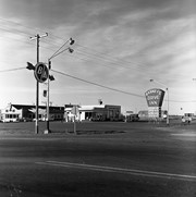
Scope and Content
Image consists of an aerial view looking north at the intersection of Highways 1 and 10 and shows the British American dealer located at the intersection.
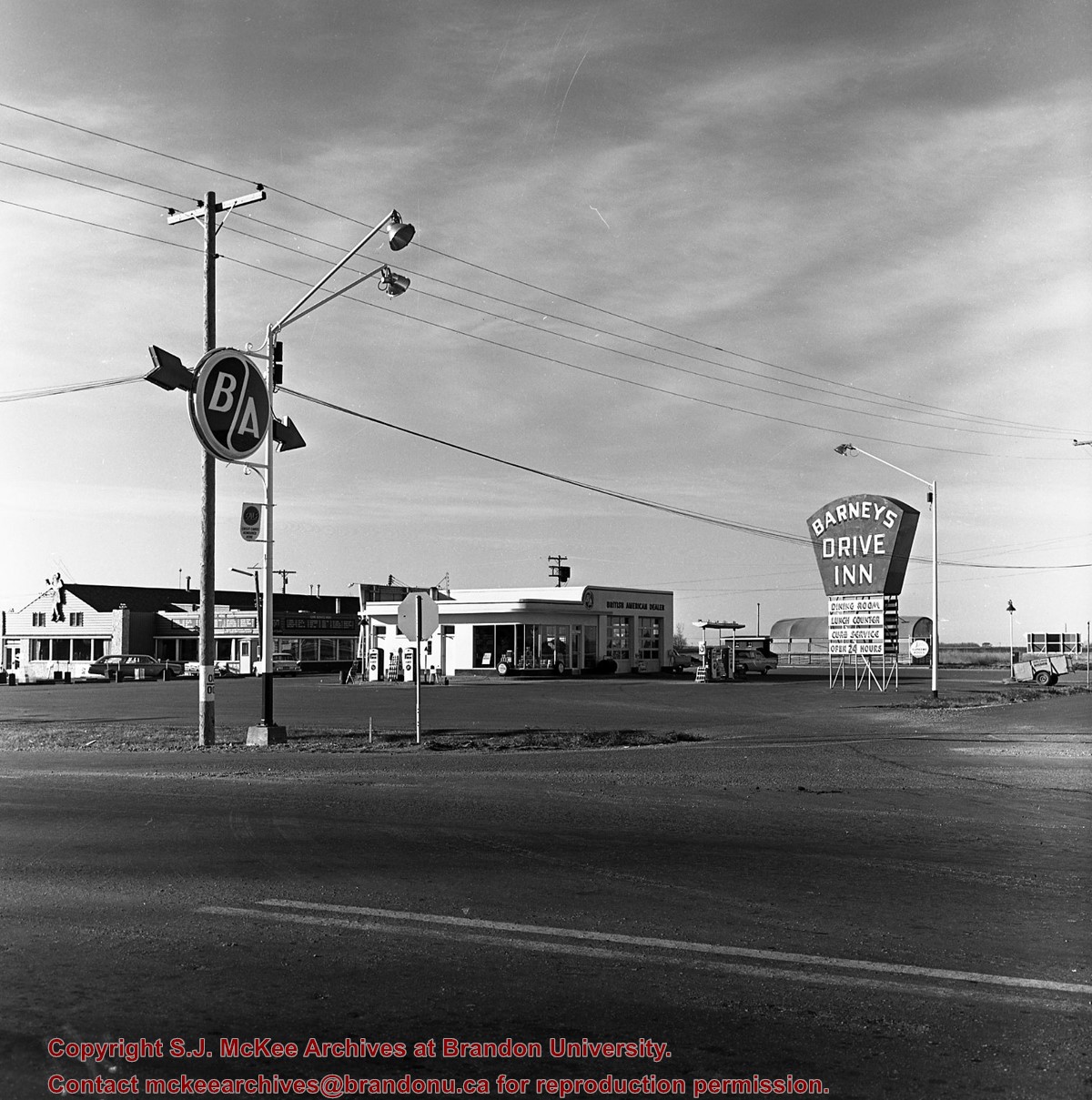
See fonds level of the CKX records for custodial history.
Scope and Content
Image consists of an aerial view looking southeast at the intersection of Highways 1 and 10 and shows the British American dealer located at the intersection.


)
)
)