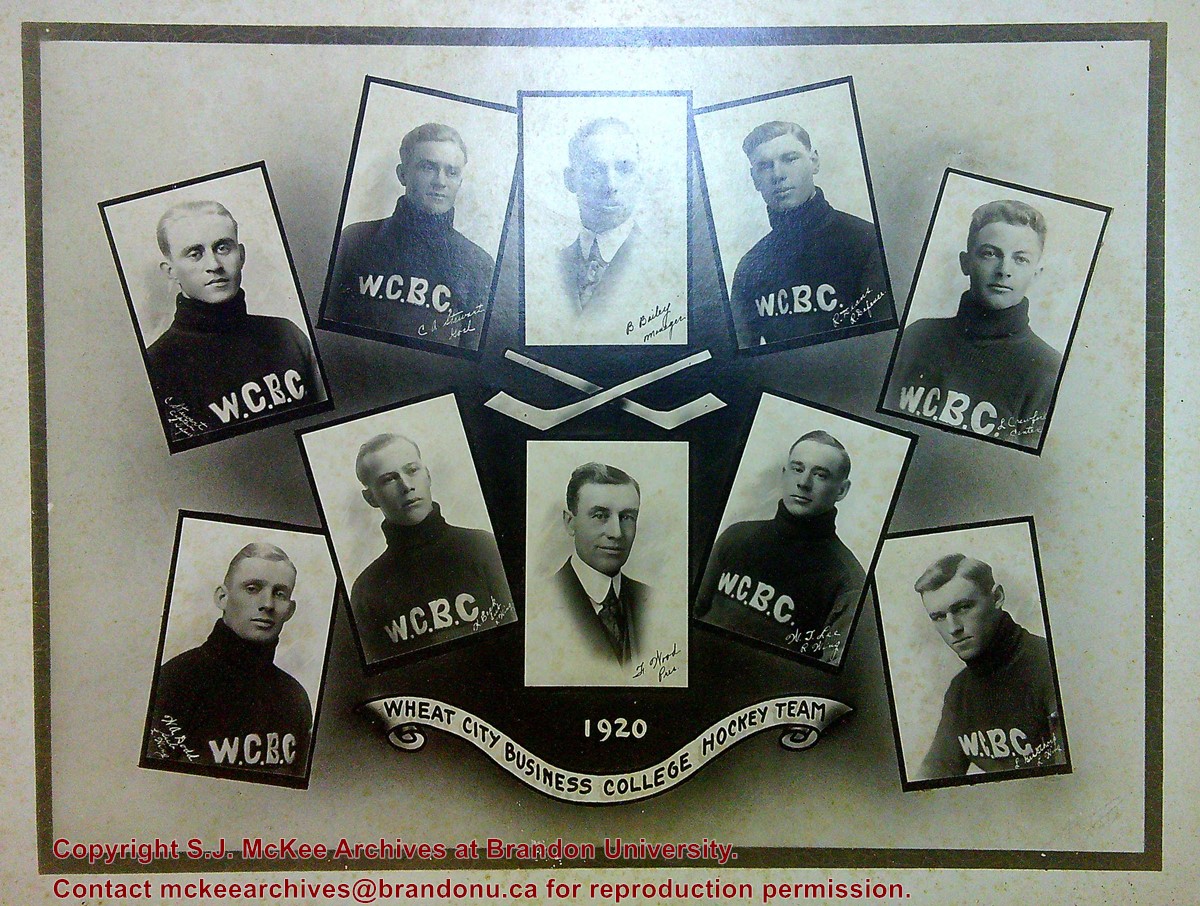
Backing board is warped and has two large tears on the back. There is foxing on the image and board on the front
Custodial History
Image was donated to the McKee Archives in 2020 by Don Smith, Associate Curator/Manager of the Cornwall Community Museum/SD&G Historical Society and a volunteer with the City of Cornwall's Heritage Cornwall Committee. Smith was asked by a local used bookstore owner to find a home for a box of items they had acquired from the new owner of a Lancaster, ON are antique/collectibles operation.
Scope and Content
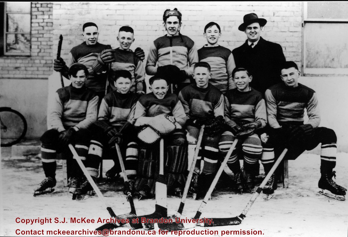
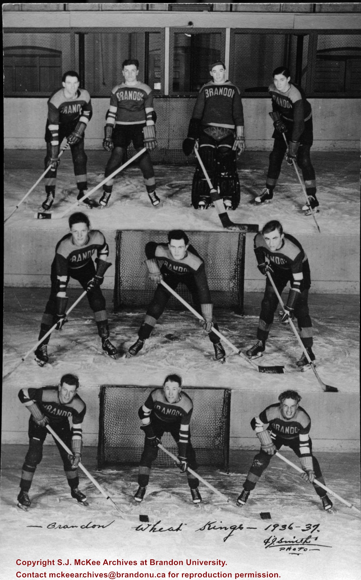
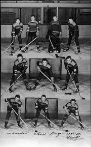
Composite portrait of the players, manager and president of the Wheat City Business College hockey team. The name and position/role of each man is written in the bottom right corner of their portrait.
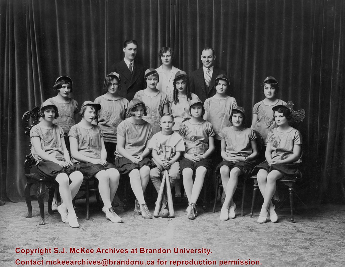
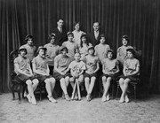
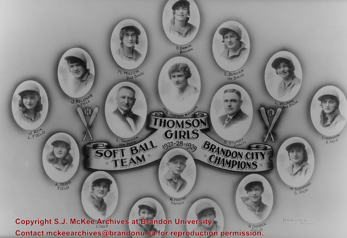
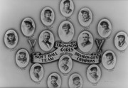
The photographs (BAPC 7.6 and 7.7) were left with Esther Bryan of the City of Brandon's Recreation Department responsible for scheduling of baseball/softball games at Curran Park. She gave them to Niel Henry, a local girls fastball coach in Brandon ca. 2000. The photographs were stored at Henry's residence at 27 Grant Blvd. until he gave them to the McKee Archives in September 2006.
Scope and Content
Photograph is a portrait of the players, coach, manager and honorary president of the Thomson girls softball team, Brandon City Champions 1927-1928-1929.
The photographs (BAPC 7.6 and 7.7) were left with Esther Bryan of the City of Brandon's Recreation Department responsible for scheduling of baseball/softball games at Curran Park. She gave them to Niel Henry, a local girls fastball coach in Brandon ca. 2000. The photographs were stored at Henry's residence at 27 Grant Blvd. until he gave them to the McKee Archives in September 2006.
Scope and Content
Photograph consists of portraits of the players, coach, manager and honorary president of the Thomson girls softball team, Brandon City Champions 1927-1928-1929.
Notes
The names of the two catchers, M. Kennedy and O. Johnson are missing from the scanned image.
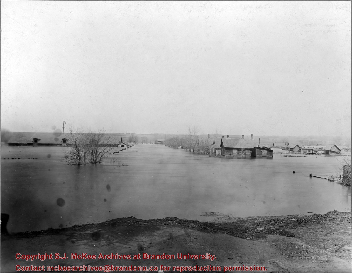
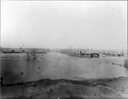
The "flats" refers to the Assiniboine River floodplane from 18th Street to First Street on either side of the river. See p. 223 of G.F. Barker's Brandon: A City for a description of the 1922 flood.
Custodial History
The photo was owned by Mrs. Wes Railton prior to its donation to the Archives.
Scope and Content
Photograph contains an image of houses on the Assiboine floodplane (Brandon's "flats") submerged in flood-waters.
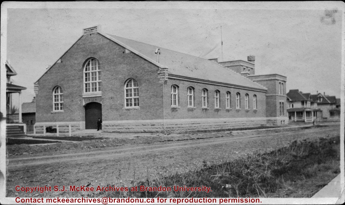
The Brandon Armoury was built in 1907. The extension on the southside was built in 1937.
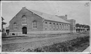
Custodial History
The photograph was donated to the Archives by Cy Kenny in 2005.
Scope and Content
Photograph is looking northwest from the east side of 11th Street. It shows the back and east side of the Brandon Armoury, which is located on the at 1116 Victoria Avenue.
Photograph is looking northwest probably from the northwest corner of 18th Street and Louise Avenue. The photographer was laying down when s/he took the shot. Photograph shows the field to the south of the Citizens' Science Building, as well as the Citizens' Science Building, part of the Brandon College Building and Clark Hall, and two H-Huts. The photo was taken in summer as the field is full of dandelions.
View is southwest from approximately 18th Street and Lorne Avenue. Photograph shows the Brandon University campus in winter, including: the Brandon University sign, the John R. Brodie Science Centre, the Citizens' Science Building and McMaster Hall.
View is southwest from the north side of Princess Avenue. Photograph shows the original Music Building, the north driveway entrance and parts of Clark Hall and the Brandon College building.
View is southwest from the sidewalk on the west side of 18th Street. Photograph shows the Brandon University sign, the front lawn, the Citizens' Science Building, McMaster Hall and the John R. Brodie Science Centre.
View is south from the north side of Princess Avenue. Photograph shows the walkway leading south across campus, the original Music Building, the A.E. McKenzie Building, the J.R.C. Evans Lecture Theatre, Flora Cowan Hall and Darrach Hall.
View is southwest from Princess Avenue. Photograph shows the original Music Building, the A.E. McKenzie Building, the J.R.C. Evans Lecture Theatre and Darrach Hall. Also visible are the field where the Western Manitoba Centennial Auditorium now stands, as well as a number of houses on 20th Street.
View is southwest. Photograph shows Clark Hall, the Brandon College Building, the Citizens' Science Building and the driveway running in front of the buildings. Portions of the front lawn and the Kinsmen Staduim are also visible.
View is northeast fron the west side of the Dining Hall. Photograph shows portions of the J.R.C. Evans Lecture Theatre and the A.E. McKenzie Building, as well as an H-Hut, Clark Hall, the Brandon College Building and the quadrangle.
View is north from approximately the Citizens' Science Building. Photograph shows the driveway running in front of the Brandon College Building and Clark Hall, a number of cars and students along the driveway and the Education Building in the background.
View is south from the lawn in front of the Education Building and shows a student exiting the building. The driveway and John R. Brodie Science Centre are visible in the background.


