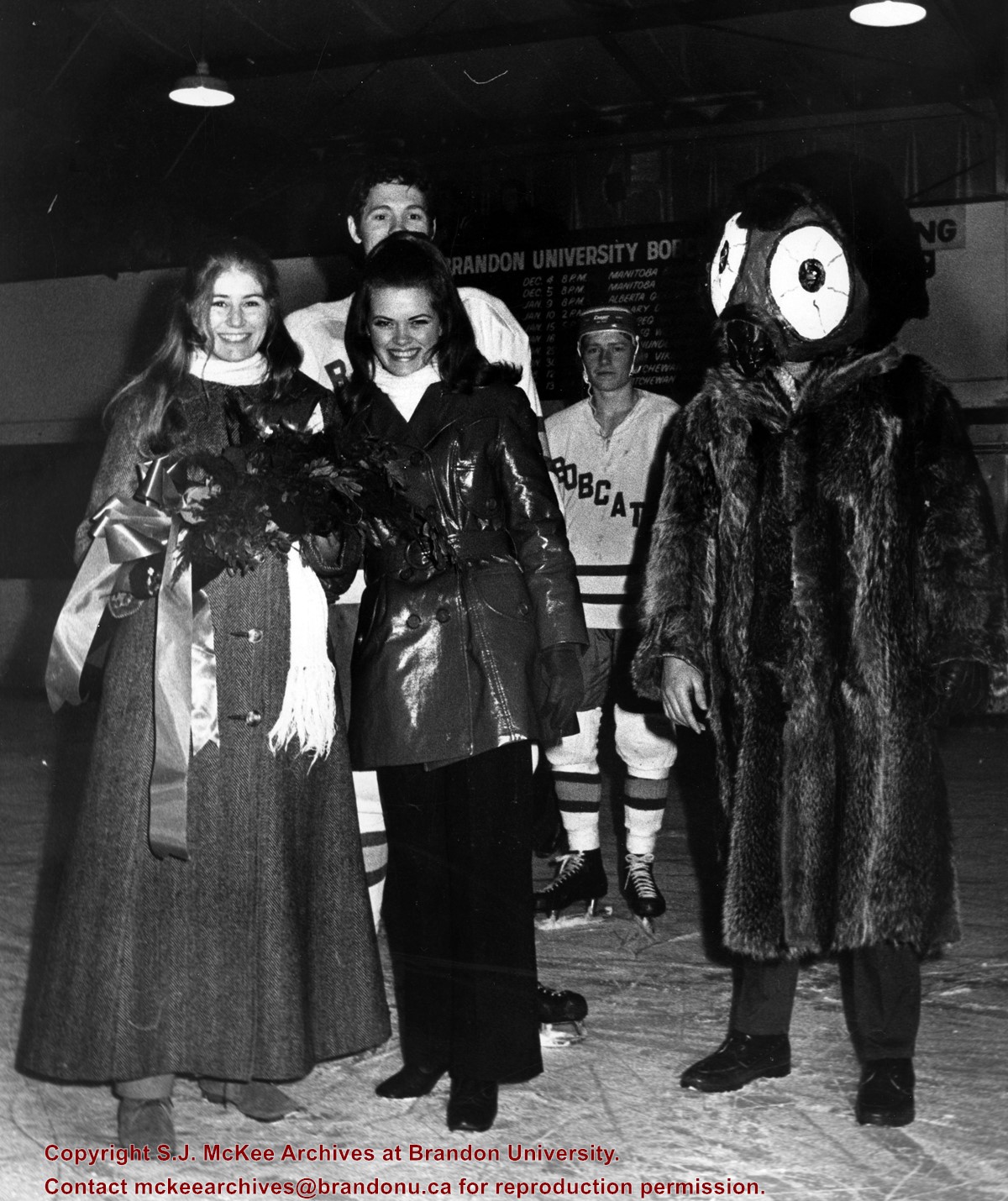
The winter carnival was composed of recreational and athletic activities. It also included a dance and the crowning of a carnival king and queen.
Scope and Content
Photograph of students on an ice rink taken during Brandon University's winter carnival. The partially visible hockey player is Mel Jesson. To the right is the winter carnival mascot.
Photograph was donated by C. Allan Elsey in September 2003. The photograph belonged to the donor's father Charles Spurgen Elsey.
Scope and Content
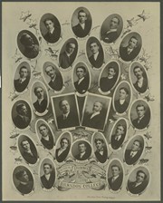
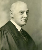
Item consists of portraits of the members of the Ministerial Association of Brandon College. Members included: J.W. Williamson; L. Whitelaw; C.S. Elsey; C. Gale; R. Standerwick; A.S. Parnell; W.P. Freeman; John Erb; A. Bowbrick (Vice President); E. Selley (President); H.S. Sneyd (Sec. Treasurer); A.W. Mayse; H.S. Mullowney; William Parsons; Rev. R. McKay; Dr. A.P. McDiarmid; R.J.M. Caul; W. Smalley; H. Winton; George Reynolds; George Merritt; G. Siemens; F.W. McKinnon; F. Crossley; H.F. Finch; H.H. Best; J.H. Frith; H.S. Bagnell; and James Start.
Bob and Kay Howland at Dunrobin, in Ottawa, hosted a reunion of the Brandon University Alumni Association. Present at the function were : Jim and Marina Lalung, Mr. and Mrs. Assison Boles, Ed Neal, Connie and Del Hewitt-White, Dorine and Hugh Best, Mary and Jack Wickers, Ian and Beverley Barnes, Nevin and Mary Ann Shaw, Mr. and Mrs. Roberts, Carol and Bob Milne, Dorothy and Clay Elston, Lenore Dinsdale, Bob and Elsie Farrell, Willa Davies, Jack Perkins (Association President), Bob and Kay Howland. This reunion included people from Orleans, Fitzroy Harbour, Stittsville, Manotick, Kingston, Ottawa, and Brandon, MB. Group photo taken at the reunion
View is southwest from approximatley 16th Street between Princess and Rosser Avenues. Photograph shows the Brandon University campus, as well as surrounding residential blocks, including Flemming, J.R. Reid and Vincent Massey schools.
View is west southwest from approximatley 16th Street between Princess and Lorne Avenues. Photograph shows the Brandon University campus, as well as surrounding residential blocks between 16th and 23rd Streets, Princess and Louise Avenues..
View is west from approximatley 17th Street between Lorne and Louise Avenues. Photograph shows a portion of the Brandon University campus (excluding the Education Building and anything north of it), as well as surrounding residential blocks from approximatley 17th Street to 22nd Street.
View is west northwest from approximatley 16th Street and Louise Avenue. Photograph shows the Brandon University campus, prior to the Library Extension, and a large portion of the city to the west of the campus.
View is northwest from approximatley 16th Street and Louise Avenue. Photograph shows the Brandon University campus, prior to the Library Extension, and a large portion of the city to the west of the campus.
Photograph shows the removal of one of the houses formerly located on 20th Street between Louise and Princess Avenues. The houses on those blocks were removed to create parking lots for the University. A Fed Zavislak Ltd. Well Drilling & Trucking pickup truck is visible at the curb.
Photograph shows the removal of one of the houses formerly located on 20th Street between Louise and Princess Avenues. The houses on those blocks were removed to create parking lots for the University.
View is northeast probably from the roof of McMaster Hall. Photograph shows the construction of the new roof on Clark Hall and the Brandon College Building. A portion of the east side of the 000 and 100 blocks of 18th Street, as well as the corner of 18th Street and Rosser Avenue are visible in the upper left hand corner. This includes the "Downtown Brandon" sign.
View is north northeast probably from the roof of McMaster Hall. Photograph shows the construction of the new roof on Clark Hall and the Brandon College Building, as well as the construction of the extension to Clark Hall and the skywalk. Portions of the city as far north as the Assiniboine River are also visible.
View is northwest from Clark Hall. Photograph shows construction materials in the area between Clark Hall and the A.E. McKenzie Building during winter. The Western Manitoba Centennial Auditorium is visible in the upper right hand corner.
View is south southeast from the skywalk. Photograph shows the courtyard in winter full of vehicles, machines and building materials. Also visible are the Development and Physical Plant H-Huts, the Citizens' Science Building, the John R. Brodie Science Centre and McMaster Hall.


