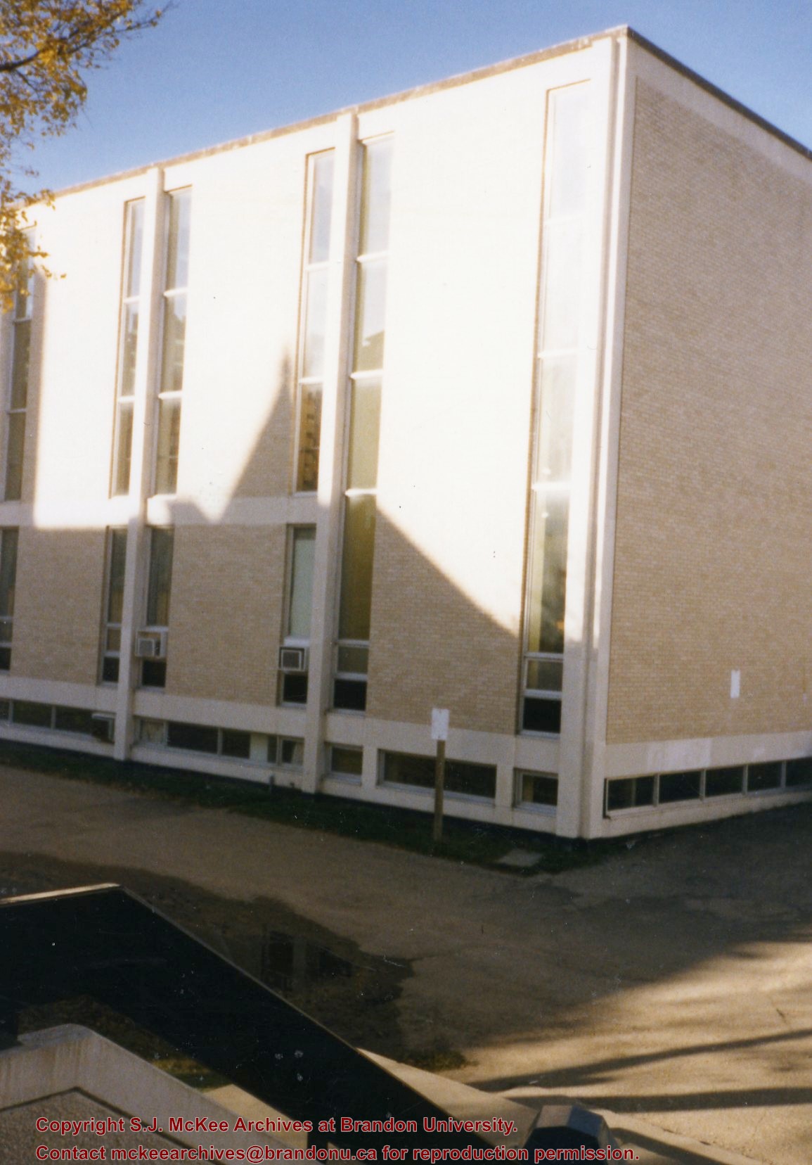
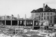
Photograph is looking southwest from the back steps of the Education Building and shows the northeast corner of the A.E. McKenzie Building, which housed the Library and Faculty of Arts.
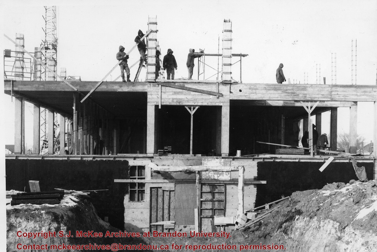
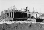
Photograph is looking either north or south into the A.E. McKenzie Building (Library and Arts Building) during construction. A number of the members of the construction crew are visible.
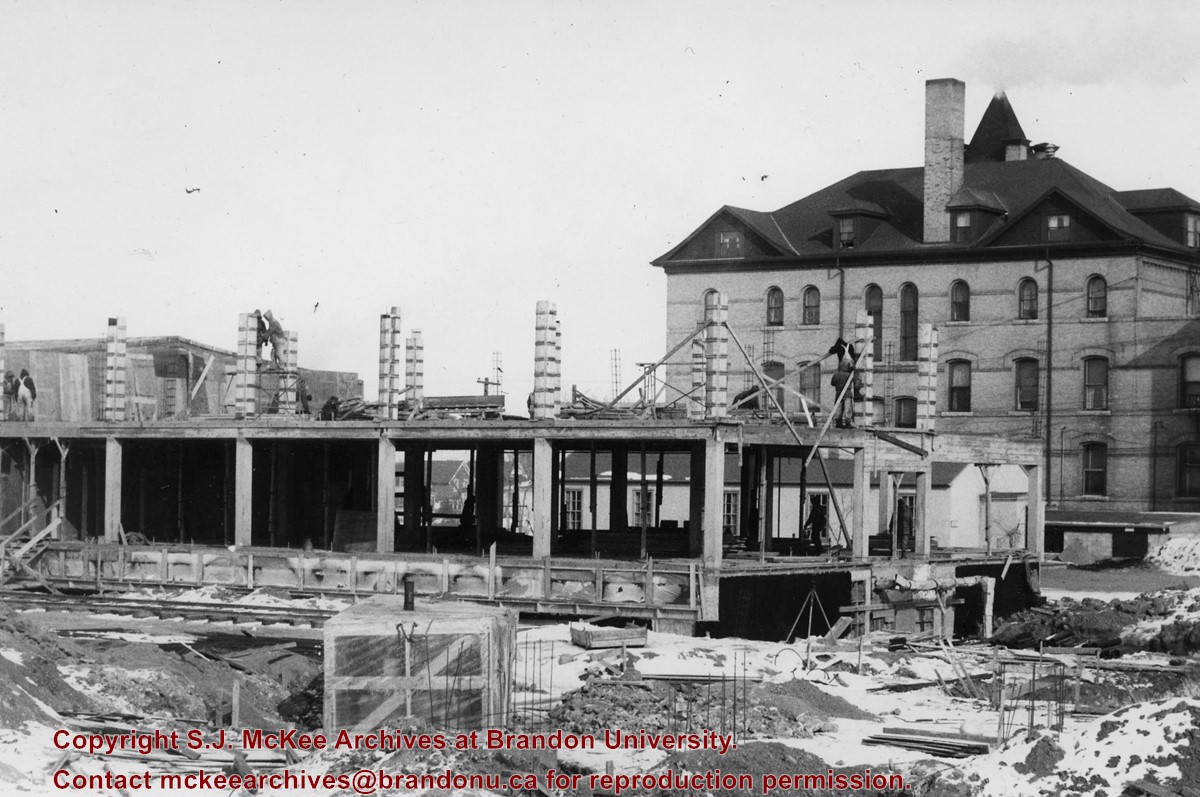
Photograph is looking east northeast and shows the construction of the A.E. McKenzie Building (Library and Arts Building). Clark Hall is in the background.
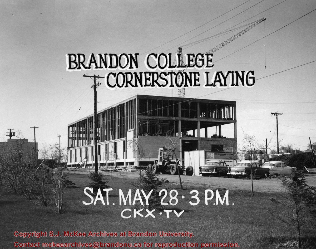
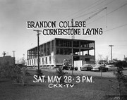
Photograph is looking southwest and shows the A.E. McKenzie Building under construction. In black lettering above the building are the words: "Brandon College Cornerstone Laying." In white lettering below the building are the words: "Sat. May 28 - 3 pm CKX TV"
Notes
The Winnipeg Tribune is stamped on the back of the photograph.
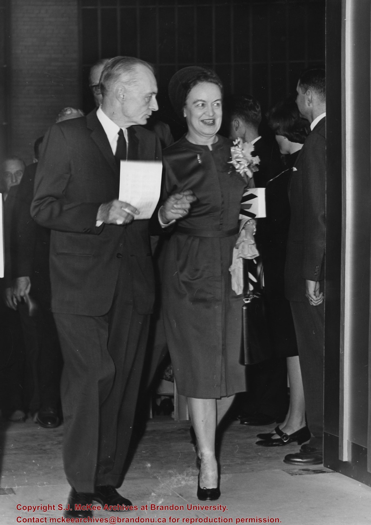
Photograph was taken at the opening of the A.E. McKenzie Building (including the Evans Theatre) and shows the J.R.C. Evans Lecture Theatre doorway. L to R Dr. John E. Robbins, Mrs. Olive (Freeman) Diefenbaker (Class of 1923 and wife of Prime Minister John George Diefenbaker)
Notes
The opening of the A.E. McKenzie Building took place the same day as the installation of John E. Robbins as President of Brandon College.
Brandon College looking south from 19th Street. Photograph was taken after Flora Cowan Hall was built but before construction of the Education Building.
Image is looking east northeast from approximately the 300 block of 23rd Street between Lorne and Louise Avenues. Photograph shows the Brandon College campus after the opening of the original Music Building in 1963, but before the construction of the Education Building in 1966. A number of house on the 300 blocks of 22nd and 21st Streets are visible in the foreground, with the A.E. McKenzie Seed Co., the Prince Edward Hotel and various grain elevators on the horizon.
Image shows the Brandon College campus from 17th Street looking southwest. The photo was taken after the completion of the original Music Building in 1963, but construction of the Education Building. Also visible are a number of properties on the 200 block of 18th Street and the 200 block of 20th Street.
View is southwest from approximatley 16th Street between Princess and Rosser Avenues. Photograph shows the Brandon University campus, as well as surrounding residential blocks, including Flemming, J.R. Reid and Vincent Massey schools.
View is west southwest from approximatley 16th Street between Princess and Lorne Avenues. Photograph shows the Brandon University campus, as well as surrounding residential blocks between 16th and 23rd Streets, Princess and Louise Avenues..
View is west from approximatley 17th Street between Lorne and Louise Avenues. Photograph shows a portion of the Brandon University campus (excluding the Education Building and anything north of it), as well as surrounding residential blocks from approximatley 17th Street to 22nd Street.
View is west northwest from approximatley 16th Street and Louise Avenue. Photograph shows the Brandon University campus, prior to the Library Extension, and a large portion of the city to the west of the campus.
View is northwest from approximatley 16th Street and Louise Avenue. Photograph shows the Brandon University campus, prior to the Library Extension, and a large portion of the city to the west of the campus.
View is southwest from approximatley 16th Street between Lorne Avenue and Princess Avenue. The view extends to approximately 26th Street. Photograph shows the Brandon University campus, Kinsmen Stadium, Fleming School, Coronation Park and residential blocks.
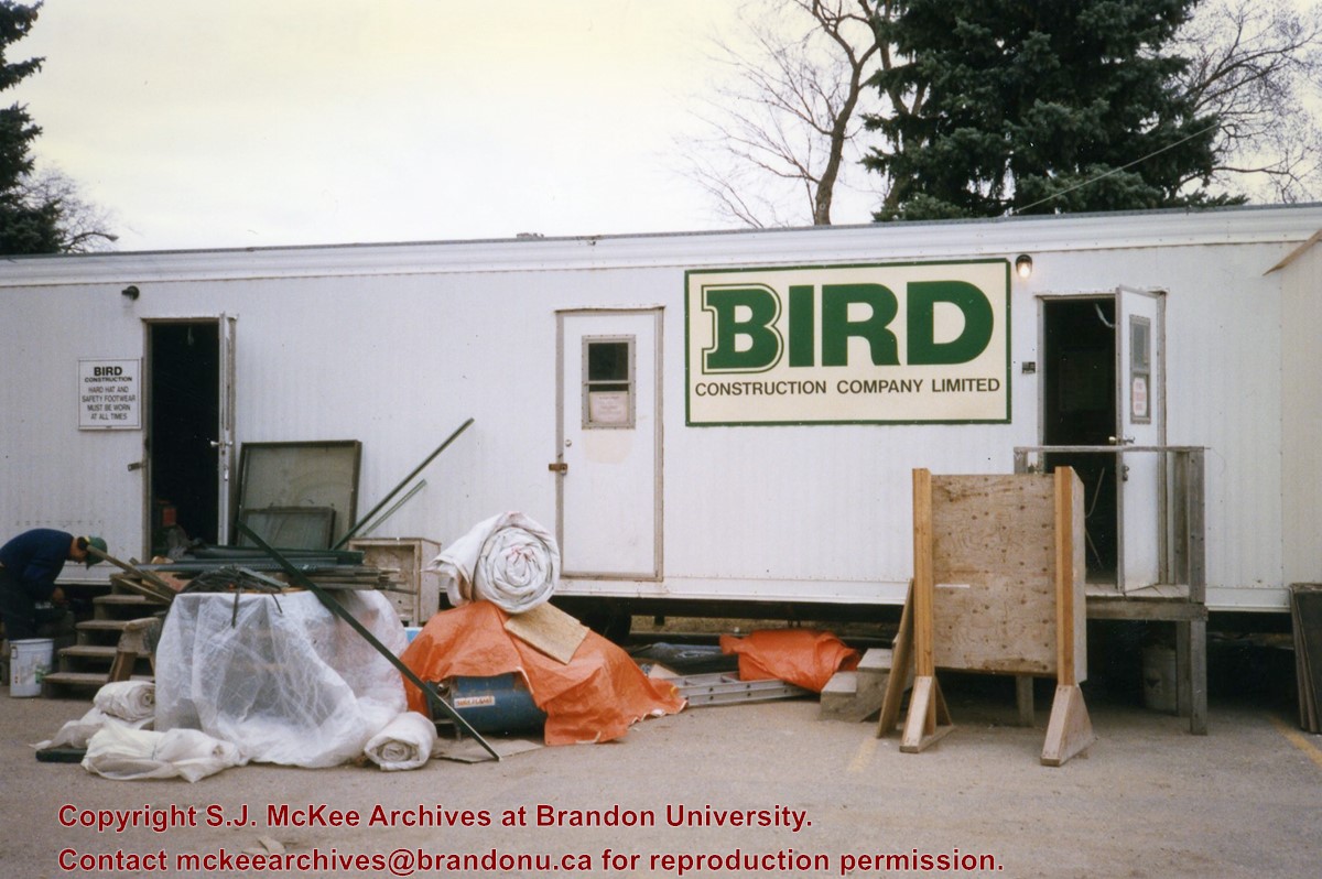
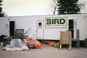
Photograph shows the Bird Construction Company Limited trailer located on the driveway of the Brandon University campus during the renovations to the Brandon College Building and Clark Hall.
View is northwest from the roof of the John R. Brodie Science Centre. Photograph shows the roof of the Knowles Douglas Students' Union Centre, the Citizens' Science Building, and the Brandon College Building and Clark Hall during renovation.
Photograph was taken from the roof of the Library and shows the walkway and flower bed on the southeast corner of the George T. Richardson Centre. The Physical Plant H-Hut is visible in the top right hand corner.
View is southwest from the roof of the George T. Richardson Centre. Photograph shows the curved glass wall of the John E. Robbins Library, the walkway between the Library and the Dining Hall, the Dining Hall and Darrach Hall.


