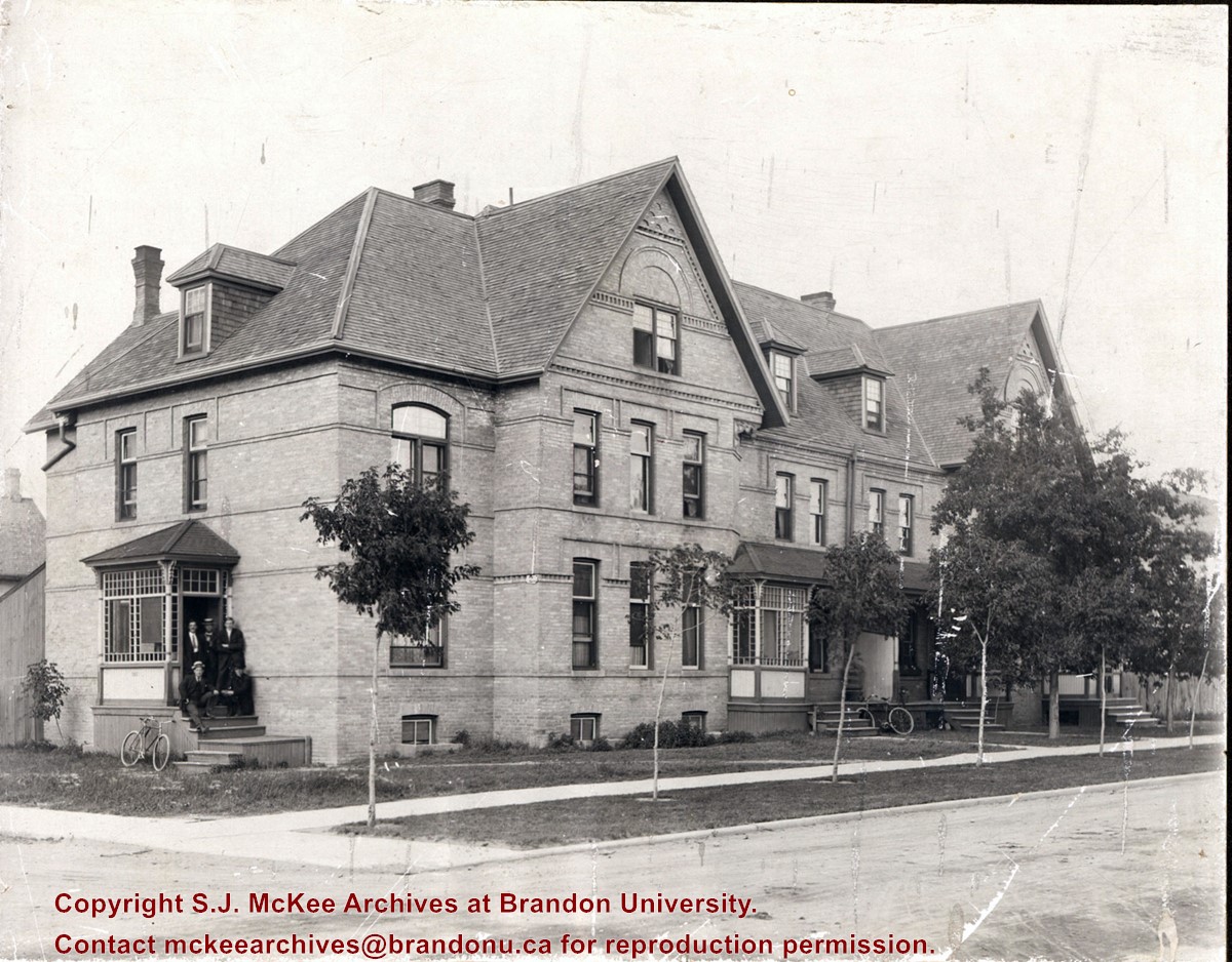
Photograph shows a three-storey multi-family brick house that appears to have at least four units. The structure also has a basement. A group of five men are posing on a stoop on the west side of the building. Sapplings have been planted on the boulevard in front the building.
Notes
Writing on the back of the photograph reads: Lorne Terrace, 12th and Lorne, always in the Hughes Family.
Photograph is scratche and scuffed. Top right corner is creased.
Scope and Content
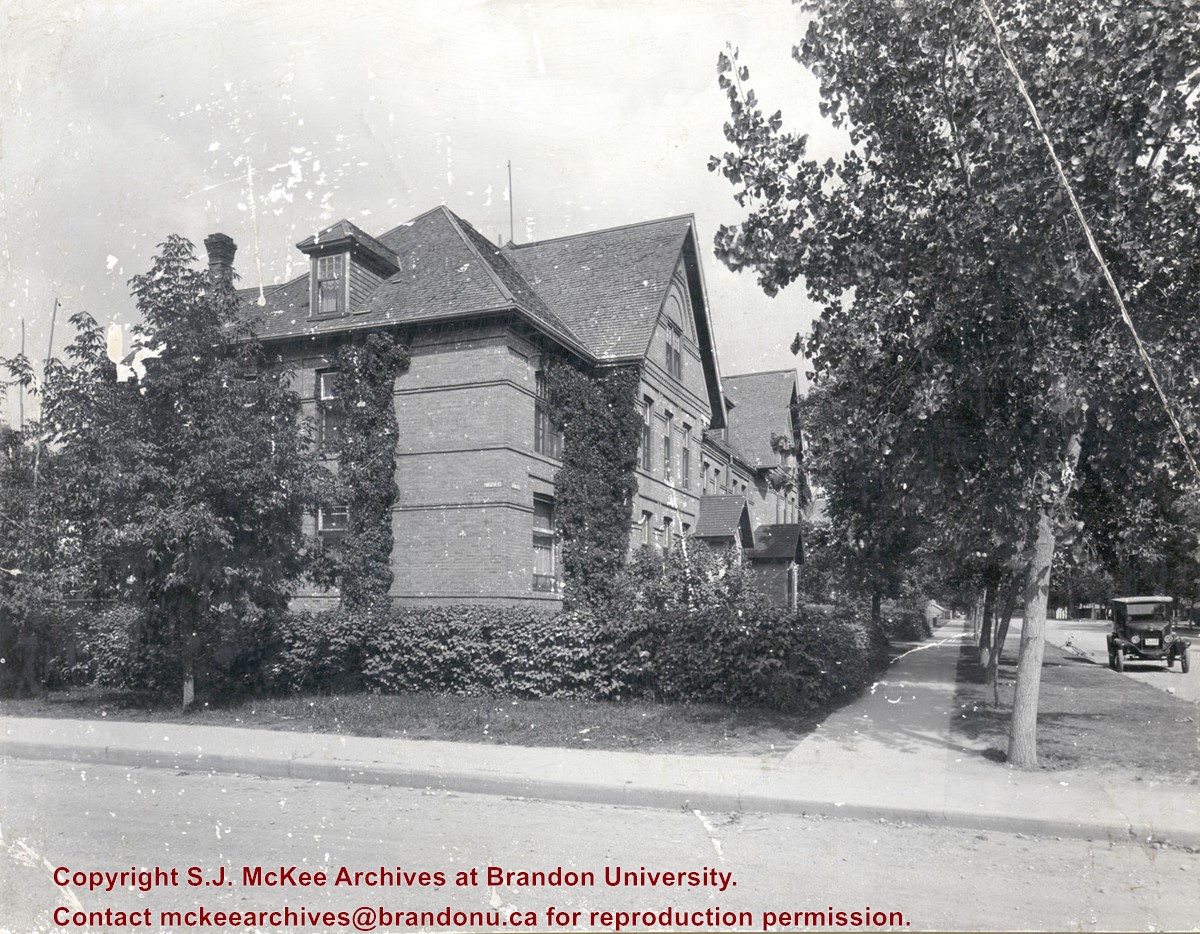
Photograph shows the three storey brick terraced property at 12th Street and Lorne Avenue. The entrance/stoop on the west side of the property appears to have been removed and the Lorne Street entrances have been modified (see 3-1997.72 for a comparison). Ivy is growing up the side of the house and the tree on the boulevard have grown and tower above the roof-line. A motor car is parked on Lorne Avenue in front the property.
Photograph of east side of 10th Street, Brandon, Manitoba, between Rosser and Princess Avenues. Visible businesses include: The Bank of Montreal, Barclay's Shoe Store, Carlton Cafe (in the former Cigar Factory), and Ted Heming Jewellers. The McKenzie Seed building is visible in the background.
Photograph shows the southeast corner of 10th Street and Rosser Avenue, Brandon, Manitoba. The Bank of Montreal is situated on the corner. Visible businesses along the east side of 10th Street include: Barclay's Shoe Store, Carlton Cafe, and Ted Heming Jewellers.
Postcard shows an aerial view of 9th Street facing south in Brandon, Manitoba. Visible businesses and landmarks include: Beaubier Hotel, YMCA/police station, the original CKX Radio station towers on 8th Street (est. 1928 - moved 1940), the old City Hall, Prince Edward Hotel, and the original Manitoba Power commission smokestack on 10th Street.
Notes
Writing on the front of the photograph reads: Brandon, Man., Jerrett Photo. This photograph shows a rare view of the 800-block between Rosser and Princess Avenues.


