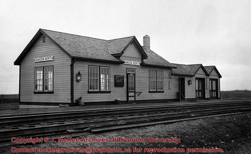
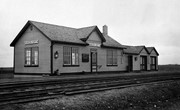
[This station, located 13 km north of Brandon on the east side of PTH 10, was] built in the early 1930s to replace Knox as the CNR’s mainline station for Brandon. All passenger trains stopped and buses operated between the CNR’s Brandon station and Brandon North to meet all trains. It was enlarged as shown here in late 1930s, and at peak operation in the 1940s & 1950s saw six daily passenger trains 1 - 2 & 3 - 4 “Continental Limited” and 11 - 12 locals. VIA trains 3 and 4 "Supercontinental" ceased operation Nov. 15, 1981 leaving no passenger service on the former Grand Trunk Pacific mainline of CNR [at that time]. This station was demolished in the fall of 1982.
Custodial History
For custodial history see the collection level description of the Lawrence Stuckey collection.
Photograph shows the Red Indian (Gasoline) Station on the north side Princess Avenue between 9th and 10th Streets, Brandon. Attached to the west side of the gas station is another shop which contains Hutchings' Drug Store. The Alexandra Block on 10th Street is visible in the background.
For custodial history see the collection level description of the Lawrence Stuckey collection.
Scope and Content
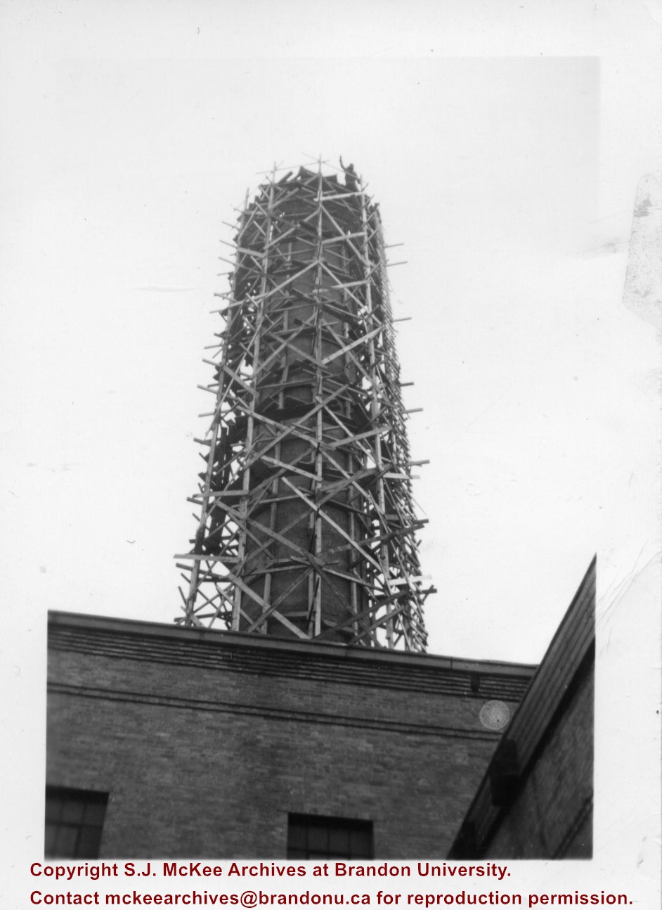
Brandon University [Brodie Science Centre (foreground), McMaster Hall (background)]
Notes
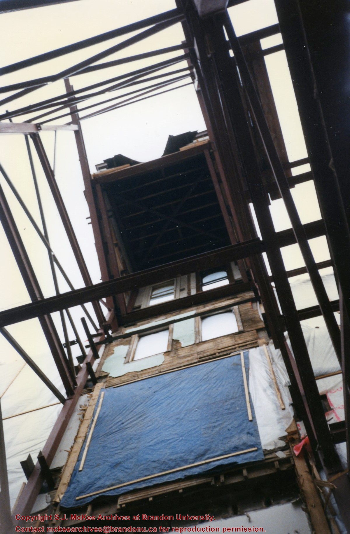
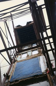
Construction of new [Brodie Science Centre].
[Note McMaster Hall under construction in background.]
[Mr. Stuckey put two negatives in the same envelope and taped the prints to the outside. We have separated them and numbered the negatives DA9(1) and DA9(2), and the prints DA9(1a) and DA9(2a).]
For custodial history see the collection level description of the Lawrence Stuckey collection.
Scope and Content
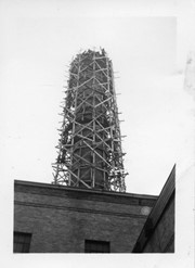
Brandon University [Brodie Science Centre (foreground), McMaster Hall (background)]
Notes
Construction of new [Brodie Science Centre].
[Note McMaster Hall under construction in background.]
[Mr. Stuckey put two negatives in the same envelope and taped the prints to the outside. We have separated them and numbered the negatives DA9(1) and DA9(2), and the prints DA9(1a) and DA9(2a).]
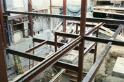
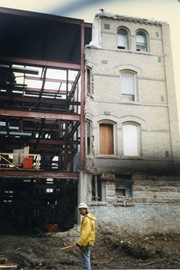
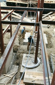
Photograph shows construction on the basement of the Brandon College Building and Clark Hall, including support beams, concrete walls, mounds of dirt and a number of workers.
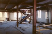
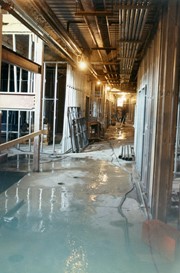
Photograph shows what appears to be a flood in one of the hallways of the Brandon College Building and Clark Hall after the interior walls had been framed out.
Photograph shows the 700-block of Rosser Avenue facing west. Visible businesses on the north side of Rosser Avenue include: Burchill's Music Store, E.W. Woolworth Co. Ltd. 5-10 and 15 Cent Store in the E.E. Evans Block, Empire Hotel, and W.A. Paterson Drugs. Automobiles are parked on both sides of the avenue and at the time the photograph was taken, Rosser Avenue was a two-way street.
Notes
Part of "Souvenir of Brandon, Manitoba, Canada [viewbook], Printed by Photogelatine Engraving Co. Limited, Ottawa." Dates obtained from the Burchill's Music Store Henderson's Brandon City Directory listings (1927-1929). Writing on the front of the photograph reads: Rosser St. [sic.] - Brandon, Man.
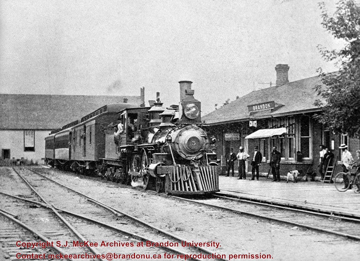
The building near the back of the train was the original Salvation Army Citadel. Built in 1889, it was purchased by Wm. Graham in 1910 and moved to the west side of the 300 block of 10th St. It had to be moved to build the Prince Edward Hotel and eventually became part of "Billy" Graham's dance hall.
Custodial History
For custodial history see the collection level description of the Lawrence Stuckey collection.
Scope and Content
Northern Pacific and Manitoba Railway engine No. 5, with passenger train
Photograph shows the Greyhound Bus Depot at 11th Street and Princess Avenue. Western Motors, Wheelers Esso Station, and the Prince Edward Hotel are visible along the south side of Princess Avenue. Traffic is travelling one-way on Princess Avenue.
Photograph shows Western Motors Ltd. on the southwest corner of 10th Street and Princess Avenue. To the west of the car dealership/garage is the Greyhound Bus Station and its Maxwell House Cafe as well as the court house.
Red ink stain is on the front right corner of postcard
Scope and Content
Photograph shows 10th Street facing south from Princess Avenue. Visible landmarks and businesses include: Manitoba Power Commission (MPC)'s power sub-station, First Baptist Church, Wheat City Arena, and the grand stand at the Exhibition Grounds.
The partial sign visible at the bottom of the photograph on the east side of 10th Street reads Yates and Neale, which refers to a plumbing and heating company that dissolved in 1943 to be replaced by Neale, Stothard and Chapman.
Businesses on the west side of 10th Street include: Dominion Tire & Radio Co., Bolts Barber Shop, Elviss T.E. Co. Stables.
Notes
Information concerning Yates and Neale courtesy Jack Stothard. Writing on the front of the postcard reads: Brandon, Looking S.W., Jerrett Photo. This photograph shows a rare view of the 200-block of 10th Street.
Photograph shows a street view of 10th Street facing north. There are many automobiles parked along the street and several pedestrians in summer dress are on the sidewalks and street. Visible business signs include: Hentzman & Co. Pianos (possibly belonging to J.J.H. McLean Co. Ltd.), the Strand Theatre, T & D Clothes, Campbell & Campbell, the CPR Station, and Bowling Alley and Billiards.
Notes
Part of "Souvenir of Brandon, Manitoba, Canada [viewbook], Printed by Photogelatine Engraving Co. Limited, Ottawa." Dates obtained from the Burchill's Music Store Henderson's Brandon City Directory listings (1927-1929). Writing on the front of the photograph reads: 10th St., looking north (C.P.R. Station at end of Street) Brandon, Man.
.jpg?width=1200&404=no-img.jpg&watermark=wmk)
.jpg?width=180&404=no-img.jpg)


.jpg?width=1200&404=no-img.jpg&watermark=wmk)
.jpg?width=180&404=no-img.jpg)
.jpg?width=1200&404=no-img.jpg&watermark=wmk)
.jpg?width=180&404=no-img.jpg)


.jpg%3fmaxheight%3d1000%26maxwidth%3d1000%26watermark%3dwmk&description=CNR+Station+at+Prince+Edward+Hotel)
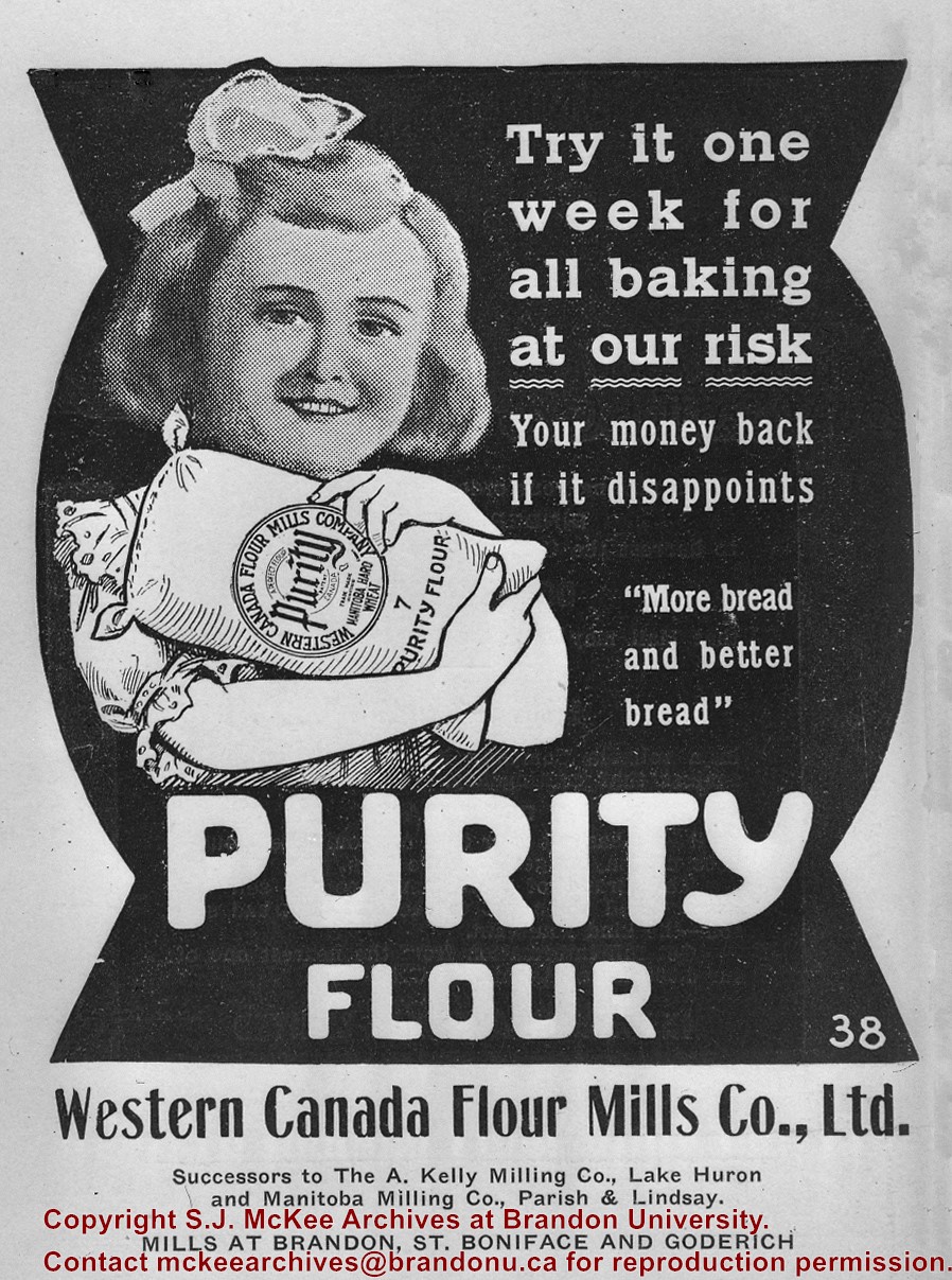
+-+Advertisement)
+north+side+Princess+Avenue+between+9th+Street+and+10th+Street%2c+Brandon%2c+Manitoba)
.jpg%3fmaxheight%3d1000%26maxwidth%3d1000%26watermark%3dwmk&description=Brandon+University+-+Brodie+Science+Centre+Construction)
.jpg%3fmaxheight%3d1000%26maxwidth%3d1000%26watermark%3dwmk&description=Brandon+University+-+Brodie+Science+Centre+Construction)