According to Stuckey and Bain (1996), “The Brandon, Saskatchewan & Hudson’s Bay Railway was built and operated as a totally owned subsidiary of the Great Northern Railway. Construction commenced in late 1905 and by the end of 1905, less than a mile of track had been laid north of the boundary at St. John. In 1906, the remaining 68.6 miles to Brandon were laid and service commenced that year. During the Depression of the 1930s, traffic declined significantly and the entire branch was abandoned in 1936. Over much of the branch’s length, the ties and rails were laid on the prairie without ballast and today little remains of the line apart from traces where there were cuts and bridges.” (p. 18)
Stuckey, L. A., & Bain, D. M. (1996). The Great Northern and Northern Pacific railways in Canada. Calgary, Alberta: British Railway Modellers of North America.
Custodial History
For custodial history see the collection level description of the Lawrence Stuckey collection.
Scope and Content
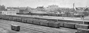
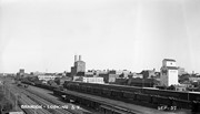
View of Canadian Pacific (foreground) and Great Northern (background) railway yards, as well as Great Northern station in Brandon, Manitoba.
Notes
Shows a 500 series F-1 class 2-8-0 engine switching
Published in Canadian Rail, August 1975
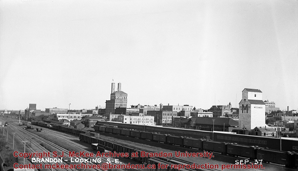
Buildings that are visible in this photo, but now gone (1987), include Codvilles, Western Grocers (Burbridge Saddlery), John E. Smith Block, Federal building, City Hall, and the Prince Edward Hotel [Fred McGuinness collection (20-2009)].
[This copy negative was produced using a previously published image. P.E. 30/07/09]
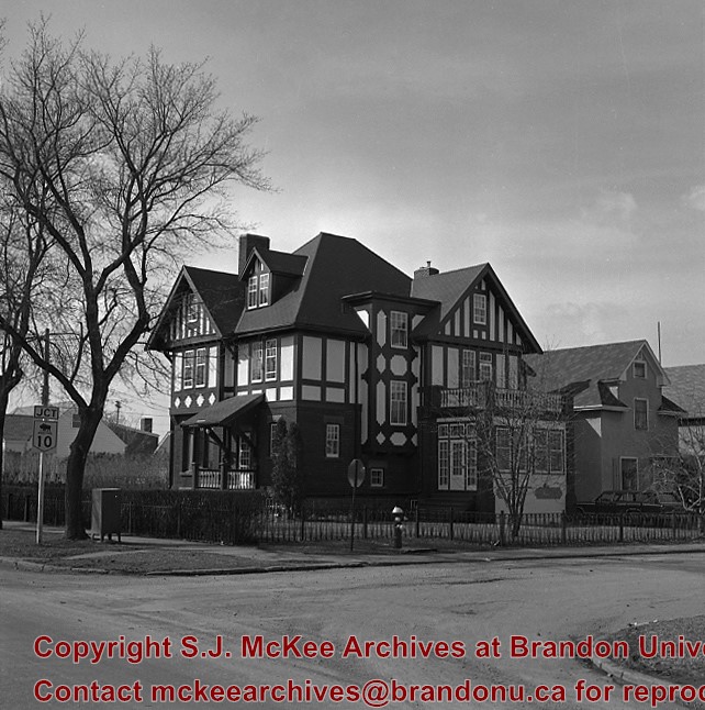
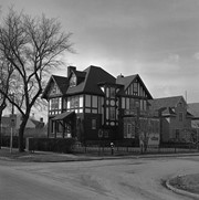
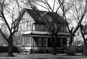
Casa Maley was constructed in 1912 by Henry F. Maley, founder and owner of the Brandon Brewery Company. Erected towards the end of Brandon’s great economic boom, the house is representative of those stately homes that grace the central area of the city. The Tudor styling, expressed in the half timbers and dramatic play of dark and light patterns, was a popular architectural expression of the era. The spacious interior includes an ornate staircase constructed in quarter cut oak and, throughout the house, wood detailing of exquisite craftsmanship. The house was purchased by Dr. McDiarmid, whose family occupied the home for the next sixty years. It is currently used as a bed and breakfast establishment.
Scope and Content
Photograph is looking northwest and shows 1605 Victoria Avenue.
Notes
Manitoba Municipal Heritage Site No. 80. History/Bio taken from the Manitoba Culture, Heritage, Tourism and Sport webpage, available at: http://www.gov.mb.ca/chc/hrb/mun/m080.html (August 2008).
Repro Restriction
The McKee Archives is the copyright holder for the Stuckey materials.
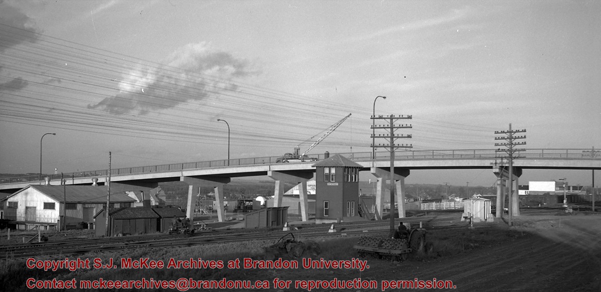
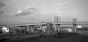
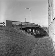
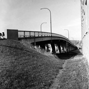
Photograph is looking east down Lorne Avenue East from approximately the 13th Avenue East intersection. On the north side of the street are the Hillside Townhouses with the Lady Sylvia apartment block and Simplot Canada Ltd. in the background.
Repro Restriction
The McKee Archives is the copyright holder for the Stuckey materials.
For custodial history see the collection level description of the Lawrence Stuckey collection.
Scope and Content
View of Assiniboine Avenue running west, from Ninth Street North
Notes
Second building from right - Westbrook & Fairchild Implements. At left - Western Hotel; Data [courtesy of] Roy Brown from Henderson's [Directory]; From Manitoba Archives
For custodial history see the collection level description of the Lawrence Stuckey collection.
Scope and Content
Photograph is looking east down Lorne Avenue East from approximately the 13th Avenue East intersection. On the north side of the street are the Hillside Townhouses with the Lady Sylvia apartment block and Simplot Canada Ltd. in the background.
The McKee Archives is the copyright holder for the Stuckey materials.
Location Copy
1-2002.3.9.110
Storage Location
Lawrence Stuckey collection
Arrangement
[Mr. Stuckey put 5 and 5 prints negatives in the same envelope. We have separated them and numbered the negatives CA15(1) to CA15(5), and the corresponding prints CA15(1a) to CA15(5a).]
[The land on which city hall stood in this photo is now known as Princess Park. P.E. 01/06/09]
Custodial History
For custodial history see the collection level description of the Lawrence Stuckey collection.
Scope and Content
Princess Avenue, showing City Hall & CKX radio tower
Notes
[View is from 9th Street looking east. P.E.]
"Radio towers of CKX on city hall grounds were 150 feet tall; Studio and transmitter were on the east side of city hall." - Fred McGuinness collection (20-2009).
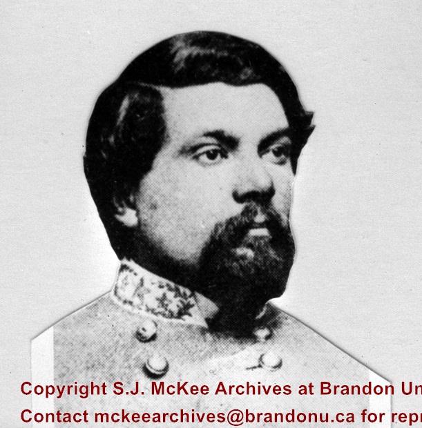
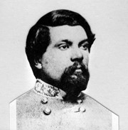
Stuckey's notes: Chief Engineer Northern Pac. RR. 1870-1882. Chief Engineer CPR 1881, Winnipeg-Oak Lake, Man. Selected Brandon as site of First Div. Point W. of Winnipeg.
Scope and Content
Portrait of Thomas Lafayette Rosser.
Notes
Corresponds with negative 1-2002.3.9.P1.
Repro Restriction
The McKee Archives is the copyright holder for the Stuckey materials.
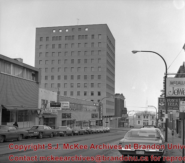
Photograph is looking north northwest along 10th Street to Pacific Avenue. Visible are: Pollock Beauty School, Tru-Art for Beauty, Beneficial Financial Systems Loans, Kresge's, Scotia Towers, Cecil Hotel, CPR Station, and the signs for Stylerite, Trifon's Pizza and Spaghetti House, and McCallum's Jewellers.
Repro Restriction
The McKee Archives is the copyright holder for the Stuckey materials.
The McKee Archives is the copyright holder for the Stuckey materials.
Storage Location
Lawrence Stuckey collection
Arrangement
[Mr. Stuckey put 2 negatives and a print in the same envelope. He numbered the negatives BH2 and BH2a. We separated them and kept his original numbering. We numbered the print BH2aa and placed it in its own envelope.]
For custodial history see the collection level description of the Lawrence Stuckey collection.
Scope and Content
10th Street Commercial Block
Notes
The Commercial Block is located on the east side of the 100 block of 10th Street, directly south of the Hughes Block.
[Mr. Stuckey put two negatives and two prints in one envelope. We have separated them and numbered the negatives EA2(1) and EA2(2), and the prints EA2(1a) and EA2(2a).]

.jpg?width=1200&404=no-img.jpg&watermark=wmk)
.jpg?width=180&404=no-img.jpg)


.jpg?width=1200&404=no-img.jpg&watermark=wmk)
.jpg?width=180&404=no-img.jpg)
.jpg?width=1200&404=no-img.jpg&watermark=wmk)
.jpg?width=180&404=no-img.jpg)
.jpg%3fmaxheight%3d1000%26maxwidth%3d1000%26watermark%3dwmk&description=Townhouses+on+Lorne+Avenue+East)
.jpg%3fmaxheight%3d1000%26maxwidth%3d1000%26watermark%3dwmk&description=Townhouses+on+Lorne+Avenue+East)
.jpg%3fmaxheight%3d1000%26maxwidth%3d1000%26watermark%3dwmk&description=10th+Street+Commercial+Block)
.jpg%3fmaxheight%3d1000%26maxwidth%3d1000%26watermark%3dwmk&description=10th+Street+Commercial+Block)