Skip header and navigation

Revise Search

20 records – page 5 of 1.

Brandon University campus construction

http://archives.brandonu.ca/en/permalink/descriptions8022
Part Of
Brandon University Photograph collection
Description Level
Item
GMD
graphic
Date Range
c. 1996
Part Of
Brandon University Photograph collection
Creator
Photographer: Sandy Black
Description Level
Item
Series Number
2.1
Item Number
BUPC 2.1.88
GMD
graphic
Date Range
c. 1996
Physical Description
4" x 6" (colour)
Scope and Content
View is north northwest from the roof of the John R. Brodie Science Centre. Photograph shows the Knowles Douglas Students' Union Building, and the Citizens' Science Building, the Brandon College Building and Clark Hall under restoration, as well as parts of the driveway and front lawn, including the flag pole.
Subject Access
campus photographs
campus buildings
campus construction
Images
Show Less

Brandon University campus construction

http://archives.brandonu.ca/en/permalink/descriptions8024
Part Of
Brandon University Photograph collection
Description Level
Item
GMD
graphic
Date Range
c. 1996
Part Of
Brandon University Photograph collection
Description Level
Item
Series Number
2.1
Item Number
BUPC 2.1.90
GMD
graphic
Date Range
c. 1996
Physical Description
6" x 4" (colour)
Scope and Content
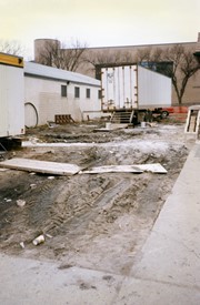
Image is looking north along the driveway in front of Clark Hall and the Brandon College Building, and shows building materials, equipment and debris. The photograph was taken during the renovations of the Brandon College Building and Clark Hall.
Subject Access
campus photographs
campus construction
Images
Show Less

Brandon University campus construction

http://archives.brandonu.ca/en/permalink/descriptions8025
Part Of
Brandon University Photograph collection
Description Level
Item
GMD
graphic
Date Range
c. 1996
Part Of
Brandon University Photograph collection
Description Level
Item
Series Number
2.1
Item Number
BUPC 2.1.91
GMD
graphic
Date Range
c. 1996
Physical Description
4" x 6" (colour)
Scope and Content
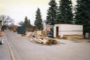
View is west from the sidewalk between the Brandon College Building and the Citzens' Science Building. Photograph shows an H-Hut, two trailers and general construction mayhem.
Subject Access
campus photographs
campus construction
Images
Show Less

Aerial view: Brandon University campus

http://archives.brandonu.ca/en/permalink/descriptions605
Part Of
Aerial views and campus photographs
Description Level
Item
GMD
graphic
Date Range
c. 1969
Part Of
Aerial views and campus photographs
Description Level
Item
Series Number
2.1
Item Number
2.1.12
GMD
graphic
Date Range
c. 1969
Physical Description
3.5" x 3.5" (b/w)
Scope and Content
View is northeast. Brandon University campus and some of the surrounding residential areas.
Images
Show Less

Aerial view: Brandon University campus

http://archives.brandonu.ca/en/permalink/descriptions607
Part Of
Aerial views and campus photographs
Description Level
Item
GMD
graphic
Date Range
c. 1970
Part Of
Aerial views and campus photographs
Description Level
Item
Series Number
2.1
Item Number
2.1.14
GMD
graphic
Date Range
c. 1970
Physical Description
5" x 3" (b/w)
Scope and Content
View is north northwest from the roof of Flora Cowan Hall (?). Photograph shows: the J.R.C. Evans Lecture Theatre, the A.E. McKenzie Building and the Western Manitoba Centennial Auditorium as well as a number of houses on 20th Street.
Images
Show Less

Aerial view: Brandon University campus

http://archives.brandonu.ca/en/permalink/descriptions618
Part Of
Aerial views and campus photographs
Description Level
Item
GMD
graphic
Date Range
c. 1969
Part Of
Aerial views and campus photographs
Description Level
Item
Series Number
2.1
Item Number
2.1.26
GMD
graphic
Date Range
c. 1969
Physical Description
3.5" x 3.5" (b/w)
Scope and Content
Taken from an airplane, photograph is looking northwest from approximatley 15th Street and Louise Avenue. Shown are a number of residential blocks, the Brandon University campus, the railroad tracks and the Assiniboine River to approximatley 34th Street.
Images
Show Less

Aerial view: Brandon University campus

http://archives.brandonu.ca/en/permalink/descriptions619
Part Of
Aerial views and campus photographs
Description Level
Item
GMD
graphic
Date Range
c. 1969
Part Of
Aerial views and campus photographs
Description Level
Item
Series Number
2.1
Item Number
2.1.27
GMD
graphic
Date Range
c. 1969
Physical Description
3.5" x 3.5" (b/w)
Scope and Content
Taken from an airplane, photograph is looking north northwest from almost right above the Brandon University campus.
Images
Show Less

Aerial view: Brandon College campus

http://archives.brandonu.ca/en/permalink/descriptions622
Part Of
Aerial views and campus photographs
Description Level
Item
GMD
graphic
Date Range
c. 1962
Part Of
Aerial views and campus photographs
Description Level
Item
Series Number
2.1
Item Number
2.1.20
GMD
graphic
Date Range
c. 1962
Physical Description
10" x 8" (b/w)
Scope and Content
View is northwest from approximately the corner of 18th Street and Louise Avenue. Photograph shows the Brandon College campus after the completion of Flora Cowan Hall.
Notes
BUPC 2.1.24 is a smaller version of this photograph.
Images
Show Less

Brandon University campus front lawn

http://archives.brandonu.ca/en/permalink/descriptions769
Part Of
Aerial views and campus photographs
Description Level
Item
GMD
graphic
Date Range
May 1978
Part Of
Aerial views and campus photographs
Description Level
Item
Series Number
2.1
Item Number
2.1.143
GMD
graphic
Date Range
May 1978
Physical Description
3.5" x 5" (colour)
Scope and Content
Photograph is looking south and shows the front lawn. The John R. Brodie Science Centre is in the background.
Images
Show Less

Brandon University campus front lawn

http://archives.brandonu.ca/en/permalink/descriptions772
Part Of
Aerial views and campus photographs
Description Level
Item
GMD
graphic
Date Range
May 1978
Part Of
Aerial views and campus photographs
Description Level
Item
Series Number
2.1
Item Number
2.1.32
GMD
graphic
Date Range
May 1978
Physical Description
5" x 3.5" (colour)
Scope and Content
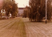
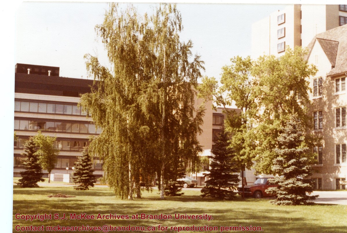
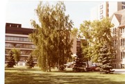
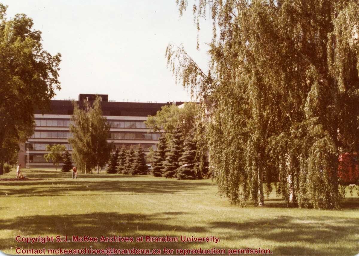
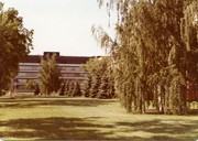
View is south southwest. Photograph shows the Brandon University campus front lawn in summer, with the John R. Brodie Science Centre, McMaster Hall, and the Citizens' Science Building in the background.
Images
Show Less

Brandon University campus front lawn

http://archives.brandonu.ca/en/permalink/descriptions774
Part Of
Aerial views and campus photographs
Description Level
Item
GMD
graphic
Date Range
May 1978
Part Of
Aerial views and campus photographs
Description Level
Item
Series Number
2.1
Item Number
2.1.33
GMD
graphic
Date Range
May 1978
Physical Description
5" x 3.5" (colour)
Scope and Content
View is south. Photograph shows the Brandon University campus front lawn in summer. The John R. Brodie Science Centre is in the background.
Images
Show Less

Brandon College campus from the north

http://archives.brandonu.ca/en/permalink/descriptions957
Part Of
Aerial views and campus photographs
Description Level
Item
GMD
graphic
Date Range
c. 1950s
Part Of
Aerial views and campus photographs
Description Level
Item
Series Number
2.1
Item Number
2.1.39
GMD
graphic
Date Range
c. 1950s
Physical Description
4.5" x 2.75" (b/w)
Scope and Content
View is southwest. Photograph shows: Clark Hall, the Brandon College Building and the Citizens' Science Building.
Images
Show Less

Aerial view - Brandon University campus

http://archives.brandonu.ca/en/permalink/descriptions7989
Part Of
Brandon University Photograph collection
Description Level
Item
GMD
graphic
Date Range
c. 2000
Part Of
Brandon University Photograph collection
Creator
Photograph commissioned by Brandon University and taken by Yourview Aerial Scenics Ltd.
Description Level
Item
Series Number
2.1
Item Number
BUPC 2.1.55
GMD
graphic
Date Range
c. 2000
Physical Description
6" x 4" (colour)
Scope and Content
View is southwest from approximatley 16th Street between Princess and Rosser Avenues. Photograph shows the Brandon University campus, as well as surrounding residential blocks, including Flemming, J.R. Reid and Vincent Massey schools.
Subject Access
aerial photographs
campus photographs
campus buildings
Brandon streets
Images
Show Less

Aerial view - Brandon University campus

http://archives.brandonu.ca/en/permalink/descriptions7990
Part Of
Brandon University Photograph collection
Description Level
Item
GMD
graphic
Date Range
c. 2000
Part Of
Brandon University Photograph collection
Creator
Photograph commissioned by Brandon University and taken by Yourview Aerial Scenics Ltd.
Description Level
Item
Series Number
2.1
Item Number
BUPC 2.1.56
GMD
graphic
Date Range
c. 2000
Physical Description
6" x 4" (colour)
Scope and Content
View is west southwest from approximatley 16th Street between Princess and Lorne Avenues. Photograph shows the Brandon University campus, as well as surrounding residential blocks between 16th and 23rd Streets, Princess and Louise Avenues..
Subject Access
aerial photographs
campus photographs
campus buildings
Brandon streets
Images
Show Less

Aerial view - Brandon University campus

http://archives.brandonu.ca/en/permalink/descriptions7991
Part Of
Brandon University Photograph collection
Description Level
Item
GMD
graphic
Date Range
c. 2000
Part Of
Brandon University Photograph collection
Creator
Photograph commissioned by Brandon University and taken by Yourview Aerial Scenics Ltd.
Description Level
Item
Series Number
2.1
Item Number
BUPC 2.1.57
GMD
graphic
Date Range
c. 2000
Physical Description
6" x 4" (colour)
Scope and Content
View is west from approximatley 17th Street between Lorne and Louise Avenues. Photograph shows a portion of the Brandon University campus (excluding the Education Building and anything north of it), as well as surrounding residential blocks from approximatley 17th Street to 22nd Street.
Subject Access
aerial photographs
campus photographs
campus buildings
Brandon streets
Images
Show Less

Aerial view - Brandon University campus

http://archives.brandonu.ca/en/permalink/descriptions7992
Part Of
Brandon University Photograph collection
Description Level
Item
GMD
graphic
Date Range
c. 1990
Part Of
Brandon University Photograph collection
Description Level
Item
Series Number
2.1
Item Number
BUPC 2.1.58
GMD
graphic
Date Range
c. 1990
Physical Description
5" x 3.5" (colour)
Scope and Content
View is west northwest from approximatley 16th Street and Louise Avenue. Photograph shows the Brandon University campus, prior to the Library Extension, and a large portion of the city to the west of the campus.
Subject Access
aerial photographs
campus photographs
campus buildings
Brandon streets
Images
Show Less

Aerial view: Brandon University campus

http://archives.brandonu.ca/en/permalink/descriptions8046
Part Of
Aerial views and campus photographs
Description Level
Item
GMD
graphic
Date Range
late 1970s
Part Of
Aerial views and campus photographs
Description Level
Item
Series Number
2.1
Item Number
2.1.115
GMD
graphic
Date Range
late 1970s
Physical Description
5" x 3.5" (colour)
Scope and Content
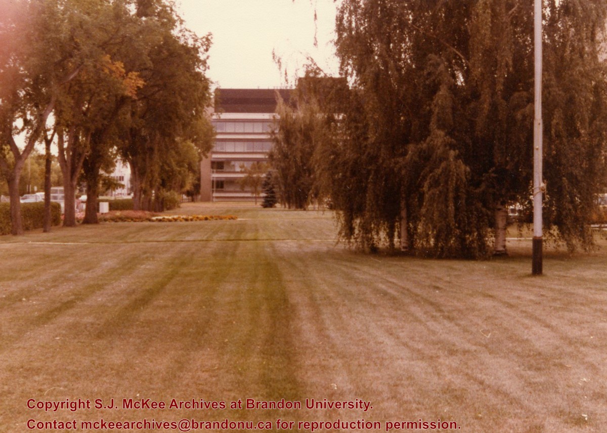
View is southwest from approximately Princess Avenue and 17th Street. Photograph shows the Brandon University campus in fall, as well as the southwest portion of the city.
Images
Show Less

Aerial view: Brandon University campus

http://archives.brandonu.ca/en/permalink/descriptions8047
Part Of
Aerial views and campus photographs
Description Level
Item
GMD
graphic
Date Range
1967-1969
Part Of
Aerial views and campus photographs
Description Level
Item
Series Number
2.1
Item Number
2.1.116
GMD
graphic
Date Range
1967-1969
Physical Description
5" x 4" (colour)
Scope and Content
View is south southwest from approximatley the east corner of 18th Street and Princess Avenue. Photograph shows the Brandon University campus, Kinsmen Stadium, Earl Oxford school and a number of residential blocks, particularly southwest of 18th Street.
Images
Show Less

Aerial view: Brandon University campus

http://archives.brandonu.ca/en/permalink/descriptions8048
Part Of
Aerial views and campus photographs
Description Level
Item
GMD
graphic
Date Range
1967-1969
Part Of
Aerial views and campus photographs
Description Level
Item
Series Number
2.1
Item Number
2.1.117
GMD
graphic
Date Range
1967-1969
Physical Description
5" x 4" (colour)
Scope and Content
View is southeast from approximatley 23rd Street and Rosser Avenue. Photograph shows the Brandon University campus, Kinsmen Stadium, Earl Oxford school, the Fair Grounds (including the Grandstand and Racetrack) and a number of residential blocks, particularly in the southeast part of the city.
Images
Show Less

Aerial view: Brandon University campus

http://archives.brandonu.ca/en/permalink/descriptions8049
Part Of
Aerial views and campus photographs
Description Level
Item
GMD
graphic
Date Range
1967-1969
Part Of
Aerial views and campus photographs
Description Level
Item
Series Number
2.1
Item Number
2.1.118
GMD
graphic
Date Range
1967-1969
Physical Description
5" x 3.5" (colour)
Scope and Content
View is west from 17th Street between Louise and Princess Avenues. Photograph shows the Brandon University Campus, Fleming School and Coronation Park, as well as a number of residential blocks.
Images
Show Less

20 records – page 5 of 1.