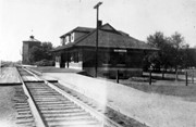
For custodial history see the collection level description of the Lawrence Stuckey collection.
Scope and Content
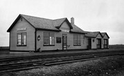
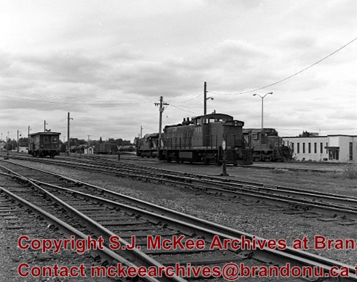
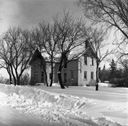
Canadian National Railway terminal building.
Notes
[Building located just west of First Street.]
[Although filed in this location, Mr. Stuckey did not number this envelope. There were two negatives contained within it; we have separated and numbered them PD4(1) and PD4(2). P.E.]
For custodial history see the collection level description of the Lawrence Stuckey collection.
Scope and Content
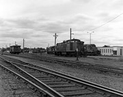
Canadian National Railway terminal building.
Notes
[Building located just west of First Street.]
[Although filed in this location, Mr. Stuckey did not number this envelope. There were two negatives contained within it; we have separated and numbered them PD4(1) and PD4(2). P.E.]
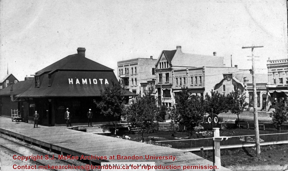
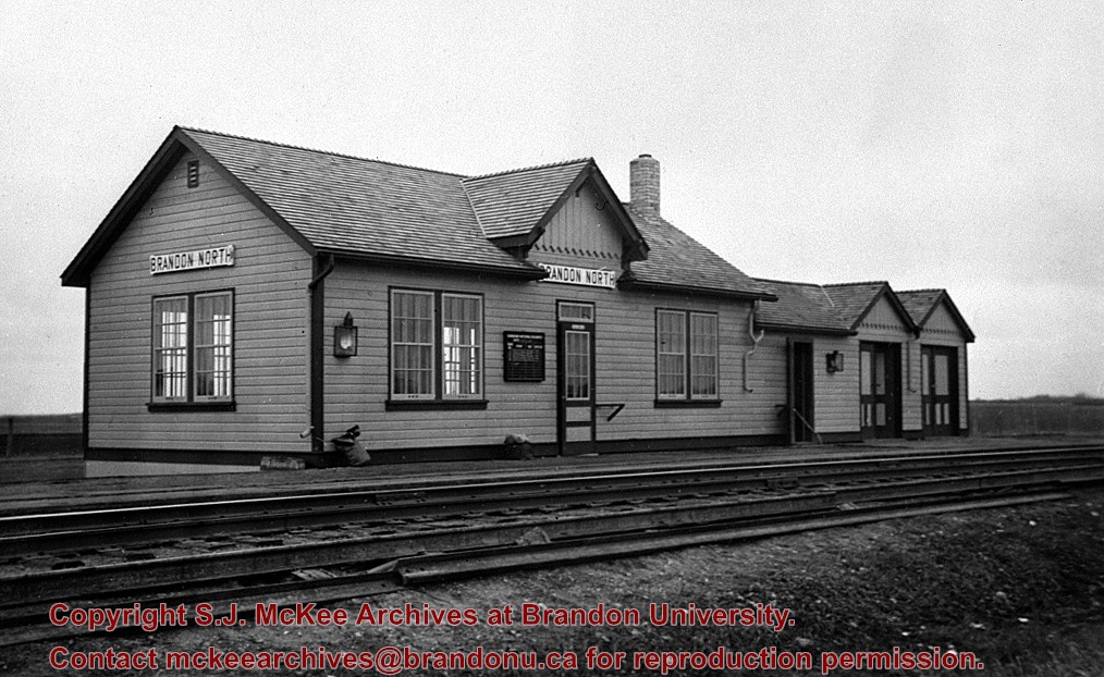
[This station, located 13 km north of Brandon on the east side of PTH 10, was] built in the early 1930s to replace Knox as the CNR’s mainline station for Brandon. All passenger trains stopped and buses operated between the CNR’s Brandon station and Brandon North to meet all trains. It was enlarged as shown here in late 1930s, and at peak operation in the 1940s & 1950s saw six daily passenger trains 1 - 2 & 3 - 4 “Continental Limited” and 11 - 12 locals. VIA trains 3 and 4 "Supercontinental" ceased operation Nov. 15, 1981 leaving no passenger service on the former Grand Trunk Pacific mainline of CNR [at that time]. This station was demolished in the fall of 1982.
Custodial History
For custodial history see the collection level description of the Lawrence Stuckey collection.
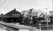
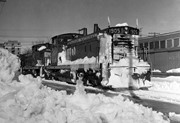
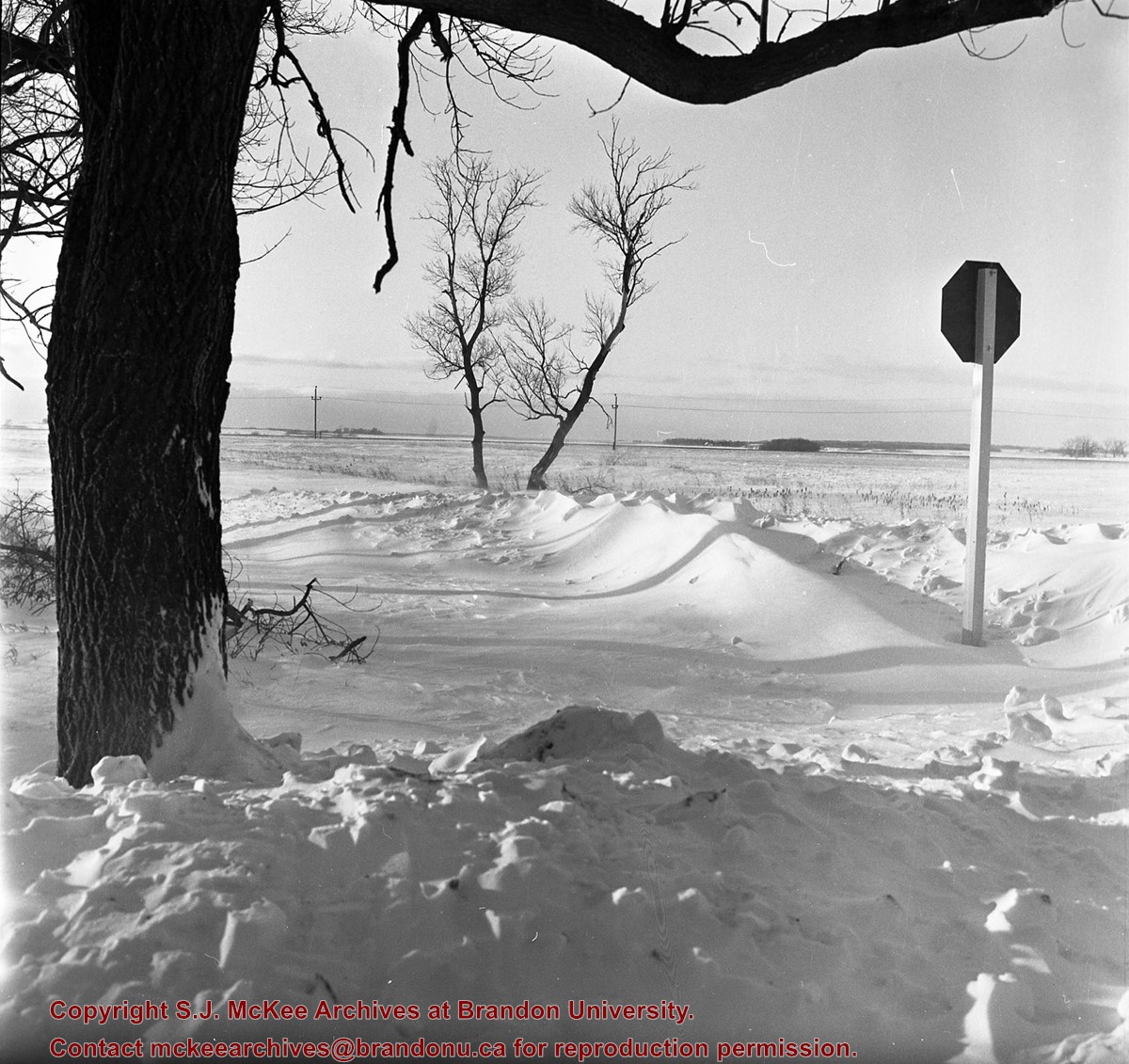
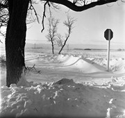
[According to Mr. Stuckey] it snowed continuously from Oct. 7 to 10th, giving [Brandon] the heaviest snowfall ever recorded in October - must have been about 40".
Custodial History
For custodial history see the collection level description of the Lawrence Stuckey collection.
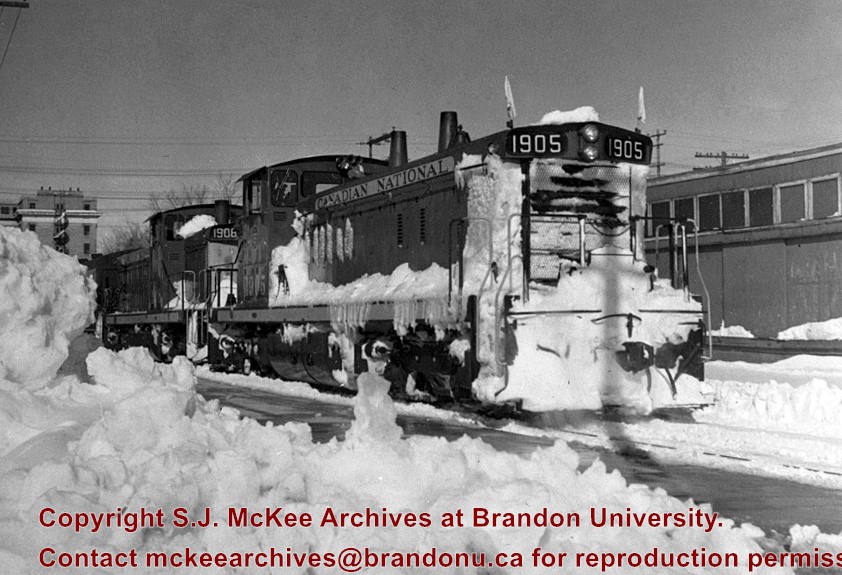
Scope and Content
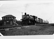
Canadian National Railway [passenger train] No. 6, with engines 1905 and 1906, in snow at station.
Notes
In this photo CNR No. 6 Edmonton-Regina-Winnipeg is running 10 hours late as an Extra train
[Note that the train has backed into the station located on Ninth Street, adjacent to the Prince Edward Hotel. P.E. 28/07/09.]
Brient was a point along the Algoma Central Railway line that connected the Helen Mine to the Michipicoten Harbour. It is located southwest of Wawa, Ontario.
Scope and Content
Photograph shows ore box cars in a railway yard.
Notes
Writing beneath the photograph in the album reads: yard at Brient
Trembley was a point along the Algoma Central Railway line that connected the Helen Mine to the Michipicoten Harbour. It is located southwest of Wawa, Ontario.
Scope and Content
Photograph shows railroad tracks. A line of ore cars stretch along one track. Writing on the side of one of the cars (#3017) reads: Algoma Central Railway Co.
Notes
Writing beneath the photograph in the album reads: Trembley - Ore Cars
The McKee Archives is the copyright holder of the Stuckey materials.
Storage Location
Lawrence Stuckey collection
Arrangement
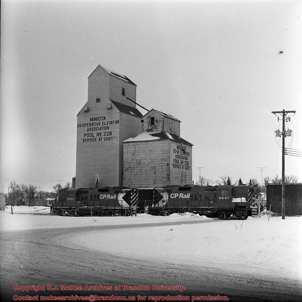
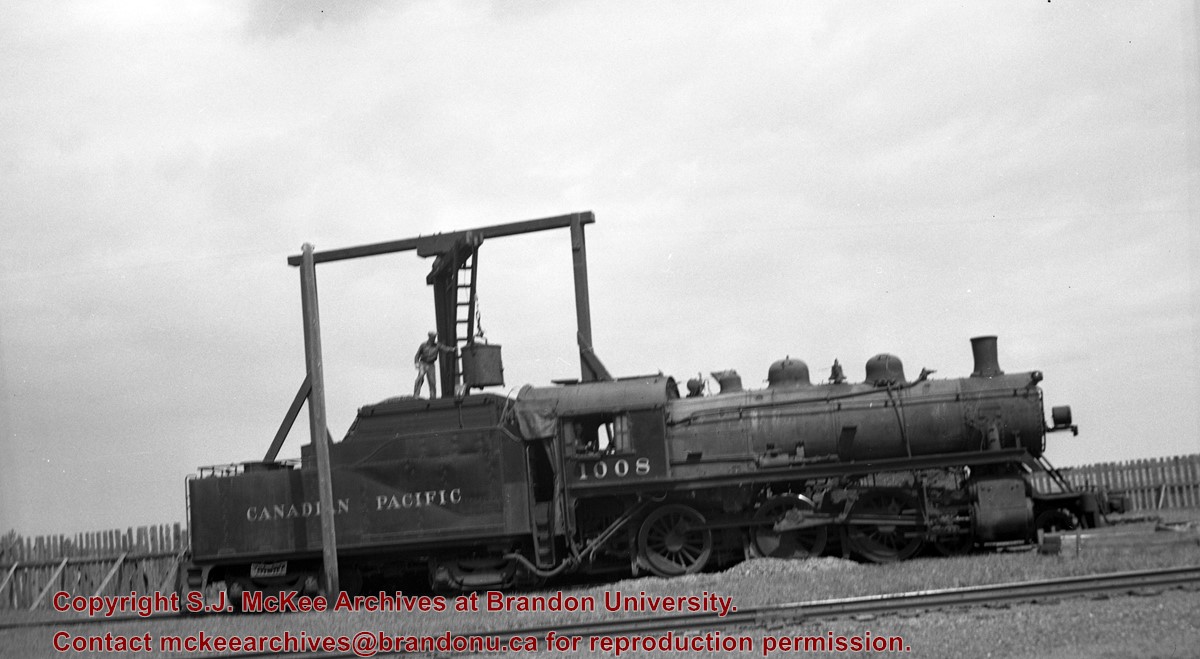
[Two original negatives C.P. in Manitoba volume 1. Mr. Stuckey put two negatives in same envelope. We have separated them and numbered them (10a) and (10b).
The McKee Archives is the copyright holder of the Stuckey materials.
Storage Location
Lawrence Stuckey collection
Arrangement
[Two original negatives C.P. in Manitoba volume 1. Mr. Stuckey put two negatives in same envelope. We have separated them and numbered them (10a) and (10b).
Brient was a point along the Algoma Central Railway line that connected the Helen Mine to the Michipicoten Harbour. It is located southwest of Wawa, Ontario.
Scope and Content
Photograph shows several men standing on railway tracks before a wood-framed train station in the winter. A sign attached to the station reads: British American Express Co. The man in the foreground appears to have a mailbag over on his back and several newspapers tucked beneath his arm.
Notes
Writing beneath the photograph in the album reads: station at Brient
In 1901, American entrepreneur Francis Hector Clergue (1856-1939) obtained the charter for the Ontario, Hudson Bay and Western Railway. Following his purchase, he reincoporated the Algoma Central Railway to the Algoma Central and Hudson's Bay Railway. (Source: Sault St. Mairie Public Library, "Transportation - Algoma Central Railway," Sault History Online, 2008)
Scope and Content
Photograph shows railroad tracks cutting through the Canadian Shield.
Notes
Writing beneath the photograph in the album reads: Algoma Central & Hundson Bay Ry.
The Lake Talbot tresle was a point along the Algoma Central Railway line that connected the Helen Mine to the Michipicoten Harbour. It is located north of Wawa and southwest of the Helen Mine.
Scope and Content
Photograph shows several men walking a railway line. Before them is a tresle bridge.
Notes
Writing beneath the photograph in the album reads: Lake Talbott Tresle [sic.]

.jpg?width=1200&404=no-img.jpg&watermark=wmk)
.jpg?width=180&404=no-img.jpg)
.jpg?width=1200&404=no-img.jpg&watermark=wmk)
.jpg?width=180&404=no-img.jpg)


.jpg%3fmaxheight%3d1000%26maxwidth%3d1000%26watermark%3dwmk&description=CNR+Terminal+Building)
.jpg%3fmaxheight%3d1000%26maxwidth%3d1000%26watermark%3dwmk&description=CNR+Terminal+Building)
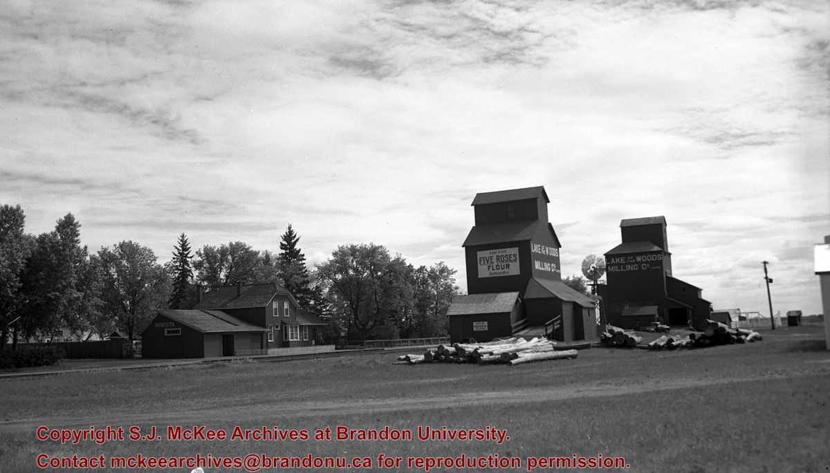
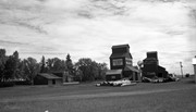
+elevators%2c+Miniota%2c+Manitoba)