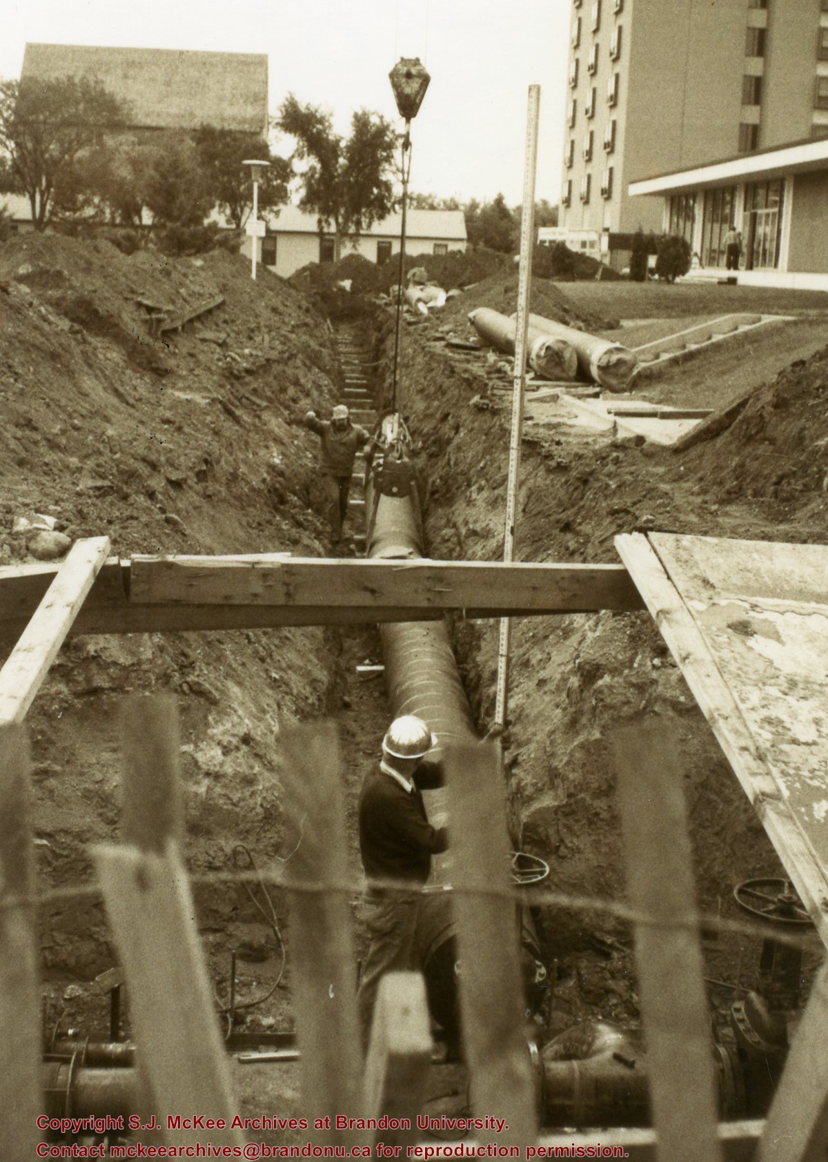
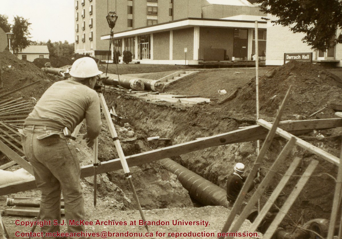
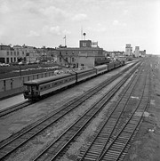
Photograph is looking southeast from 20th Street and shows the laying of pipes to the north of Darrach Hall and the Dining Hall as part of the Library extension. Photograph also shows a man surveying the site.
The building pictured was built in 1906-1907. Prior to its use as the Public Library, the building housed the Merchants Bank of Canada. The Library left this location in 1984 when it moved to the former Co-op store on 7th Street & Princess Avenue. This building subsequently became the Brandon Chamber of Commerce building in September of 1985. According to Stuckey, the façade of the building is to remain as heritage building, with interior renovations undertaken with government financing.
Custodial History
For custodial history see the collection level description of the Lawrence Stuckey collection.
Scope and Content
Brandon Public Library [branch of Western Manitoba Regional Library].
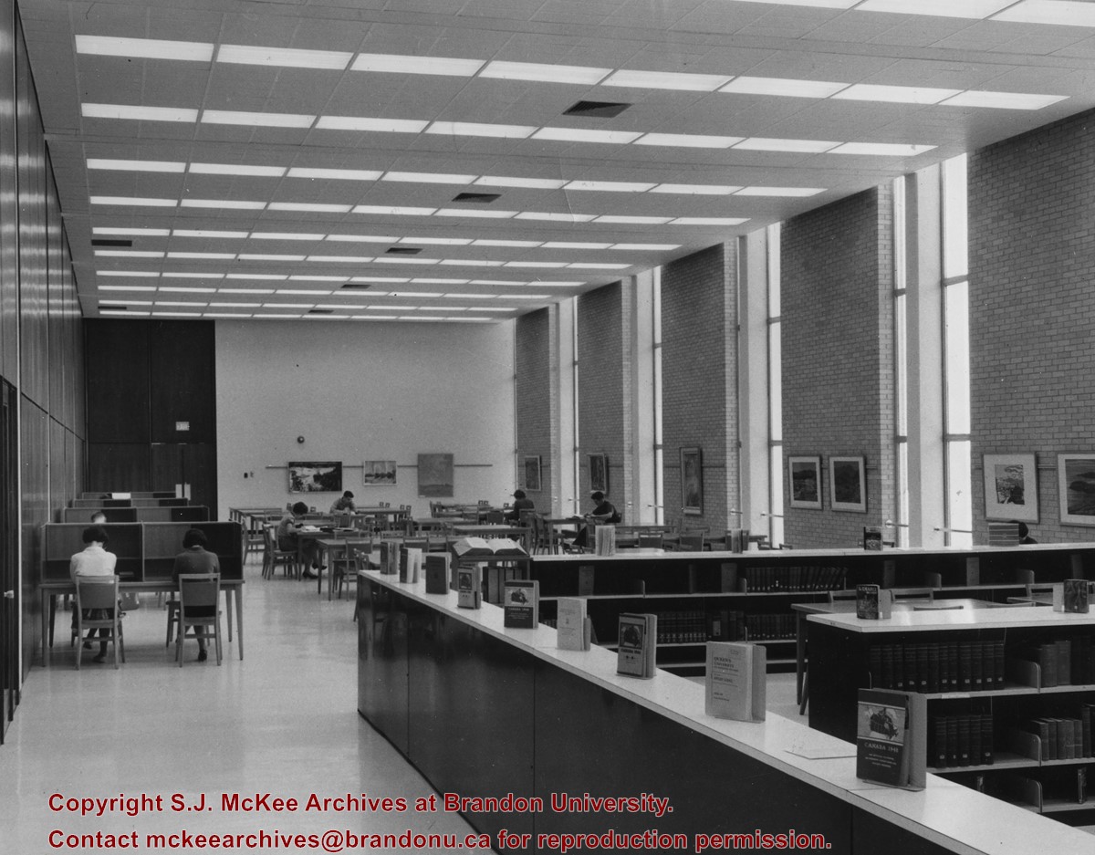
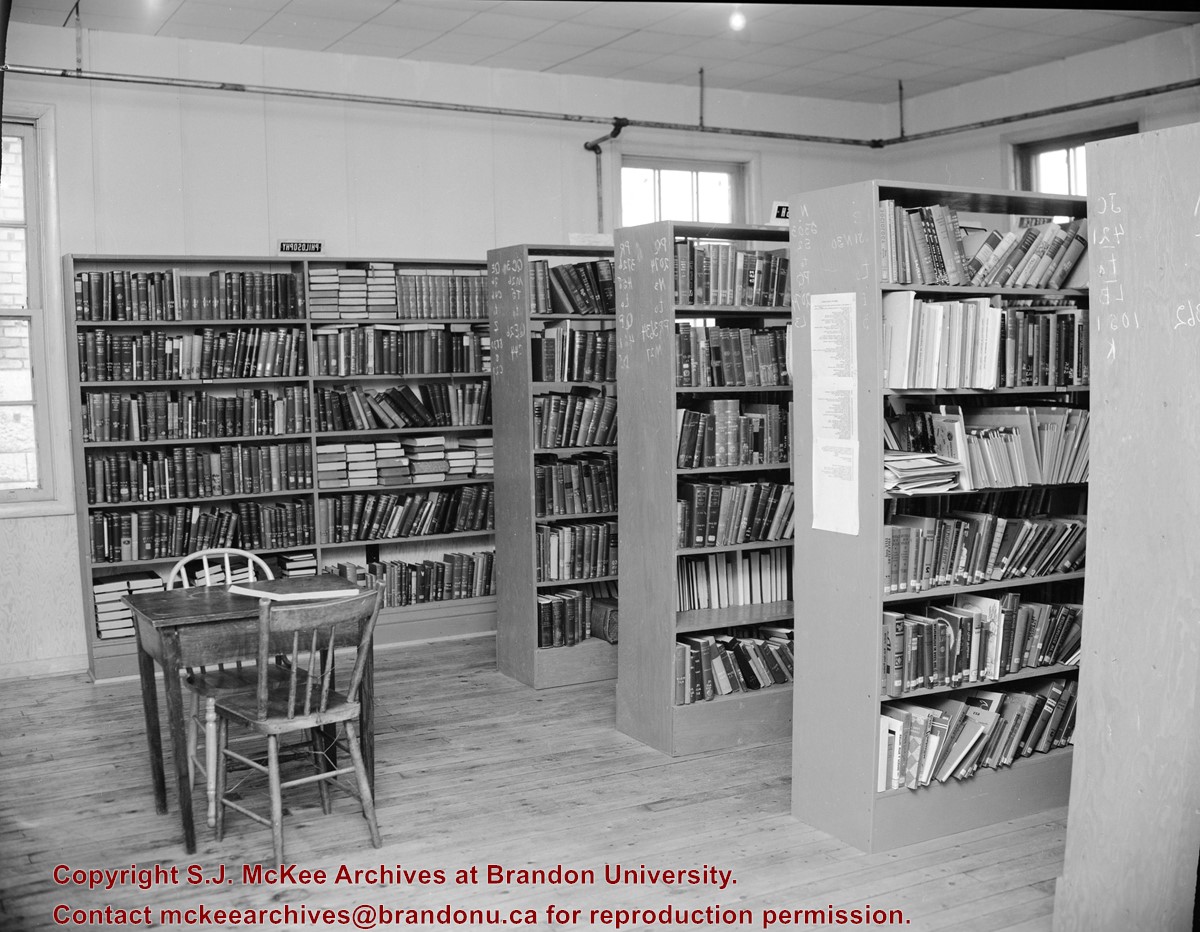
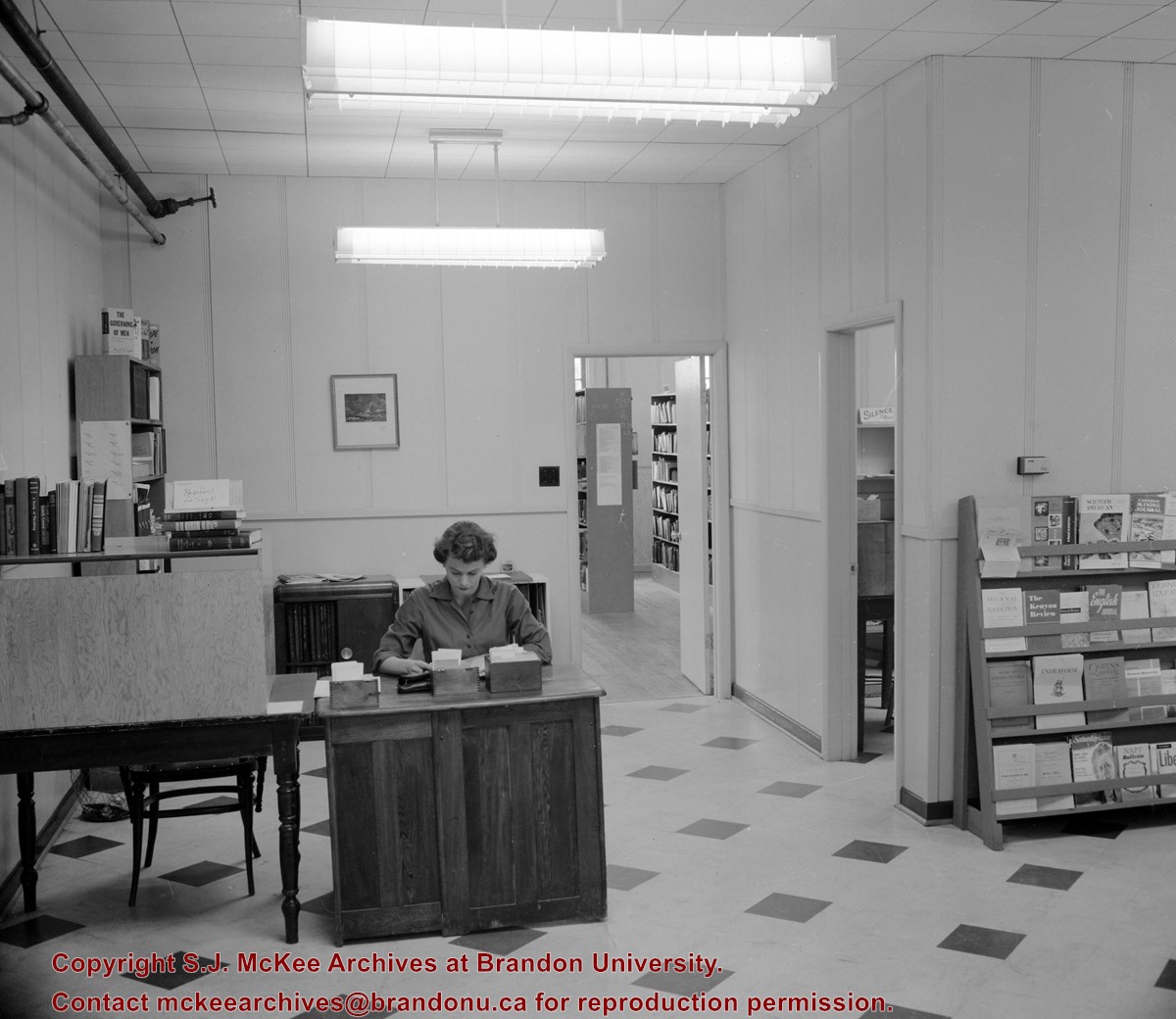
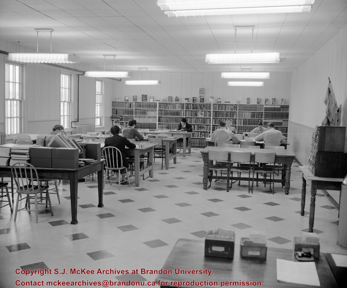
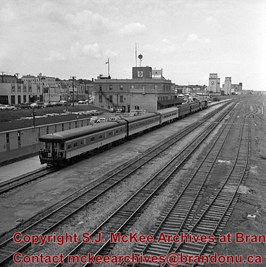
The Main Library was located in the A.E. McKenzie Building. The reading room was on the second floor in what is now the North Stacks. The Main Library was renamed the John E. Robbins Library on October 4, 1974.
Scope and Content
Photograph is looking north into the reading room of the Main Library.
Built 1906-07; Former Merchants Bank of Canada; Library moved to former Co-op store on 7th Street & Princess Ave in 1984; This building became the Brandon Chamber of Commerce in September of 1985; Façade to remain as heritage building, interior renovations to be conducted with government financing.
Custodial History
For custodial history see the collection level description of the Lawrence Stuckey collection.
Scope and Content
The Merchants Bank of Canada (Western Manitoba Regional Library)
Notes
[Mr. Stuckey wrote on envelope "3 negs." but there is only one in the envelope.]
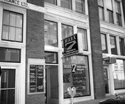
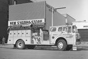
Mark 7 Hobbycrafts and Religious Supplies was located in the Security Building at 21 on 10th Street. The business appears to have opened on October 31 1966 and was owned by Lorne Baldrow. The previous owner of the store was Agusuta E. Wing and had called the store the Christian Book and Music Center. The store appears to have closed around 1969 when Lorne and his wife Edna moved to Calgary.
Custodial History
See fonds level description for custordial history.
Scope and Content
Image of the exterior of Mark 7 Hobbycrafts and Religious Supplies. Visible to the right is the office of Gerald Dressler, Optomistrist. To the left is a tenant sign for the Security Building. Tenants in 1968 included: the John Howard Society, Brandon Emergency Measures Organization, Viscount Optical, Kent's Accordion College, and Loch Lomond Knitwear Lts.
Notes
History/bio information taken from Henderson's Directories. Description by Christy Henry.
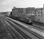
The Medicine Hat Exhibition and Stampede Parade Day was held on Thursday, July 19, 1962, at 9:30 a.m. The local newspaper reported that approximately 24,000 people were in attendance to see parade marshall Rod Ashburner leading 175 entries consisting of 90 floats, 75 horses, and 10 bands. There were 19 parade categories eligible for $12,000 in prize money and included: junior and senior cowboys and cowgirls; fancy and Shetland ponies; sulky class open; comic, commercial, industrial and organizational floats; decorated cars; special ranch class; 4-H Clubs; and a non-competitive class.
The parade route started at Second St. and Allowance Ave., from Second St. to Ash Ave., north on Ash to First St. SE., from First St. S.E. to Fourth Ave., south to Second St. to South Railway St., south on South Railway St. to Third St., with a finish at McLeod Trail. A route map was published in the Medicine Hat News the day before the parade.
Aerial photographs of the parade were taken by Medicine Hat News photographer Howard Heid (1930-2005) from the private helicopter of John Bourn. Bourn was a pilot from Woodville, Wisconsin, who chartered his four-seater helicopter for sight-seers at exhibitions and stampedes across the county.
(Sources: Pat Currie, "Let 'Er Go!," Medicine Hat News, 19 July 1962,1; Harald Gunderson, "'Eye in the Sky' Best Parade View," Medicine Hat News, 19 July 1962,1; "Parade Starts at 9:30 Sharp," 18 July 1962)
Scope and Content
Photograph shows an aerial view of the Medicine Hat Exhibition and Stampede Parade route with a focus on the First Street SE and Sixth Avenue intersection. A number of gas stations and garages are visible along this route and include Texaco, Shell, Ford, and B/A. A number of observers can be seen sitting on rooftops.
Notes
This photograph shows the neighbourhood before rezoning and commercial development.
.jpg?width=1200&404=no-img.jpg&watermark=wmk)
.jpg?width=180&404=no-img.jpg)
.jpg?width=1200&404=no-img.jpg&watermark=wmk)
.jpg?width=180&404=no-img.jpg)
.jpg?width=1200&404=no-img.jpg&watermark=wmk)
.jpg?width=180&404=no-img.jpg)
.jpg?width=1200&404=no-img.jpg&watermark=wmk)
.jpg?width=180&404=no-img.jpg)


.jpg%3fmaxheight%3d1000%26maxwidth%3d1000%26watermark%3dwmk&description=Brandon+Public+Library)
.jpg%3fmaxheight%3d1000%26maxwidth%3d1000%26watermark%3dwmk&description=Brandon+Public+Library)
.jpg%3fmaxheight%3d1000%26maxwidth%3d1000%26watermark%3dwmk&description=Merchants+Bank+(Public+Library)+Building)
.jpg%3fmaxheight%3d1000%26maxwidth%3d1000%26watermark%3dwmk&description=Merchants+Bank+(Public+Library)+Building)