Library Reading Room, 2nd floor McKenzie Building. Tour of library by members of St. Mary's Ukrainian Catholic Church associated with gifts of funds. L Father Rudachek, 2nd from L Helen Harris, front row: girl on left ___ Zwednicki
Photograph is looking west southwest approximately from the driveway and shows one of the H-Huts. In this photograph the H-Hut was a science laboratory. It later became Student Services (c. 1980) and was removed from campus in the 1990s.
Notes
The H-Hut running north-south in the background beside the Citzens' Science Building was demolished c. 1987.
Photograph is looking west southwest approximately from the driveway and shows one of the H-Huts. In this photograph the H-Hut was a science laboratory. At one point it also housed the Geology Annex. It later became Student Services (c. 1980) and was removed from campus in the 1990s. McMaster Hall is in the background.
Periodicals section as equipped in the early 1970's. Basement Floor, MacKenzie. Tour of Robbins Library by members of St. Mary's Roman (sic) Catholic Church – associated with a gift of funds to the Library
Education curriculum collection room opening westward off Library Reading Room, Library and Arts Building. L. to R. Ralph Berry, Margaret Ariss and students
The building pictured was built in 1906-1907. Prior to its use as the Public Library, the building housed the Merchants Bank of Canada. The Library left this location in 1984 when it moved to the former Co-op store on 7th Street & Princess Avenue. This building subsequently became the Brandon Chamber of Commerce building in September of 1985. According to Stuckey, the façade of the building is to remain as heritage building, with interior renovations undertaken with government financing.
Custodial History
For custodial history see the collection level description of the Lawrence Stuckey collection.
Scope and Content
Brandon Public Library [branch of Western Manitoba Regional Library].
Photograph is looking west from the east side of the driveway and shows the Continuing Education H-Hut, which was located between the Brandon College Building and the Citzens' Science Building.
The Student Services H-Hut was located between the Brandon College Building and the Citzens' Science Building. It was placed there c. 1950 and it was removed sometime in the 1990s. Originally the H-Hut in this photograph was the Geology Depatment, housing offices, classrooms and the lab.
Scope and Content
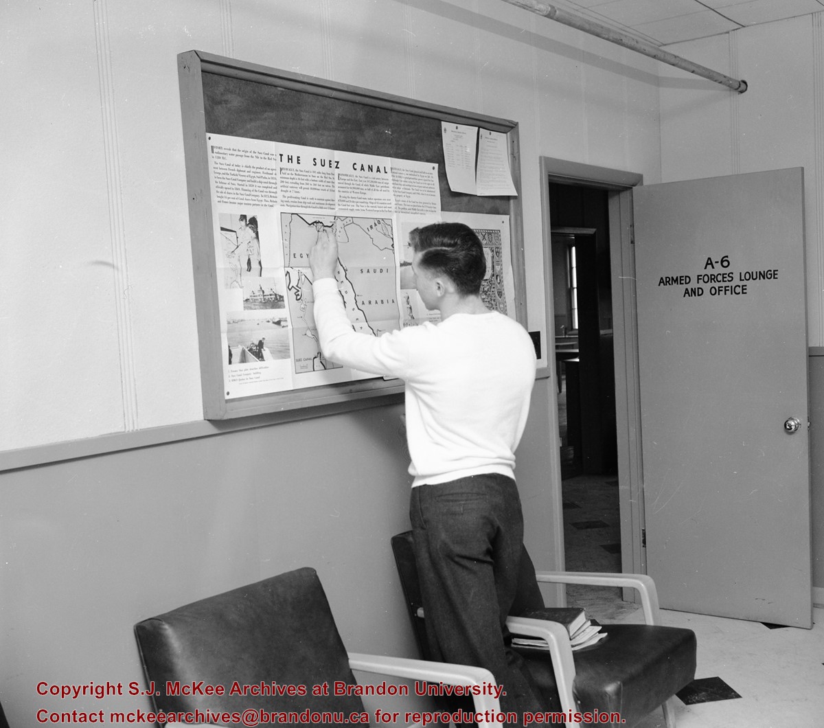
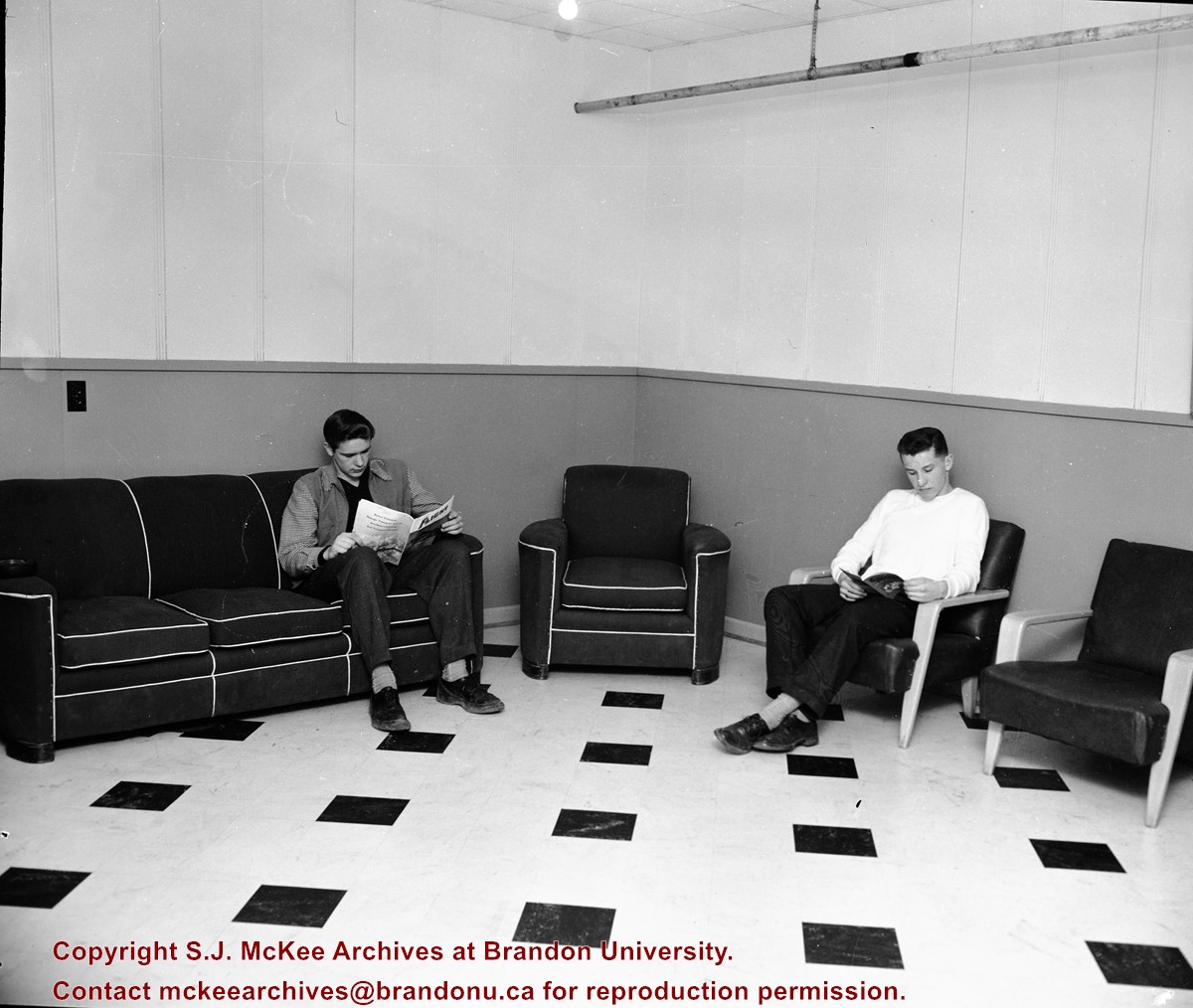
Photograph is looking west and shows the entrance to the Student Services H-Hut.
Notes
History/Bio information from Tom Mitchell and Harvey Young.
H-Huts refer to structures built to house military personnel at the Commonwealth Air Training Program just north of Brandon during World War II. The name H-Hut derives from the layout of the structures, which were built in an "H" formation. The original H-Huts were moved onto the Brandon College campus in 1956 to house the library and arts classrooms.. Additional H-Huts have been located in various places and used for various departments and services on campus including Student Services, Continuing Education, and the carpenter's workshop. Only the Physical Plant H-Huts, located to the west of the Knowles-Douglas Student Union Centre, remain on campus in 2007.
Scope and Content
Sub-series consists of photographs of various H-Huts on campus.
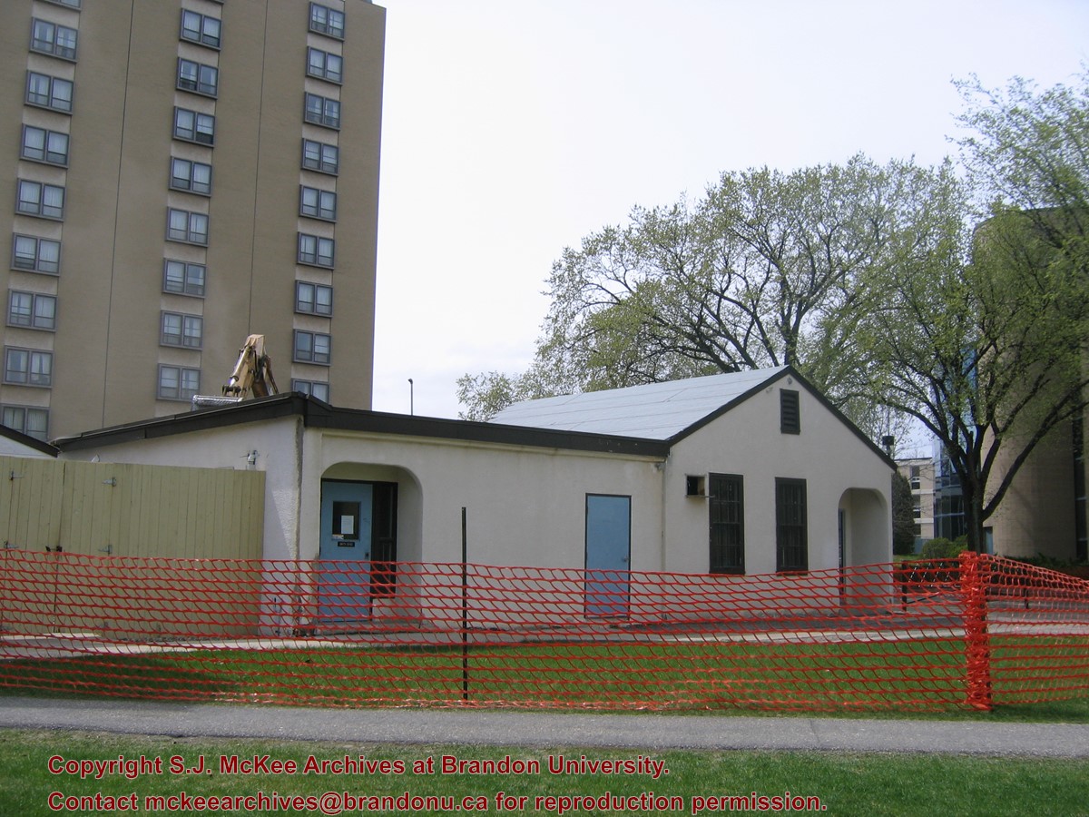
Located at the centre of the Brandon University campus, the Physical Plant H-Hut was destroyed following the opening of the new $3.9M, 13,600 square-foot physical plant on 07 April 2010.
Custodial History
Photograph was taken by McKee Archives project archivist Jill Sutherland.
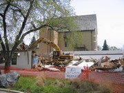
Scope and Content
Photograph shows the demolition of the Physical Plant H-Hut.
Located at the centre of the Brandon University campus, the Physical Plant H-Hut was destroyed following the opening of the new $3.9M, 13,600 square-foot physical plant on 07 April 2010.
Custodial History
Photograph was taken by McKee Archives project archivist Jill Sutherland.
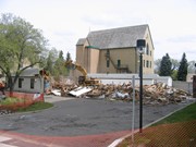
Scope and Content
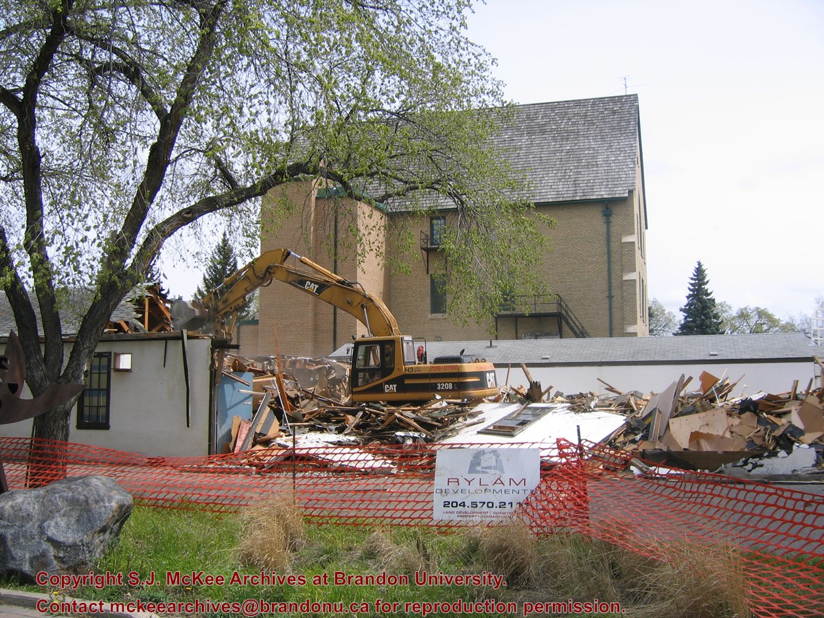
Photograph shows the demolition of the Physical Plant H-Hut. A sign for Rylam Development is visible on the snow fence fencing off the demolition site.
Located at the centre of the Brandon University campus, the Physical Plant H-Hut was destroyed following the opening of the new $3.9M, 13,600 square-foot physical plant on 07 April 2010.
Custodial History
Photograph was taken by McKee Archives project archivist Jill Sutherland.
Scope and Content
Photograph shows the demolition of the Physical Plant H-Hut. The photograph is looking northeast from the steps of Harvest Hall. The Citizens' Science Centre (BUSU Building) is visible in the background.
.jpg?width=1200&404=no-img.jpg&watermark=wmk)
.jpg?width=180&404=no-img.jpg)
.jpg?width=1200&404=no-img.jpg&watermark=wmk)
.jpg?width=180&404=no-img.jpg)


.jpg%3fmaxheight%3d1000%26maxwidth%3d1000%26watermark%3dwmk&description=Brandon+Public+Library)
.jpg%3fmaxheight%3d1000%26maxwidth%3d1000%26watermark%3dwmk&description=Brandon+Public+Library)