Corners of photograph mat are bent. Picture is cracked.
Scope and Content
Photograph shows an early view of Brandon's 6th Street in the 1880s. The Winter & O'Neail Groceries & Provisions and James Smart Hardware storefronts have been photographed. A street sign designating 6th Street can be seen below the Winter & O'Neail sign. A horse and cart is parked in front of the grocery store. A number of men wearing hats and jackets are standing along the boardwalk while posing for the picture. Lumber/timber saws are displayed in teh windows of the hardware store.
Notes
Front of photograph reads: 6th Street, Brandon, Manitoba, 1881-1882, Entrance [to Winter & O'Neail] corner of Rosser Ave & 6th Street.
Photograph is stained and water damaged. A newspaper clipping about William (Billy) Muir is glued to the top left hand corner of the mat. The image is exfoliated in the right hand corner. The negative has been reverse printed.
History / Biographical
Coombs & Stewart opened the first general store in Brandon in 1881, which was located on 6th Street and Pacific Avenue. According to G.F. Barker (Brandon: A City, 1977, 291), William (Billy) Muir worked at the store until he opened his own grocery store in 1888.
Custodial History
Donated to Fred McGuinness by Allena Strath (nee Coombs).
Scope and Content
Photograph shows the Coombs & Stewart general store located on the corner of Pacific Avenue and 6th Street. A group of men pose in front of the wood-framed store.
Notes
Back of photograph reads: One of first stores in Brandon, Coombs...[?]
Photograph mat is bent. Emulsion problems with image.
Scope and Content
Photograph shows Rosser Avenue in its incipient stages. Canvas tents are mixed amongst wooden structures. The James Smart Hardware store, Winter & O'Neail Groceries & Provisions, and the law office of F.G.A. Henderson in the Molesworth Block can be seen on the north side of Rosser Avenue. A street sign designating 6th Street can be seen below the Winter & O'Neail sign. A horse and buggie is traveling down the dirt track that is Rosser Avenue. Groups of men can be seen congregating outside some of the local businesses.
Notes
Front of photograph reads: Rosser Avenue, Brandon 1882-1883, from east of Six Street. Back of photograph is stamped: I. Bennetto & Co., Photographers, Opposite Post-Office, Winnipeg, Man.
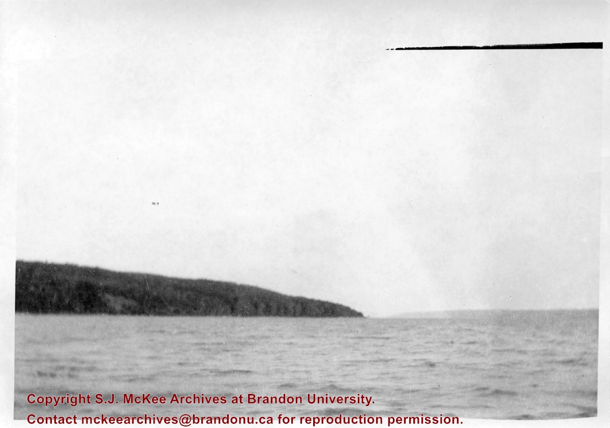
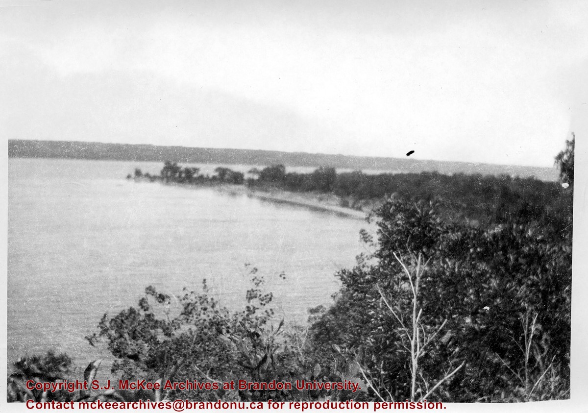
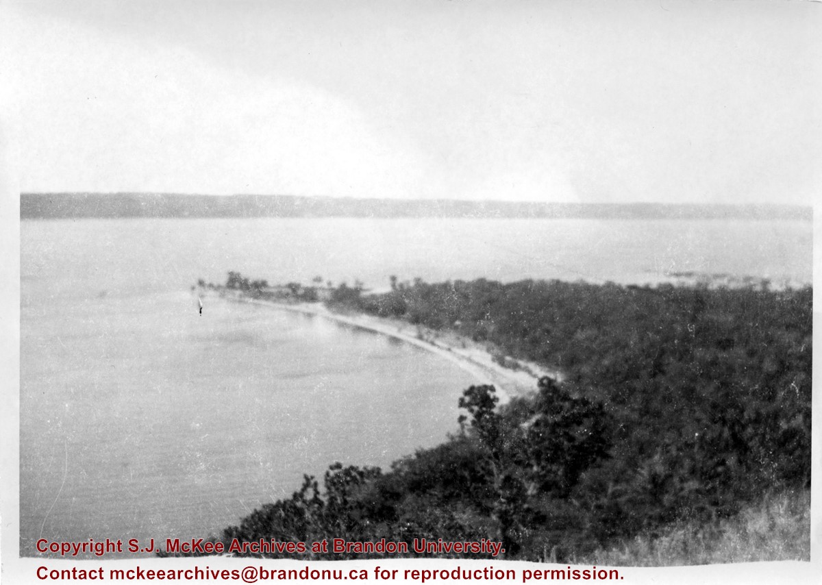
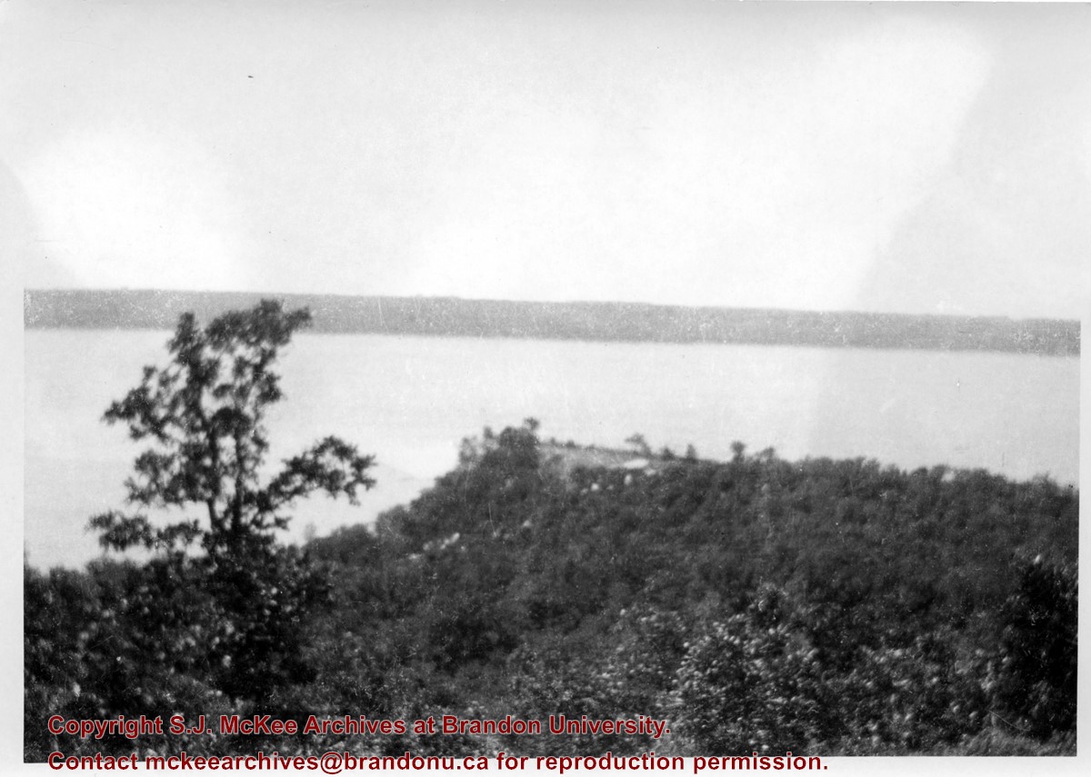
Photograph shows the lake and shoreline of "Y" Point, Pelican Lake.
Notes
Writing on the back of the photograph reads: Scenes. "Y" Point YMCA camp at Pelian Lake. We took train to Belmont and farmer's wagon to Camp. 10.00 per week. I was there 1922-25 as camper and 1925 as leader and leader training camp.
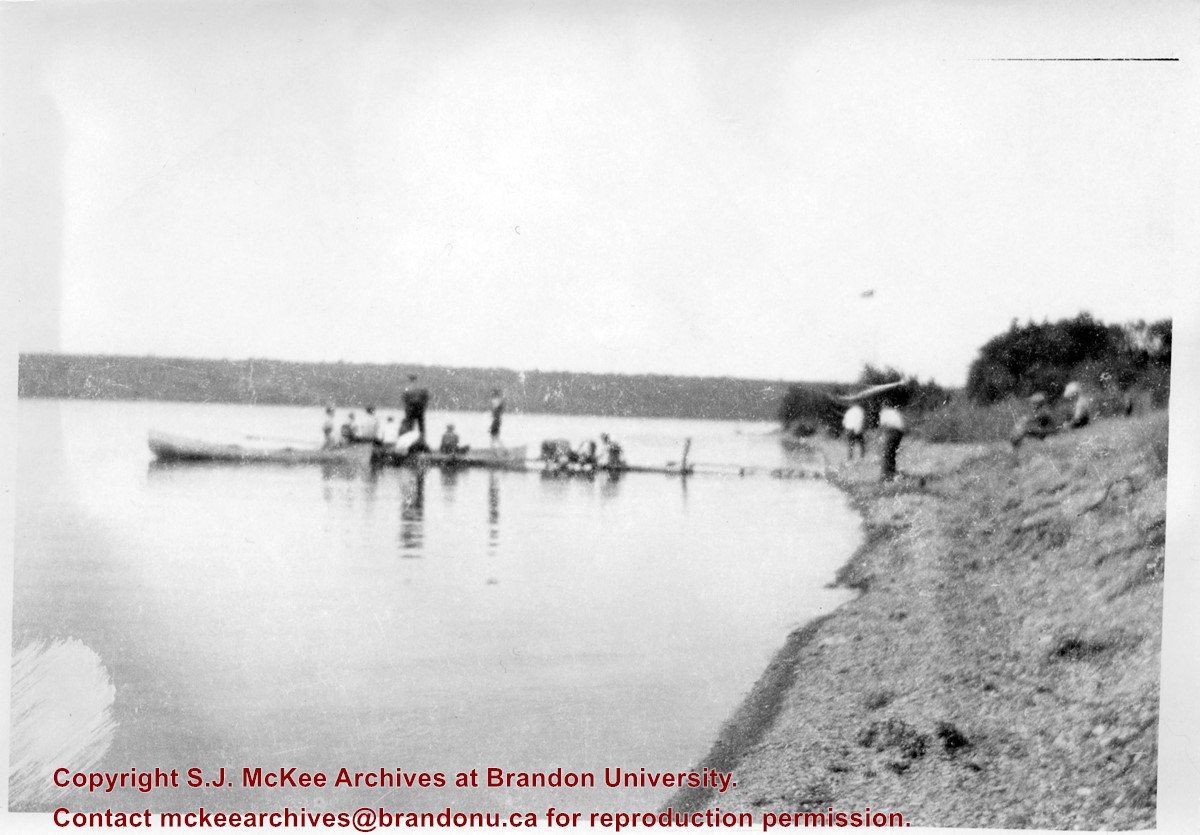
Photograph shows a group of boys seated on a dock along the shoreline at "Y" Point, Pelican Lake. Canoes are tied to the dock and a couple of boys are walking and sitting along the pebble beach.
This photo was taken by C.J. Smith for Bryant Studio. Bryant Studio (I believe) was opened in 1907 by Smith for Bryant. Smith later bought the studio when Bryant planned to close it. The same studio was subsequently purchased by L.A. Stuckey on January 1, 1958. LAS.
Custodial History
For custodial history see the collection level description of the Lawrence Stuckey collection.
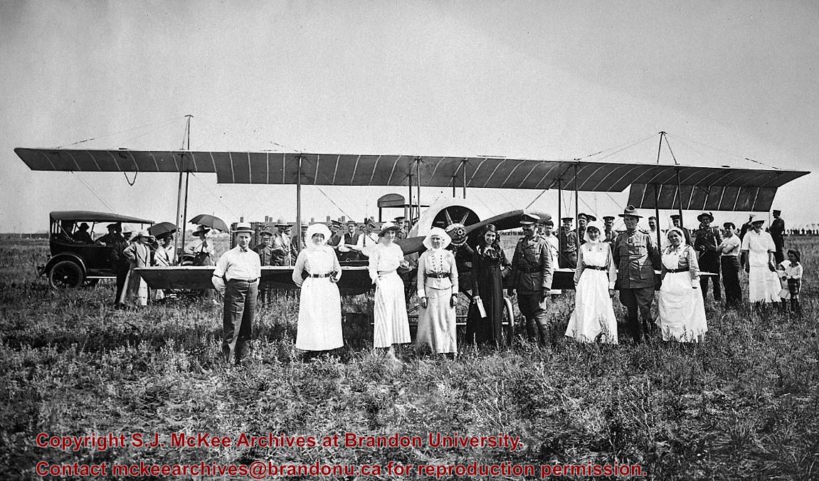
Scope and Content
Photo of Katherine Stinson and her aircraft at Camp Hughes, including Army officers and nurses.
Notes
See Lawrence Stuckey file (Finding Aids) for biography of Katherine Stinson.
3 m textual records; 100 photographs and drawings; 19 books and pamphlets
History / Biographical
John Tyman was born in Kent County, England. After briefly serving with the British Army, Tyman attended the University of Oxford. He came to Canada first in the summer of 1957 to work for a short time, before returning to England in the fall. In 1959, he returned to study at McGill University, and obtained an M.A. in 1961. In 1962, he moved to Brandon to establish a Geography department at Brandon College. Tyman served as a professor and, for a short time, as Dean of Science during his time at Brandon University. In 1970, he obtained a Ph.D. from the Oxford University. In 1976, Tyman left Brandon University and moved to Australia. In Australia he taught at Mount Gravatt College in Brisbane until his retirement in 1994. As of January 2006, John Tyman continues to reside in Australia.
Custodial History
The Tyman fonds remained in the possession of the Geography Department at Brandon University following Dr. Tyman's departure to Australia in 1976. With Dr. Tyman's approval the records were transferred to the McKee Archives in May 2001.
Scope and Content
This fonds contains a copy of "By Section, Township & Range: Studies in Prairie Settlement," by John Langston Tyman. This publication was based on Tyman's doctoral thesis, which is also included in the fonds. His doctoral thesis was completed in 1970 and titled, "The Disposition of Farm Lands in Western Manitoba, 1870 - 1930: Studies in Prairie Settlement."
Fonds also includes extensive research materials compiled by Dr. Tyman on prairie settlement. They include: copies of the Annual Report of the Department of the Interior; documents relating to C.P.R. land sales (c.1870-1900); personal accounts and local histories of municipalities in southern Manitoba such as Shoal Lake, Justice, and local C.P.R. lines; the Canadian Homestead Settlement Co.; The Free Land Homestead Co,; the Canadian Northwest Lands Co.; the N.W.H.B., C.N.R., Lake Manitoba Railway & Canal Co.; land grants given to Veterans; Wellams and Dominion Steamship Co.; maps of southern Manitoba RM's; Sowden and Co. (a land settlement company); correspondance to a Rev. L.O. Armstrong in Emerson (c. 1885); legislation; agricultural progress; history of school lands; correspondance to and from J. Tyman (c.1960); the settlement of Icelandic, Hungarian, and Scandinavian immigrants; a plethora of maps both relating to prairie settlement and to world geography; a manuscript by William Pearce (1925); a transcript titled "Patterns of Settlement"; 5 rolls of microfilm containing maps and copies of some publications acquired by Dr. Tyman; a number of books and c.1900 publications to do with prairie settlement; maps by township and range of the prairies; 100 photos and drawings all c.1880 to 1900; extensive township summaries; and extensive land disposal records as recorded by the Lands Department, including the names of settlers.
Notes
Fonds level description written by Mike White (2001).
Many documents in this collection were copied from originals at the Glenbow-Alberta Institute, Calgary, Alberta, Library and Archives Canada, the Archives of Manitoba, land titles and corporate offices.
Storage Location
MG 3 Brandon University Teaching and Administration
1.3 John Langston Tyman
According to Stuckey and Bain (1996), “The Brandon, Saskatchewan & Hudson’s Bay Railway was built and operated as a totally owned subsidiary of the Great Northern Railway. Construction commenced in late 1905 and by the end of 1905, less than a mile of track had been laid north of the boundary at St. John. In 1906, the remaining 68.6 miles to Brandon were laid and service commenced that year. During the Depression of the 1930s, traffic declined significantly and the entire branch was abandoned in 1936. Over much of the branch’s length, the ties and rails were laid on the prairie without ballast and today little remains of the line apart from traces where there were cuts and bridges.” (p. 18)
Stuckey, L. A., & Bain, D. M. (1996). The Great Northern and Northern Pacific railways in Canada. Calgary, Alberta: British Railway Modellers of North America.
Custodial History
For custodial history see the collection level description of the Lawrence Stuckey collection.
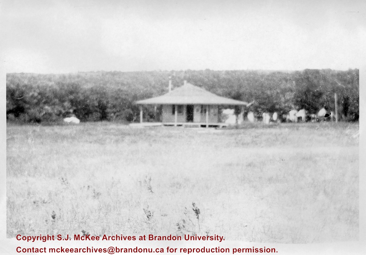
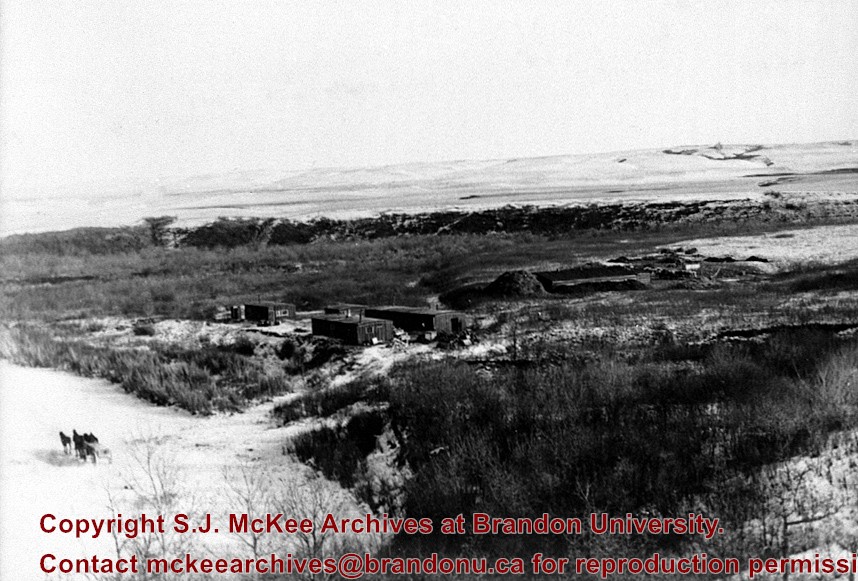
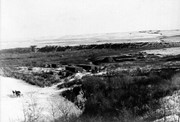
Scope and Content
Great Northern (Brandon, Saskatchewan and Hudson's Bay) Railway construction camp near Bunclody, Manitoba.
Notes
From the collection of Gilford Copeland of Bunclody, Manitoba
Field journals have been scanned in multi-page PDF files. Artifact catalogues are PDF files in spreadsheet format. Photographs are in jpeg format.
History / Biographical
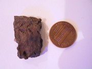
Directed by Dr. Nicholson, a crew of five students from Brandon University under the supervision of Dr. Scott Hamilton excavated a total of 9 units in 1985. This testing indicated the presence of artifacts manufactured by Blackduck and Duckbay peoples from the boreal forest and northern parkland areas. Other ceramics diagnostic of groups from the Saskatchewan Basin and the Middle Missouri area were also recovered in surface collection from the cultivated area of the locale.
Scope and Content
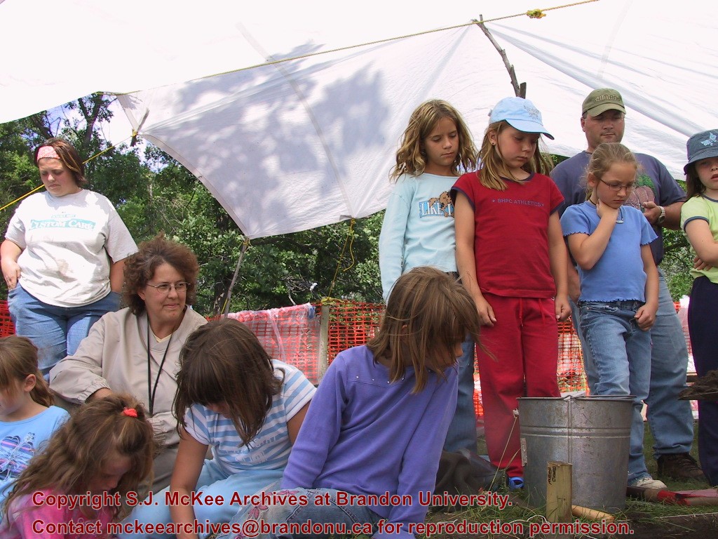
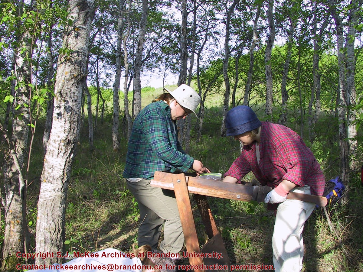
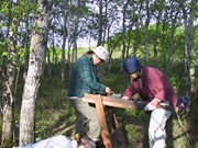
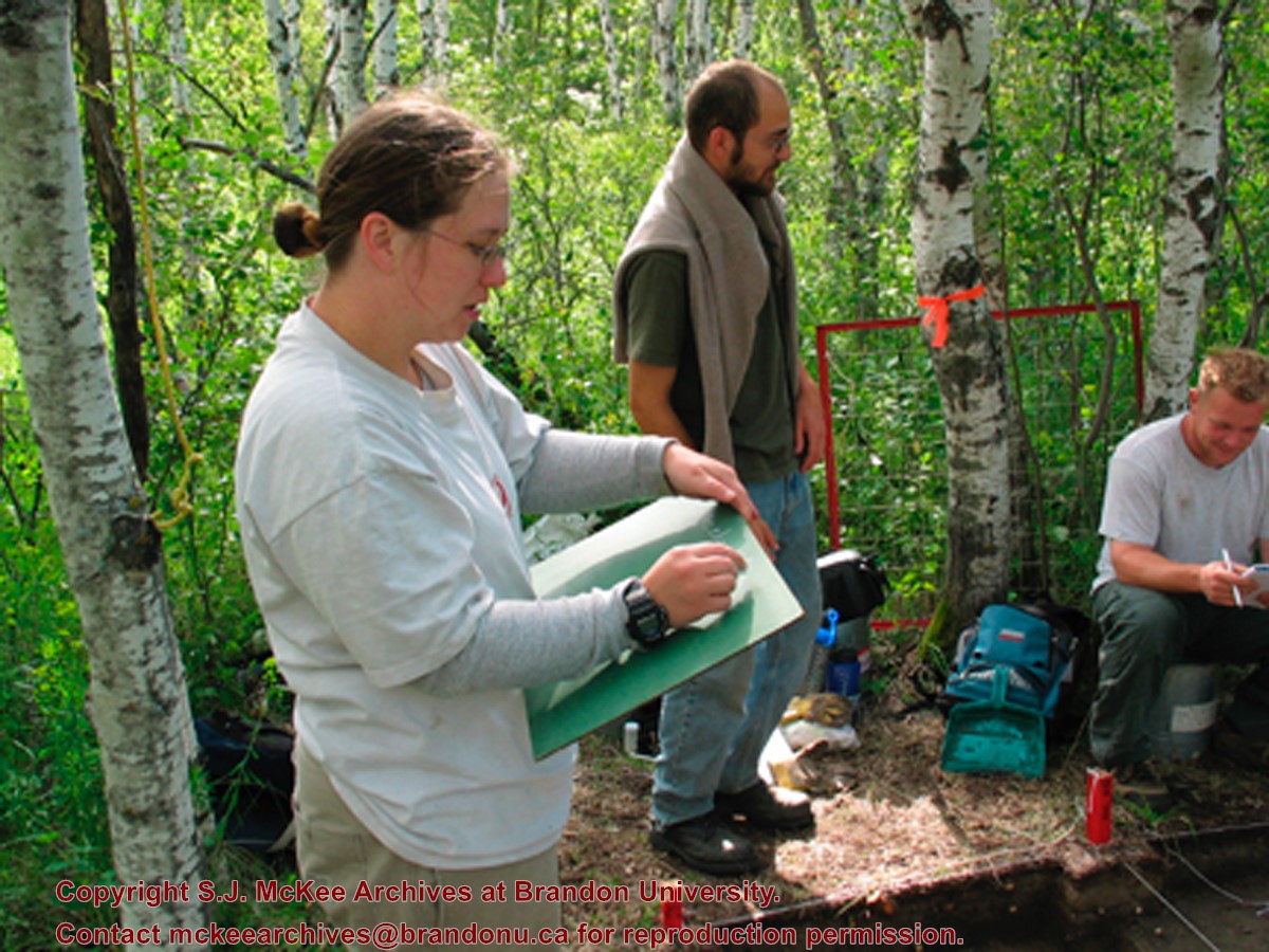
Sub-sub-sub series contains: Summary information of field methology, number and co-ordinates of excavations, personnel and their staff position; Field journals are daily records of recoveries, features and activities at the site; Site records include excavation level and unit summaries, feature sheets, profiles; sample records and maps; Artifact catalogues are lists and identifications of all artifacts recovered; Photographs are of excavation units, features, the landscape and personnel.
Field journals have been scanned in multi-page PDF files. Artifact catalogues are PDF files in spreadsheet format. Photographs are in jpeg format.
History / Biographical
Directed by Dr. Nicholson with Brenda Kramarchuck as crew chief, two students from Brandon University were hired to excavate an additional sample of 15 1m2 units in 1986. This work confirmed the results of the first season, and resulted in an increased sample of faunal material, lithics, ceramics, and in the identification of distinctive ceramic clusters from different locations within the locale. These two seasons of testing satisfactorily demonstrated the presence of a large Prehistoric locale containing the remains of Late Woodland occupation which included lithics, ceramics and reasonably well preserved faunal remains.
Scope and Content
Sub-sub-sub series contains: Summary information of field methology, number and co-ordinates of excavations, personnel and their staff position; Field journals are daily records of recoveries, features and activities at the site; Site records include excavation level and unit summaries, feature sheets, profiles; sample records and maps; Artifact catalogues are lists and identifications of all artifacts recovered; Photographs are of excavation units, features, the landscape and personnel.


+Railway+Construction+Camp+near+Bunclody)