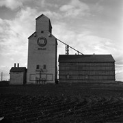
Stuckey's notes: Beulah was terminal of CN Rapid City subdivision from Hallboro Junction. Service ended in 1978.[ Mr. Stuckey consistently spelt it "Buelah"]
Custodial History
For custodial history see the collection level description of the Lawrence Stuckey collection.
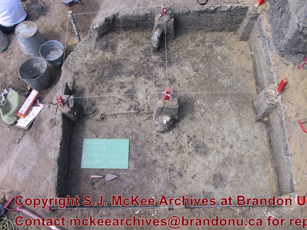
Scope and Content
Image of an old Manitoba Pool elevator #44, Beulah, Manitoba, taken along the CNR line, Rapid City subdivision.
The Medicine Hat Exhibition and Stampede Parade Day was held on Thursday, July 19, 1962, at 9:30 a.m. The local newspaper reported that approximately 24,000 people were in attendance to see parade marshall Rod Ashburner leading 175 entries consisting of 90 floats, 75 horses, and 10 bands. There were 19 parade categories eligible for $12,000 in prize money and included: junior and senior cowboys and cowgirls; fancy and Shetland ponies; sulky class open; comic, commercial, industrial and organizational floats; decorated cars; special ranch class; 4-H Clubs; and a non-competitive class.
The parade route started at Second St. and Allowance Ave., from Second St. to Ash Ave., north on Ash to First St. SE., from First St. S.E. to Fourth Ave., south to Second St. to South Railway St., south on South Railway St. to Third St., with a finish at McLeod Trail. A route map was published in the Medicine Hat News the day before the parade.
Aerial photographs of the parade were taken by Medicine Hat News photographer Howard Heid (1930-2005) from the private helicopter of John Bourn. Bourn was a pilot from Woodville, Wisconsin, who chartered his four-seater helicopter for sight-seers at exhibitions and stampedes across the county.
(Sources: Pat Currie, "Let 'Er Go!," Medicine Hat News, 19 July 1962,1; Harald Gunderson, "'Eye in the Sky' Best Parade View," Medicine Hat News, 19 July 1962,1; "Parade Starts at 9:30 Sharp," 18 July 1962)
Scope and Content
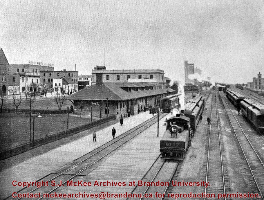
Photograph shows an aerial view of the Medicine Hat Exhibition and Stampede Parade route, with a focus on Second Street SE. A residential area showing homes with extensive backyard gardens can be seen. The South Saskatchewan River can be see on the right of the photograph.
Notes
This photograph shows the neighbourhood before rezoning and commercial development.
See MG 1 Brandon College Teaching and Administration, 1.11 Martin Johns fonds for custodial history.
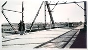
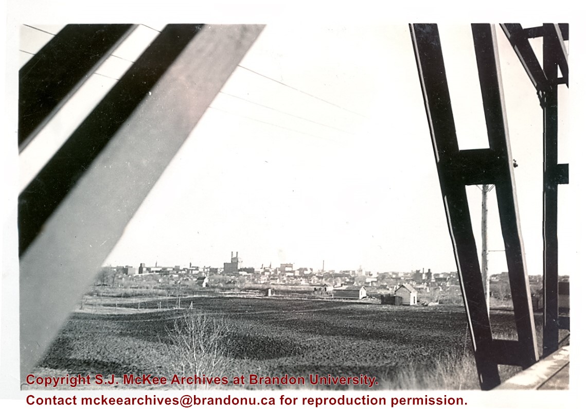
Scope and Content
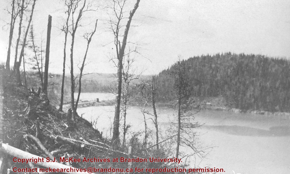
Photograph is looking south southeast from the Assiniboine bridge on 18th Street and shows the Brandon cityscape in the background.
Notes
Writing on the back of the photo reads: "Brandon from the Assiniboine bridge. The 2 girls were just local coloring. Don't ask me who they were or are? The College is just off the street on the right away in the background."


/12-2004_6.jpg?width=1200&404=no-img.jpg&watermark=wmk)
/12-2004_6.jpg?width=180&404=no-img.jpg)
/12-2004_14.jpg?width=1200&404=no-img.jpg&watermark=wmk)
/12-2004_14.jpg?width=180&404=no-img.jpg)

)
%2f12-2004_6.jpg%3fmaxheight%3d1000%26maxwidth%3d1000%26watermark%3dwmk&description=Baldur%2c+MB+from+south)
%2f12-2004_14.jpg%3fmaxheight%3d1000%26maxwidth%3d1000%26watermark%3dwmk&description=Baldur%2c+Manitoba+from+southwest)